Category:Grote Gracht (Schoonhoven)
Jump to navigation
Jump to search
| Object location | | View all coordinates using: OpenStreetMap |
|---|
 | |||||
| Upload media | |||||
| Instance of |
| ||||
|---|---|---|---|---|---|
| Location | Schoonhoven, Krimpenerwaard, South Holland, Netherlands | ||||
| Street address |
| ||||
| Heritage designation |
| ||||
 | |||||
|
This is a category about rijksmonument number 33541
|
| Address |
|
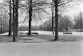
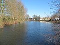
Media in category "Grote Gracht (Schoonhoven)"
The following 4 files are in this category, out of 4 total.
-
 Grote Gracht bij Lopikersingel - Schoonhoven - 20198208 - RCE.jpg 1,200 × 811; 190 KB
-
 Grote Gracht langs Nieuwe Singel - Schoonhoven - 20198209 - RCE.jpg 1,200 × 811; 226 KB
-
 Grote Gracht vanaf Opweg - Schoonhoven - 20198207 - RCE.jpg 1,200 × 806; 316 KB
-
 RM33541 Schoonhoven - Grote Gracht bij Lopikerweg.jpg 2,592 × 1,944; 1.98 MB


