Category:Guidel
Zur Navigation springen
Zur Suche springen
französische Gemeinde | |||||
| Medium hochladen | |||||
| Aussprache (Audiodatei) | |||||
|---|---|---|---|---|---|
| Ist ein(e) | |||||
| Ort |
| ||||
| Liegt am oder im Gewässer | |||||
| Leiter der Regierung oder Verwaltung |
| ||||
| Einwohnerzahl |
| ||||
| Fläche |
| ||||
| Höhe über dem Meeresspiegel |
| ||||
| offizielle Website | |||||
 | |||||
Unterkategorien
Es werden 24 von insgesamt 24 Unterkategorien in dieser Kategorie angezeigt:
In Klammern die Anzahl der enthaltenen Kategorien (K), Seiten (S), Dateien (D)
A
B
- Bois de Coatroual (4 D)
C
- Chapelle Polignac (3 D)
- Château de Bothané (2 D)
- Château de Kerbastic (2 D)
D
- Dolmen de Lesvariel (7 D)
E
G
- Guidel Communal Cemetery (1 D)
L
M
- Maps of Guidel (4 D)
- Moulin de Beg-Nénez (4 D)
P
- Postcards of Guidel (3 D)
R
T
- Tumulus de Kerméné (2 D)
Medien in der Kategorie „Guidel“
Folgende 40 Dateien sind in dieser Kategorie, von 40 insgesamt.
-
049 Fontaine Fetan Guidel.jpg 4.318 × 3.236; 7,07 MB
-
070 Guidel.jpg 3.234 × 4.316; 10,42 MB
-
444 Guidel.jpg 4.242 × 3.134; 5,86 MB
-
449 Guidel.jpg 4.317 × 2.047; 2,93 MB
-
Ancien puit a guidel - panoramio.jpg 4.000 × 3.000; 4,81 MB
-
Blason ville fr Guidel (Morbihan).svg 600 × 660; 42 KB
-
Bouteille Néolithique musée de Bretagne D2004.0001.23.jpg 378 × 512; 90 KB
-
Bus Irisbus Récréo 2 - TBK.jpg 3.456 × 4.608; 2,84 MB
-
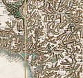
Carte de Cassini Guidel et environs.jpg 581 × 549; 329 KB
-
CHAVANEL 20020715.jpg 2.204 × 1.452; 368 KB
-
FIL 2015 - Derryclavin pipe band - Guidel - 8539.jpg 5.184 × 3.456; 2,58 MB
-
Finistère - Guidel Clohars-Carnoët 1954 L93.jpg 46.669 × 46.669; 214,9 MB
-
Fête patronale Guidel 1911.jpg 593 × 508; 247 KB
-
GONZALEZ DE GALDEANO 20020715.jpg 2.788 × 1.615; 445 KB
-
Guidel - 56520 - 2021.06.09 - TBK - RATP Dev - Iveco Crossway n°RD2 © Anthony Levrot.jpg 5.184 × 3.888; 11,24 MB
-
Guidel - panoramio (1).jpg 4.000 × 3.000; 4,74 MB
-
Guidel - panoramio (10).jpg 3.000 × 4.000; 4,29 MB
-
Guidel - panoramio (11).jpg 4.000 × 3.000; 5,21 MB
-
Guidel - panoramio (12).jpg 3.000 × 4.000; 4,36 MB
-
Guidel - panoramio (14).jpg 4.000 × 3.000; 5,15 MB
-
Guidel - panoramio (2).jpg 4.000 × 3.000; 4,77 MB
-
Guidel - panoramio (7).jpg 4.000 × 3.000; 4,86 MB
-
Guidel - panoramio (9).jpg 4.000 × 3.000; 4,73 MB
-
Guidel - panoramio.jpg 4.000 × 3.000; 4,67 MB
-
Guidel limite communale.jpg 1.292 × 812; 164 KB
-
Guidel mnh 5 chemins.jpg 4.608 × 3.072; 1,72 MB
-
Guidel mnh er-herine.jpg 4.608 × 3.072; 3,56 MB
-
Guidel plages.jpg 2.816 × 2.112; 1,53 MB
-
Guidel vers 1920.jpg 796 × 502; 223 KB
-
Guidel-plage vu du Pouldu 1.JPG 1.600 × 661; 563 KB
-
Le monument aux morts de guidel - panoramio.jpg 4.000 × 3.000; 5,08 MB
-
Localisation Guidel dept56.png 612 × 495; 36 KB
-
Maurice Denis-The Sacred Spring at Guidel-Hermitage Museum.jpg 2.813 × 3.204; 2,19 MB
-
MILLAR 20020715.jpg 2.179 × 1.299; 409 KB
-
Panneaux directionnels D29 à Guidel.jpg 3.456 × 4.608; 4,33 MB
-
Plan du tumulus du Cruguel Guidel.jpg 370 × 539; 178 KB
-
Plan Laïta Ploemeur XVIIIe.jpg 927 × 600; 328 KB
-
Population - Municipality code 56078.svg 475 × 355; 13 KB
-
Sentier cotier a guidel - panoramio.jpg 4.000 × 3.000; 4,68 MB
-
Tree of Life (13946844500).jpg 5.350 × 3.218; 7,59 MB


