Category:Gunthorpe, Norfolk
Jump to navigation
Jump to search
English: Gunthorpe is a village and a civil parish in the English county of Norfolk.. The village is 8.6 miles east north east of the town of Fakenham, 14.9 miles west south west of Cromer and 122 miles north north east of London. The nearest railway station is at Sheringham for the Bittern Line which runs between Sheringham, Cromer and Norwich. The nearest airport is Norwich International Airport.
village and civil parish in Norfolk, United Kingdom  | |||||
| Upload media | |||||
| Instance of | |||||
|---|---|---|---|---|---|
| Location | North Norfolk, Norfolk, East of England, England | ||||
| Population |
| ||||
| Area |
| ||||
 | |||||
Subcategories
This category has the following 4 subcategories, out of 4 total.
B
G
H
M
Media in category "Gunthorpe, Norfolk"
The following 75 files are in this category, out of 75 total.
-
 A148 - geograph.org.uk - 3835051.jpg 640 × 395; 50 KB
-
 A148 north of Gunthorpe Park - geograph.org.uk - 3630010.jpg 640 × 481; 60 KB
-

-
 A148 westbound near Bale - geograph.org.uk - 3629971.jpg 640 × 481; 46 KB
-
 A148 westbound near Stowe Ollands - geograph.org.uk - 3628409.jpg 640 × 481; 71 KB
-
 All Saints' church, Bale - geograph.org.uk - 6169485.jpg 5,464 × 3,517; 5.51 MB
-
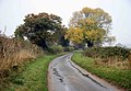 Autumn tints - geograph.org.uk - 1566096.jpg 640 × 442; 85 KB
-
 Bale cemetery - geograph.org.uk - 5616258.jpg 3,456 × 2,592; 3.94 MB
-
 Bale village sign - geograph.org.uk - 6813276.jpg 2,355 × 2,355; 1.86 MB
-
 Barley field in evening light - geograph.org.uk - 3014660.jpg 640 × 480; 103 KB
-
 Cake's Lane - geograph.org.uk - 5930200.jpg 1,600 × 1,200; 499 KB
-
 Cake's Lane - geograph.org.uk - 5930206.jpg 1,600 × 1,200; 427 KB
-
 Clip Street Farm in Clip Street, Bale - geograph.org.uk - 5616854.jpg 3,456 × 2,592; 2.9 MB
-
 Clip Street Farm in Clip Street, Bale - geograph.org.uk - 5616857.jpg 3,456 × 2,592; 2.82 MB
-
 Clipstreet Farm - geograph.org.uk - 4037706.jpg 800 × 513; 192 KB
-
 Close to Gunthorpe Park - geograph.org.uk - 6229996.jpg 2,000 × 1,333; 1.62 MB
-
 Concrete farm hardstand - geograph.org.uk - 989186.jpg 640 × 480; 108 KB
-
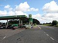
 Countryside Filling Station, near Bale - geograph.org.uk - 4644083.jpg 640 × 427; 349 KB
-
 Cross roads near Bale - geograph.org.uk - 3014620.jpg 640 × 480; 74 KB
-
 Crossroads at Gunthorpe - geograph.org.uk - 1565848.jpg 640 × 436; 97 KB
-
 Crossroads at Stowe Ollands, Bale - geograph.org.uk - 1043940.jpg 640 × 480; 112 KB
-
 Farm track to Lobb's Valley - geograph.org.uk - 989172.jpg 480 × 640; 101 KB
-
 Fast moving traffic - geograph.org.uk - 6229989.jpg 1,893 × 1,226; 436 KB
-
 Field beside Swanton Road - geograph.org.uk - 989183.jpg 480 × 640; 122 KB
-
 Field Dalling Road - geograph.org.uk - 6419681.jpg 800 × 533; 138 KB
-
 Field Dalling Road past Bale Hall - geograph.org.uk - 529915.jpg 640 × 480; 86 KB
-
 Fields towards Bale Wood - geograph.org.uk - 3851408.jpg 2,892 × 1,926; 4.37 MB
-
 Filling station by the A148 - geograph.org.uk - 3835048.jpg 640 × 430; 61 KB
-
 Font, All Saints' church, Bale - geograph.org.uk - 6169627.jpg 3,120 × 5,150; 7.96 MB
-
 Gunthorpe Hall - geograph.org.uk - 510154.jpg 640 × 480; 92 KB
-
 Gunthorpe village sign (detail) - geograph.org.uk - 4580441.jpg 640 × 480; 210 KB
-
 Gunthorpe village sign - geograph.org.uk - 6657320.jpg 3,456 × 2,592; 3.97 MB
-
 Gunthorpe Village Sign.jpg 640 × 480; 123 KB
-
 Hall Farm, Gunthorpe - geograph.org.uk - 3014612.jpg 640 × 480; 99 KB
-
 HGV on the A148 near Bale - geograph.org.uk - 4644105.jpg 640 × 480; 398 KB
-
 High Voltage cable warnings - geograph.org.uk - 5616254.jpg 3,456 × 2,592; 3.82 MB
-
 Interior, All Saints' church, Bale - geograph.org.uk - 6169613.jpg 5,508 × 3,635; 6.34 MB
-

-
 Lane out of Bale - geograph.org.uk - 5930212.jpg 1,600 × 1,221; 401 KB
-
 Layby on Southbound A148 - geograph.org.uk - 4644119.jpg 640 × 427; 373 KB
-
 Layby on the A148 - geograph.org.uk - 4644112.jpg 640 × 427; 383 KB
-
 Manor Farm - geograph.org.uk - 6419686.jpg 800 × 533; 98 KB
-
 Mature trees by the roadside - geograph.org.uk - 6229987.jpg 1,767 × 1,144; 446 KB
-
 Medieval stained glass detail, All Saints' church, Bale - geograph.org.uk - 6170773.jpg 1,937 × 4,791; 7.21 MB
-
 Minor road off Field Dalling Road - geograph.org.uk - 5930185.jpg 1,600 × 1,200; 369 KB
-
 Northbound A148, Stowe Ollands - geograph.org.uk - 4644143.jpg 640 × 427; 362 KB
-
 Northern edge of Gunthorpe - geograph.org.uk - 3014633.jpg 640 × 480; 81 KB
-
 Old Stowe at Gunthorpe with Stowe Ollands ahead - geograph.org.uk - 5616851.jpg 3,456 × 2,592; 3.84 MB
-
 Organ, All Saints' church, Bale - geograph.org.uk - 6171166.jpg 3,431 × 5,460; 5.87 MB
-
 Passing a junction - geograph.org.uk - 6229993.jpg 2,000 × 1,333; 1.77 MB
-
 Road to Clipstreet Farm - geograph.org.uk - 6419691.jpg 800 × 533; 126 KB
-
 Roadside house near Bale Hall - geograph.org.uk - 3014645.jpg 640 × 480; 101 KB
-
 Sharrington Road, Bale - geograph.org.uk - 5930209.jpg 1,600 × 1,200; 342 KB
-
 Sign Commemorating the Bale Oak, Bale, Norfolk - geograph.org.uk - 5382184.jpg 3,000 × 4,000; 2.91 MB
-
 Sign Commemorating the Bale Oak, Bale, Norfolk - geograph.org.uk - 5382185.jpg 4,000 × 3,000; 2.77 MB
-
 Southbound A148 near Bale - geograph.org.uk - 4644085.jpg 640 × 480; 388 KB
-
 Southbound A148, Stowe Ollands - geograph.org.uk - 4644129.jpg 640 × 427; 352 KB
-

-
 Stained glass window, All Saints' church, Bale - geograph.org.uk - 6170072.jpg 2,804 × 4,917; 6.36 MB
-
 Stubble field by Cake's Lane - geograph.org.uk - 5930204.jpg 1,600 × 1,200; 252 KB
-
 Tea Room - geograph.org.uk - 510166.jpg 640 × 480; 112 KB
-
 The Old Gatehouse next to the B1345.jpg 640 × 454; 104 KB
-
 The Old School House, Gunthorpe - geograph.org.uk - 2737674.jpg 4,320 × 3,240; 5.37 MB
-
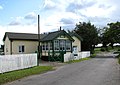
 The old school, Gunthorpe - geograph.org.uk - 2240716.jpg 640 × 480; 253 KB
-
 The old village school - geograph.org.uk - 1565869.jpg 640 × 445; 80 KB
-
 Unusual farm track near Bale Hall - geograph.org.uk - 529923.jpg 640 × 480; 63 KB
-

-
-
 View NE from SW corner of grid square - geograph.org.uk - 550606.jpg 640 × 480; 70 KB
-
 View north across farmland - geograph.org.uk - 550610.jpg 640 × 480; 54 KB
-
 Village green - geograph.org.uk - 1565857.jpg 640 × 463; 104 KB
-
 Village green, Gunthorpe - geograph.org.uk - 3014622.jpg 640 × 480; 91 KB
-
 Wheatfield and house near Guthorpe - geograph.org.uk - 3014615.jpg 640 × 480; 120 KB
-
 A hidden pond - geograph.org.uk - 550666.jpg 480 × 640; 110 KB
-


_-_geograph.org.uk_-_4580441.jpg)


