Category:Gustavsgarten (Bad Homburg)
Jump to navigation
Jump to search
| Object location | | View all coordinates using: OpenStreetMap |
|---|
This is the category of the Hessian Kulturdenkmal (cultural monument) with the ID 8408 (Wikidata)
|
 | |||||
| Upload media | |||||
| Instance of | |||||
|---|---|---|---|---|---|
| Location | Bad Homburg vor der Höhe, Hochtaunuskreis, Darmstadt Government Region, Hesse, Germany | ||||
| Street address |
| ||||
| Heritage designation | |||||
 | |||||
Subcategories
This category has only the following subcategory.
S
Media in category "Gustavsgarten (Bad Homburg)"
The following 12 files are in this category, out of 12 total.
-
 Bad Homburg Gustavsgarten 2017-03-16-10-34-30.jpg 2,998 × 1,631; 5.79 MB
-
 Bad Homburg, Gustavsgarten, alte Klinikgebäude.JPG 4,288 × 2,848; 6.49 MB
-
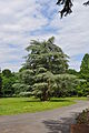 Bad Homburg, Gustavsgarten, Parkblick.JPG 2,848 × 4,288; 6.05 MB
-
 Bad Homburg, Gustavsgarten, Pförtnerhaus mit Brunnen.JPG 4,288 × 2,848; 6.3 MB
-
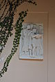 Bad Homburg, Gustavsgarten, Tempel, Tafel links.JPG 2,848 × 4,288; 4.1 MB
-
 Bad Homburg, Gustavsgarten, Tempel, Tafel rechts.JPG 2,848 × 4,288; 4.12 MB
-
 Bad Homburg, Gustavsgarten, Tempel.JPG 2,848 × 4,288; 6.05 MB
-
 Bad Homburg, Tannenwaldallee 50, Pförtnerhaus.JPG 4,288 × 2,848; 6.05 MB
-
 Tannenwaldallee-2014-Bad-Homburg-Gustavsgarten-163.jpg 4,428 × 3,339; 3.23 MB
-
 Tannenwaldallee-2014-Bad-Homburg-Gustavsgarten-164.jpg 2,651 × 4,061; 6.76 MB
-
 Tannenwaldallee-2014-Bad-Homburg-Gustavsgarten-165-168.jpg 7,364 × 2,932; 16.14 MB
-
 Villa Wertheimber.JPG 1,562 × 1,149; 309 KB


