Category:Gørløse Kirke
Jump to navigation
Jump to search
| Object location | | View all coordinates using: OpenStreetMap |
|---|
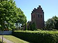
church building in Hillerød Municipality, Denmark  | |||||
| Upload media | |||||
| Instance of | |||||
|---|---|---|---|---|---|
| Location | Gørløse, Hillerød Municipality, Capital Region of Denmark, Denmark | ||||
| Street address |
| ||||
| Diocese | |||||
| Religion or worldview | |||||
| official website | |||||
 | |||||
Media in category "Gørløse Kirke"
The following 6 files are in this category, out of 6 total.
-
 04-11-07-d1-copie 2 Gørløse (Hillerød).jpg 819 × 614; 226 KB
-
 04-11-07-d2-copie 2 Gørløse (Hillerød).jpg 819 × 614; 258 KB
-
 GoerloeseKirke.jpg 2,344 × 1,544; 2.83 MB
-
 Gørløse Kirke 03.jpg 3,072 × 2,304; 2.26 MB
-
 Gørløse Kirke 04.JPG 3,072 × 2,304; 2.19 MB
-
 Gørløse Kirke.jpg 2,272 × 1,704; 1.63 MB
.jpg)
.jpg)


