Category:HMS Ferret (shore establishment 1940)
Jump to navigation
Jump to search
shore establishment and naval base of the Royal Navy during the Second World War  | |||||
| Upload media | |||||
| Instance of |
| ||||
|---|---|---|---|---|---|
| Location | Derry, Derry City and Strabane, Northern Ireland | ||||
 | |||||
Media in category "HMS Ferret (shore establishment 1940)"
The following 166 files are in this category, out of 166 total.
-
 "Harp" bus, Londonderry (April 1992) - geograph.org.uk - 4016599.jpg 640 × 384; 89 KB
-
 "Real Derry stew, famous chowder powder" notice - geograph.org.uk - 3603161.jpg 1,920 × 2,560; 1.66 MB
-

-
 A train stands in Londonderry Station - geograph.org.uk - 4949523.jpg 640 × 480; 204 KB
-
 Americans in Britain, 1942 - 1945 A9191.jpg 2,321 × 1,772; 1.05 MB
-
 Americans in Britain, 1942 - 1945 A9194.jpg 800 × 607; 62 KB
-
 Americans in Britain, 1942 - 1945 A9196.jpg 2,528 × 1,823; 998 KB
-
 Americans in Britain, 1942 - 1945 A9207.jpg 800 × 606; 69 KB
-
 Americans in Britain, 1942 - 1945 A9212.jpg 800 × 613; 66 KB
-
 Americans in Britain, 1942 - 1945 A9593.jpg 800 × 602; 99 KB
-

-

-
 Banner, Derry - Londonderry - geograph.org.uk - 3600999.jpg 640 × 480; 83 KB
-
 Browning Drive towards Ebrington Square - geograph.org.uk - 4779616.jpg 1,200 × 799; 315 KB
-
 BT building, Derry - Londonderry - geograph.org.uk - 3602707.jpg 640 × 480; 52 KB
-
 Building at Ebrington Barracks - geograph.org.uk - 3786495.jpg 640 × 480; 38 KB
-
 Buildings on Limavady Road - geograph.org.uk - 4779413.jpg 1,200 × 799; 321 KB
-
 Café Soul - The Healthy Way - geograph.org.uk - 3066396.jpg 640 × 480; 73 KB
-
 Cappucccinos, Derry - Londonderry - geograph.org.uk - 3785966.jpg 640 × 480; 63 KB
-
 Cappuccinos, Derry - Londonderry - geograph.org.uk - 3602689.jpg 640 × 480; 60 KB
-
 City Hotel, Derry - Londonderry - geograph.org.uk - 3545422.jpg 640 × 480; 67 KB
-
 Coach, Derry - Londonderry - geograph.org.uk - 3601007.jpg 640 × 480; 57 KB
-
 Derry - bt.com Building - geograph.org.uk - 3989293.jpg 1,976 × 1,317; 1.68 MB
-
 Derry - bt.com Building along Foyle Embankment - geograph.org.uk - 3732382.jpg 2,747 × 1,831; 2.8 MB
-
 Derry - Buildings along West Bank of River Foyle - geograph.org.uk - 3991497.jpg 2,093 × 1,395; 1.5 MB
-
 Derry - City Hotel - geograph.org.uk - 3725321.jpg 2,899 × 1,933; 3.1 MB
-
 Derry - City Hotel - geograph.org.uk - 3725331.jpg 2,772 × 1,848; 2.76 MB
-
 Derry - City Hotel - geograph.org.uk - 3989260.jpg 1,344 × 896; 766 KB
-
 Derry - City Hotel along West Bank of River Foyle - geograph.org.uk - 3732394.jpg 2,973 × 1,982; 2.83 MB
-
 Derry - City Hotel from Peace Bridge - geograph.org.uk - 3731698.jpg 2,935 × 1,957; 3.54 MB
-

-

-

-

-

-
 Derry - Ebrington Square at West End of Peace Bridge - geograph.org.uk - 3731701.jpg 2,891 × 1,927; 3.63 MB
-
 Derry - Entertainment on the Peace Bridge - geograph.org.uk - 3731700.jpg 1,608 × 2,412; 2.27 MB
-

-
 Derry - Foyleside Shopping Centre - geograph.org.uk - 3732330.jpg 3,008 × 2,000; 3.58 MB
-
 Derry - Guildhall (South and East Sides from Peace Bridge) - geograph.org.uk - 3991493.jpg 2,171 × 1,447; 1.74 MB
-
 Derry - Guildhall - Four Stained Glass Windows in Hall - geograph.org.uk - 3991406.jpg 1,203 × 1,999; 1.76 MB
-
 Derry - Guildhall - geograph.org.uk - 3725671.jpg 2,941 × 1,960; 2.54 MB
-
 Derry - Guildhall - Six Stained Glass Windows in Hall - geograph.org.uk - 3991421.jpg 1,235 × 1,668; 1.6 MB
-
 Derry - Guildhall - Stained Glass Window in Foyer - geograph.org.uk - 3991390.jpg 1,038 × 1,417; 970 KB
-

-
 Derry - Guildhall - Three stained Glass Windows in Hall - geograph.org.uk - 3991417.jpg 1,249 × 1,219; 1.09 MB
-

-

-
 Derry - Guildhall Interior - Doors at Northeast Wall - geograph.org.uk - 3731093.jpg 1,798 × 2,697; 2.7 MB
-

-

-

-

-

-
 Derry - Guildhall Interior - Stained Glass Windows - geograph.org.uk - 3731065.jpg 1,734 × 2,601; 1.88 MB
-

-
 Derry - Guildhall Interior - View to Northeast - Pipe Organ - geograph.org.uk - 3731032.jpg 2,906 × 1,937; 2.73 MB
-
 Derry - Guildhall Interior - View to Southwest - geograph.org.uk - 3731023.jpg 3,008 × 2,000; 2.6 MB
-

-
 Derry - Londonderry - geograph.org.uk - 3601016.jpg 640 × 480; 53 KB
-
 Derry - Middle of Peace Bridge - geograph.org.uk - 3991473.jpg 1,593 × 1,062; 1.01 MB
-
 Derry - Peace Bridge - Ebrington Square at East End - geograph.org.uk - 3991490.jpg 1,776 × 1,184; 1.55 MB
-

-
 Derry - Peace Bridge - Plaque - geograph.org.uk - 3991469.jpg 1,507 × 471; 405 KB
-

-

-
 Derry - Rear view of Guildhall - geograph.org.uk - 3732371.jpg 3,008 × 2,000; 4.04 MB
-
 Derry - Sign at East End of Peace Bridge (2011-06-25) - geograph.org.uk - 3731703.jpg 2,814 × 1,876; 3.39 MB
-

-
 Derry - Unique Pedestrian Peace Bridge over the River Foyle - geograph.org.uk - 3731692.jpg 1,768 × 2,651; 2.63 MB
-
 Derry - Unique Pedestrian Peace Bridge over the River Foyle - geograph.org.uk - 3731693.jpg 2,514 × 1,675; 3.59 MB
-
 Derry - Walking Tour Guide - Ronan McNamara - geograph.org.uk - 3991446.jpg 964 × 1,285; 550 KB
-
 Derry - West Bank of River Foyle just north of Peace Bridge - geograph.org.uk - 3731704.jpg 2,853 × 1,902; 2.87 MB
-
 Derry-Londonderry railway station - geograph.org.uk - 4948222.jpg 640 × 480; 163 KB
-
 Direction signs, Derry - Londonderry - geograph.org.uk - 3599254.jpg 640 × 480; 63 KB
-

-
 Dooley's, Derry - Londonderry - geograph.org.uk - 3599247.jpg 640 × 480; 73 KB
-
 Eastern approaches to the Peace Bridge - geograph.org.uk - 3434973.jpg 640 × 480; 267 KB
-

-
 Ebrington Square - geograph.org.uk - 4613055.jpg 3,648 × 2,736; 3.53 MB
-

-

-
 Foyle Road and the A2 bridge, Londonderry - geograph.org.uk - 3456318.jpg 1,024 × 768; 211 KB
-
 Foyle Street Bus Station - geograph.org.uk - 3674297.jpg 640 × 480; 50 KB
-
 Foyle Street, Derry - Londonderry - geograph.org.uk - 3545408.jpg 640 × 480; 58 KB
-
 Foyle Street, Derry - Londonderry - geograph.org.uk - 3674286.jpg 640 × 480; 75 KB
-
 Foyle Street, Derry - Londonderry - geograph.org.uk - 3785968.jpg 640 × 480; 58 KB
-

-
 Graffiti, Derry - Londonderry - geograph.org.uk - 3066384.jpg 640 × 480; 69 KB
-

-

-
 Guildhall, Derry - Londonderry - geograph.org.uk - 3785971.jpg 640 × 480; 53 KB
-
 Hole in the road, Duke Street - geograph.org.uk - 3251961.jpg 640 × 480; 251 KB
-
 Legenderry City - geograph.org.uk - 3786512.jpg 640 × 480; 55 KB
-
 Limavady Road, Londonderry - Derry - geograph.org.uk - 4779409.jpg 1,200 × 799; 264 KB
-
 Loco-hauled train, Londonderry - geograph.org.uk - 3025937.jpg 640 × 391; 58 KB
-
 Magazine Street, Derry - Londonderry - geograph.org.uk - 3603159.jpg 640 × 480; 68 KB
-

-
 Memorial to the Battle of the Atlantic - geograph.org.uk - 4780043.jpg 1,200 × 799; 544 KB
-
 Mute Meadow - geograph.org.uk - 4613120.jpg 3,648 × 2,736; 5.16 MB
-
 Mute Meadow to the Guildhall - geograph.org.uk - 4613098.jpg 3,648 × 2,736; 4.48 MB
-

-
 Open area, Derry - Londonderry - geograph.org.uk - 3545409.jpg 640 × 480; 63 KB
-
 Open area, Derry - Londonderry - geograph.org.uk - 3601020.jpg 640 × 480; 69 KB
-
 Ornate columns, Derry - Londonderry - geograph.org.uk - 3066399.jpg 640 × 480; 55 KB
-
 Paved area, Peace Bridge - geograph.org.uk - 3434968.jpg 640 × 480; 246 KB
-
 Peace Bridge - geograph.org.uk - 3434631.jpg 640 × 480; 282 KB
-
 Peace Bridge - geograph.org.uk - 3434645.jpg 640 × 480; 240 KB
-

-
 Peace Bridge, Derry - geograph.org.uk - 3551009.jpg 480 × 640; 67 KB
-
 Peace Bridge, Derry - geograph.org.uk - 3551010.jpg 640 × 480; 52 KB
-
 Peace Bridge, Derry - Londonderry - geograph.org.uk - 3224892.jpg 640 × 482; 46 KB
-
 Peace Bridge, Derry - Londonderry - geograph.org.uk - 3545425.jpg 640 × 481; 43 KB
-
 Peace Bridge, Derry - Londonderry - geograph.org.uk - 3602773.jpg 640 × 480; 37 KB
-
 Peace Bridge, Derry - Londonderry - geograph.org.uk - 3786493.jpg 4,320 × 3,240; 4.56 MB
-
 Peace Flame, Derry - Londonderry - geograph.org.uk - 3545413.jpg 640 × 480; 67 KB
-
 Plaque, The Peace Bridge - geograph.org.uk - 3602777.jpg 640 × 482; 64 KB
-
 Primark, Derry - Londonderry - geograph.org.uk - 4601980.jpg 640 × 480; 149 KB
-
 Queen's Quay - geograph.org.uk - 3434638.jpg 640 × 480; 276 KB
-
 Rail-Link bus, Londonderry (1991) - geograph.org.uk - 3342738.jpg 640 × 402; 88 KB
-
 Railway at Derry - geograph.org.uk - 3670290.jpg 480 × 640; 119 KB
-
 Railway repairs - geograph.org.uk - 3434668.jpg 640 × 480; 292 KB
-
 Random boxes, Derry - Londonderry - geograph.org.uk - 3066408.jpg 640 × 480; 67 KB
-
 Reflections in the River Foyle - geograph.org.uk - 3551012.jpg 640 × 480; 51 KB
-
 River Foyle, Derry - Londonderry - geograph.org.uk - 3786491.jpg 640 × 480; 42 KB
-

-
 Sculpture, Derry - Londonderry - geograph.org.uk - 4601986.jpg 640 × 480; 151 KB
-
 Shipquay Place, Derry - Londonderry - geograph.org.uk - 3341842.jpg 640 × 480; 54 KB
-
 Shipquay Street - geograph.org.uk - 3434633.jpg 640 × 480; 295 KB
-
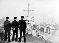 Ships at HMS Ferret.jpg 300 × 218; 13 KB
-

-
 Swilly bus, Derry - Londonderry - geograph.org.uk - 3602686.jpg 640 × 480; 53 KB
-
 The former Ebrington Barracks - geograph.org.uk - 4779618.jpg 1,200 × 799; 446 KB
-
 The former Ebrington Barracks - geograph.org.uk - 4779622.jpg 1,200 × 799; 222 KB
-
 The former Ebrington Barracks - geograph.org.uk - 4779624.jpg 1,200 × 799; 174 KB
-
 The former Ebrington Barracks - geograph.org.uk - 4779645.jpg 1,200 × 799; 244 KB
-
 The former Ebrington Barracks - geograph.org.uk - 4779661.jpg 1,200 × 799; 227 KB
-
 The former Ebrington Barracks - geograph.org.uk - 4779663.jpg 1,200 × 799; 226 KB
-
 The former Ebrington Barracks - geograph.org.uk - 4779665.jpg 1,200 × 799; 344 KB
-
 The former Ebrington Barracks - geograph.org.uk - 4779666.jpg 1,200 × 799; 357 KB
-
 The former Ebrington Barracks - geograph.org.uk - 4779697.jpg 1,200 × 799; 239 KB
-
 The former Ebrington Barracks - geograph.org.uk - 4779701.jpg 1,200 × 799; 230 KB
-
 The former Ebrington Barracks - geograph.org.uk - 4779829.jpg 1,200 × 799; 293 KB
-
 The Guildhall and the Peace Bridge - geograph.org.uk - 4613049.jpg 3,648 × 2,736; 4.71 MB
-
 The Guildhall from the Peace Bridge - geograph.org.uk - 4613065.jpg 3,648 × 2,736; 3.46 MB
-
 The Guildhall, Derry - geograph.org.uk - 3679591.jpg 2,736 × 3,648; 4.74 MB
-
 The Guildhall, Derry - Londonderry - geograph.org.uk - 3341840.jpg 640 × 480; 50 KB
-

-
 The Oak Grove - geograph.org.uk - 4613084.jpg 3,648 × 2,736; 3.68 MB
-
 The Peace Bridge over the River Foyle - geograph.org.uk - 4780050.jpg 1,200 × 799; 232 KB
-
 The Royal Navy during the Second World War A17024.jpg 800 × 594; 57 KB
-
 The Royal Navy during the Second World War A17025.jpg 596 × 800; 61 KB
-
 The Royal Navy during the Second World War A17057.jpg 605 × 800; 60 KB
-
 Track relaid - geograph.org.uk - 3434678.jpg 640 × 480; 273 KB
-

-
 Up and down, Derry - Londonderry - geograph.org.uk - 3786448.jpg 640 × 480; 60 KB
-
 View from the A2 Bridge Derry - geograph.org.uk - 4673628.jpg 1,632 × 918; 349 KB
-

-

-

-

-
 Walled City Brewery - geograph.org.uk - 4779660.jpg 1,200 × 799; 290 KB
-

-

-
 Weed spraying train, Londonderry - geograph.org.uk - 3756959.jpg 640 × 351; 52 KB
-
 Welcome banner, Derry - Londonderry - geograph.org.uk - 3602757.jpg 640 × 480; 50 KB
_-_geograph.org.uk_-_4016599.jpg)


_-_geograph.org.uk_-_3732344.jpg)

_-_geograph.org.uk_-_3991493.jpg)


_Wall_of_Hall_-_Organ_Pipes_-_geograph.org.uk_-_3991350.jpg)


_Wall_of_Hall_-_Seating_with_Balcony_-_geograph.org.uk_-_3991338.jpg)


_%5E_Buildings_along_West_Bank_of_River_Foyle_-_geograph.org.uk_-_3731705.jpg)


_-_geograph.org.uk_-_3731703.jpg)


_-_geograph.org.uk_-_3342738.jpg)


