Category:Hackelstein-Gipfel bei Fuchsmühl
Jump to navigation
Jump to search
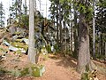
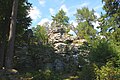
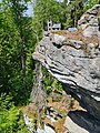
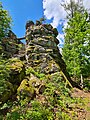
Geotop in Landkreis Tirschenreuth in Bavaria, Germany  | |||||
| Upload media | |||||
| Instance of | |||||
|---|---|---|---|---|---|
| Location | Fuchsmühl, Tirschenreuth, Upper Palatinate, Bavaria, Germany | ||||
| Heritage designation | |||||
| Width |
| ||||
| Length |
| ||||
| Area |
| ||||
| Elevation above sea level |
| ||||
| official website | |||||
 | |||||
Media in category "Hackelstein-Gipfel bei Fuchsmühl"
The following 8 files are in this category, out of 8 total.
-
 Augsburger Felsen - panoramio.jpg 4,320 × 3,240; 2.94 MB
-
 Hackelstein Fuchsmühl (1).JPG 4,752 × 3,168; 11.09 MB
-
 Hackelstein Fuchsmühl (2).JPG 3,168 × 4,752; 12 MB
-
 Hackelstein Fuchsmühl (3).JPG 4,752 × 3,168; 13.92 MB
-
 Hackelstein Fuchsmühl 2021 (1) 01.jpg 4,032 × 3,024; 8.61 MB
-
 Hackelstein Fuchsmühl 2021 (1) 02.jpg 2,418 × 1,360; 3.52 MB
-
 Hackelstein Fuchsmühl 2021 (1) 03.jpg 3,024 × 4,032; 11.11 MB
-
 Hackelstein Fuchsmühl 2021 (1) 04.jpg 3,024 × 4,032; 5.31 MB
.JPG)
.JPG)
.JPG)
_01.jpg)
_02.jpg)
_03.jpg)
_04.jpg)