Category:Hadnall
Aller à la navigation
Aller à la recherche
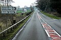
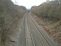
English: Hadnall is a village and civil parish in Shropshire, England. It lies on the A49, some 9 km north-north-east of Shrewsbury. The Welsh Marches Line runs just outside the village and there was once a railway station.
village britannique  | |||||
| Téléverser des médias | |||||
| Nature de l’élément | |||||
|---|---|---|---|---|---|
| Lieu | Shropshire, Midlands de l'Ouest, Angleterre | ||||
 | |||||
Sous-catégories
Cette catégorie comprend 2 sous-catégories, dont les 2 ci-dessous.
H
- Hadnall railway station (3 F)
Média dans la catégorie « Hadnall »
Cette catégorie comprend 72 fichiers, dont les 72 ci-dessous.
-
 A49 at Littlewood Farm - geograph.org.uk - 2869110.jpg 640 × 480 ; 51 kio
-
 A49 at Painsbrook Lane - geograph.org.uk - 2959925.jpg 640 × 480 ; 63 kio
-
 A49 at Saracens B^B, Hadnall - geograph.org.uk - 2869121.jpg 640 × 480 ; 60 kio
-
 A49 at the junction for Haston - geograph.org.uk - 2869124.jpg 640 × 480 ; 61 kio
-
 A49 at the turning for Hardwicke Stables - geograph.org.uk - 2869132.jpg 640 × 480 ; 79 kio
-
 A49 crosses the Shropshire Way - geograph.org.uk - 2869103.jpg 640 × 480 ; 65 kio
-
 A49 in Hadnall - geograph.org.uk - 2869113.jpg 640 × 480 ; 58 kio
-
 A49 near Hadnall - geograph.org.uk - 5060523.jpg 640 × 427 ; 344 kio
-
 A49 north of Painsbrook Lane - geograph.org.uk - 2869127.jpg 640 × 480 ; 53 kio
-
 A49 Shrewsbury Road in Hadnall - geograph.org.uk - 2959918.jpg 640 × 481 ; 76 kio
-
 A49, Hadnall - geograph.org.uk - 5060525.jpg 640 × 427 ; 351 kio
-
 Autumn colour by A49, Hadnall - geograph.org.uk - 2125577.jpg 524 × 372 ; 164 kio
-
 B and B - geograph.org.uk - 2509100.jpg 4 000 × 3 000 ; 5,91 Mio
-

-
 Farm buildings at Painsbrook - geograph.org.uk - 2895368.jpg 1 142 × 857 ; 262 kio
-
 Fields across to Astley Lodge - geograph.org.uk - 2561704.jpg 640 × 432 ; 50 kio
-
 Fields off Plex Road - geograph.org.uk - 3865081.jpg 640 × 480 ; 245 kio
-
 Fieldside oaks on the Hatch bridleway - geograph.org.uk - 2895523.jpg 1 142 × 857 ; 406 kio
-
 Footpath heading out of Hadnall - geograph.org.uk - 2895343.jpg 1 142 × 857 ; 251 kio
-
 Foxwoods cottage - geograph.org.uk - 2895356.jpg 1 142 × 857 ; 359 kio
-
 Hadnall - geograph.org.uk - 3865037.jpg 640 × 480 ; 253 kio
-
 Hadnall pond - low water levels in late winter. - geograph.org.uk - 2895676.jpg 1 142 × 857 ; 419 kio
-
 Hadnall, Bus Layby on Shrewsbury Road - geograph.org.uk - 5060539.jpg 640 × 384 ; 314 kio
-
 Hadnall, Shrewsbury Road - geograph.org.uk - 5060528.jpg 640 × 427 ; 327 kio
-
 Haston Farm - geograph.org.uk - 6097573.jpg 640 × 443 ; 49 kio
-
 House at Providence Grove - geograph.org.uk - 4885730.jpg 3 322 × 2 419 ; 1,07 Mio
-
 Land at Littlewood Farm - geograph.org.uk - 2561754.jpg 640 × 480 ; 93 kio
-
 Lane between Harmer Hill and Haston - geograph.org.uk - 3866049.jpg 640 × 480 ; 272 kio
-
 Moated Site at Hadnall (geograph 7390148).jpg 1 600 × 1 200 ; 1 001 kio
-
 New Inn at Hadnall - geograph.org.uk - 4885716.jpg 2 819 × 2 177 ; 1,02 Mio
-

-

-

-

-
 Part of Shrewsbury Road, Hadnall - geograph.org.uk - 5737820.jpg 640 × 480 ; 71 kio
-
 Plex Road - geograph.org.uk - 3865085.jpg 640 × 480 ; 322 kio
-
 Pond off Wood Road - geograph.org.uk - 3865055.jpg 640 × 480 ; 328 kio
-
 Saracens, Hadnall - geograph.org.uk - 590781.jpg 640 × 480 ; 209 kio
-
 Shrewsbury Road (A49) - geograph.org.uk - 5060541.jpg 640 × 427 ; 339 kio
-
 Shrewsbury Road, Hadnall - geograph.org.uk - 5060536.jpg 640 × 427 ; 341 kio
-
 Shrewsbury to Crewe railway line - geograph.org.uk - 701888.jpg 640 × 480 ; 92 kio
-
 Shropshire Way - geograph.org.uk - 2509115.jpg 4 000 × 3 000 ; 4,49 Mio
-
 Slightly adrift of the footpath - geograph.org.uk - 2895347.jpg 1 142 × 857 ; 308 kio
-
 Station Road, Hadnall - geograph.org.uk - 3865041.jpg 640 × 480 ; 298 kio
-
 Telecommunications tower, Plex - geograph.org.uk - 3865065.jpg 640 × 480 ; 236 kio
-
 The A49 at Hadnall - geograph.org.uk - 5946118.jpg 1 024 × 768 ; 261 kio
-
 The Covert cottage - geograph.org.uk - 2895362.jpg 1 142 × 857 ; 271 kio
-
 The New Inn at Hadnall - geograph.org.uk - 2670231.jpg 800 × 600 ; 334 kio
-

-
 The pond at Hadnall - geograph.org.uk - 1036686.jpg 640 × 480 ; 123 kio
-
 The Shrewsbury to Crewe line - geograph.org.uk - 1036689.jpg 640 × 480 ; 95 kio
-
 The White Tower at Grinshill quarry - geograph.org.uk - 685810.jpg 480 × 640 ; 148 kio
-
 There's a stile in there somewhere... - geograph.org.uk - 2895350.jpg 979 × 734 ; 366 kio
-
 Trees in field near Wood Farm - geograph.org.uk - 6097575.jpg 640 × 443 ; 57 kio
-
 View down Haston Road - geograph.org.uk - 5737865.jpg 640 × 480 ; 74 kio
-
 View to Black Birches across the lake - geograph.org.uk - 5737882.jpg 640 × 480 ; 65 kio
-
 Wood Lane - geograph.org.uk - 3865072.jpg 640 × 480 ; 276 kio
-
 Woodland near Hardwicke Grange Farm - geograph.org.uk - 6158098.jpg 800 × 472 ; 62 kio
-
 Bridge to farmland - geograph.org.uk - 701887.jpg 640 × 480 ; 78 kio
-
 Do as the sign says - geograph.org.uk - 701889.jpg 640 × 480 ; 91 kio
-
 Double gates - geograph.org.uk - 590837.jpg 640 × 480 ; 207 kio
-
 Entrance and Sunnyside Farm - geograph.org.uk - 590704.jpg 640 × 429 ; 189 kio
-
 Field and hedge looking towards Boarpit Rough - geograph.org.uk - 658208.jpg 640 × 480 ; 68 kio
-
 Haston Grove - geograph.org.uk - 590839.jpg 640 × 480 ; 215 kio
-
 Painsbrook - geograph.org.uk - 658189.jpg 640 × 480 ; 55 kio
-
 Railway line from Braidway level crossing - geograph.org.uk - 701890.jpg 640 × 480 ; 92 kio
-
 Road junction - geograph.org.uk - 590825.jpg 640 × 480 ; 135 kio
-
 Stiles to a footpath that crosses a railway line - geograph.org.uk - 701891.jpg 640 × 480 ; 112 kio
-

-

-
 Track to Painsbrook - geograph.org.uk - 658187.jpg 640 × 480 ; 89 kio
-
 Track to Shawbury Heath woods. - geograph.org.uk - 658174.jpg 640 × 480 ; 73 kio


.jpg)


_-_geograph.org.uk_-_5060541.jpg)


