Category:Hale, Surrey
Jump to navigation
Jump to search
English: Hale is a village in Surrey, England. It lies between Farnham and Aldershot. Located on the side of sandy hills, parts of the village are frequently referred to as either Upper Hale or Lower Hale. Residents have views south towards Hindhead. The census area Farnham Upper Hale has a population of 4,241.
village in Surrey, United Kingdom | |||||
| Upload media | |||||
| Instance of | |||||
|---|---|---|---|---|---|
| Location | Farnham, Waverley, Surrey, South East England, England | ||||
 | |||||
Subcategories
This category has the following 4 subcategories, out of 4 total.
B
- Bethel Baptist Church, Hale (6 F)
H
- Hale Methodist Church (4 F)
J
U
- St Mark's Church, Heath End (53 F)
Media in category "Hale, Surrey"
The following 23 files are in this category, out of 23 total.
-
 112 Alma Lane, Upper Hale, Farnham (May 2015).jpg 2,000 × 1,600; 556 KB
-
 Caesar's Camp - geograph.org.uk - 20069.jpg 640 × 480; 171 KB
-
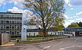 Farnham Heath End School 2020.jpg 3,639 × 2,200; 1.6 MB
-
 Farnham Heath End School Betjeman 2020.jpg 3,772 × 2,139; 1.03 MB
-
 Farnham Heath End School block 2020.jpg 3,992 × 2,656; 1.28 MB
-
 Flooded Gravel Pit, Caesar's Camp - geograph.org.uk - 1763669.jpg 640 × 457; 66 KB
-
 Former Ball and Wicket pub, Upper Hale - geograph.org.uk - 5377685.jpg 2,560 × 1,536; 782 KB
-
 Gates Hale Cemetery Farnham.jpg 3,996 × 2,529; 5.37 MB
-
 Hale and Heath End Constitutional Club, Upper Hale Road, Upper Hale, Farnham (May 2015).jpg 2,592 × 1,944; 1,001 KB
-
 Hale Cemetery Farnham chapels.jpg 4,000 × 3,000; 1.84 MB
-
 Hale Recreation Ground, Upper Hale Road, Upper Hale, Farnham (May 2015).jpg 2,592 × 1,944; 999 KB
-
 Hampton Road - geograph.org.uk - 746909.jpg 640 × 480; 109 KB
-
 Rifle Range at Farnham - geograph.org.uk - 102061.jpg 640 × 495; 119 KB
-
 The Ball and Wicket pub, Upper Hale Road, Upper Hale, Farnham (May 2015).jpg 2,400 × 1,600; 692 KB
-
 The Lobster Pot pub, Upper Hale Road, Upper Hale, Farnham (May 2015).jpg 2,500 × 1,500; 585 KB
-
 Upper Hale War Memorial, Upper Hale Road, Farnham, Surrey.jpg 1,735 × 2,892; 2 MB
-
 Upper Hale War Memorial, Upper Hale Road, Upper Hale, Farnham (May 2015).jpg 1,600 × 2,200; 709 KB
-
 William Ellis grave Hale Cemetery.jpg 2,154 × 2,777; 1.27 MB
-
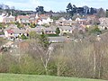 Hale - geograph.org.uk - 746902.jpg 640 × 480; 104 KB
-
 Old Cemetery and Chapel, Upper Hale - geograph.org.uk - 102338.jpg 640 × 480; 135 KB
-
 Old Park Service Station - geograph.org.uk - 20072.jpg 640 × 480; 113 KB
-
 Princess Royal Pub near Runfold - geograph.org.uk - 99486.jpg 640 × 480; 101 KB
-
 Weybourne Road, a.k.a. the B3007 - geograph.org.uk - 158222.jpg 640 × 480; 97 KB
.jpg)


.jpg)

.jpg)


.jpg)
.jpg)

.jpg)


