Category:Ham, Wiltshire
Jump to navigation
Jump to search
village and civil parish in Wiltshire, England  | |||||
| Upload media | |||||
| Instance of | |||||
|---|---|---|---|---|---|
| Location | Wiltshire, South West England, England | ||||
| Population |
| ||||
 | |||||
English: Ham is a village and civil parish in the English county of Wiltshire. In the Census 2001, the parish had a population of 152.
Nederlands: Ham is een gehucht in het graafschap Wiltshire in Engeland. Ham is een zogenaamde civil parish. Tijdens de volkstelling van 2001 woonden er 152 mensen in Ham. Het gehucht heeft een pub (The Crown and Anchor) en een Indiaas restaurant. Het gemeentehuis is sinds 2002 in gebruik als voorschoolse opvang.
Media in category "Ham, Wiltshire"
The following 125 files are in this category, out of 125 total.
-
 A Stand of Pine on Ham Hill, Wiltshire - geograph.org.uk - 4056539.jpg 1,024 × 651; 199 KB
-
 Above Ham - geograph.org.uk - 243812.jpg 640 × 478; 86 KB
-
 All Saints Church, Ham - geograph.org.uk - 4172096.jpg 4,608 × 3,456; 4.71 MB
-
 Approach to Mount Prosperous - geograph.org.uk - 345106.jpg 477 × 640; 123 KB
-
 Arable land and Horse pasture east of Hungerford Road - geograph.org.uk - 3360843.jpg 3,648 × 2,736; 2.63 MB
-
 Arable land north of Woodcote Road - geograph.org.uk - 3360857.jpg 3,648 × 2,736; 3.41 MB
-
 Ashley drove south of New Buildings - geograph.org.uk - 3360827.jpg 3,475 × 2,570; 2.21 MB
-
 Bitham Lane - geograph.org.uk - 345857.jpg 640 × 477; 126 KB
-
 Byway above Buttermere - geograph.org.uk - 243626.jpg 640 × 480; 132 KB
-
 Byway along the crest - geograph.org.uk - 345654.jpg 640 × 477; 85 KB
-
 Byway, Buttermere - geograph.org.uk - 5641540.jpg 640 × 480; 91 KB
-
 Byway, Buttermere - geograph.org.uk - 5641543.jpg 640 × 480; 83 KB
-
 Carpet of snowdrops - geograph.org.uk - 345097.jpg 640 × 481; 134 KB
-
 Church of All Saints - geograph.org.uk - 3361465.jpg 3,648 × 2,736; 2.65 MB
-

-
 Copper beech leaves in Ham, Wiltshire - geograph.org.uk - 4084104.jpg 800 × 646; 147 KB
-
 Distant view of Shalbourne from Ham Hill - geograph.org.uk - 4190070.jpg 4,608 × 3,456; 4.46 MB
-
 Downland, Ham - geograph.org.uk - 6080551.jpg 1,024 × 768; 198 KB
-
 Downs view from the Mid Wilts Way - geograph.org.uk - 4172099.jpg 4,608 × 3,456; 5.85 MB
-
 Ewe looking at me^ - geograph.org.uk - 345220.jpg 640 × 477; 120 KB
-
 Farmland, Ham - geograph.org.uk - 762460.jpg 640 × 480; 140 KB
-
 Farmland, Ham - geograph.org.uk - 763931.jpg 640 × 480; 132 KB
-
 Farmland, Ham - geograph.org.uk - 769158.jpg 640 × 480; 114 KB
-
 Farmland, Ham - geograph.org.uk - 769161.jpg 640 × 480; 141 KB
-
 Farmland, Ham - geograph.org.uk - 769166.jpg 640 × 480; 126 KB
-
 Farmland, Ham - geograph.org.uk - 769173.jpg 640 × 480; 142 KB
-
 Farmland, Ham, Wiltshire - geograph.org.uk - 4048548.jpg 800 × 517; 148 KB
-
 Farmland, Shalbourne - geograph.org.uk - 6087649.jpg 1,024 × 768; 299 KB
-
 Footpath in pasture, Ham - geograph.org.uk - 1014736.jpg 640 × 480; 137 KB
-
 Footpath through wheat, Henley - geograph.org.uk - 769232.jpg 640 × 480; 98 KB
-
 Ham - Church Road - geograph.org.uk - 1300414.jpg 640 × 480; 150 KB
-
 Ham - Cottages In The Main Street - geograph.org.uk - 1300421.jpg 640 × 480; 73 KB
-
 Ham - Crown And Anchor Public House - geograph.org.uk - 1300425.jpg 640 × 480; 63 KB
-
 Ham - Dove House - geograph.org.uk - 1301797.jpg 640 × 480; 103 KB
-
 Ham - Road Sign - geograph.org.uk - 1303333.jpg 480 × 640; 113 KB
-
 Ham - The Old Rectory - geograph.org.uk - 1301783.jpg 640 × 480; 104 KB
-
 Ham - Village Green - geograph.org.uk - 1300433.jpg 640 × 480; 79 KB
-
 Ham - Village Green - geograph.org.uk - 1301778.jpg 640 × 480; 98 KB
-
 Ham - Village Street - geograph.org.uk - 1301791.jpg 640 × 480; 92 KB
-
 Ham Hill - geograph.org.uk - 1014691.jpg 640 × 480; 149 KB
-
 Ham Hill - geograph.org.uk - 1014692.jpg 640 × 480; 148 KB
-
 Ham Hill - geograph.org.uk - 1014699.jpg 640 × 480; 150 KB
-
 Ham Hill - geograph.org.uk - 1014704.jpg 640 × 480; 161 KB
-
 Ham Hill - geograph.org.uk - 1014716.jpg 640 × 480; 178 KB
-
 Ham Hill - geograph.org.uk - 1014717.jpg 640 × 480; 139 KB
-
 Ham Hill - geograph.org.uk - 1014718.jpg 640 × 480; 150 KB
-
 Ham Hill - geograph.org.uk - 243602.jpg 640 × 480; 124 KB
-
 Ham Hill, Ham, Wiltshire - geograph.org.uk - 4056471.jpg 800 × 524; 138 KB
-
 Ham Hill, Wiltshire - geograph.org.uk - 4190064.jpg 4,608 × 3,456; 4.64 MB
-
 Ham Road junction with Cutting Hill - geograph.org.uk - 3387460.jpg 3,648 × 2,736; 2.56 MB
-
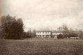
 Ham Spray House (geograph 2393080).jpg 2,560 × 1,920; 2.38 MB
-
 Ham Village Green - geograph.org.uk - 3361480.jpg 3,648 × 2,736; 2.19 MB
-
 Ham, postbox № SN8 115 - geograph.org.uk - 1896695.jpg 640 × 480; 84 KB
-
 Ham, postbox № SN8 137, Ham Spray - geograph.org.uk - 1896686.jpg 480 × 640; 151 KB
-
 HamSprayHouse.jpg 859 × 572; 429 KB
-
 Land art south of Inkpen - geograph.org.uk - 2214235.jpg 2,560 × 1,920; 3.33 MB
-
 Maize and farm road, Ham - geograph.org.uk - 1014723.jpg 640 × 427; 106 KB
-
 Maize, Ham - geograph.org.uk - 1014738.jpg 640 × 480; 205 KB
-
 Maize, Ham Spray - geograph.org.uk - 243527.jpg 640 × 480; 133 KB
-
 Manor House and church tower, Ham - geograph.org.uk - 1014735.jpg 640 × 480; 133 KB
-

-
 Pasture, Ham - geograph.org.uk - 1014732.jpg 640 × 480; 128 KB
-
 Pasture, Ham - geograph.org.uk - 2223405.jpg 640 × 427; 148 KB
-
 Pasture, Ham - geograph.org.uk - 769187.jpg 640 × 480; 125 KB
-
 Plantation below Ham Hill - geograph.org.uk - 1014708.jpg 640 × 480; 178 KB
-
 Rose Cottage, Ham (geograph 7469946).jpg 4,080 × 3,060; 4.86 MB
-
 Rose hips in a hedge north of Inkpen Hill - geograph.org.uk - 576823.jpg 640 × 640; 316 KB
-
 Rural perfection - geograph.org.uk - 345614.jpg 477 × 640; 85 KB
-
 Spray Road - geograph.org.uk - 243542.jpg 640 × 480; 149 KB
-
 Spray Road passes south of Cowleys Copse - geograph.org.uk - 3361886.jpg 3,525 × 2,645; 2.03 MB
-
 Stand of Pine on Ham Hill, Wiltshire - geograph.org.uk - 4058172.jpg 696 × 800; 173 KB
-
 Stubble and farm road, Ham - geograph.org.uk - 1014727.jpg 640 × 480; 136 KB
-
 Stubble, Ham - geograph.org.uk - 1014728.jpg 640 × 480; 142 KB
-
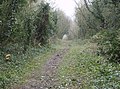
 Un-named road enters Ham - geograph.org.uk - 3361423.jpg 3,593 × 2,667; 1.82 MB
-
 Unnamed lane approaches the centre of Ham - geograph.org.uk - 3361445.jpg 3,648 × 2,736; 1.95 MB
-
 View from Ham Hill, Wiltshire - geograph.org.uk - 4058229.jpg 800 × 736; 177 KB
-
 Village green, Ham in Wiltshire - geograph.org.uk - 4172092.jpg 4,608 × 3,456; 4.14 MB
-
 Village houses, Ham, Wiltshire - geograph.org.uk - 4579727.jpg 3,968 × 2,537; 4.98 MB
-
 Well Cottage, Ham (geograph 7469999).jpg 4,080 × 3,060; 5.26 MB
-

-
 At the junction - geograph.org.uk - 345093.jpg 640 × 477; 144 KB
-
 Bitham Lane - geograph.org.uk - 345856.jpg 640 × 477; 130 KB
-
 Bridleway near Lower Green - geograph.org.uk - 345848.jpg 640 × 477; 135 KB
-
 Bridleway near Lower Green - geograph.org.uk - 345850.jpg 640 × 477; 137 KB
-
 Bungum Lane - geograph.org.uk - 345846.jpg 477 × 640; 145 KB
-
 Bungum Lane and Inkpen Hill - geograph.org.uk - 345841.jpg 640 × 477; 102 KB
-
 Buttermere Bottom - geograph.org.uk - 243789.jpg 640 × 480; 84 KB
-
 Byway along the crest - geograph.org.uk - 345657.jpg 640 × 477; 74 KB
-
 Byway, Ham Hill - geograph.org.uk - 243594.jpg 640 × 480; 108 KB
-
 Downland, Ham - geograph.org.uk - 762459.jpg 640 × 480; 126 KB
-
 Downland, Ham - geograph.org.uk - 769142.jpg 640 × 480; 131 KB
-
 Farm track near Ham - geograph.org.uk - 345623.jpg 640 × 477; 88 KB
-
 Farmland - geograph.org.uk - 345862.jpg 640 × 477; 109 KB
-
 Farmland above Buttermere - geograph.org.uk - 243692.jpg 640 × 480; 102 KB
-
 Farmland looking towards Mount Prosperous - geograph.org.uk - 345860.jpg 640 × 477; 101 KB
-
 Farmland near Ham - geograph.org.uk - 345221.jpg 640 × 477; 107 KB
-
 Farmland near Hungerford - geograph.org.uk - 760986.jpg 640 × 480; 139 KB
-
 Farmland next to Ashley Drove - geograph.org.uk - 243810.jpg 640 × 480; 97 KB
-
 Farmland, Oxenwood - geograph.org.uk - 763739.jpg 640 × 480; 141 KB
-
 Footpath near Anvilles Farm - geograph.org.uk - 345870.jpg 640 × 477; 69 KB
-
 Footpath up Ham Hill - geograph.org.uk - 99731.jpg 640 × 481; 67 KB
-
 Garden, Ham Spray - geograph.org.uk - 243552.jpg 640 × 480; 192 KB
-
 Gate - geograph.org.uk - 345102.jpg 640 × 477; 83 KB
-
 Grassland - geograph.org.uk - 345863.jpg 640 × 477; 93 KB
-
 Ham Hill - geograph.org.uk - 762458.jpg 640 × 480; 150 KB
-
 Ham Hill from above - geograph.org.uk - 345633.jpg 640 × 477; 77 KB
-
 Ham village - geograph.org.uk - 345608.jpg 640 × 477; 81 KB
-
 Ham village - geograph.org.uk - 345618.jpg 640 × 477; 80 KB
-
 Ham village - geograph.org.uk - 345619.jpg 640 × 477; 120 KB
-
 Ham village green - geograph.org.uk - 345611.jpg 640 × 477; 81 KB
-
 Ham Village Green - geograph.org.uk - 607978.jpg 640 × 427; 124 KB
-
 Ham Village Green - geograph.org.uk - 607983.jpg 640 × 427; 110 KB
-
 Heifers, near Upper Green, West Berkshire - geograph.org.uk - 778217.jpg 640 × 480; 125 KB
-
 In Elm Copse - geograph.org.uk - 345090.jpg 477 × 640; 145 KB
-
 Manor Farm - geograph.org.uk - 99743.jpg 640 × 481; 48 KB
-
 Over the fields to Ham Hill - geograph.org.uk - 99736.jpg 640 × 481; 33 KB
-
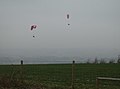 Paragliders - geograph.org.uk - 345648.jpg 640 × 477; 41 KB
-
 Path to Inkpen Hill - geograph.org.uk - 345836.jpg 640 × 477; 108 KB
-
 Restricted Byway (formerly RUPP) - geograph.org.uk - 345854.jpg 640 × 477; 150 KB
-
 Right of way^ - geograph.org.uk - 345624.jpg 640 × 477; 89 KB
-
 That way^ Really^ - geograph.org.uk - 345869.jpg 640 × 477; 102 KB
-
 The downs approaching Ham Hill - geograph.org.uk - 345643.jpg 640 × 477; 52 KB
-
 The gate off Ham Hill - geograph.org.uk - 345637.jpg 640 × 477; 78 KB
-
 Top of Ham Hill, looking North East - geograph.org.uk - 99738.jpg 640 × 481; 32 KB
-
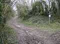
 Where's that footpath^ - geograph.org.uk - 345604.jpg 640 × 477; 100 KB


.jpg)


.jpg)


.jpg)


_-_geograph.org.uk_-_345854.jpg)


