Category:Handley, Cheshire
Aller à la navigation
Aller à la recherche
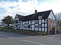
English: Handley is a village and civil parish in the unitary authority of Cheshire West and Chester and the ceremonial county of Cheshire, England.
village britannique  | |||||
| Téléverser des médias | |||||
| Nature de l’élément | |||||
|---|---|---|---|---|---|
| Lieu | Cheshire West and Chester, Cheshire, Angleterre du Nord-Ouest, Angleterre | ||||
 | |||||
Sous-catégories
Cette catégorie comprend 2 sous-catégories, dont les 2 ci-dessous.
A
- All Saints Church, Handley (9 F)
C
Média dans la catégorie « Handley, Cheshire »
Cette catégorie comprend 40 fichiers, dont les 40 ci-dessous.
-
 A41 Handley bypass - geograph.org.uk - 2874946.jpg 639 × 446 ; 119 kio
-
 Ambulance Station, Milton Green - geograph.org.uk - 2830563.jpg 4 000 × 3 000 ; 2,51 Mio
-
 Bridleway to Milton Green - geograph.org.uk - 4135429.jpg 4 000 × 3 000 ; 3,01 Mio
-
 Calveley Arms, Handley, Cheshire - geograph.org.uk - 827783.jpg 640 × 480 ; 64 kio
-
 Chapel Lane near Calveley Hall - geograph.org.uk - 2830547.jpg 4 000 × 3 000 ; 3,92 Mio
-
 Chapel Lane near Milton Green - geograph.org.uk - 2830511.jpg 4 000 × 3 000 ; 3,49 Mio
-
 Commemorative Monument, Handley - geograph.org.uk - 2830413.jpg 4 000 × 3 000 ; 3,64 Mio
-
 Field and gate on Chapel Lane - geograph.org.uk - 2830536.jpg 4 000 × 3 000 ; 3,14 Mio
-
 Footbridge over Golborne Brook - geograph.org.uk - 3696427.jpg 4 000 × 3 000 ; 2,79 Mio
-
 Footbridge over Golborne Brook - geograph.org.uk - 3697355.jpg 3 000 × 4 000 ; 4,02 Mio
-
 Footbridge over Mere Brook - geograph.org.uk - 4135449.jpg 4 000 × 3 000 ; 3,15 Mio
-
 Frog Lane-Whitchurch Road junction - geograph.org.uk - 2250503.jpg 640 × 480 ; 72 kio
-
 Gate on the Bishop Bennet Way - geograph.org.uk - 3697209.jpg 4 000 × 3 000 ; 2,27 Mio
-
 Golborne Bridge (geograph 4490348).jpg 1 600 × 1 202 ; 1,19 Mio
-
 Handley Oak 02.jpg 4 000 × 3 000 ; 812 kio
-
 Handley Oak, was three buildings, one being the post office.jpg 2 796 × 2 031 ; 1,55 Mio
-
 Handley Oak.jpg 3 648 × 2 736 ; 3,54 Mio
-
 Land beside Golborne Brook - geograph.org.uk - 3696391.jpg 4 000 × 3 000 ; 3,04 Mio
-
 Land beside Golborne Brook - geograph.org.uk - 3696407.jpg 4 000 × 3 000 ; 2,7 Mio
-
 Langford House, Handley.jpg 4 000 × 3 000 ; 896 kio
-
 Langford house.jpg 7 296 × 5 472 ; 11,31 Mio
-
 Milton Green - A41 at Chapel lane - geograph.org.uk - 2874949.jpg 639 × 453 ; 118 kio
-
 Milton Green - A41 at the car dealership - geograph.org.uk - 2874952.jpg 639 × 450 ; 126 kio
-
 Milton Green fm.jpg 7 296 × 5 472 ; 13,18 Mio
-
 Northern junction for Handley, A41 - geograph.org.uk - 2874944.jpg 639 × 447 ; 121 kio
-
 Railway bridge supports by A41 - geograph.org.uk - 4490360.jpg 1 600 × 1 199 ; 1,33 Mio
-
 Rocky Lane near Tattenhall - geograph.org.uk - 3121665.jpg 4 000 × 3 000 ; 3,04 Mio
-
 Site of railway bridge over the A41, Chowley - geograph.org.uk - 2874940.jpg 639 × 449 ; 120 kio
-
 Southern junction for Handley, A41 - geograph.org.uk - 2874941.jpg 635 × 452 ; 112 kio
-
 The A41 (Whitchurch Road) at Milton Green - geograph.org.uk - 2830429.jpg 4 000 × 3 000 ; 1,96 Mio
-
 The A41 (Whitchurch Road) near Handley - geograph.org.uk - 2830420.jpg 4 000 × 3 000 ; 2,23 Mio
-
 The Bishop Bennet Way - geograph.org.uk - 3697254.jpg 4 000 × 3 000 ; 2,59 Mio
-
 The Bishop Bennet Way near Beachin Stud - geograph.org.uk - 3697310.jpg 4 000 × 3 000 ; 3,2 Mio
-
 The Bishop Bennet Way near Beachin Wood - geograph.org.uk - 3697345.jpg 4 000 × 3 000 ; 3,65 Mio
-
 The Calveley Arms, Handley - geograph.org.uk - 2830307.jpg 4 995 × 3 661 ; 2,15 Mio
-
 View from Rocky Lane - geograph.org.uk - 3121653.jpg 4 000 × 3 000 ; 2,42 Mio
-
 View from the Bishop Bennet Way - geograph.org.uk - 3697328.jpg 4 000 × 3 000 ; 2,61 Mio
-
 Well House Farm, Handley.jpg 4 000 × 3 000 ; 5,11 Mio
-
 Whitchurch Road, Handley - geograph.org.uk - 2830251.jpg 4 000 × 3 000 ; 2,41 Mio
-
 Handley - view along Mere Brook - geograph.org.uk - 220723.jpg 640 × 480 ; 85 kio


.jpg)


_at_Milton_Green_-_geograph.org.uk_-_2830429.jpg)
_near_Handley_-_geograph.org.uk_-_2830420.jpg)


