Category:Hapsford
Aller à la navigation
Aller à la recherche
English: Hapsford is a village and former civil parish in the unitary authority of Cheshire West and Chester and the ceremonial county of Cheshire, England. It is located on the A5117 road, with Helsby to the east and the village of Elton, near Ellesmere Port, to the north west. Junction 14 of the M56 motorway and Chester services motorway service station are sited nearby. Map
village britannique  | |||||
| Téléverser des médias | |||||
| Nature de l’élément |
| ||||
|---|---|---|---|---|---|
| Lieu | Dunham-on-the-Hill and Hapsford, Cheshire West and Chester, Cheshire, Angleterre du Nord-Ouest, Angleterre | ||||
 | |||||
Sous-catégories
Cette catégorie comprend seulement la sous-catégorie ci-dessous.
H
- Hapsford Hall (3 F)
Média dans la catégorie « Hapsford »
Cette catégorie comprend 17 fichiers, dont les 17 ci-dessous.
-
 Brick shelter at Hapsford.JPG 4 320 × 3 240 ; 4,7 Mio
-
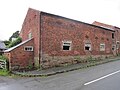 Derelict farm building, Hapsford (1).JPG 4 320 × 3 240 ; 3,67 Mio
-
 Derelict farm building, Hapsford (2).JPG 4 320 × 3 240 ; 3,05 Mio
-
 Helsby Arms Public House - geograph.org.uk - 619342.jpg 640 × 480 ; 71 kio
-
 Manor Farm Hapsford.JPG 4 000 × 3 000 ; 4,53 Mio
-
 Modern art^ - geograph.org.uk - 440595.jpg 640 × 477 ; 86 kio
-
 Moor Lane, Hapsford.JPG 4 320 × 3 240 ; 2,92 Mio
-
 Old farm buildings, Hapsford, Cheshire - geograph.org.uk - 1610163.jpg 640 × 480 ; 62 kio
-
 Side view of Hapsford Hall.JPG 4 320 × 3 240 ; 3,07 Mio
-
 Silo at Hapsford (1).JPG 4 320 × 3 240 ; 3,36 Mio
-
 Silo at Hapsford (2).JPG 4 320 × 3 240 ; 3,57 Mio
-
 Telephone kiosk, Hapsford.JPG 3 240 × 4 320 ; 4,09 Mio
-
 The Helsby Arms - geograph.org.uk - 422578.jpg 640 × 480 ; 63 kio
-
 Due south to Great Elm - geograph.org.uk - 747646.jpg 640 × 473 ; 128 kio
-
 Elliotts junction - geograph.org.uk - 295199.jpg 640 × 480 ; 67 kio
-
 Railway arch on quarry line - geograph.org.uk - 440604.jpg 640 × 477 ; 114 kio
-
 Track to Murtrey Hill Farm - geograph.org.uk - 448972.jpg 640 × 480 ; 105 kio

.JPG)
.JPG)


.JPG)
.JPG)


