Category:Hapton, Lancashire
Jump to navigation
Jump to search
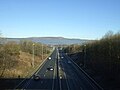
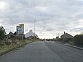
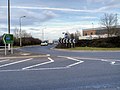
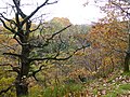
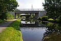
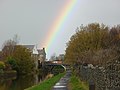
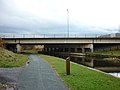
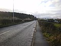
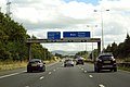
English: Hapton is a village and civil parish in the borough of Burnley, in the English county of Lancashire. The village is west of Burnley town centre, and has a railway station on the East Lancashire Line. It has a population of 3,769. The Leeds and Liverpool Canal and M65 motorway both pass through the village. (→Hapton, Lancashire)
Nederlands: Hapton is een plaats en civil parish in het bestuurlijke gebied Burnley, in het Engelse graafschap Lancashire met 3.769 inwoners. (→Hapton)
Polski: Hapton – wieś w Anglii, w hrabstwie Lancashire, w dystrykcie Burnley. Leży 36 km na północ od miasta Manchester i 293 km na północny zachód od Londynu. W 2001 miejscowość liczyła 3769 mieszkańców. (→Hapton (Lancashire))

village and civil parish in Burnley, Lancashire, England  | |||||
| Upload media | |||||
| Instance of | |||||
|---|---|---|---|---|---|
| Location | Burnley, Lancashire, North West England, England | ||||
| Population |
| ||||
 | |||||
Subcategories
This category has the following 4 subcategories, out of 4 total.
H
- Hameldon Hill (41 F)
- Hapton railway station (5 F)
S
- Shuttleworth Hall (2 F)
Media in category "Hapton, Lancashire"
The following 200 files are in this category, out of 400 total.
(previous page) (next page)-
-

-
 A clough above Huncoat - geograph.org.uk - 1654055.jpg 640 × 428; 87 KB
-
 A cow on Hameldon Hill - geograph.org.uk - 3543025.jpg 3,872 × 2,592; 4.17 MB
-
 A distant windfarm - geograph.org.uk - 4137037.jpg 4,592 × 3,056; 7.49 MB
-
 A footpath cuts across the loop in the canal - geograph.org.uk - 4841956.jpg 3,056 × 4,592; 6.99 MB
-
 A noisy Canada Goose - geograph.org.uk - 4843981.jpg 4,485 × 2,897; 5.89 MB
-
 A rainy day on the M65 - geograph.org.uk - 5464014.jpg 2,000 × 1,333; 1.26 MB
-
 A View Northwards towards Burnley - geograph.org.uk - 5757252.jpg 5,184 × 3,456; 6.75 MB
-
-
 A56 near Huncoat - geograph.org.uk - 4073590.jpg 1,351 × 857; 147 KB
-
-
 A56, Childers Green - geograph.org.uk - 2942386.jpg 640 × 481; 513 KB
-
 A6068 looking south - geograph.org.uk - 3337437.jpg 640 × 480; 47 KB
-
 A6068 Near Hapton - geograph.org.uk - 2935906.jpg 640 × 481; 540 KB
-
 A679 Accrington Road - geograph.org.uk - 6308145.jpg 1,024 × 768; 168 KB
-
 A679 Accrington Road at Hapton boundary - geograph.org.uk - 6308168.jpg 1,024 × 770; 112 KB
-
 A679 Burnley Road nears the A56 junction - geograph.org.uk - 6308191.jpg 1,024 × 769; 117 KB
-
 A679 Link Road to M65 Junction 9 - geograph.org.uk - 4377853.jpg 640 × 480; 271 KB
-
 A679 nearing The Hapton Inn - geograph.org.uk - 6308185.jpg 1,024 × 768; 118 KB
-
 A679 Traffic Island, Accrington Road - geograph.org.uk - 4377850.jpg 640 × 480; 248 KB
-
 Above Park Scout - geograph.org.uk - 5757263.jpg 5,184 × 3,456; 6.61 MB
-
 Access Lane leading from Old Barn Farm - geograph.org.uk - 5303589.jpg 5,184 × 3,456; 6.49 MB
-
 Accrington Bypass A56 looking North - geograph.org.uk - 1370083.jpg 640 × 480; 62 KB
-
 Accrington Bypass A56 looking South - geograph.org.uk - 1370086.jpg 640 × 480; 64 KB
-
 Accrington Road (A679) - geograph.org.uk - 5229696.jpg 640 × 480; 79 KB
-
 Accrington Road (A679) - geograph.org.uk - 5229708.jpg 640 × 463; 41 KB
-

-
 Advertising Hoardings Junction 9 M65 - geograph.org.uk - 1443577.jpg 640 × 480; 72 KB
-
 Agra Indian Restaurant (13132067194).jpg 5,184 × 3,456; 3.12 MB
-
 Agra Indian Restaurant (13132075564).jpg 5,184 × 3,456; 3.19 MB
-
 Agra, Indian Restaurant - geograph.org.uk - 2192834.jpg 640 × 480; 72 KB
-
 Agra, Indian Restaurant, Sign - geograph.org.uk - 2192838.jpg 640 × 480; 124 KB
-
 All that remains of Hepworth Pipes - geograph.org.uk - 3064465.jpg 640 × 480; 118 KB
-
 All that remains of Hepworth Pipes - geograph.org.uk - 3064472.jpg 640 × 480; 136 KB
-
 An accumulation of vehicles at Old Barn Farm - geograph.org.uk - 2230968.jpg 3,872 × 2,592; 2.08 MB
-
 Approaching bridge 120 and an end to the mud - geograph.org.uk - 4850479.jpg 4,592 × 3,056; 6.21 MB
-
 Approaching Shuttleworth Hall Bridge - geograph.org.uk - 3707995.jpg 1,600 × 1,200; 780 KB
-
 Autumn at Childers Green (geograph 3749535).jpg 1,600 × 1,200; 355 KB
-
 Autumn colour at Castle Clough wood - geograph.org.uk - 3749550.jpg 1,600 × 1,200; 838 KB
-
 Autumn foliage at Castle Clough Wood - geograph.org.uk - 3749545.jpg 1,600 × 1,200; 849 KB
-
 Barley Green from Thorney Bank Wood - geograph.org.uk - 3749581.jpg 1,600 × 1,200; 359 KB
-
 Bentley Wood Farm public house - geograph.org.uk - 5229702.jpg 640 × 480; 65 KB
-
 Beyond the future - geograph.org.uk - 616415.jpg 640 × 425; 49 KB
-
 Bridge 119A, Leeds ^ Liverpool Canal - geograph.org.uk - 6249994.jpg 1,280 × 850; 792 KB
-
 Bridge 120, Leeds ^ Liverpool Canal - geograph.org.uk - 6249976.jpg 1,280 × 862; 693 KB
-
 Bridge 120, Leeds ^ Liverpool Canal - geograph.org.uk - 6249982.jpg 1,280 × 1,024; 772 KB
-
 Bridge 121 on the Leeds and Liverpool Canal at Hapton - geograph.org.uk - 4841909.jpg 4,362 × 2,847; 7.85 MB
-
 Bridge 121, Leeds ^ Liverpool Canal - geograph.org.uk - 6249955.jpg 1,280 × 850; 638 KB
-
 Bridge 122A on the Leeds Liverpool Canal - geograph.org.uk - 5303795.jpg 5,184 × 3,456; 7.31 MB
-
 Bridge 122A, Leeds ^ Liverpool Canal - geograph.org.uk - 6249236.jpg 1,280 × 862; 687 KB
-
 Bridge 122A, Leeds ^ Liverpool Canal - geograph.org.uk - 6249328.jpg 1,280 × 862; 610 KB
-
 Bridge 122AA on the Leeds Liverpool Canal - geograph.org.uk - 5303792.jpg 5,184 × 3,456; 4.2 MB
-
 Bridge 123, Leeds ^ Liverpool Canal - geograph.org.uk - 6249324.jpg 1,280 × 850; 684 KB
-
 Bridge and walkers on the Leeds and Liverpool Canal - geograph.org.uk - 4842599.jpg 4,096 × 2,423; 7.91 MB
-
 Bridge over the M65 - Hapton - geograph.org.uk - 2285712.jpg 4,028 × 2,688; 1.8 MB
-

-

-
 Bridge ^119A, Shuttleworth Bridge - geograph.org.uk - 2935898.jpg 640 × 481; 576 KB
-

-
-
-

-
 Bridge^124AA, Leeds and Liverpool Canal - geograph.org.uk - 4374685.jpg 640 × 481; 359 KB
-
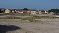 Brown-field housing development, Hapton - geograph.org.uk - 6249402.jpg 1,280 × 720; 482 KB
-

-
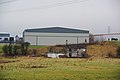
 Burnley Bridge Business Park - geograph.org.uk - 5940198.jpg 640 × 432; 89 KB
-

-

-
 Burnley Business Park Bridge - geograph.org.uk - 3708691.jpg 1,600 × 1,200; 706 KB
-
 Burnley Business Park Bridge - geograph.org.uk - 4374628.jpg 640 × 480; 292 KB
-
 Burnley Lane, Bridge Over the A56 - geograph.org.uk - 2942377.jpg 640 × 481; 558 KB
-
 Burnley Road, Hapton - geograph.org.uk - 1146966.jpg 640 × 480; 72 KB
-
 Burnley Road, Hapton - geograph.org.uk - 1606223.jpg 640 × 480; 64 KB
-
 Burnley Way above Thorny Bank Clough - geograph.org.uk - 5899268.jpg 5,184 × 3,456; 7.23 MB
-
 Burnley Way descending Hameldon Scouts - geograph.org.uk - 5899246.jpg 5,184 × 3,456; 7.72 MB
-
 Burnley Way near Childers Green.jpg 3,005 × 4,007; 6.36 MB
-
 Burnley Way near Green Side Farm, Hapton.jpg 3,005 × 4,007; 4.96 MB
-
 Burnley Way on Hameldon Hill - geograph.org.uk - 2764210.jpg 3,072 × 2,304; 1.12 MB
-
 Burnley Way on Hameldon Hill - geograph.org.uk - 5757267.jpg 5,184 × 3,456; 7.56 MB
-
 Burnley Way on the Eastern Flanks of Great Hameldon - geograph.org.uk - 5899279.jpg 5,184 × 3,456; 7.61 MB
-
 Burnt Out Car on Hameldon Hill - geograph.org.uk - 5757293.jpg 5,184 × 3,456; 7.37 MB
-

-
 Bypass A56 - geograph.org.uk - 1199015.jpg 640 × 480; 86 KB
-
 Cable bridges over the River Calder - geograph.org.uk - 2357556.jpg 3,872 × 2,592; 3.67 MB
-
 Cable bridges over the River Calder - geograph.org.uk - 4528559.jpg 1,600 × 1,200; 562 KB
-
 Canal and Motorway - geograph.org.uk - 3707985.jpg 1,600 × 1,200; 523 KB
-
 Canal and motorway crossing Castle Clough - geograph.org.uk - 2359049.jpg 3,872 × 2,592; 4.23 MB
-

-
 Castle Clough Cottages at Hapton - geograph.org.uk - 5940546.jpg 640 × 481; 95 KB
-
 Castle Clough Farm - geograph.org.uk - 2359037.jpg 3,872 × 2,592; 2.48 MB
-
 Castle Clough near Hapton - geograph.org.uk - 3749556.jpg 1,600 × 1,200; 807 KB
-
 Castle Clough Wood - geograph.org.uk - 1596500.jpg 640 × 480; 160 KB
-
 Castle Clough, Hapton - geograph.org.uk - 2054496.jpg 640 × 480; 235 KB
-
 Causing a queue - geograph.org.uk - 5313575.jpg 1,024 × 742; 155 KB
-
 Childers Green Ford - geograph.org.uk - 5642173.jpg 4,032 × 3,024; 4.08 MB
-
-
 Country above New Barn Clough - geograph.org.uk - 5302825.jpg 5,184 × 3,456; 6.71 MB
-
 Cronker Plantation - geograph.org.uk - 1654068.jpg 640 × 428; 89 KB
-
 Derelict house by the industrial estate - geograph.org.uk - 2230935.jpg 3,872 × 2,592; 2.24 MB
-
 Dereliction and beauty side by side - geograph.org.uk - 2168913.jpg 800 × 600; 235 KB
-
 Descending towards Old Barn Farm - geograph.org.uk - 5303583.jpg 5,184 × 3,456; 5.31 MB
-
 Drainage into the Calder valley - geograph.org.uk - 2230916.jpg 3,872 × 2,592; 2.05 MB
-
 Dry Stone Walling off Accrington Road, Hapton - geograph.org.uk - 2042604.jpg 1,632 × 1,224; 555 KB
-
 East Lancashire Line near Hapton.jpg 3,976 × 2,983; 3.45 MB
-
 Eastbound slip to M65 at Junction 8 - geograph.org.uk - 3337440.jpg 640 × 480; 51 KB
-
 Electricity - geograph.org.uk - 616411.jpg 640 × 425; 56 KB
-
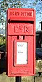
 Elizabeth II postbox on Manchester Road, Lane Ends - geograph.org.uk - 5252222.jpg 2,848 × 2,136; 1.41 MB
-
 Entrance to Burnley Bridge Business Park - geograph.org.uk - 4377861.jpg 640 × 480; 241 KB
-
 Entrance to Hameldon Wood at Barley Green - geograph.org.uk - 3749563.jpg 1,600 × 1,200; 653 KB
-
 Entrance to Shuttleworth Hall Farm - geograph.org.uk - 2935904.jpg 640 × 427; 441 KB
-

-
 Farm on Mill Hill Lane - geograph.org.uk - 5229522.jpg 640 × 480; 60 KB
-
 Farm track off Accrington Road (A679) - geograph.org.uk - 5229699.jpg 640 × 408; 120 KB
-
 Footpath following a disused railway line - geograph.org.uk - 4895547.jpg 3,056 × 4,592; 7.72 MB
-
 Footpath following a disused railway line - geograph.org.uk - 4895599.jpg 2,369 × 3,847; 6.33 MB
-
 Footpath heading towards Bentley Wood Green - geograph.org.uk - 5303601.jpg 5,184 × 3,456; 4.08 MB
-
 Footpath in Hameldon Woods - geograph.org.uk - 5898474.jpg 5,184 × 3,456; 4.11 MB
-
 Footpath off the A679 - geograph.org.uk - 2230269.jpg 3,872 × 2,592; 2.85 MB
-
 Footpath to Bentley Wood Green - geograph.org.uk - 4842495.jpg 4,422 × 2,837; 6.44 MB
-
 Footpath to Miste Farm - geograph.org.uk - 5848483.jpg 4,592 × 3,056; 7.19 MB
-
 Ford and Rider at Childers Green - geograph.org.uk - 3334258.jpg 2,048 × 1,536; 1.22 MB
-
 Ford on Mill Hill Lane - geograph.org.uk - 2054530.jpg 640 × 480; 219 KB
-
 Ford on Mill Hill Lane - geograph.org.uk - 5229516.jpg 640 × 480; 129 KB
-
 Former Blythe Chemical Works - geograph.org.uk - 1523817.jpg 640 × 480; 50 KB
-
 Former Blythe Chemical Works - geograph.org.uk - 1523818.jpg 640 × 480; 49 KB
-
 Former Blythe Chemical Works - geograph.org.uk - 1523822.jpg 640 × 480; 64 KB
-
 Former Blythe Chemical Works, Gate - geograph.org.uk - 1523826.jpg 640 × 480; 59 KB
-

-

-
 Former Hapton Valley Coal Mine - geograph.org.uk - 1146965.jpg 640 × 480; 55 KB
-
 Former Hapton Valley Coal Mine, Steps - geograph.org.uk - 1146971.jpg 480 × 640; 113 KB
-
 Frost covered fields near Shuttleworth Hall - geograph.org.uk - 2240602.jpg 4,592 × 3,056; 7.8 MB
-
 Frozen Moorland On Great Hameldon - geograph.org.uk - 3345634.jpg 2,592 × 1,944; 1.88 MB
-
 Gantry sign over the M65 - geograph.org.uk - 4237437.jpg 1,500 × 999; 863 KB
-
 Gate and track leading to Old Barn Farm - geograph.org.uk - 2230259.jpg 3,872 × 2,592; 2.54 MB
-
 Grazing north of Mill Hill Lane - geograph.org.uk - 5229519.jpg 640 × 480; 51 KB
-
 Grazing off Accrington Road (A679) - geograph.org.uk - 5229542.jpg 640 × 422; 35 KB
-
 Grazing off Accrington Road (A679) - geograph.org.uk - 5229701.jpg 640 × 480; 61 KB
-
 Great and Little Hameldon - geograph.org.uk - 4668472.jpg 3,648 × 2,736; 3.86 MB
-
 Great Hameldon - geograph.org.uk - 3345629.jpg 2,592 × 1,944; 1.92 MB
-
 Great Hameldon - geograph.org.uk - 3795005.jpg 3,648 × 2,736; 4.37 MB
-
 Great Hameldon and Longridge Fell - geograph.org.uk - 3795025.jpg 3,648 × 2,736; 4.82 MB
-
 Great Hameldon and Oswaldtwistle Moor - geograph.org.uk - 5215908.jpg 5,152 × 3,864; 7.06 MB
-
 Great Hill to Clowbridge Reservoir - geograph.org.uk - 5215891.jpg 5,152 × 3,864; 7.12 MB
-
 H pworth, Hapton - geograph.org.uk - 2232480.jpg 480 × 640; 102 KB
-
 Hameldon Common to Pendle - geograph.org.uk - 4668429.jpg 3,648 × 2,736; 3.66 MB
-
 Hameldon Hill Weather Station - geograph.org.uk - 4036622.jpg 2,240 × 1,024; 378 KB
-
 Hameldon Hill Windfarm, aerial 2014 - geograph.org.uk - 4101680.jpg 1,024 × 636; 104 KB
-
 Hameldon Hill with masts - geograph.org.uk - 3795039.jpg 3,648 × 2,736; 3.99 MB
-
 Hameldon Hill, aerial 2018 - geograph.org.uk - 5886146.jpg 800 × 533; 100 KB
-
 Hameldon to Oswaldtwistle Moor - geograph.org.uk - 5215901.jpg 5,152 × 3,864; 7.1 MB
-
 Hameldon to Pendle - geograph.org.uk - 4668495.jpg 3,648 × 2,736; 4.49 MB
-
 Happy Valley - geograph.org.uk - 1118954.jpg 640 × 480; 78 KB
-
 Hapton , A56 - geograph.org.uk - 6360118.jpg 6,000 × 4,000; 5.83 MB
-
 Hapton , Motorway Sliproad - geograph.org.uk - 6360026.jpg 6,000 × 4,000; 5.57 MB
-
 Hapton , The A56 - geograph.org.uk - 6360122.jpg 6,000 × 4,000; 5.06 MB
-
 Hapton , The A6068 - geograph.org.uk - 6360027.jpg 6,000 × 4,000; 5.91 MB
-
 Hapton , The A6068 - geograph.org.uk - 6360032.jpg 6,000 × 4,000; 5.95 MB
-
 Hapton , The A6068 - geograph.org.uk - 6360036.jpg 6,000 × 4,000; 5.99 MB
-
 Hapton Bridge - geograph.org.uk - 4572204.jpg 2,452 × 1,766; 2.19 MB
-
 Hapton Bridge No 121 - geograph.org.uk - 5940295.jpg 640 × 433; 75 KB
-
 Hapton Bridge, Leeds ^ Liverpool Canal - geograph.org.uk - 3708662.jpg 1,600 × 1,200; 583 KB
-
 Hapton Castle.jpg 5,344 × 3,008; 6.57 MB
-
 Hapton Inn, Lane Ends - geograph.org.uk - 2897209.jpg 640 × 480; 411 KB
-
 Hapton Park - geograph.org.uk - 4668461.jpg 3,648 × 2,736; 4.64 MB
-
 Hapton Reservoir separated from local industry by the M65 - geograph.org.uk - 4841852.jpg 4,567 × 2,529; 6.74 MB
-
 Hapton Tower excavation 2.jpg 4,008 × 3,005; 4.55 MB
-
 Hapton Tower excavation.jpg 4,008 × 3,006; 4.13 MB
-
 Hapton Valley Colliery 1.jpg 4,008 × 3,005; 5.13 MB
-
 Hapton Valley Colliery 2.jpg 4,008 × 3,006; 2.35 MB
-
 Hapton Valley Colliery 3.jpg 4,008 × 3,005; 3.37 MB
-
 Hapton War Memorial - geograph.org.uk - 2897190.jpg 480 × 640; 504 KB
-
 Hapton, Lancashire - geograph.org.uk - 2042602.jpg 1,632 × 1,224; 510 KB
-
 Harvester pub sign - geograph.org.uk - 5229704.jpg 640 × 602; 158 KB
-
 Haslingden and Holcombe from Hameldon - geograph.org.uk - 4674395.jpg 3,648 × 2,736; 3.45 MB
-
 Haslingden Grane from the Burnley Way - geograph.org.uk - 3795011.jpg 3,648 × 2,736; 4.14 MB
-
 Haslingden Moor - geograph.org.uk - 4668350.jpg 3,648 × 2,736; 4.72 MB
-
 Haslingden Moor and Musbury Heights - geograph.org.uk - 5215940.jpg 5,152 × 3,864; 7.04 MB
-
 Hepworth, Hapton - geograph.org.uk - 2232440.jpg 640 × 480; 127 KB
-
 Hepworth, Hapton - geograph.org.uk - 2232442.jpg 640 × 480; 123 KB
-
 Hepworth, Hapton - geograph.org.uk - 2232445.jpg 640 × 480; 131 KB
-
 Hepworth, Hapton - geograph.org.uk - 2232447.jpg 640 × 480; 121 KB
-
 Hepworth, Hapton - geograph.org.uk - 2232448.jpg 640 × 480; 100 KB
-
 Hepworth, Hapton - geograph.org.uk - 2232449.jpg 640 × 480; 108 KB
-
 Hepworth, Hapton - geograph.org.uk - 2232454.jpg 604 × 452; 113 KB
-
 Hepworth, Hapton - geograph.org.uk - 2232455.jpg 640 × 480; 111 KB
-
 Hepworth, Hapton - geograph.org.uk - 2232457.jpg 640 × 480; 115 KB
-
 Hepworth, Hapton - geograph.org.uk - 2232458.jpg 602 × 450; 102 KB
-
 Hepworth, Hapton - geograph.org.uk - 2232460.jpg 640 × 480; 167 KB
-
 Hepworth, Hapton - geograph.org.uk - 2232462.jpg 640 × 480; 166 KB
-
 Hepworth, Hapton - geograph.org.uk - 2232465.jpg 640 × 480; 103 KB
-
 Hepworth, Hapton - geograph.org.uk - 2232472.jpg 480 × 640; 78 KB
-
 Hepworth, Hapton - geograph.org.uk - 2232474.jpg 480 × 640; 81 KB
-
 Hepworth, Hapton - geograph.org.uk - 2232475.jpg 640 × 480; 159 KB
-
 Hepworth, Hapton - geograph.org.uk - 2232476.jpg 640 × 480; 156 KB
-
 Hepworth, Hapton - geograph.org.uk - 2232481.jpg 640 × 480; 158 KB
-
 Hepworth, Hapton, Sign - geograph.org.uk - 2232463.jpg 480 × 640; 46 KB
-
 Higher Shuttleworth (A6068) - geograph.org.uk - 6128164.jpg 800 × 600; 129 KB
-
 Higher Shuttleworth Bridge - geograph.org.uk - 3953383.jpg 4,320 × 3,240; 3.8 MB


_-_geograph.org.uk_-_5229696.jpg)
_-_geograph.org.uk_-_5229708.jpg)


.jpg)
.jpg)


.jpg)


,_Lane_Ends_-_geograph.org.uk_-_5229538.jpg)


_-_geograph.org.uk_-_5229699.jpg)


_-_geograph.org.uk_-_5229542.jpg)
_-_geograph.org.uk_-_5229701.jpg)


_-_geograph.org.uk_-_6128164.jpg)
