Category:Harley, Shropshire
Aller à la navigation
Aller à la recherche
village britannique  Eglwys y Santes Fair, Harley | |||||
| Téléverser des médias | |||||
| Nature de l’élément | |||||
|---|---|---|---|---|---|
| Lieu | Shropshire, Midlands de l'Ouest, Angleterre | ||||
 | |||||
Sous-catégories
Cette catégorie comprend seulement la sous-catégorie ci-dessous.
M
Média dans la catégorie « Harley, Shropshire »
Cette catégorie comprend 107 fichiers, dont les 107 ci-dessous.
-
 A field-edge footpath near Harley - geograph.org.uk - 2801722.jpg 1 142 × 857 ; 313 kio
-
 A marsh no more - geograph.org.uk - 2801726.jpg 1 240 × 930 ; 317 kio
-
 A narrow bridleway towards Blakeway Farm - geograph.org.uk - 1929251.jpg 691 × 518 ; 207 kio
-
 A steep track on Harley Hill - geograph.org.uk - 1929247.jpg 666 × 499 ; 190 kio
-
 A258 road crossing Wenlock Edge at Harley Hill - geograph.org.uk - 1935517.jpg 800 × 541 ; 209 kio
-
 A458 approaching Harley Bridge - geograph.org.uk - 2867208.jpg 640 × 480 ; 60 kio
-
-
 A458 at the junction for Wigwig and Homer - geograph.org.uk - 2867216.jpg 640 × 480 ; 46 kio
-
 A458 at the southern junction for Harley - geograph.org.uk - 2867212.jpg 640 × 480 ; 69 kio
-
 A458 north of Harley Hill - geograph.org.uk - 2867152.jpg 640 × 480 ; 44 kio
-
 A458 towards Much Wenlock - geograph.org.uk - 6108822.jpg 640 × 480 ; 101 kio
-
 A458 towards Shrewsbury - geograph.org.uk - 6108522.jpg 800 × 600 ; 140 kio
-
 A458 towards Shrewsbury - geograph.org.uk - 6108809.jpg 800 × 600 ; 153 kio
-
 A458 towards Shrewsbury - geograph.org.uk - 6108829.jpg 800 × 600 ; 128 kio
-
 A458, Harley - geograph.org.uk - 6108816.jpg 800 × 600 ; 180 kio
-
 Across the field to The Gippols - geograph.org.uk - 821192.jpg 640 × 480 ; 72 kio
-
 Along the lane towards Harley - geograph.org.uk - 2802785.jpg 1 306 × 979 ; 317 kio
-
 Approaching Rowley Farm from the Gippols direction - geograph.org.uk - 2804233.jpg 1 142 × 857 ; 330 kio
-
 Ash tree - geograph.org.uk - 4080786.jpg 853 × 1 280 ; 1,89 Mio
-
 Barn conversions at Castlehill - geograph.org.uk - 2797586.jpg 979 × 734 ; 368 kio
-
 Barn conversions in Harley - geograph.org.uk - 2800660.jpg 1 306 × 979 ; 313 kio
-
 Blakeway Coppice, Wenlock Edge - geograph.org.uk - 6220995.jpg 1 024 × 683 ; 387 kio
-
 Blakeway Hollow - geograph.org.uk - 6220878.jpg 1 024 × 683 ; 388 kio
-
 Brant, Harley.jpg 1 142 × 857 ; 334 kio
-
 Bridleway along Wenlock Edge - geograph.org.uk - 4080776.jpg 1 280 × 1 280 ; 3,25 Mio
-
 Bridleway along Wenlock Edge - geograph.org.uk - 4080781.jpg 1 280 × 1 280 ; 3,17 Mio
-
 Church Cottage - geograph.org.uk - 740911.jpg 640 × 480 ; 80 kio
-
 Cottage Coppice - geograph.org.uk - 6108519.jpg 800 × 578 ; 186 kio
-
 Crop field and hedgerow, Harley - geograph.org.uk - 6108810.jpg 800 × 528 ; 118 kio
-
 Crop spraying north of Harley - geograph.org.uk - 6108828.jpg 800 × 521 ; 127 kio
-
 Down the lane to the bridge over the Harley Brook - geograph.org.uk - 2796670.jpg 1 077 × 808 ; 349 kio
-
 Field entrance, Harley - geograph.org.uk - 6108812.jpg 800 × 600 ; 120 kio
-
 Footbridge over the Harley Brook - geograph.org.uk - 1929252.jpg 640 × 480 ; 214 kio
-
 Footpath across winter wheat near Wigwig - geograph.org.uk - 2800678.jpg 1 306 × 979 ; 379 kio
-
 Grazing, Harley Bridge - geograph.org.uk - 6108528.jpg 800 × 600 ; 152 kio
-
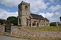
 Harley church - geograph.org.uk - 5798124.jpg 1 024 × 680 ; 293 kio
-
 Harley church - geograph.org.uk - 5798126.jpg 1 024 × 680 ; 243 kio
-
 Harley church - geograph.org.uk - 5798128.jpg 1 024 × 680 ; 262 kio
-
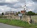 Harley fingerpost - geograph.org.uk - 740910.jpg 640 × 480 ; 81 kio
-
 Harley Nursery - geograph.org.uk - 6108819.jpg 800 × 529 ; 146 kio
-
 Harley village from the south - geograph.org.uk - 2797583.jpg 1 306 × 979 ; 366 kio
-
 Hatchment in Harley church - geograph.org.uk - 5798161.jpg 1 024 × 680 ; 133 kio
-
 Hatchment in Harley church - geograph.org.uk - 5798163.jpg 1 024 × 680 ; 140 kio
-
 Hay bales - geograph.org.uk - 4080787.jpg 1 280 × 1 280 ; 1,91 Mio
-
 Its steeper than it looks. - geograph.org.uk - 724187.jpg 640 × 480 ; 85 kio
-
 Junction in Harley - geograph.org.uk - 2797591.jpg 1 142 × 857 ; 358 kio
-
 Kissing Gate and Footpath - geograph.org.uk - 724174.jpg 640 × 480 ; 92 kio
-
 Long distance paths - geograph.org.uk - 689484.jpg 640 × 480 ; 132 kio
-
 Looking back along the lane towards Harley - geograph.org.uk - 2801720.jpg 979 × 734 ; 379 kio
-
 Looking south from a lay-by on the A458 - geograph.org.uk - 6090273.jpg 4 000 × 3 000 ; 2,27 Mio
-
 Lower Springs Farm - geograph.org.uk - 740868.jpg 640 × 480 ; 86 kio
-
 Narrow lane at Domas - geograph.org.uk - 740907.jpg 640 × 480 ; 93 kio
-
 National Trust sign at Wenlock Edge - geograph.org.uk - 200861.jpg 640 × 480 ; 166 kio
-
 No. 3 Harley.jpg 3 264 × 2 448 ; 1,92 Mio
-
 Northbound layby on the A458 - geograph.org.uk - 2867226.jpg 640 × 480 ; 44 kio
-
 Old Direction Sign - Signpost by the former A458, Harley Parish - geograph.org.uk - 6043751.jpg 1 400 × 1 050 ; 331 kio
-
 Old Direction Sign - Signpost in Harley - geograph.org.uk - 6094806.jpg 900 × 1 200 ; 185 kio
-
 Old Direction Sign - Signpost in Harley village - geograph.org.uk - 6093895.jpg 600 × 800 ; 121 kio
-
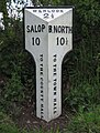 Old Milepost by the A458, Harley Parish - geograph.org.uk - 6044048.jpg 757 × 1 000 ; 148 kio
-
 Old Rectory, Harley.jpg 1 142 × 857 ; 356 kio
-
-
 Sign for the Plume of Feathers - geograph.org.uk - 6108524.jpg 631 × 800 ; 84 kio
-
 Slow going on Harley Hill - geograph.org.uk - 6368687.jpg 3 917 × 2 537 ; 3,2 Mio
-
 Snow on fields at Merrishaw Farm - geograph.org.uk - 2804223.jpg 1 142 × 857 ; 305 kio
-
 Stile on footpath into Rabbit Warren Plantation - geograph.org.uk - 628145.jpg 640 × 480 ; 108 kio
-
 The A458 road to Much Wenlock and Bridgnorth - geograph.org.uk - 1935002.jpg 800 × 555 ; 123 kio
-
 The A458 road to Shrewsbury - geograph.org.uk - 1934594.jpg 800 × 534 ; 122 kio
-
 The Harley Brook - upstream of the bridge - geograph.org.uk - 2796674.jpg 734 × 979 ; 406 kio
-
 The lane from Rowley Farm towards Harley - geograph.org.uk - 2796666.jpg 1 077 × 808 ; 345 kio
-
 The Old Rectory, Harley - geograph.org.uk - 5798151.jpg 1 024 × 680 ; 311 kio
-
 The Plume of Feathers (inn sign) - geograph.org.uk - 1934583.jpg 591 × 800 ; 109 kio
-
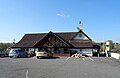
 The Plume of Feathers - geograph.org.uk - 1934546.jpg 1 024 × 688 ; 160 kio
-
 The Plume of Feathers - geograph.org.uk - 252078.jpg 640 × 480 ; 91 kio
-
 The Plume of Feathers - geograph.org.uk - 6108523.jpg 800 × 518 ; 73 kio
-
 The Plume of Feathers on A458 south of Harley - geograph.org.uk - 5998380.jpg 1 600 × 890 ; 644 kio
-
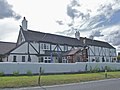 The Plume of Feathers, Harley - geograph.org.uk - 2496525.jpg 3 488 × 2 616 ; 2,28 Mio
-
 The village bus-stop - geograph.org.uk - 740909.jpg 640 × 480 ; 131 kio
-
 This village is full of signs - geograph.org.uk - 740912.jpg 640 × 480 ; 83 kio
-
 Treetops along Wenlock Edge - geograph.org.uk - 5044766.jpg 640 × 352 ; 51 kio
-
 Waterlogged field entrance off the A458 - geograph.org.uk - 6108826.jpg 800 × 600 ; 213 kio
-
 Wenlock Edge from Harley Hill end, looking South - geograph.org.uk - 6344359.jpg 1 024 × 575 ; 205 kio
-
 Wig Wig Ford - geograph.org.uk - 706876.jpg 640 × 480 ; 111 kio
-
 Wood Lane near Harley - geograph.org.uk - 740275.jpg 640 × 480 ; 104 kio
-
 Woodland on Wenlock Edge - geograph.org.uk - 6220879.jpg 1 024 × 683 ; 416 kio
-
 Woodland on Wenlock Edge - geograph.org.uk - 6220881.jpg 1 024 × 683 ; 411 kio
-
 You can relax at the bus-stop here - geograph.org.uk - 740269.jpg 640 × 480 ; 124 kio
-
 Blakeway Cottage and National Trust fields - geograph.org.uk - 1503767.jpg 640 × 480 ; 78 kio
-
 Blakeway Farm - geograph.org.uk - 1503772.jpg 640 × 480 ; 76 kio
-
 Blakeway Farm - geograph.org.uk - 200857.jpg 640 × 480 ; 103 kio
-
 Blakeway Hollow, above Blakeway Farm - geograph.org.uk - 1503764.jpg 480 × 640 ; 144 kio
-
 Cattle and Poultry, near Harley, Shropshire - geograph.org.uk - 631181.jpg 1 440 × 1 049 ; 1,17 Mio
-
 Cottage Coppice and the A 458 to Shrewsbury - geograph.org.uk - 724190.jpg 640 × 480 ; 92 kio
-
 Detail of trig. point - geograph.org.uk - 288109.jpg 480 × 640 ; 141 kio
-
 Field by Merrishaw Farm - geograph.org.uk - 740864.jpg 640 × 480 ; 58 kio
-
 Fields, hedges and Lord's Coppice - geograph.org.uk - 288096.jpg 640 × 480 ; 91 kio
-
 Footpath At Rowley - geograph.org.uk - 480584.jpg 640 × 480 ; 93 kio
-
 Harley Brook Bridge, Domas - geograph.org.uk - 480579.jpg 640 × 480 ; 105 kio
-
 Harley Pound - geograph.org.uk - 252076.jpg 640 × 480 ; 74 kio
-
 Harley Pound, sign - geograph.org.uk - 252077.jpg 640 × 480 ; 84 kio
-
 Lane at Harley Brook - geograph.org.uk - 739763.jpg 640 × 480 ; 107 kio
-
 Lane to Harley - geograph.org.uk - 740904.jpg 640 × 480 ; 91 kio
-
 Lane to Homer - geograph.org.uk - 724193.jpg 640 × 480 ; 76 kio
-
 Pond in Rabbit Warren Plantation - geograph.org.uk - 628149.jpg 640 × 480 ; 118 kio
-
 Red House Farm, Wigwig - geograph.org.uk - 480575.jpg 640 × 480 ; 89 kio
-
 Rowley Farm, Dinas - geograph.org.uk - 480582.jpg 640 × 480 ; 102 kio
-
 Triangulation pillar on Fetch Hill - geograph.org.uk - 288113.jpg 640 × 480 ; 83 kio
-
 Wyres Barn - geograph.org.uk - 288105.jpg 640 × 480 ; 90 kio


_-_geograph.org.uk_-_1934583.jpg)


