Category:Hartlepool Power Station
Jump to navigation
Jump to search
nuclear power plant in County Durham, North East England  | |||||
| Upload media | |||||
| Instance of | |||||
|---|---|---|---|---|---|
| Location | County Durham, North East England, England | ||||
| Main building contractor | |||||
| Operator |
| ||||
| Service entry |
| ||||
| Nominal power capacity |
| ||||
 | |||||
Media in category "Hartlepool Power Station"
The following 15 files are in this category, out of 15 total.
-
 Bran Sands - geograph.org.uk - 1709318.jpg 1,280 × 845; 311 KB
-
 Bran Sands Two Hours After Low Tide - geograph.org.uk - 624486.jpg 640 × 427; 61 KB
-
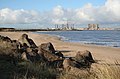
 Dunes and lagoon, Teesmouth - geograph.org.uk - 1387953.jpg 640 × 480; 174 KB
-
 EDF Visitor Centre - geograph.org.uk - 4705784.jpg 640 × 480; 81 KB
-
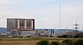
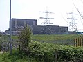
 Hartlepool Nuclear Power Station - geograph.org.uk - 4064709.jpg 640 × 480; 140 KB
-
 Hartlepool Nuclear Power Station - geograph.org.uk - 4705793.jpg 640 × 480; 70 KB
-
 Hartlepool nuclear power station 2022.JPG 6,796 × 3,708; 7.83 MB
-
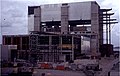
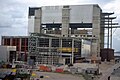 Hartlepool Nuclear Power Station under construction - geograph.org.uk - 4736256.jpg 1,797 × 1,197; 1.19 MB
-
 Hartlepool nuclear power station-1983.jpg 790 × 520; 60 KB
-
 Hartlepool nuclear power station.jpg 1,280 × 848; 171 KB
-
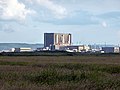
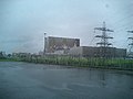 Hartlepool Power Station - geograph.org.uk - 24819.jpg 640 × 480; 101 KB
-
 Hartlepool Power Station - geograph.org.uk - 260790.jpg 640 × 407; 50 KB
-
 Hartlepool Power Station - geograph.org.uk - 35144.jpg 480 × 640; 99 KB
-
 Hartlepool Power Station - geograph.org.uk - 832048.jpg 640 × 480; 82 KB
-
 Tees Mouth - geograph.org.uk - 624467.jpg 640 × 426; 40 KB


