Category:Hastingleigh
Aller à la navigation
Aller à la recherche
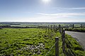
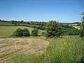
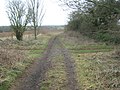
English: The small civil parish of Hastingleigh lies on top of the North Downs in Kent three miles east of Wye and ten miles south of Canterbury, near the locally renowned beauty spot of the Devil's Kneading Trough, on the North Downs Way with views towards Ashford, Romney Marsh and the Weald.
village britannique  | |||||
| Téléverser des médias | |||||
| Nature de l’élément | |||||
|---|---|---|---|---|---|
| Lieu | Ashford (borough), Kent, Angleterre du Sud-Est, Angleterre | ||||
| Superficie |
| ||||
| Réputé identique à | Hastingleigh (page en doublon, paroisse civile) | ||||
 | |||||
Sous-catégories
Cette catégorie comprend 3 sous-catégories, dont les 3 ci-dessous.
O
- Oasts in Hastingleigh (1 F)
Média dans la catégorie « Hastingleigh »
Cette catégorie comprend 259 fichiers, dont les 200 ci-dessous.
(page précédente) (page suivante)-
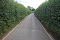
 A narrow Kent lane - geograph.org.uk - 4231811.jpg 640 × 430 ; 95 kio
-

-
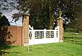 A white gate at South Hill - geograph.org.uk - 4216230.jpg 640 × 430 ; 114 kio
-
 An imposing wall - geograph.org.uk - 4216085.jpg 640 × 430 ; 104 kio
-
 An old Chalk Quarry, Brabourne Downs - geograph.org.uk - 4017371.jpg 640 × 430 ; 80 kio
-
 Ashenfield Road - geograph.org.uk - 2475702.jpg 640 × 480 ; 158 kio
-
 Becket's Close, Hastingleigh - geograph.org.uk - 5275283.jpg 3 542 × 2 361 ; 1,73 Mio
-
 Becket's Close, Hastingleigh - geograph.org.uk - 5275286.jpg 3 542 × 2 361 ; 2,04 Mio
-
 Bend in the road near South hill Farm - geograph.org.uk - 4216074.jpg 640 × 430 ; 112 kio
-
 Big Coombe Cottages - geograph.org.uk - 1765862.jpg 3 072 × 2 304 ; 1,91 Mio
-
 Brabourne Downs - geograph.org.uk - 4017365.jpg 640 × 430 ; 86 kio
-
 Brabourne Downs - geograph.org.uk - 4017367.jpg 640 × 430 ; 51 kio
-
 Brabourne Downs - geograph.org.uk - 4017370.jpg 640 × 430 ; 42 kio
-
 Brabourne Downs - geograph.org.uk - 4017377.jpg 640 × 430 ; 42 kio
-
 Brabourne Downs - geograph.org.uk - 5563043.jpg 640 × 428 ; 103 kio
-
 Bradbourne Downs viewed from the Triangulation Pillar - geograph.org.uk - 4927124.jpg 4 000 × 3 000 ; 2,39 Mio
-
 Brass to John and Anne Halke - geograph.org.uk - 3742372.jpg 3 475 × 2 272 ; 5,96 Mio
-
 Bridle path in snow - geograph.org.uk - 1151776.jpg 640 × 480 ; 101 kio
-
 Bungalow on Tamley Lane - geograph.org.uk - 4216062.jpg 640 × 430 ; 108 kio
-
 Byway and footpath junction near Smeed Farm - geograph.org.uk - 1766945.jpg 3 072 × 2 304 ; 2,4 Mio
-
 Byway at Folly Town - geograph.org.uk - 4208618.jpg 640 × 430 ; 117 kio
-
 Byway junction near Mill Down Wood - geograph.org.uk - 1765884.jpg 3 072 × 2 304 ; 2,15 Mio
-
 Byway near Little Combe - geograph.org.uk - 1765944.jpg 3 072 × 2 304 ; 2,23 Mio
-
 Byway on Hassell Street - geograph.org.uk - 1765910.jpg 3 072 × 2 304 ; 2,04 Mio
-
 Byway on Smeed Farm access road - geograph.org.uk - 1766938.jpg 3 072 × 2 304 ; 2,45 Mio
-
 Byway to Whatsole Street - geograph.org.uk - 1767065.jpg 3 072 × 2 304 ; 3,01 Mio
-
 Byway to Whatsole Street - geograph.org.uk - 1767093.jpg 3 072 × 2 304 ; 2,65 Mio
-
 Cattle grazing on a hillside - geograph.org.uk - 4216068.jpg 640 × 430 ; 67 kio
-
 Chalk dry valley - geograph.org.uk - 4216071.jpg 640 × 430 ; 56 kio
-
 Chancel, St Mary the Virgin church, Hastingleigh - geograph.org.uk - 3740524.jpg 1 974 × 2 765 ; 3,05 Mio
-
 Church Lane, Hastingleigh - geograph.org.uk - 1767100.jpg 3 072 × 2 304 ; 1,58 Mio
-
 Climbing South Hill - geograph.org.uk - 4216073.jpg 640 × 430 ; 96 kio
-
 Cold Blow - geograph.org.uk - 4208601.jpg 640 × 430 ; 54 kio
-
 Cold Blow Farm - geograph.org.uk - 1772039.jpg 3 072 × 2 304 ; 1,58 Mio
-
 Cold Brow - geograph.org.uk - 4208604.jpg 640 × 430 ; 70 kio
-
 Coldharbour Lane - geograph.org.uk - 4208616.jpg 640 × 430 ; 105 kio
-
 Coldharbour Lane - geograph.org.uk - 4208624.jpg 640 × 430 ; 72 kio
-
 Coldharbour Lane - geograph.org.uk - 4208633.jpg 640 × 430 ; 81 kio
-
 Coldharbour Lane - geograph.org.uk - 4208635.jpg 640 × 430 ; 77 kio
-
 Coldharbour Lane - geograph.org.uk - 4208636.jpg 640 × 430 ; 83 kio
-
 Coldharbour Lane - geograph.org.uk - 4208638.jpg 640 × 430 ; 78 kio
-
 Coldharbour Lane - geograph.org.uk - 4208640.jpg 640 × 430 ; 70 kio
-
 Coldharbour Lane - geograph.org.uk - 4208651.jpg 640 × 430 ; 77 kio
-
 Coldharbour Lane - geograph.org.uk - 4216010.jpg 640 × 430 ; 76 kio
-
 Coldharbour Lane - geograph.org.uk - 4216011.jpg 640 × 430 ; 64 kio
-
 Coldharbour Lane - geograph.org.uk - 6385991.jpg 1 024 × 684 ; 417 kio
-
 Collyerhill Wood - geograph.org.uk - 4204025.jpg 640 × 430 ; 94 kio
-
 Coombe Manor Farm - geograph.org.uk - 1765816.jpg 3 072 × 2 304 ; 1,81 Mio
-
 Cottage near South Hill Farm - geograph.org.uk - 4216082.jpg 640 × 430 ; 94 kio
-
 Cows on the Downs - geograph.org.uk - 3737501.jpg 2 883 × 1 856 ; 4,34 Mio
-
 Cycling up the North Downs - geograph.org.uk - 2678809.jpg 1 024 × 768 ; 310 kio
-
 Descending to Coombe Manor - geograph.org.uk - 4536010.jpg 4 000 × 3 000 ; 4,03 Mio
-
 Descent from North Downs - geograph.org.uk - 4345313.jpg 640 × 427 ; 51 kio
-
 Downland pasture - geograph.org.uk - 4231774.jpg 640 × 430 ; 64 kio
-
 Eagle Owl - geograph.org.uk - 4345320.jpg 640 × 427 ; 87 kio
-
 Entering Hastingleigh - geograph.org.uk - 4208648.jpg 640 × 430 ; 79 kio
-
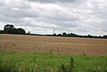 Farmland near Hastingleigh - geograph.org.uk - 4208641.jpg 640 × 430 ; 57 kio
-
 Farmland on top of The North Downs - geograph.org.uk - 4231739.jpg 640 × 430 ; 66 kio
-
 Farmland on top of The North Downs - geograph.org.uk - 4231741.jpg 640 × 430 ; 70 kio
-
 Field at the top of the North Downs - geograph.org.uk - 2678807.jpg 1 024 × 768 ; 346 kio
-
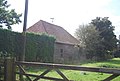 Field barn, South Hill Farm - geograph.org.uk - 4216077.jpg 640 × 430 ; 70 kio
-
 Field by a lane bend on the downs - geograph.org.uk - 3740228.jpg 3 072 × 2 035 ; 5,38 Mio
-
 Field edge track below Hurst Wood - geograph.org.uk - 4619988.jpg 4 606 × 3 454 ; 7,15 Mio
-
 Field with sheep, South Hill - geograph.org.uk - 5563048.jpg 640 × 480 ; 142 kio
-
 Fields near Court Lodge - geograph.org.uk - 1956048.jpg 1 024 × 768 ; 223 kio
-
 Folly Town Junction - geograph.org.uk - 4208615.jpg 640 × 430 ; 99 kio
-
 Follytown Cottage - geograph.org.uk - 4208626.jpg 640 × 430 ; 104 kio
-
 Footpath along the hedge - geograph.org.uk - 4231742.jpg 640 × 430 ; 68 kio
-
 Footpath junction on the byway near Hastingleigh - geograph.org.uk - 1767075.jpg 3 072 × 2 304 ; 3,13 Mio
-
 Footpath off Coldharbour Lane - geograph.org.uk - 4208630.jpg 640 × 430 ; 84 kio
-
 Footpath off Tamley Lane - geograph.org.uk - 4216059.jpg 640 × 430 ; 119 kio
-
 Footpath through the hedge - geograph.org.uk - 4216231.jpg 640 × 430 ; 117 kio
-
 From the edge of Hurst Wood toward Wye Down - geograph.org.uk - 4619972.jpg 4 608 × 3 456 ; 4,56 Mio
-
 Garage at Hastingleigh - geograph.org.uk - 2475634.jpg 640 × 480 ; 141 kio
-
 Garage at Hastingleigh - geograph.org.uk - 2477330.jpg 640 × 480 ; 110 kio
-
 Gates on the byway from Hastingleigh - geograph.org.uk - 1767099.jpg 3 072 × 2 304 ; 2,3 Mio
-
 Giddy Horn on the North Downs - geograph.org.uk - 1850690.jpg 3 072 × 1 728 ; 1,19 Mio
-
 Grisaille glass window, St Mary's church, Hastingleigh - geograph.org.uk - 3804216.jpg 675 × 2 624 ; 1,76 Mio
-
 Ham Wood - geograph.org.uk - 1771973.jpg 3 072 × 2 304 ; 1,28 Mio
-
 Hassell Street - geograph.org.uk - 2476440.jpg 640 × 480 ; 163 kio
-
 'Southview' reflected in the village pond - geograph.org.uk - 1246164.jpg 640 × 480 ; 190 kio
-
 Hastingleigh - geograph.org.uk - 4216017.jpg 640 × 430 ; 70 kio
-
 Hastingleigh church - geograph.org.uk - 5563104.jpg 640 × 480 ; 166 kio
-
 Hastingleigh Village Stores - geograph.org.uk - 1246124.jpg 640 × 480 ; 145 kio
-
 Hastingleigh Water Reservoir - geograph.org.uk - 1766981.jpg 3 072 × 2 304 ; 1,24 Mio
-
 Hastingleigh, Agricultural land - geograph.org.uk - 6268299.jpg 5 023 × 3 350 ; 5,08 Mio
-
 Hastingleigh, Beck's Wood and the agricultural land surrounding it - geograph.org.uk - 6268011.jpg 5 884 × 3 923 ; 5,84 Mio
-
 Hastingleigh, Looking towards where South Hill joins New Barn Road - geograph.org.uk - 6268002.jpg 5 370 × 3 581 ; 6,42 Mio
-
 Hastingleigh, South Hill - geograph.org.uk - 6268018.jpg 2 331 × 1 554 ; 1,05 Mio
-
 Hastingleigh, South Hill Farm - geograph.org.uk - 6268024.jpg 4 547 × 3 032 ; 6,1 Mio
-
 Hastingleigh, St. Mary's Church - geograph.org.uk - 6268168.jpg 6 262 × 4 174 ; 6,54 Mio
-
 Hastingleigh, St. Mary's Church - geograph.org.uk - 6268177.jpg 6 332 × 4 222 ; 6,43 Mio
-

-

-

-
 Hastingleigh, St. Mary's Church, Beautiful original c15th oak screen - geograph.org.uk - 6268228.jpg 7 867 × 5 245 ; 7,53 Mio
-

-
 Hastingleigh, St. Mary's Church, Blocked south doorway - geograph.org.uk - 6268280.jpg 4 135 × 6 203 ; 7,5 Mio
-

-

-

-
 Hastingleigh, St. Mary's Church, c14th porch - geograph.org.uk - 6268285.jpg 4 378 × 6 567 ; 7,16 Mio
-

-

-

-

-

-

-

-

-
 Hastingleigh, St. Mary's Church, Eastern aspect - geograph.org.uk - 6268274.jpg 6 677 × 4 452 ; 5,73 Mio
-

-
 Hastingleigh, St. Mary's Church, Small stained glass window - geograph.org.uk - 6268261.jpg 3 682 × 5 522 ; 4,43 Mio
-
 Hastingleigh, St. Mary's Church, South east aspect - geograph.org.uk - 6268181.jpg 6 772 × 4 515 ; 6,93 Mio
-
 Hastingleigh, St. Mary's Church, South western aspect - geograph.org.uk - 6268271.jpg 6 327 × 4 217 ; 6,38 Mio
-
 Hastingleigh, St. Mary's Church, Stained glass window - geograph.org.uk - 6268250.jpg 4 123 × 6 185 ; 3,9 Mio
-
 Hastingleigh, St. Mary's Church, The chancel roof - geograph.org.uk - 6268205.jpg 7 107 × 4 738 ; 5,77 Mio
-
 Hastingleigh, St. Mary's Church, The Early English chancel - geograph.org.uk - 6268194.jpg 7 332 × 4 888 ; 5,86 Mio
-

-
 Hazel Grove Cottage - geograph.org.uk - 1765936.jpg 3 072 × 2 304 ; 1,61 Mio
-
 Hedge on top of the North Downs - geograph.org.uk - 4231749.jpg 640 × 430 ; 71 kio
-
 High hedges, Tamley Lane - geograph.org.uk - 4216066.jpg 640 × 430 ; 102 kio
-
 House near Crabtree Farm - geograph.org.uk - 4216064.jpg 640 × 430 ; 96 kio
-
 House on Coldharbour Lane - geograph.org.uk - 4208625.jpg 640 × 430 ; 95 kio
-
 House, Tamley Lane - geograph.org.uk - 4216063.jpg 640 × 430 ; 82 kio
-
 Interior, St Mary the Virgin church, Hastingleigh - geograph.org.uk - 3740354.jpg 2 867 × 1 899 ; 3,64 Mio
-

-
 Junction on Church Lane - geograph.org.uk - 1767120.jpg 3 072 × 2 304 ; 2,44 Mio
-
 Junction on Coldharbour Lane - geograph.org.uk - 3737549.jpg 2 862 × 1 825 ; 4,74 Mio
-
 Junction on Coldharbour Lane - geograph.org.uk - 4208627.jpg 640 × 430 ; 65 kio
-
 Kissing gate, South Hill - geograph.org.uk - 4216070.jpg 640 × 430 ; 101 kio
-
 Lane from Cold Brow - geograph.org.uk - 4208609.jpg 640 × 430 ; 119 kio
-
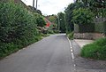
 Lane in Hastingleigh - geograph.org.uk - 4216008.jpg 640 × 430 ; 84 kio
-
 Lane junction near Hastingleigh - geograph.org.uk - 1767008.jpg 3 072 × 2 304 ; 2,23 Mio
-
 Lane junction on the North Downs Way near New Barn Farm - geograph.org.uk - 1772002.jpg 3 072 × 2 304 ; 1,5 Mio
-
 Lane junction south of Hastingleigh - geograph.org.uk - 4216067.jpg 640 × 430 ; 80 kio
-
 Lane near South Hill Farm - geograph.org.uk - 4216075.jpg 640 × 430 ; 114 kio
-
 Lane to Brabourne - geograph.org.uk - 1956040.jpg 1 024 × 768 ; 209 kio
-
 Lane to Hastingleigh Church - geograph.org.uk - 4216069.jpg 640 × 430 ; 68 kio
-
 Lane to Staple Farm - geograph.org.uk - 4208606.jpg 640 × 430 ; 104 kio
-
 Lane towards Hastingleigh - geograph.org.uk - 3737524.jpg 3 018 × 1 975 ; 4,6 Mio
-
 Lane towards Waltham - geograph.org.uk - 6385999.jpg 1 024 × 684 ; 258 kio
-
 Little Combe - geograph.org.uk - 1766905.jpg 3 072 × 2 304 ; 1,66 Mio
-
 Llama, Cold Blow - geograph.org.uk - 4208505.jpg 640 × 430 ; 95 kio
-
 Looking to Coombe Manor from Collyerhill Wood - geograph.org.uk - 4536025.jpg 4 000 × 3 000 ; 4,32 Mio
-
 Looking towards Long Wood - geograph.org.uk - 3740236.jpg 3 696 × 2 448 ; 2,23 Mio
-
 Looking up The Downs - geograph.org.uk - 4013044.jpg 640 × 430 ; 54 kio
-
 Looking up the scarp slope - geograph.org.uk - 4231810.jpg 640 × 430 ; 69 kio
-
 Looking W past The White House, Hastingleigh - geograph.org.uk - 1246182.jpg 640 × 480 ; 185 kio
-
 Lyddendane Farm - geograph.org.uk - 2475692.jpg 640 × 480 ; 136 kio
-
 Meeting the North Downs Way - geograph.org.uk - 4216232.jpg 640 × 430 ; 70 kio
-
 Mobile Mast in Newlands Wood - geograph.org.uk - 1766962.jpg 2 304 × 3 072 ; 1,76 Mio
-
 Moorlands House - geograph.org.uk - 1766994.jpg 3 072 × 2 304 ; 2,26 Mio
-
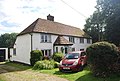
 Morris Minor at Hastingleigh - geograph.org.uk - 2475673.jpg 640 × 480 ; 100 kio
-
 Narrow lane in Hastingleigh - geograph.org.uk - 4216055.jpg 640 × 430 ; 81 kio
-
 Narrow lane off Coldharbour Lane - geograph.org.uk - 4208629.jpg 640 × 430 ; 81 kio
-
 Narrow lane on the North Downs - geograph.org.uk - 4208613.jpg 640 × 430 ; 114 kio
-
 New Barn Road - geograph.org.uk - 2480108.jpg 640 × 480 ; 104 kio
-
 North Downs Way - geograph.org.uk - 1956046.jpg 1 024 × 768 ; 246 kio
-
 North Downs Way - geograph.org.uk - 4216235.jpg 640 × 430 ; 94 kio
-
 North Downs Way across top of Brabourne Downs - geograph.org.uk - 392069.jpg 640 × 504 ; 131 kio
-
 North Downs Way along the road - geograph.org.uk - 4216233.jpg 640 × 430 ; 98 kio
-
 North Downs Way to Cold Blow - geograph.org.uk - 4208501.jpg 640 × 430 ; 80 kio
-
 North Downs Way track - geograph.org.uk - 3739155.jpg 3 072 × 2 035 ; 7,31 Mio
-
 Old chalk pit in field - geograph.org.uk - 5563138.jpg 640 × 480 ; 122 kio
-
 Old fencing - geograph.org.uk - 2480106.jpg 640 × 480 ; 133 kio
-
 On top of the North Downs - geograph.org.uk - 4231747.jpg 640 × 430 ; 66 kio
-
 Parish Farm - geograph.org.uk - 1765931.jpg 3 072 × 2 304 ; 1,41 Mio
-
 Pasture on The Downs - geograph.org.uk - 4013045.jpg 640 × 430 ; 35 kio
-
 Path above Coombe Manor - geograph.org.uk - 4534023.jpg 4 000 × 3 000 ; 3,86 Mio
-
 Pond, Hastingleigh - geograph.org.uk - 397466.jpg 591 × 465 ; 104 kio
-
 Public footpath next to Coombe Manor - geograph.org.uk - 3552821.jpg 2 048 × 1 536 ; 651 kio
-
 Road towards Waltham - geograph.org.uk - 6385983.jpg 1 024 × 684 ; 208 kio
-
 Scarp slope of the North Downs - geograph.org.uk - 4231763.jpg 640 × 430 ; 81 kio
-
 Scarp slope of the North Downs - geograph.org.uk - 4231769.jpg 640 × 430 ; 68 kio
-
 Scarp slope of the North Downs - geograph.org.uk - 4231808.jpg 640 × 430 ; 63 kio
-
 Shallow chalk valley - geograph.org.uk - 4216009.jpg 640 × 430 ; 73 kio
-
 Sheep grazing - geograph.org.uk - 4216225.jpg 640 × 430 ; 94 kio
-
 Small lane just S of the village pond - geograph.org.uk - 1246174.jpg 640 × 480 ; 172 kio
-
 Smeed Farm - geograph.org.uk - 1766936.jpg 3 072 × 2 304 ; 2,27 Mio
-
 South Hill Farm - geograph.org.uk - 4216076.jpg 640 × 430 ; 111 kio
-
 South Hill Farm - geograph.org.uk - 4216080.jpg 640 × 430 ; 76 kio
-
 South Hill Farmhouse - geograph.org.uk - 4216083.jpg 640 × 430 ; 91 kio
-
 St Mary the Virgin church, Hastingleigh (2) - geograph.org.uk - 3740337.jpg 2 970 × 1 967 ; 5,2 Mio
-
 St Mary the Virgin church, Hastingleigh - geograph.org.uk - 3740320.jpg 3 696 × 2 448 ; 5,43 Mio
-
 St. Mary's Church, Hastingleigh - geograph.org.uk - 2210852.jpg 1 132 × 787 ; 515 kio
-
 Stained Glass Window - geograph.org.uk - 3742390.jpg 386 × 593 ; 191 kio
-
 Stained Glass window, Hastingleigh church - geograph.org.uk - 3742385.jpg 1 763 × 2 844 ; 3,88 Mio
-
 Staple Farm - geograph.org.uk - 4208612.jpg 640 × 430 ; 90 kio
-
 Stile beside the North Downs Way near Partridge Wood - geograph.org.uk - 1771945.jpg 2 304 × 3 072 ; 1,84 Mio
-
 Stiles on a byway near St Mary's Church - geograph.org.uk - 1767085.jpg 3 072 × 2 304 ; 2,94 Mio
-
 Stubble field, North Downs - geograph.org.uk - 4231746.jpg 640 × 430 ; 71 kio
-
 Stubble on the North Downs - geograph.org.uk - 4231740.jpg 640 × 430 ; 70 kio
-
 Take a pew - enjoy the view - geograph.org.uk - 2678812.jpg 1 024 × 768 ; 376 kio
-
 Tamley Lane - geograph.org.uk - 4216019.jpg 640 × 430 ; 100 kio
-
 Tamley Lane - geograph.org.uk - 4216056.jpg 640 × 430 ; 111 kio
-
 Tamley Lane - geograph.org.uk - 4216065.jpg 640 × 430 ; 126 kio
-
 Tamley Lane, southbound - geograph.org.uk - 4216228.jpg 640 × 430 ; 114 kio
-
 Ten Acres by The Pilgrims' Way - geograph.org.uk - 4013046.jpg 640 × 430 ; 63 kio
-
 The Bowl Inn - geograph.org.uk - 4216013.jpg 640 × 419 ; 67 kio


_-_geograph.org.uk_-_6268258.jpg)


_-_geograph.org.uk_-_3740337.jpg)


