Category:Hayton, Nottinghamshire
Jump to navigation
Jump to search
English: Hayton is a village in Nottinghamshire, England. It is located 4 miles north-east of Retford. According to the 2001 census it had a population of 386 .
village and civil parish in Bassetlaw, Nottinghamshire, England  | |||||
| Upload media | |||||
| Instance of | |||||
|---|---|---|---|---|---|
| Location | Bassetlaw, Nottinghamshire, East Midlands, England | ||||
 | |||||
Subcategories
This category has the following 3 subcategories, out of 3 total.
Media in category "Hayton, Nottinghamshire"
The following 200 files are in this category, out of 259 total.
(previous page) (next page)-
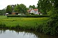
 A bath with a view - geograph.org.uk - 1907511.jpg 1,024 × 720; 477 KB
-
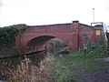
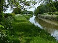
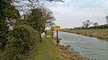
 Across the canal by bridge no 64 - geograph.org.uk - 1907841.jpg 1,024 × 671; 500 KB
-
 Aerial and Works near Hill Top Farm - geograph.org.uk - 4325334.jpg 640 × 424; 43 KB
-
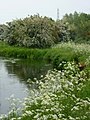
 Alongside Broom Wood - geograph.org.uk - 2744501.jpg 1,024 × 768; 132 KB
-

-
 Approaching Ash Holt - geograph.org.uk - 2741346.jpg 1,024 × 768; 245 KB
-
 Approaching Decoy Wood - geograph.org.uk - 2760082.jpg 1,024 × 768; 241 KB
-
 B1403 meets Chainbridge Lane - geograph.org.uk - 5938665.jpg 5,376 × 3,024; 3.92 MB
-
 B1403 towards Hayton - geograph.org.uk - 2688055.jpg 800 × 600; 59 KB
-
 Bailey bridge across River Idle - geograph.org.uk - 6409351.jpg 5,376 × 3,024; 3.63 MB
-
 Bench mark, former Methodist Chapel, Hayton - geograph.org.uk - 4197367.jpg 1,280 × 960; 650 KB
-
 Bench mark, St Peter's Church, Hayton - geograph.org.uk - 4197082.jpg 1,280 × 960; 804 KB
-
 Bench Mark, Townend Bridge, Hayton - geograph.org.uk - 4197396.jpg 1,280 × 945; 479 KB
-
 Bend in the canal - geograph.org.uk - 2760197.jpg 1,024 × 768; 232 KB
-
 Bend in the River Idle - panoramio.jpg 4,608 × 3,456; 6 MB
-
 Black Syke Drain overflow - geograph.org.uk - 5133149.jpg 800 × 600; 183 KB
-
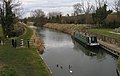
 Boat on the canal near Hayton - geograph.org.uk - 2088862.jpg 617 × 900; 353 KB
-
 Bridge 62 - geograph.org.uk - 2744465.jpg 1,024 × 768; 178 KB
-
 Bridge 65 over the Chesterfield Canal - geograph.org.uk - 3839311.jpg 3,776 × 2,520; 4.27 MB
-

-
 Bridge over the Idle - geograph.org.uk - 3708759.jpg 640 × 480; 207 KB
-
 Bridge over the River Idle - geograph.org.uk - 4610731.jpg 1,024 × 683; 267 KB
-
 Bridge over the River Idle - geograph.org.uk - 5807190.jpg 800 × 600; 170 KB
-
 Bridge ^66, Chesterfield Canal - geograph.org.uk - 3051646.jpg 800 × 600; 104 KB
-
 Bridleway approaching Ash Holt - geograph.org.uk - 3839290.jpg 3,776 × 2,520; 4.11 MB
-
 Bridleway following Long Road West Drain - geograph.org.uk - 4429430.jpg 1,024 × 768; 222 KB
-
 Bridleway on Haughgate Hill - geograph.org.uk - 3838377.jpg 3,776 × 2,520; 4.11 MB
-
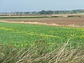
 Broad beans growing east of Tiln Holt Plantation - geograph.org.uk - 3616636.jpg 3,648 × 2,736; 2.26 MB
-
 By Chain Bridge Lane - geograph.org.uk - 1963352.jpg 1,024 × 644; 408 KB
-
 Byway crossroads - geograph.org.uk - 1907158.jpg 1,024 × 670; 476 KB
-
 Byway under threatening sky - geograph.org.uk - 5942172.jpg 5,376 × 3,024; 3.09 MB
-
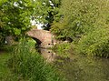
 Canal bridge no 63, near Hayton Church - geograph.org.uk - 1907847.jpg 1,024 × 734; 572 KB
-
 Canal bridge no 65, Hayton - geograph.org.uk - 1907837.jpg 1,024 × 719; 528 KB
-
 Canal north of Townend Bridge - geograph.org.uk - 3153043.jpg 640 × 429; 292 KB
-
 Cattle grazing on landscaped former gravel pits - geograph.org.uk - 5205559.jpg 1,024 × 768; 164 KB
-
 Chain Bridge - geograph.org.uk - 5807161.jpg 800 × 600; 150 KB
-
 Chain Bridge Lane - geograph.org.uk - 2688053.jpg 800 × 600; 80 KB
-
 Chain Bridge lane, looking east - geograph.org.uk - 1963360.jpg 1,024 × 732; 407 KB
-
 Chainbridge Lane crossing the River Idle - geograph.org.uk - 5205553.jpg 1,024 × 768; 253 KB
-
 Chapel House - former chapel in Hayton - geograph.org.uk - 3616600.jpg 3,239 × 2,313; 1.36 MB
-
 Chesterfield Canal - geograph.org.uk - 1131406.jpg 640 × 427; 80 KB
-
 Chesterfield Canal - geograph.org.uk - 2010355.jpg 640 × 426; 117 KB
-
 Chesterfield Canal - geograph.org.uk - 2010357.jpg 640 × 426; 92 KB
-
 Chesterfield Canal - geograph.org.uk - 2688058.jpg 800 × 600; 111 KB
-
 Chesterfield Canal - geograph.org.uk - 2688069.jpg 800 × 600; 135 KB
-
 Chesterfield Canal - geograph.org.uk - 3406480.jpg 800 × 533; 143 KB
-
 Chesterfield Canal - geograph.org.uk - 451513.jpg 640 × 480; 91 KB
-
 Chesterfield Canal and Cuckoo Way - geograph.org.uk - 3405608.jpg 4,000 × 2,248; 2.04 MB
-
 Chesterfield Canal and Decoy Wood - geograph.org.uk - 2741329.jpg 1,024 × 768; 214 KB
-
 Chesterfield Canal at Hayton - geograph.org.uk - 3834826.jpg 1,500 × 952; 1.45 MB
-
 Chesterfield Canal at Hayton - geograph.org.uk - 4197413.jpg 1,280 × 960; 839 KB
-
 Chesterfield Canal from bridge no 63 - geograph.org.uk - 1907849.jpg 1,024 × 691; 396 KB
-
 Chesterfield Canal moorings at Hayton - geograph.org.uk - 4197406.jpg 1,280 × 960; 637 KB
-
 Chesterfield Canal near Hayton - geograph.org.uk - 4429441.jpg 1,024 × 768; 244 KB
-
 Church Bridge - geograph.org.uk - 3152970.jpg 640 × 640; 333 KB
-
 Church Bridge - geograph.org.uk - 3152976.jpg 640 × 441; 240 KB
-
 Church Bridge - geograph.org.uk - 3152979.jpg 640 × 414; 236 KB
-
 Church Bridge and Church Lane, Hayton - geograph.org.uk - 4423481.jpg 1,600 × 1,200; 631 KB
-
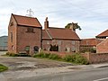
 Church Farm in Hayton - geograph.org.uk - 5132537.jpg 800 × 482; 77 KB
-
 Church Farm, Hayton - geograph.org.uk - 1907856.jpg 1,024 × 692; 401 KB
-
 Church Farm, Hayton - geograph.org.uk - 4197275.jpg 1,280 × 791; 267 KB
-
 Church Farmhouse and Pigeoncote, Hayton - geograph.org.uk - 4197359.jpg 1,280 × 960; 479 KB
-
 Church Lane Bridge, Hayton - geograph.org.uk - 4197272.jpg 1,280 × 945; 542 KB
-
 Church Lane, Hayton - geograph.org.uk - 4197262.jpg 1,280 × 960; 660 KB
-
 Church Lane, Hayton - geograph.org.uk - 4335084.jpg 1,600 × 1,016; 636 KB
-
 Clarborough Top Bridge No 62 - geograph.org.uk - 5132516.jpg 800 × 536; 177 KB
-
 Clarborough Top Bridge on Smeath Lane - geograph.org.uk - 4197299.jpg 1,280 × 960; 567 KB
-
 Converted barn at Church Farm - geograph.org.uk - 4197356.jpg 1,280 × 1,044; 563 KB
-
 Cordall Lane - geograph.org.uk - 3406483.jpg 800 × 533; 132 KB
-
 Corner Farm, Clarborough - geograph.org.uk - 4197349.jpg 1,280 × 960; 461 KB
-
 Country road nr Hayton - geograph.org.uk - 844626.jpg 586 × 640; 84 KB
-
-
 Different field, different colour - geograph.org.uk - 2663169.jpg 1,024 × 768; 164 KB
-
 Farm track off Common Lane - geograph.org.uk - 4335106.jpg 1,600 × 1,062; 604 KB
-
 Farming countryside - geograph.org.uk - 1907287.jpg 1,024 × 686; 470 KB
-
 Farmland off Hollinhill Lane - geograph.org.uk - 2688062.jpg 1,024 × 768; 168 KB
-
 Farmland west of Hayton - geograph.org.uk - 1881400.jpg 1,024 × 764; 476 KB
-
 Farmland west of Hayton - geograph.org.uk - 1963393.jpg 1,024 × 757; 444 KB
-
 Farmland, Hayton Smeath - geograph.org.uk - 2688071.jpg 800 × 600; 81 KB
-
 Field by Smeath Lane - geograph.org.uk - 1881361.jpg 1,024 × 698; 497 KB
-
 Field corner and trees - geograph.org.uk - 2088837.jpg 900 × 489; 292 KB
-
 Field corner and trees - geograph.org.uk - 2088846.jpg 900 × 525; 259 KB
-
 Field corner near Tiln Holt - geograph.org.uk - 1881405.jpg 1,024 × 768; 530 KB
-
 Field overlooking Hayton - geograph.org.uk - 1907191.jpg 1,024 × 599; 377 KB
-

-
 Fields near Tiln Holt - geograph.org.uk - 5942177.jpg 5,376 × 3,024; 2.8 MB
-
 Fields west of the canal - geograph.org.uk - 1907845.jpg 1,024 × 628; 449 KB
-
 Floodplain of the River Idle - geograph.org.uk - 3708783.jpg 640 × 480; 287 KB
-
 Folly Dyke - geograph.org.uk - 5205561.jpg 1,024 × 768; 197 KB
-
 Footbridge over the River Idle - geograph.org.uk - 2452946.jpg 640 × 427; 118 KB
-
 Footpath between the river and the lake - geograph.org.uk - 1884922.jpg 1,024 × 696; 550 KB
-
 Footpath off Hangingside Lane - geograph.org.uk - 3839328.jpg 3,776 × 2,520; 3.9 MB
-
 Footpath off Main Street, Hayton - geograph.org.uk - 2688066.jpg 800 × 600; 174 KB
-
 Footpath off the B1403 - geograph.org.uk - 2688054.jpg 800 × 600; 130 KB
-
 Footpath through a field of wheat - geograph.org.uk - 5807170.jpg 800 × 640; 194 KB
-
 Footpath to Clayworth - geograph.org.uk - 4028427.jpg 1,024 × 768; 154 KB
-
 Footpath To Hayton - geograph.org.uk - 1131421.jpg 640 × 427; 65 KB
-
 Footpath to Hayton - geograph.org.uk - 179402.jpg 640 × 480; 108 KB
-
 Footpath to the Chesterfield Canal - geograph.org.uk - 1062351.jpg 640 × 569; 75 KB
-
 Footpath towards Hayton - geograph.org.uk - 1881373.jpg 818 × 1,024; 511 KB
-
 Footpath towards Hayton - geograph.org.uk - 1881467.jpg 1,024 × 768; 449 KB
-
 Footpath towards Hayton - geograph.org.uk - 1907476.jpg 1,024 × 768; 465 KB
-
 Footpath with open views to the south - geograph.org.uk - 1907440.jpg 1,024 × 694; 445 KB
-
 Former Methodist Chapel, Main Street Hayton - geograph.org.uk - 4197371.jpg 1,280 × 774; 519 KB
-
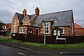
 Former village school and school house, Hayton - geograph.org.uk - 4197381.jpg 1,280 × 949; 546 KB
-
 Free range pig farm near Tiln - geograph.org.uk - 5807180.jpg 800 × 600; 166 KB
-
 Gap in the hedge - geograph.org.uk - 1881459.jpg 768 × 1,024; 551 KB
-
 Glimpse past hedge and trees - geograph.org.uk - 1907449.jpg 1,024 × 761; 538 KB
-
 Hangingside Lane - geograph.org.uk - 2010371.jpg 640 × 426; 125 KB
-
 Hangingside Lane - geograph.org.uk - 2010378.jpg 640 × 426; 132 KB
-

-
 Hangingside Lane, Hayton - geograph.org.uk - 5199032.jpg 1,024 × 768; 263 KB
-
 Hayton church - geograph.org.uk - 3152975.jpg 640 × 427; 223 KB
-
 Hayton church - geograph.org.uk - 4197274.jpg 1,280 × 940; 649 KB
-
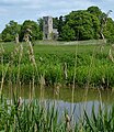
 Hayton church seen across the Chesterfield Canal - geograph.org.uk - 2744462.jpg 1,024 × 768; 220 KB
-
 Hayton horse boxes - geograph.org.uk - 2663135.jpg 1,024 × 768; 114 KB
-
 Hayton Parish Footpaths map - geograph.org.uk - 4197376.jpg 1,280 × 960; 467 KB
-
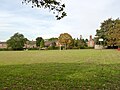 Hayton Recreation Ground - geograph.org.uk - 4197363.jpg 1,280 × 960; 544 KB
-
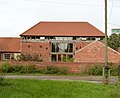
 Hayton Village Hall - geograph.org.uk - 4335079.jpg 1,600 × 1,062; 636 KB
-
 Hayton Village sign - geograph.org.uk - 4191297.jpg 1,280 × 960; 327 KB
-
 Hollin hill lane. - geograph.org.uk - 5209628.jpg 640 × 480; 55 KB
-
 Hollinhill Lane (track) - geograph.org.uk - 2688061.jpg 800 × 600; 102 KB
-
 Hollinhill Lane on the way down to Hayton - geograph.org.uk - 3839304.jpg 3,776 × 2,520; 4.1 MB
-
 House on Main Street, Hayton - geograph.org.uk - 2688064.jpg 800 × 600; 92 KB
-
 Idle Valley - geograph.org.uk - 4610893.jpg 1,024 × 683; 202 KB
-
 Idle Valley nature reserve - geograph.org.uk - 5770412.jpg 4,608 × 3,456; 3.68 MB
-
 Junction of tracks east of Hayton - geograph.org.uk - 3616610.jpg 3,648 × 2,736; 2.09 MB
-
 Just another gate - geograph.org.uk - 5942161.jpg 5,376 × 3,024; 5.55 MB
-
 Landscaped former gravel pit - geograph.org.uk - 5205556.jpg 1,024 × 768; 124 KB
-
 Late autumn on Long Road - geograph.org.uk - 5207703.jpg 1,024 × 768; 297 KB
-
 Lecture Room Bridge, Hayton - geograph.org.uk - 4197394.jpg 1,280 × 947; 806 KB
-
 Left hand bend ahead, with road junction right - geograph.org.uk - 4196216.jpg 1,280 × 940; 345 KB
-
 Local communications - geograph.org.uk - 4197391.jpg 1,280 × 960; 465 KB
-
 Log pile against a large shed, Hayton - geograph.org.uk - 2663130.jpg 1,024 × 768; 155 KB
-
 Long Road - geograph.org.uk - 2045713.jpg 640 × 426; 91 KB
-
 Long Road - geograph.org.uk - 5204133.jpg 1,024 × 768; 253 KB
-
 Long Road - geograph.org.uk - 5207701.jpg 1,024 × 768; 166 KB
-
 Long Road - geograph.org.uk - 5207708.jpg 1,024 × 768; 180 KB
-
 Long Road West Drain - geograph.org.uk - 5207538.jpg 1,024 × 768; 209 KB
-
 Looking along the canal west of Hayton - geograph.org.uk - 1907585.jpg 1,024 × 741; 544 KB
-
 Looking along Tiln Lane - geograph.org.uk - 2088798.jpg 900 × 459; 299 KB
-
 Looking east along Smeath Lane, Clarborough - geograph.org.uk - 3616595.jpg 3,565 × 2,547; 2.1 MB
-
 Lorries over 13 tons prohibited - geograph.org.uk - 4196213.jpg 1,280 × 960; 879 KB
-
 Lovers Walk - geograph.org.uk - 2010375.jpg 640 × 426; 156 KB
-
 Lovers walk-Hangingside lane junction. - geograph.org.uk - 5209626.jpg 640 × 480; 117 KB
-
 Lovers' Walk crossing Hangingside Lane - geograph.org.uk - 5198194.jpg 1,024 × 768; 264 KB
-
 Lovers' Walk. Hayton - geograph.org.uk - 5199028.jpg 1,024 × 768; 265 KB
-
 Main Street, Hayton - geograph.org.uk - 4197387.jpg 1,280 × 960; 357 KB
-
 May blossom and view across a field - geograph.org.uk - 1881454.jpg 1,024 × 730; 486 KB
-
 Meeting of the ways - geograph.org.uk - 3405617.jpg 4,000 × 2,248; 2.01 MB
-

-

-
 Narrowboat near Church Bridge No 63 - geograph.org.uk - 4970409.jpg 800 × 628; 176 KB
-
 Narrowboat on the Chesterfield Canal - geograph.org.uk - 5132530.jpg 800 × 643; 214 KB
-
 New arrivals - geograph.org.uk - 3405624.jpg 4,000 × 2,248; 2.17 MB
-
 New footpath - geograph.org.uk - 5205563.jpg 1,024 × 768; 168 KB
-
 Not totally redundant - geograph.org.uk - 2744492.jpg 1,024 × 768; 248 KB
-
 Old warning notice on a gate - geograph.org.uk - 1907506.jpg 1,024 × 768; 599 KB
-
 Open fields above Hayton - geograph.org.uk - 1907491.jpg 1,024 × 680; 345 KB
-
 Overflow channel - geograph.org.uk - 2760187.jpg 1,024 × 768; 308 KB
-

-
 Path across the fields - geograph.org.uk - 2744455.jpg 1,024 × 768; 113 KB
-
 Path and gate to Wheatley Field - geograph.org.uk - 6103097.jpg 1,024 × 1,024; 292 KB
-
 Path heading down to Goit Lane - geograph.org.uk - 6103091.jpg 1,024 × 683; 260 KB
-
 Pig farming by Tiln Lane - geograph.org.uk - 2089349.jpg 900 × 430; 273 KB
-
 Pigeoncote at Blyth House - geograph.org.uk - 4197410.jpg 1,280 × 960; 755 KB
-
 Pigs near Whitehouse Farm - geograph.org.uk - 6409382.jpg 5,139 × 2,891; 2.14 MB
-
 Pivot bench mark, Clarborough Top Bridge - geograph.org.uk - 4197296.jpg 1,280 × 960; 682 KB
-
 Power line through a solar farm - geograph.org.uk - 5807173.jpg 800 × 594; 67 KB
-
 Power takes a turn - geograph.org.uk - 6409374.jpg 5,376 × 3,024; 2.85 MB
-
 Puddles in the field - geograph.org.uk - 1601578.jpg 640 × 427; 82 KB
-
 Reflections of trees, Chesterfield Canal - geograph.org.uk - 2663290.jpg 1,024 × 768; 152 KB
-
 Rising fields east of Hayton - geograph.org.uk - 1907250.jpg 881 × 1,024; 468 KB
-
 River Idle - geograph.org.uk - 2688050.jpg 800 × 600; 123 KB
-
 River Idle - geograph.org.uk - 3708768.jpg 640 × 480; 230 KB
-
 River Idle - geograph.org.uk - 5938663.jpg 5,376 × 3,024; 4.28 MB
-
 River Idle and Bolham Wood - geograph.org.uk - 1854398.jpg 1,024 × 768; 505 KB
-
 River Idle heading north - panoramio.jpg 4,608 × 3,456; 5.88 MB
-
 River Idle with lake beyond - geograph.org.uk - 1884896.jpg 861 × 1,024; 612 KB
-
 Road leaving Hayton - geograph.org.uk - 1907569.jpg 1,024 × 728; 420 KB
-
 Road to Clayworth - geograph.org.uk - 1963383.jpg 1,024 × 664; 392 KB
-
 Road to Hayton - geograph.org.uk - 1963388.jpg 1,024 × 768; 353 KB
-
 Rolls Royce abandoned in a farm yard - geograph.org.uk - 5807178.jpg 800 × 600; 176 KB
-
 Scotter Lane Bridge No 65 - geograph.org.uk - 5132809.jpg 800 × 692; 230 KB
-
 Scotter Lane Road Bridge No 65 - geograph.org.uk - 5132803.jpg 800 × 537; 153 KB
-
 Sluice, weir, ford, bridge - geograph.org.uk - 3405636.jpg 4,000 × 2,248; 2.05 MB
-
 Smeath Road - geograph.org.uk - 2688072.jpg 800 × 600; 132 KB
-
 Solar energy farm - geograph.org.uk - 5942183.jpg 5,376 × 3,024; 3.49 MB
-
 Springtime by the River Idle - geograph.org.uk - 1884919.jpg 765 × 1,024; 530 KB
-
 St Peter's church in Hayton - geograph.org.uk - 5132579.jpg 693 × 800; 215 KB
-
 St Peter's Church, Hayton - geograph.org.uk - 4423483.jpg 1,600 × 1,200; 585 KB
-
 Stile and footpath towards Hayton - geograph.org.uk - 1907466.jpg 1,024 × 768; 542 KB
-
 Swan at Lecture Room Bridge - geograph.org.uk - 2663123.jpg 1,024 × 768; 180 KB
-
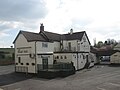 The Boat Inn at Hayton - geograph.org.uk - 4423494.jpg 1,600 × 1,200; 365 KB
-
 The Boat Inn, Hayton - geograph.org.uk - 4335090.jpg 1,600 × 1,062; 517 KB
-
 The Chesterfield Canal - geograph.org.uk - 2741341.jpg 1,024 × 768; 200 KB
-
 The Chesterfield Canal - geograph.org.uk - 844611.jpg 427 × 640; 89 KB
-
 The Chesterfield Canal at Hayton - geograph.org.uk - 2744506.jpg 1,024 × 768; 206 KB
-
 The Chesterfield Canal from Townend Bridge - geograph.org.uk - 3616628.jpg 3,288 × 2,631; 2.1 MB
-
 The Chesterfield Canal near Hayton - geograph.org.uk - 3051648.jpg 800 × 600; 145 KB


_-_geograph.org.uk_-_2688061.jpg)


