Category:Heilige Kruiskapel (Luyksgestel)
Jump to navigation
Jump to search
| Object location | | View all coordinates using: OpenStreetMap |
|---|
  | |||||
| Upload media | |||||
| Instance of | |||||
|---|---|---|---|---|---|
| Location |
| ||||
| Street address |
| ||||
| Located on street |
| ||||
| Heritage designation |
| ||||
| Inception |
| ||||
| Religion or worldview | |||||
 | |||||
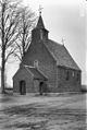
Nederlands: Kruiskapel - anno 1727
|
This is a category about rijksmonument number 26320
|
| Address |
|
Media in category "Heilige Kruiskapel (Luyksgestel)"
The following 26 files are in this category, out of 26 total.
-
 Exterieur - Luyksgestel - 20143253 - RCE.jpg 806 × 1,200; 233 KB
-
 Exterieur kapel van het H. Kruis - Luyksgestel - 20143272 - RCE.jpg 981 × 1,200; 326 KB
-
 Heilig Kruiskapel Kappellerweg, Luyksgestel.jpg 6,000 × 4,000; 6.64 MB
-
 Kruiswegstatie 1 - Luyksgestel - 20143254 - RCE.jpg 1,200 × 949; 264 KB
-
 Kruiswegstatie 10 - Luyksgestel - 20143263 - RCE.jpg 1,200 × 952; 278 KB
-
 Kruiswegstatie 10, achterzijde - Luyksgestel - 20143264 - RCE.jpg 1,200 × 940; 194 KB
-
 Kruiswegstatie 11 - Luyksgestel - 20143265 - RCE.jpg 1,200 × 955; 259 KB
-
 Kruiswegstatie 12 - Luyksgestel - 20143266 - RCE.jpg 1,200 × 952; 276 KB
-
 Kruiswegstatie 13 - Luyksgestel - 20143267 - RCE.jpg 1,200 × 952; 260 KB
-
 Kruiswegstatie 14 - Luyksgestel - 20143268 - RCE.jpg 1,200 × 956; 272 KB
-
 Kruiswegstatie 2 - Luyksgestel - 20143255 - RCE.jpg 1,200 × 948; 259 KB
-
 Kruiswegstatie 3 - Luyksgestel - 20143256 - RCE.jpg 1,200 × 955; 267 KB
-
 Kruiswegstatie 4 - Luyksgestel - 20143257 - RCE.jpg 1,200 × 946; 254 KB
-
 Kruiswegstatie 5 - Luyksgestel - 20143258 - RCE.jpg 1,200 × 941; 263 KB
-
 Kruiswegstatie 6 - Luyksgestel - 20143259 - RCE.jpg 1,200 × 949; 264 KB
-
 Kruiswegstatie 7 - Luyksgestel - 20143260 - RCE.jpg 1,200 × 952; 276 KB
-
 Kruiswegstatie 8 - Luyksgestel - 20143261 - RCE.jpg 1,200 × 947; 262 KB
-
 Kruiswegstatie 9 - Luyksgestel - 20143262 - RCE.jpg 1,200 × 952; 255 KB
-
 Luijksgestel - Kapellerweg 21 - H. Kruiskapel - Elisabeth van Thüringen.jpg 3,888 × 2,592; 6.47 MB
-
 Luijksgestel - Kapellerweg 21 - H. Kruiskapel - interieur.jpg 2,592 × 3,888; 4.78 MB
-
 Luijksgestel - Kapellerweg 21 - H. Kruiskapel - Maria met kind.jpg 3,888 × 2,592; 6.32 MB
-
 Luijksgestel - Kapellerweg 21 - H. Kruiskapel.jpg 800 × 534; 355 KB
-
 Overzicht zuidwestgevel - Luyksgestel - 20348020 - RCE.jpg 1,200 × 1,188; 426 KB
-
 Westgevel - Luyksgestel - 20143270 - RCE.jpg 788 × 1,200; 286 KB
-
 Zuid-oost gevel - Luyksgestel - 20143271 - RCE.jpg 1,200 × 788; 229 KB
-
 Zuid-west gevel - Luyksgestel - 20143269 - RCE.jpg 1,200 × 802; 259 KB


