Category:Helsby
Vai alla navigazione
Vai alla ricerca
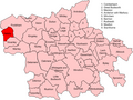
Cittadina del Cheshire (Inghilterra)  | |||||
| Carica un file multimediale | |||||
| Istanza di | |||||
|---|---|---|---|---|---|
| Luogo | Cheshire West and Chester, Cheshire, Nord Ovest dell'Inghilterra, Inghilterra | ||||
| Popolazione |
| ||||
| Considerato essere uguale a | Helsby (pagina Wikimedia duplicata, parrocchia civile dell'Inghilterra) | ||||
 | |||||
Sottocategorie
Questa categoria contiene le 6 sottocategorie indicate di seguito, su un totale di 6.
H
- Helsby Quarry (46 F)
- Helsby railway station (53 F)
P
- Pubs in Helsby (14 F)
W
- Helsby War Memorial (2 F)
File nella categoria "Helsby"
Questa categoria contiene 152 file, indicati di seguito, su un totale di 152.
-

-
 A view over the M56 to the River Mersey beyond - geograph.org.uk - 4762829.jpg 4 333 × 2 506; 7,64 MB
-
 A56 - Primrose Lane junction, Helsby - geograph.org.uk - 2882955.jpg 639 × 452; 152 KB
-
 A56 Chester Road at Helsby - DSC05968.JPG 3 648 × 2 736; 3,58 MB
-
 Alvanley House.jpg 4 000 × 3 000; 2,7 MB
-
 Alvanley Road, Helsby - geograph.org.uk - 3165784.jpg 5 184 × 3 456; 4,62 MB
-
 Alvanley Road, Helsby - geograph.org.uk - 3165802.jpg 5 184 × 3 456; 7,59 MB
-
 Alvanley Road, Helsby - geograph.org.uk - 6242190.jpg 1 024 × 576; 313 KB
-
 Bank House Lane, Helsby - geograph.org.uk - 6197065.jpg 1 024 × 768; 144 KB
-

-

-

-
 Brick shelter, Chester Road, Helsby (1).JPG 3 240 × 4 320; 4,19 MB
-
 Brick shelter, Chester Road, Helsby (2).JPG 3 240 × 4 320; 4,68 MB
-
 Bridge carrying Lower Rake Lane - geograph.org.uk - 5116246.jpg 6 000 × 4 000; 6,75 MB
-

-
 Chester Old Road in Helsby - geograph.org.uk - 5978107.jpg 4 000 × 3 000; 4,03 MB
-
 Chester Road (A56) - geograph.org.uk - 2160225.jpg 640 × 480; 128 KB
-
 Chester Road footbridge - geograph.org.uk - 4351900.jpg 640 × 428; 51 KB
-

-
 Chester Road Footbridge, Woodhouses - geograph.org.uk - 2160277.jpg 640 × 480; 142 KB
-
 Chester to Manchester Line, near Helsby station.jpg 4 320 × 3 240; 4,4 MB
-
 Crags, Helsby - geograph.org.uk - 6242276.jpg 1 024 × 576; 247 KB
-
 Crescent Drive, Helsby (1).JPG 4 000 × 3 000; 2,91 MB
-
 Crescent Drive, Helsby (2).JPG 4 000 × 3 000; 2,88 MB
-
 Crescent Drive, Helsby.JPG 4 320 × 3 240; 4,21 MB
-
 Edward VII pillarbox at Helsby - geograph.org.uk - 1238339.jpg 480 × 640; 132 KB
-

-
 Fields north of Helsby - geograph.org.uk - 6197090.jpg 1 024 × 768; 163 KB
-
 Fields towards Grassy Lane from M56 - geograph.org.uk - 2409351.jpg 640 × 480; 71 KB
-
 Filling station on the A56, Helsby - geograph.org.uk - 2882956.jpg 638 × 450; 138 KB
-

-
 Flowerbed at Helsby (1).JPG 4 320 × 3 240; 5,75 MB
-
 Footpath to Alvanley - geograph.org.uk - 3163918.jpg 5 184 × 3 456; 6,24 MB
-
 Footpath to Helsby Hill - geograph.org.uk - 3163442.jpg 5 183 × 3 455; 5,54 MB
-
 Frodsham Wind Farm - geograph.org.uk - 6242262.jpg 1 024 × 576; 142 KB
-
 GrowHow - geograph.org.uk - 6242255.jpg 1 024 × 576; 149 KB
-
 Helsby - Chester Road - geograph.org.uk - 2882978.jpg 638 × 454; 142 KB
-
 Helsby - Chester Road at Mill Rise - geograph.org.uk - 2882980.jpg 639 × 449; 151 KB
-
 Helsby - Chester Road at Robin Hood Lane - geograph.org.uk - 2882969.jpg 638 × 452; 136 KB
-
 Helsby - geograph.org.uk - 6242245.jpg 1 024 × 576; 343 KB
-
 Helsby - geograph.org.uk - 6242279.jpg 1 024 × 576; 187 KB
-
 Helsby and Ince Works from Foxhill - geograph.org.uk - 172106.jpg 640 × 480; 52 KB
-
 Helsby Community Sports Club (1).JPG 4 320 × 3 240; 3,46 MB
-
 Helsby Community Sports Club - DSC05965.JPG 3 648 × 2 736; 3,64 MB
-
 Helsby from the air - geograph.org.uk - 1581563.jpg 640 × 428; 65 KB
-
 Helsby High School - geograph.org.uk - 2159934.jpg 640 × 402; 68 KB
-
 Helsby Hill - geograph.org.uk - 6242209.jpg 1 024 × 576; 229 KB
-
 Helsby Hill - geograph.org.uk - 6443825.jpg 1 280 × 889; 344 KB
-
 Helsby Hill view - geograph.org.uk - 5978405.jpg 800 × 533; 81 KB
-
 Helsby Junction Signal Box - geograph.org.uk - 6004300.jpg 1 024 × 576; 143 KB
-
 Helsby Junction signal box - geograph.org.uk - 6171632.jpg 1 024 × 768; 129 KB
-
 Helsby Marsh - geograph.org.uk - 6242264.jpg 1 024 × 576; 188 KB
-

-
 Helsby Quarry Nature Reserve - geograph.org.uk - 6242299.jpg 1 024 × 576; 394 KB
-
 Helsby Quarry Nature Reserve - geograph.org.uk - 6242304.jpg 1 024 × 576; 384 KB
-
 Helsby Railway Station - geograph.org.uk - 6004308.jpg 1 024 × 576; 169 KB
-
 Helsby Railway Station - geograph.org.uk - 6148053.jpg 1 024 × 683; 129 KB
-
 Helsby Sub Post Office - geograph.org.uk - 2161020.jpg 640 × 441; 54 KB
-
 Helsby, Lower Rake Lane bridge - geograph.org.uk - 5221774.jpg 1 600 × 1 065; 565 KB
-
 Helsby, Snowfall at Chester Road - geograph.org.uk - 208872.jpg 640 × 480; 76 KB
-
 Industrial Landscape - geograph.org.uk - 89463.jpg 640 × 479; 60 KB
-
 Junction of the A56 and the A5117 - geograph.org.uk - 1208089.jpg 640 × 426; 50 KB
-
 Lower Rake Lane and Helsby Hill - geograph.org.uk - 3367689.jpg 480 × 640; 108 KB
-
 Lower Rake Lane motorway bridge - geograph.org.uk - 3367699.jpg 640 × 480; 85 KB
-
 Lower Rake Lane over the M56 motorway - geograph.org.uk - 1239321.jpg 640 × 480; 122 KB
-
 Lower Rake Lane railway bridge, Helsby - geograph.org.uk - 3367672.jpg 640 × 480; 118 KB
-
 Lower Rake Lane, Helsby (1).JPG 4 320 × 3 240; 3,15 MB
-
 Lower Rake Lane, Helsby (2).JPG 3 240 × 4 320; 3,36 MB
-
 Lower Rake Lane, Helsby (3).JPG 3 240 × 4 320; 4,21 MB
-
 Lower Rake Lane, Helsby (4).JPG 4 320 × 3 240; 3,92 MB
-
 Lower Rake Lane, Helsby (5).JPG 4 320 × 3 240; 3,7 MB
-
 Lower Rake Lane, Helsby - geograph.org.uk - 1238467.jpg 640 × 480; 163 KB
-
 M56 east from Lower Rake Lane bridge - geograph.org.uk - 1239327.jpg 640 × 480; 92 KB
-
 M56 Footbridge, Helsby Marsh - geograph.org.uk - 2154391.jpg 640 × 480; 127 KB
-

-

-
 M56 motorway at Helsby (1).JPG 4 320 × 3 240; 3,07 MB
-
 M56 motorway at Helsby (2).JPG 4 000 × 3 000; 2,79 MB
-
 M56 motorway at Helsby (3).JPG 4 000 × 3 000; 2,79 MB
-
 M56 motorway at Helsby (4).JPG 4 000 × 3 000; 2,78 MB
-
 M56 motorway at Helsby (5).JPG 4 000 × 3 000; 2,84 MB
-
 M56 motorway at Helsby (6).JPG 4 320 × 3 240; 3,8 MB
-
 M56 Motorway crossing Helsby Marsh - geograph.org.uk - 2253110.jpg 640 × 480; 55 KB
-
 M56 near Helsby - geograph.org.uk - 2357447.jpg 640 × 481; 36 KB
-
 M56 west from Lower Rake Lane bridge - geograph.org.uk - 1239324.jpg 640 × 480; 100 KB
-
 M56 westbound by Helsby Marsh - geograph.org.uk - 4796025.jpg 640 × 480; 35 KB
-
 M56 westbound near Helsby - geograph.org.uk - 2357431.jpg 640 × 480; 36 KB
-
 M56, Helsby Lower Rake Lane Bridge - geograph.org.uk - 2154793.jpg 800 × 480; 149 KB
-
 M56, Helsby Marsh - geograph.org.uk - 2154383.jpg 720 × 480; 152 KB
-
 M56, Helsby Marsh - geograph.org.uk - 6242270.jpg 1 024 × 576; 183 KB
-
 Meadow Farm - geograph.org.uk - 6242250.jpg 1 024 × 576; 244 KB
-

-
 Mill Rise, Helsby - geograph.org.uk - 6197057.jpg 1 024 × 768; 157 KB
-
 Mixed traffic on Chester Road - geograph.org.uk - 4762795.jpg 3 761 × 2 414; 6,54 MB
-
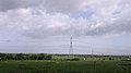
 Mobile communications tower, Helsby.JPG 3 000 × 4 000; 2,73 MB
-
-
 Old Chester Road - geograph.org.uk - 1238290.jpg 480 × 640; 170 KB
-
 Old Chester Road above Helsby - geograph.org.uk - 1238304.jpg 480 × 640; 204 KB
-
 Old Chester Road, Helsby (1).JPG 4 320 × 3 240; 5,23 MB
-
 Old Chester Road-Alvanley Road junction, Helsby - geograph.org.uk - 5651766.jpg 1 024 × 768; 406 KB
-
 Old path above Helsby - geograph.org.uk - 1238272.jpg 480 × 640; 202 KB
-
 Path, Helsby - geograph.org.uk - 6242309.jpg 1 024 × 827; 509 KB
-
 Path, Helsby Hill - geograph.org.uk - 6242193.jpg 1 024 × 576; 356 KB
-
 Petrol Station, A56, Helsby - DSC05966.JPG 3 648 × 2 736; 3,56 MB
-
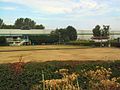
 Planter at Helsby - DSC05967.JPG 3 648 × 2 736; 3,56 MB
-
 Potatoes in front of the motorway - geograph.org.uk - 3971543.jpg 640 × 298; 43 KB
-
 Proffits Lane near Helsby approaching Chester Road (A56) - geograph.org.uk - 5978096.jpg 4 000 × 3 000; 3,9 MB
-
 Public footpath, Hale View Road, Helsby.JPG 4 320 × 3 240; 3,27 MB
-
 Pylons beside the M56 - geograph.org.uk - 2003353.jpg 2 816 × 4 224; 4,94 MB
-
 Railway north east of Helsby - geograph.org.uk - 6197084.jpg 1 024 × 768; 133 KB
-
 Railway, Helsby - geograph.org.uk - 6242289.jpg 1 024 × 576; 175 KB
-
 Restricted Byway, Lower Rake Lane, Helsby.JPG 3 240 × 4 320; 2,24 MB
-

-
 Sandy Lane, Helsby - geograph.org.uk - 3165911.jpg 5 184 × 3 456; 7,09 MB
-
 Semaphore signals, Helsby railway station - geograph.org.uk - 6197099.jpg 1 024 × 768; 210 KB
-
 Shops on Latham Avenue, Helsby (1).JPG 4 320 × 3 240; 2,7 MB
-
 Shops on Latham Avenue, Helsby (2).JPG 4 320 × 3 240; 2,67 MB
-
 Smithy Lane, Helsby (1).JPG 3 240 × 4 320; 4,96 MB
-
 Smithy Lane, Helsby - geograph.org.uk - 6197081.jpg 1 024 × 768; 222 KB
-
 Summit of Woodhouse Hill (geograph 6299550).jpg 1 024 × 683; 487 KB
-
 Tatty trig, Helsby - geograph.org.uk - 6242202.jpg 1 024 × 576; 261 KB
-
 Tesco, Helsby - geograph.org.uk - 3968267.jpg 640 × 480; 69 KB
-
 Tesco, Helsby - geograph.org.uk - 6565515.jpg 1 600 × 740; 234 KB
-
 The A56, Chester Road, Helsby - geograph.org.uk - 2722245.jpg 800 × 600; 196 KB
-
 The A56, Chester Road, Helsby - geograph.org.uk - 2722251.jpg 800 × 600; 231 KB
-
 The bin collection in Primrose Lane - geograph.org.uk - 4787109.jpg 4 047 × 2 135; 7,11 MB
-
 The Edge of Helsby Hill - geograph.org.uk - 5415204.jpg 723 × 829; 107 KB
-
 The M56 heading west - geograph.org.uk - 6169830.jpg 2 700 × 2 025; 340 KB
-
 The M56 heading west - geograph.org.uk - 6169835.jpg 2 700 × 2 025; 244 KB
-

-

-
 The M56 runs under Rake Lane - geograph.org.uk - 6169833.jpg 2 700 × 2 025; 345 KB
-
 This field remains - geograph.org.uk - 6242283.jpg 1 024 × 576; 126 KB
-
 Triangulation pillar, Helsby Hill - geograph.org.uk - 6242201.jpg 1 024 × 576; 212 KB
-
 Trig point on Helsby Hill's summit - geograph.org.uk - 5963204.jpg 5 184 × 3 888; 4,32 MB
-
 Verdant public footpath north of Helsby (1) - geograph.org.uk - 6197070.jpg 1 024 × 768; 237 KB
-
 Verdant public footpath north of Helsby (2) - geograph.org.uk - 6197074.jpg 1 024 × 768; 326 KB
-
 View from the top of Helsby Hill - geograph.org.uk - 6617560.jpg 800 × 599; 136 KB
-
 View towards Helsby from M56 west - geograph.org.uk - 2422856.jpg 640 × 480; 81 KB
-
 Vr helsby.png 591 × 443; 63 KB
-
 Westbound M56 near Helsby - geograph.org.uk - 5610903.jpg 640 × 427; 322 KB
-
 Commemorative Bench on Snidley Moor - geograph.org.uk - 62546.jpg 640 × 480; 82 KB
-
 Footpath, Snidley Moor - geograph.org.uk - 84892.jpg 640 × 480; 111 KB
-
 Helsby Marsh, beside the M56 - geograph.org.uk - 198932.jpg 640 × 480; 67 KB
-
 Helsby Sports and Social Club - geograph.org.uk - 36434.jpg 640 × 480; 76 KB
-
 Middle Walk, below Helsby Crag - geograph.org.uk - 175809.jpg 640 × 480; 151 KB
-
 Old railway Alvanley - geograph.org.uk - 60255.jpg 640 × 480; 80 KB
-
 Spring Farm, Helsby - geograph.org.uk - 198952.jpg 640 × 480; 65 KB
-

-
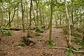
 Traditional woodland near Woodhouses - geograph.org.uk - 24391.jpg 640 × 480; 102 KB
-
 Wires over Helsby Marsh - geograph.org.uk - 350359.jpg 640 × 426; 41 KB


.JPG)
.JPG)


_-_geograph.org.uk_-_2160225.jpg)


.JPG)
.JPG)


.JPG)


.JPG)


.JPG)
.JPG)
.JPG)
.JPG)
.JPG)


.JPG)
.JPG)
.JPG)
.JPG)
.JPG)
.JPG)


.JPG)


_-_geograph.org.uk_-_5978096.jpg)


.JPG)
.JPG)
.JPG)

.jpg)


_-_geograph.org.uk_-_6197070.jpg)
_-_geograph.org.uk_-_6197074.jpg)


