Category:Herengracht 524, Amsterdam
Jump to navigation
Jump to search
| Object location | | View all coordinates using: OpenStreetMap |
|---|
 | |||||
| Upload media | |||||
| Instance of |
| ||||
|---|---|---|---|---|---|
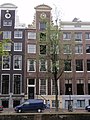
| Location | Amsterdam, North Holland, Netherlands | ||||
| Street address |
| ||||
| Located on street | |||||
| Owned by |
| ||||
| Heritage designation |
| ||||
| Inception |
| ||||
 | |||||
|
This is a category about rijksmonument number 1882
|
| Address |
|
Media in category "Herengracht 524, Amsterdam"
The following 12 files are in this category, out of 12 total.
-
 Amsterdam - Herengracht 524.JPG 3,056 × 4,592; 4.78 MB
-
 Amsterdam 4004 19.jpg 3,888 × 2,592; 3.09 MB
-
 Amsterdam 4004 20.jpg 3,888 × 2,592; 3.28 MB
-
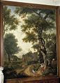
 Andriessen, Jurriaan (1742-1819), Afb B00000029524.jpg 1,296 × 2,388; 619 KB
-
 Andriessen, Jurriaan (1742-1819), Afb B00000029566.jpg 2,016 × 2,376; 1.03 MB
-
 Andriessen, Jurriaan (1742-1819), Afb B00000029567.jpg 2,013 × 2,373; 1,009 KB
-
 Andriessen, Jurriaan (1742-1819), Afb B00000029579.jpg 1,989 × 2,421; 1.01 MB
-
-
 Rm1882-2.JPG 2,736 × 3,648; 2.03 MB
-
 Rm1882.JPG 2,736 × 3,648; 2.11 MB
-
 Stadsarchief Amsterdam, Afb ANWN00112000001.jpg 1,617 × 1,023; 147 KB
-
 Steenbergh, C.J. (1859-1939), Afb 012000009363.jpg 2,076 × 2,844; 903 KB


,_Afb_B00000029524.jpg)
,_Afb_B00000029566.jpg)
,_Afb_B00000029567.jpg)
,_Afb_B00000029579.jpg)
,_behangsel,_Bosrijk_klassiek_arcadisch_landschap_met_vrouwen_die_uitrusten_van_de_jacht_-_Amsterdam_-_20394986_-_RCE.jpg)


,_Afb_012000009363.jpg)