Category:Hervormde Kerk, Hensbroek
Jump to navigation
Jump to search
| Object location | | View all coordinates using: OpenStreetMap |
|---|
 | |||||
| Upload media | |||||
| Instance of |
| ||||
|---|---|---|---|---|---|
| Part of | |||||
| Location | Hensbroek, Koggenland, North Holland, Netherlands | ||||
| Street address |
| ||||
| Heritage designation |
| ||||
 | |||||
Kerk:
|
This is a category about rijksmonument number 31216
|
Toren:
|
This is a category about rijksmonument number 31217
|
| Address |
|
Media in category "Hervormde Kerk, Hensbroek"
The following 69 files are in this category, out of 69 total.
-
 Avondmaalstin, 1755 - Hensbroek - 20108759 - RCE.jpg 1,200 × 867; 170 KB
-
 Cartouche - Hensbroek - 20108758 - RCE.jpg 946 × 1,200; 210 KB
-
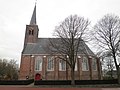
 Exterieur - Hensbroek - 20108755 - RCE.jpg 922 × 1,200; 199 KB
-
 Exterieur naar het noord-westen - Hensbroek - 20108756 - RCE.jpg 951 × 1,200; 246 KB
-

-

-
 Gedeelte van de westgevel - Hensbroek - 20108762 - RCE.jpg 963 × 1,200; 410 KB
-
 Gedenksteen tegen torenwand - Hensbroek - 20108774 - RCE.jpg 960 × 1,200; 204 KB
-
 Gezicht op Hensbroek in 1667 PK-T-2819, PK-T-6312.jpg 366 × 268; 33 KB
-
 Gezicht op Hensbroek in 1726 PK-T-2820, PK-T-2819.jpg 366 × 271; 33 KB
-
 Hensbroek, de toren van de Hervormde kerk RM31217 foto3 2015-10-12 16.06.jpg 4,352 × 3,264; 10.69 MB
-
 Herenbank - Hensbroek - 20108784 - RCE.jpg 965 × 1,200; 171 KB
-
 Hervormde Kerk van Hensbroek1.JPG 480 × 640; 91 KB
-
 Hervormde Kerk van Hensbroek2.JPG 640 × 480; 84 KB
-
 INT. GRAFZERK - Hensbroek - 20315513 - RCE.jpg 1,186 × 1,200; 407 KB
-
 INT. GRAFZERK - Hensbroek - 20315514 - RCE.jpg 1,190 × 1,200; 467 KB
-
 INT. GRAFZERK - Hensbroek - 20315515 - RCE.jpg 1,190 × 1,200; 501 KB
-
 INT. GRAFZERK - Hensbroek - 20315516 - RCE.jpg 1,190 × 1,200; 462 KB
-
 INT. GRAFZERK - Hensbroek - 20315517 - RCE.jpg 1,197 × 1,200; 505 KB
-
 INT. GRAFZERK - Hensbroek - 20315518 - RCE.jpg 1,186 × 1,200; 548 KB
-
 Interieur koor - Hensbroek - 20108782 - RCE.jpg 1,200 × 955; 198 KB
-
 Interieur naar het noord-oosten - Hensbroek - 20108757 - RCE.jpg 930 × 1,200; 192 KB
-
 Interieur naar het noord-westen tijdens restauratie - Hensbroek - 20338745 - RCE.jpg 1,195 × 1,200; 292 KB
-
 Interieur naar het oosten - Hensbroek - 20108767 - RCE.jpg 948 × 1,200; 208 KB
-
 Interieur naar het oosten - Hensbroek - 20108768 - RCE.jpg 1,200 × 960; 197 KB
-
 Interieur naar het oosten, tijdens restauratie - Hensbroek - 20338746 - RCE.jpg 1,200 × 1,200; 284 KB
-
 Interieur naar het oosten, tijdens restauratie - Hensbroek - 20338747 - RCE.jpg 1,197 × 1,200; 358 KB
-
 Interieur naar het westen - Hensbroek - 20108769 - RCE.jpg 1,200 × 941; 199 KB
-
 Interieur naar het westen - Hensbroek - 20108770 - RCE.jpg 1,200 × 948; 182 KB
-
 Interieur naar het westen - Hensbroek - 20108781 - RCE.jpg 1,200 × 953; 187 KB
-
 Interieur, bank tegen zuidwand - Hensbroek - 20108785 - RCE.jpg 1,195 × 1,200; 234 KB
-
 Interieur, fundering toren tijdens restauratie - Hensbroek - 20338748 - RCE.jpg 1,185 × 1,200; 304 KB
-
 Interieur, fundering toren tijdens restauratie - Hensbroek - 20338749 - RCE.jpg 1,193 × 1,200; 306 KB
-
 Interieur, gewelf en steunbalken, tijdens restauratie - Hensbroek - 20338755 - RCE.jpg 1,195 × 1,200; 279 KB
-
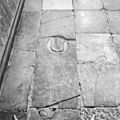
 Interieur, grafzerk - Hensbroek - 20108788 - RCE.jpg 1,200 × 1,192; 451 KB
-
 Interieur, grafzerk - Hensbroek - 20108789 - RCE.jpg 1,200 × 1,197; 390 KB
-
 Interieur, grafzerk - Hensbroek - 20108790 - RCE.jpg 1,200 × 1,200; 337 KB
-
 Interieur, grafzerk - Hensbroek - 20108791 - RCE.jpg 1,200 × 1,200; 386 KB
-
 Interieur, grafzerk - Hensbroek - 20108792 - RCE.jpg 1,200 × 1,200; 384 KB
-
 Interieur, grafzerk - Hensbroek - 20108793 - RCE.jpg 1,200 × 1,200; 402 KB
-
 Interieur, herenbank - Hensbroek - 20108773 - RCE.jpg 1,200 × 941; 161 KB
-
 Interieur, ontpleisterde wand, tijdens restauratie - Hensbroek - 20338753 - RCE.jpg 1,193 × 1,200; 240 KB
-
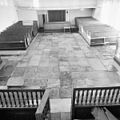 Interieur, overzicht zerkenvloer - Hensbroek - 20108786 - RCE.jpg 1,197 × 1,200; 248 KB
-
 Interieur, overzicht zerkenvloer - Hensbroek - 20108787 - RCE.jpg 1,188 × 1,200; 302 KB
-
 Interieur, toren tijdens restauratie - Hensbroek - 20338751 - RCE.jpg 1,197 × 1,200; 252 KB
-
 Noordgevel - Hensbroek - 20108763 - RCE.jpg 1,200 × 948; 284 KB
-
 Noordgevel - Hensbroek - 20108780 - RCE.jpg 960 × 1,200; 361 KB
-
 Noordgevel tijdens restauratie - Hensbroek - 20338737 - RCE.jpg 1,197 × 1,200; 458 KB
-

-
 Onderste gedeelte zijgevel tijdens restauratie - Hensbroek - 20338740 - RCE.jpg 1,188 × 1,200; 441 KB
-
 Onderste gedeelte zijgevel tijdens restauratie - Hensbroek - 20338741 - RCE.jpg 1,192 × 1,200; 438 KB
-
 Onderste gedeelte zijgevel tijdens restauratie - Hensbroek - 20338742 - RCE.jpg 1,200 × 1,200; 470 KB
-
 Oostgevel - Hensbroek - 20108764 - RCE.jpg 960 × 1,200; 258 KB
-
 Orgel - Hensbroek - 20108771 - RCE.jpg 951 × 1,200; 170 KB
-
 Overzicht zuidgevel - Hensbroek - 20108776 - RCE.jpg 961 × 1,200; 206 KB
-
 Overzicht zuidgevel tijdens restauratie - Hensbroek - 20338733 - RCE.jpg 1,200 × 1,198; 448 KB
-
 Preekstoel - Hensbroek - 20108772 - RCE.jpg 974 × 1,200; 199 KB
-
 Preekstoel - Hensbroek - 20108783 - RCE.jpg 963 × 1,200; 168 KB
-
 Tinnen avondmaalsgerei - Hensbroek - 20108760 - RCE.jpg 1,200 × 882; 167 KB
-
 Westgevel onderste gedeelte tijdens restauratie - Hensbroek - 20338739 - RCE.jpg 1,192 × 1,200; 392 KB
-
 Westgevel tijdens restauratie - Hensbroek - 20338738 - RCE.jpg 1,185 × 1,200; 418 KB
-

-
 Zuid-oost gevel - Hensbroek - 20108765 - RCE.jpg 1,200 × 960; 272 KB
-
 Zuid-oost gevel - Hensbroek - 20108766 - RCE.jpg 963 × 1,200; 255 KB
-
 Zuid-oostgevel - Hensbroek - 20108779 - RCE.jpg 1,200 × 953; 329 KB
-
 Zuid-west gevel - Hensbroek - 20108761 - RCE.jpg 963 × 1,200; 206 KB
-
 Zuid-westgevel - Hensbroek - 20108777 - RCE.jpg 972 × 1,200; 318 KB
-
 Zuidgevel - Hensbroek - 20108778 - RCE.jpg 1,200 × 956; 277 KB
-
 Zuidgevel tijdens restauratie - Hensbroek - 20338735 - RCE.jpg 1,200 × 1,200; 424 KB


