Category:Het Azijntonnetje ('s-Hertogenbosch)
Jump to navigation
Jump to search
| Object location | | View all coordinates using: OpenStreetMap |
|---|
building in 's-Hertogenbosch, Netherlands  | |||||
| Upload media | |||||
| Instance of | |||||
|---|---|---|---|---|---|
| Location | 's-Hertogenbosch, North Brabant, Netherlands | ||||
| Street address |
| ||||
| Located on street | |||||
| Heritage designation |
| ||||
 | |||||
Nederlands: Het Azijntonnetje
|
This is a category about rijksmonument number 21689
|
| Address |
|
Media in category "Het Azijntonnetje ('s-Hertogenbosch)"
The following 9 files are in this category, out of 9 total.
-
 's-Hertogenbosch Rijksmonument 21689 Korte Putstraat 21.JPG 2,736 × 3,648; 3.08 MB
-
 Interieur - 's-Hertogenbosch - 20110817 - RCE.jpg 1,200 × 955; 259 KB
-
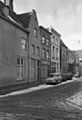 Overzicht - 's-Hertogenbosch - 20110820 - RCE.jpg 818 × 1,200; 181 KB
-
 Overzicht - 's-Hertogenbosch - 20110821 - RCE.jpg 788 × 1,200; 250 KB
-
 Overzicht wand - 's-Hertogenbosch - 20110816 - RCE.jpg 800 × 1,200; 203 KB
-
 Sleutelstuk - 's-Hertogenbosch - 20110818 - RCE.jpg 1,200 × 955; 240 KB
-
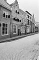
 Voorgevel - 's-Hertogenbosch - 20110814 - RCE.jpg 827 × 1,200; 192 KB
-
 Voorgevel - 's-Hertogenbosch - 20110815 - RCE.jpg 810 × 1,200; 217 KB
-
 Voorgevels - 's-Hertogenbosch - 20110819 - RCE.jpg 824 × 1,200; 197 KB


