Category:Het Kruitvat, Deventer
Jump to navigation
Jump to search
| Object location | | View all coordinates using: OpenStreetMap |
|---|
 | |||||
| Upload media | |||||
| Instance of | |||||
|---|---|---|---|---|---|
| Location | Deventer, Overijssel, Netherlands | ||||
| Street address |
| ||||
| Heritage designation |
| ||||
 | |||||
Nederlands: Magazijn De Zon, voormalig pand van Vroom en Dreesman
|
This is a category about rijksmonument number 510748
|
| Address |
|
Media in category "Het Kruitvat, Deventer"
The following 28 files are in this category, out of 28 total.
-
 Brink 100 Deventer.jpg 1,712 × 2,560; 1.07 MB
-
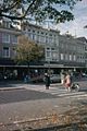
 Brink vanaf Walstraat - Deventer - 20053970 - RCE.jpg 1,197 × 1,200; 305 KB
-
 Detail gevel - Deventer - 20055805 - RCE.jpg 1,200 × 1,192; 307 KB
-
 Detail gevel - Deventer - 20055806 - RCE.jpg 1,195 × 1,200; 272 KB
-

-
 Deventer, Netherlands - panoramio (59).jpg 2,048 × 1,155; 521 KB
-
 Exterieur OVERZICHT VOORGEVELS - Deventer - 20261291 - RCE.jpg 800 × 1,200; 199 KB
-
 Exterieur OVERZICHT VOORGEVELS - Deventer - 20261292 - RCE.jpg 1,200 × 785; 199 KB
-
 Exterieur VOORGEVEL, DETAIL - Deventer - 20261293 - RCE.jpg 1,200 × 778; 158 KB
-
 Exterieur VOORGEVEL, DETAIL - Deventer - 20261294 - RCE.jpg 1,200 × 796; 146 KB
-
 Exterieur, gevelsteen Magazijn De Zon - Deventer - 20363484 - RCE.jpg 1,200 × 781; 155 KB
-
 INTERIEUR, BEGANE GROND, ART DECO MUURSCHILDERING - Deventer - 20284520 - RCE.jpg 1,199 × 1,200; 272 KB
-
 INTERIEUR, BEGANE GROND, ART DECO MUURSCHILDERING - Deventer - 20284521 - RCE.jpg 1,192 × 1,200; 263 KB
-
 INTERIEUR, BEGANE GROND, ART DECO MUURSCHILDERING - Deventer - 20284522 - RCE.jpg 1,200 × 1,197; 271 KB
-
 INTERIEUR, BEGANE GROND, ART DECO MUURSCHILDERING - Deventer - 20284523 - RCE.jpg 1,192 × 1,200; 308 KB
-
 Overzicht - Deventer - 20055791 - RCE.jpg 1,200 × 954; 221 KB
-
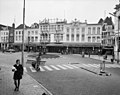
 Overzicht - Deventer - 20055793 - RCE.jpg 1,200 × 957; 212 KB
-
 Overzicht - Deventer - 20055798 - RCE.jpg 1,200 × 958; 238 KB
-
 Overzicht - Deventer - 20055802 - RCE.jpg 1,192 × 1,200; 271 KB
-
 Overzicht gevels - Deventer - 20055792 - RCE.jpg 1,200 × 954; 242 KB
-

-

-

-
 Overzicht voorgevels - Deventer - 20355815 - RCE.jpg 1,200 × 775; 194 KB
-
 Overzicht voorgevels, detail - Deventer - 20355820 - RCE.jpg 1,200 × 775; 181 KB
-
 Voorgevel - Deventer - 20055797 - RCE.jpg 1,200 × 962; 245 KB
-
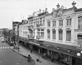
 Voorgevel V & D - Deventer - 20055803 - RCE.jpg 1,195 × 1,200; 321 KB
-
 Voorgevels - Deventer - 20055795 - RCE.jpg 1,200 × 956; 212 KB


,_glaspaneel_-_Deventer_-_20384196_-_RCE.jpg)
.jpg)


_centraal_gelegen_(_nummer_100_)_-_Deventer_-_20384192_-_RCE.jpg)
_-_Deventer_-_20384194_-_RCE.jpg)
_-_Deventer_-_20384195_-_RCE.jpg)


