Category:Heřmanice (Liberec District)
Jump to navigation
Jump to search
village in Liberec District of Liberec region  venkovský dům čp. 77   | |||||
| Upload media | |||||
| Instance of | |||||
|---|---|---|---|---|---|
| Location |
| ||||
| Population |
| ||||
| Area |
| ||||
| Elevation above sea level |
| ||||
| official website | |||||
 | |||||
Subcategories
This category has the following 13 subcategories, out of 13 total.
Media in category "Heřmanice (Liberec District)"
The following 41 files are in this category, out of 41 total.
-
 Znak Heřmanice.png 440 × 479; 115 KB
-
 Flag of Hermanice.svg 650 × 433; 26 KB
-
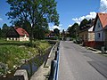
 Hermanice 009.jpg 575 × 362; 43 KB
-
 Heřmanice (okres LIberec), dům číslo 138.jpg 5,184 × 3,456; 10.21 MB
-
 Heřmanice (okres Liberec), hospůdka U Kodešovy skály, tabulka.jpg 5,184 × 3,456; 9.73 MB
-
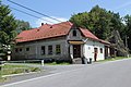 Heřmanice (okres Liberec), hospůdka U Kodešovy skály.jpg 5,184 × 3,456; 8.88 MB
-
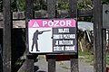 Heřmanice (okres Liberec), majitel je střelec.jpg 5,184 × 3,456; 6.95 MB
-
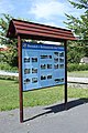
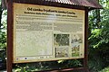
 Heřmanice (okres LIberec), mapa turistických cílů (seznam).jpg 3,456 × 5,184; 7.09 MB
-
 Heřmanice (okres LIberec), mapa turistických cílů.jpg 5,184 × 3,456; 8.86 MB
-
 Heřmanice (okres Liberec), památník povodni, informační tabule (1).jpg 3,456 × 5,184; 10.01 MB
-
 Heřmanice (okres Liberec), památník povodni, informační tabule (2).jpg 5,184 × 3,456; 8.28 MB
-
 Heřmanice (okres Liberec), památník povodni, informační tabule (3).jpg 5,184 × 3,456; 7.3 MB
-
 Heřmanice (okres Liberec), poutač Hospůdky u Kodešovy skály.jpg 5,184 × 3,456; 10 MB
-
 Heřmanice (okres LIberec), zbořeniště (1).jpg 5,184 × 3,456; 13.42 MB
-
 Heřmanice (okres LIberec), zbořeniště (2).jpg 5,184 × 3,456; 12.22 MB
-
 Heřmanice (u Frýdlantu) - chalupa čp. 53.jpg 1,600 × 1,200; 689 KB
-
 Heřmanice (u Frýdlantu) - chalupa čp. 70.jpg 1,600 × 1,200; 663 KB
-

-
 Heřmanice (u Frýdlantu) - domy čp. 106 a 30.jpg 1,600 × 1,200; 575 KB
-
 Heřmanice (u Frýdlantu) - dům čp. 138.jpg 1,200 × 1,600; 687 KB
-
 Heřmanice (u Frýdlantu) - dům čp. 22.jpg 1,600 × 1,200; 479 KB
-
 Heřmanice (u Frýdlantu) - dům čp. 56.jpg 1,600 × 1,200; 797 KB
-
 Heřmanice (u Frýdlantu) - most přes Olešku poblíž domu čp. 9.jpg 1,600 × 1,200; 621 KB
-
-
 Heřmanice (u Frýdlantu) - zbořeniště domu čp. 66, v pozadí čp. 65.jpg 1,600 × 1,200; 675 KB
-
 Heřmanice u Frýdlantu - cesta k parcele bývalé usedlosti čp. 12.jpg 6,000 × 4,000; 10.66 MB
-
 Heřmanice u Frýdlantu - hostinec (rodný dům J. V. Scheybala) (1).jpg 1,600 × 1,200; 533 KB
-
 Heřmanice u Frýdlantu - hostinec (rodný dům J. V. Scheybala) (2).jpg 1,200 × 1,600; 367 KB
-
 Heřmanice u Frýdlantu - hostinec (rodný dům J. V. Scheybala) (3).jpg 1,600 × 1,200; 353 KB
-
 Heřmanice u Frýdlantu - výhled z parcely bývalé usedlosti čp. 12 směrem k severu, ke vsi.jpg 6,000 × 4,000; 11.38 MB
-

-

-

-

-
 Heřmanice, rozhledna, informační tabule (2).jpg 5,184 × 3,456; 7.02 MB
-
 Heřmanice, rozhledna, informační tabule (3).jpg 5,184 × 3,456; 7.52 MB
-
 Heřmanice, rozhledna, informační tabule (4).jpg 5,184 × 3,456; 6.84 MB
-
 Heřmanice, rozhledna, informační tabule (5).jpg 5,184 × 3,456; 8.05 MB
-
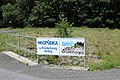
 Heřmanice, točka autobusů.jpg 5,184 × 3,456; 7.86 MB
-
 Hřiště Heřmanice 2.jpg 4,032 × 3,024; 5.1 MB
-
 Silnice mezi Heřmanicemi a Dětřichovem (1).jpg 3,456 × 5,184; 10.8 MB

,_d%C5%AFm_%C4%8D%C3%ADslo_138.jpg)
,_hosp%C5%AFdka_U_Kode%C5%A1ovy_sk%C3%A1ly,_tabulka.jpg)
,_hosp%C5%AFdka_U_Kode%C5%A1ovy_sk%C3%A1ly.jpg)
,_majitel_je_st%C5%99elec.jpg)
,_mapa_turistick%C3%BDch_c%C3%ADl%C5%AF_(seznam).jpg)
,_mapa_turistick%C3%BDch_c%C3%ADl%C5%AF.jpg)
,_pam%C3%A1tn%C3%ADk_povodni,_informa%C4%8Dn%C3%AD_tabule_(1).jpg)
,_pam%C3%A1tn%C3%ADk_povodni,_informa%C4%8Dn%C3%AD_tabule_(2).jpg)
,_pam%C3%A1tn%C3%ADk_povodni,_informa%C4%8Dn%C3%AD_tabule_(3).jpg)
,_pouta%C4%8D_Hosp%C5%AFdky_u_Kode%C5%A1ovy_sk%C3%A1ly.jpg)
,_zbo%C5%99eni%C5%A1t%C4%9B_(1).jpg)
,_zbo%C5%99eni%C5%A1t%C4%9B_(2).jpg)
_-_chalupa_%C4%8Dp._53.jpg)
_-_chalupa_%C4%8Dp._70.jpg)
_-_chalupa_%C4%8Dp._74_(p%C5%AFvodn%C3%AD_stav,_p%C5%99ed_zbo%C5%99en%C3%ADm_hr%C3%A1zd%C4%9Bn%C3%A9_%C4%8D%C3%A1sti).jpg)
_-_domy_%C4%8Dp._106_a_30.jpg)
_-_d%C5%AFm_%C4%8Dp._138.jpg)
_-_d%C5%AFm_%C4%8Dp._22.jpg)
_-_d%C5%AFm_%C4%8Dp._56.jpg)
_-_most_p%C5%99es_Ole%C5%A1ku_pobl%C3%AD%C5%BE_domu_%C4%8Dp._9.jpg)
_-_vlevo_chalupa_%C4%8Dp._74_(p%C5%99ed_zbo%C5%99en%C3%ADm_hr%C3%A1zd%C4%9Bn%C3%A9_%C4%8D%C3%A1sti),_v_pozad%C3%AD_%C4%8Dp._39,_vpravo_%C4%8Dp._137_a_121.jpg)
_-_zbo%C5%99eni%C5%A1t%C4%9B_domu_%C4%8Dp._66,_v_pozad%C3%AD_%C4%8Dp._65.jpg)

_(1).jpg)
_(2).jpg)
_(3).jpg)

.jpg)
.jpg)
.jpg)
.jpg)
.jpg)
.jpg)
.jpg)
.jpg)


.jpg)