Category:Hickling, Nottinghamshire
Jump to navigation
Jump to search
English: Hickling is a village near Melton Mowbray but is in Nottinghamshire. It is within the boundaries of Rushcliffe Borough Council, on the Grantham Canal and close to the Vale of Belvoir. The population numbers around 550 people.
village and civil parish in Nottinghamshire, UK  | |||||
| Upload media | |||||
| Instance of | |||||
|---|---|---|---|---|---|
| Location | Rushcliffe, Nottinghamshire, East Midlands, England | ||||
 | |||||
Subcategories
This category has the following 2 subcategories, out of 2 total.
P
- Plough Inn, Hickling (3 F)
Media in category "Hickling, Nottinghamshire"
The following 200 files are in this category, out of 293 total.
(previous page) (next page)-
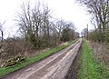
 13 1-2 miles from the Trent - geograph.org.uk - 2697670.jpg 959 × 1,280; 736 KB
-
 13 1-4 miles from the Trent - geograph.org.uk - 2697682.jpg 959 × 1,280; 473 KB
-
 13 3-4 miles from the Trent - geograph.org.uk - 2697653.jpg 959 × 1,280; 385 KB
-
 13 miles from the Trent - geograph.org.uk - 2227763.jpg 854 × 1,280; 1.02 MB
-
 A glimpse of the church - geograph.org.uk - 2227674.jpg 854 × 1,280; 216 KB
-

-
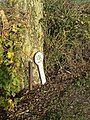
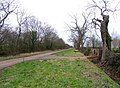
 A mile marker along the Grantham Canal - geograph.org.uk - 944972.jpg 562 × 640; 151 KB
-
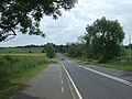
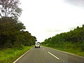 A606 approaching Hickling Pastures - geograph.org.uk - 3109252.jpg 2,592 × 1,936; 1.72 MB
-
 A606 approaching the junction with the A46 - geograph.org.uk - 3109258.jpg 2,592 × 1,936; 1.67 MB
-
 A606 at Hickling Pastures - geograph.org.uk - 2697187.jpg 1,280 × 959; 361 KB
-
 A606 near Turnpike Farm - geograph.org.uk - 3109256.jpg 2,592 × 1,936; 1.59 MB
-
 A606 towards Melton Mowbray - geograph.org.uk - 4040296.jpg 640 × 480; 82 KB
-

-

-

-

-
 Access to the railway at Bridge GSM4 43 - geograph.org.uk - 6380437.jpg 640 × 535; 117 KB
-
 Approach to Hickling - geograph.org.uk - 6380463.jpg 640 × 398; 93 KB
-
 Approach to Hickling Pastures - geograph.org.uk - 6380561.jpg 640 × 410; 76 KB
-

-
 Basin Hickling 2.JPG 2,244 × 1,656; 938 KB
-
 Before the enclosures - geograph.org.uk - 2227768.jpg 1,280 × 854; 289 KB
-
 Belvoir Angel - geograph.org.uk - 3550901.jpg 427 × 640; 140 KB
-
 Belvoir Angel - geograph.org.uk - 3551006.jpg 640 × 427; 122 KB
-
 Belvoir Angels - geograph.org.uk - 3550925.jpg 640 × 427; 129 KB
-
 Belvoir Angels - geograph.org.uk - 3551003.jpg 640 × 427; 133 KB
-
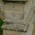 Bench mark, St Luke's Church, Hickling - geograph.org.uk - 4420489.jpg 1,280 × 1,280; 348 KB
-
 Bend in the canal - geograph.org.uk - 2848194.jpg 1,024 × 768; 199 KB
-
 Blocked canal - geograph.org.uk - 2848121.jpg 1,024 × 768; 233 KB
-
 Bowling Green Cottage - geograph.org.uk - 4420434.jpg 1,280 × 1,127; 300 KB
-
 Bridegate Lane eastwards - geograph.org.uk - 6380444.jpg 640 × 387; 85 KB
-
 Bridegate Lane eastwards - geograph.org.uk - 6380447.jpg 640 × 456; 87 KB
-
 Bridegate Lane eastwards - geograph.org.uk - 6380460.jpg 640 × 490; 94 KB
-
 Bridegate Lane westwards - geograph.org.uk - 6380448.jpg 640 × 463; 84 KB
-
 Bridegate Lane westwards - geograph.org.uk - 6380461.jpg 640 × 462; 66 KB
-

-
 Bridegate Lane-Melton Road junction - geograph.org.uk - 6380445.jpg 640 × 482; 89 KB
-
 Bridge GSM4 43 signs 0001 - geograph.org.uk - 6380549.jpg 640 × 567; 89 KB
-
 Bridge GSM4 43 signs 0002 - geograph.org.uk - 6380550.jpg 640 × 472; 93 KB
-
 Bridge GSM4 43 signs 0003 - geograph.org.uk - 6380551.jpg 640 × 564; 96 KB
-
 Bridge GSM4 43 signs 0004 - geograph.org.uk - 6380552.jpg 640 × 502; 80 KB
-
 Bridge GSM4 43 signs 0005 - geograph.org.uk - 6380553.jpg 640 × 544; 81 KB
-
 Bridge GSM4 43 signs 0006 - geograph.org.uk - 6380554.jpg 640 × 513; 84 KB
-
 Bridge GSM4 43 signs 0007 - geograph.org.uk - 6380555.jpg 640 × 554; 86 KB
-
 Bridge GSM4 43 signs 0008 - geograph.org.uk - 6380556.jpg 640 × 502; 118 KB
-
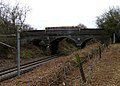
 Bridge over Dalby Brook - geograph.org.uk - 5935494.jpg 640 × 481; 91 KB
-
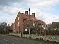
 Bridge View House - geograph.org.uk - 3550764.jpg 640 × 427; 151 KB
-
 Bridge View House.jpg 800 × 534; 386 KB
-
 Bridge ^33 on the Grantham Canal - geograph.org.uk - 6175228.jpg 640 × 480; 83 KB
-
 Bridge ^34 on the Grantham Canal - geograph.org.uk - 6175232.jpg 640 × 480; 73 KB
-
 Buildings being renovated - geograph.org.uk - 5935475.jpg 640 × 429; 69 KB
-
 Bulbs planted by the side of Bridegate Lane - geograph.org.uk - 4420454.jpg 1,280 × 869; 413 KB
-
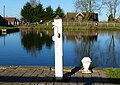
 Canal basin at Hickling - geograph.org.uk - 1069471.jpg 640 × 480; 89 KB
-
 Canal Farm sign - geograph.org.uk - 5586102.jpg 640 × 610; 106 KB
-
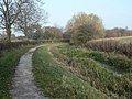
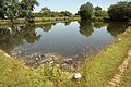
 Canal towpath near Hickling - geograph.org.uk - 2697662.jpg 1,280 × 959; 489 KB
-
 Chestnut House - geograph.org.uk - 2845437.jpg 1,024 × 768; 158 KB
-
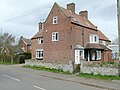 Chestnut House, Main Street - geograph.org.uk - 4420408.jpg 1,280 × 960; 332 KB
-
 Chimney of the Hickling Lengthman's Hut - geograph.org.uk - 6175223.jpg 480 × 640; 117 KB
-

-
 Church Cottage, Main Street - geograph.org.uk - 4420482.jpg 1,280 × 960; 396 KB
-
 Church Farm, Hickling - geograph.org.uk - 1047917.jpg 640 × 469; 73 KB
-
 Clawson Lane towards Hickling - geograph.org.uk - 944499.jpg 640 × 380; 41 KB
-
-
 Clawson Lane towards Long Clawson - geograph.org.uk - 5586104.jpg 640 × 438; 88 KB
-
 Collishaw Bridge - geograph.org.uk - 3551023.jpg 640 × 427; 149 KB
-
 Collishaw Bridge - geograph.org.uk - 3551027.jpg 640 × 427; 86 KB
-
 Corner of field by railway test track - geograph.org.uk - 2820059.jpg 640 × 480; 123 KB
-
 Cottage in Hickling - geograph.org.uk - 2848211.jpg 1,024 × 768; 201 KB
-
 Cottages on The Green - geograph.org.uk - 4420431.jpg 1,280 × 960; 280 KB
-
 Country Lane nr Upper Broughton - geograph.org.uk - 1843039.jpg 640 × 427; 72 KB
-
 Country road to Nether Broughton - geograph.org.uk - 908340.jpg 640 × 420; 87 KB
-
 Countryside near Clark's Bridge - geograph.org.uk - 944850.jpg 640 × 518; 140 KB
-
 Cows and farmland in South Notts - geograph.org.uk - 908337.jpg 640 × 491; 91 KB
-
 Daft family grave - geograph.org.uk - 3550871.jpg 427 × 640; 146 KB
-
 Delivery instructions for Canal Farm - geograph.org.uk - 5586105.jpg 640 × 449; 100 KB
-
 Dell Farm - geograph.org.uk - 2820081.jpg 640 × 367; 55 KB
-
 Derelict barn - geograph.org.uk - 2820082.jpg 640 × 483; 88 KB
-
 Derelict farm buildings - geograph.org.uk - 2820096.jpg 640 × 476; 92 KB
-
 Driveway to Canal Farm - geograph.org.uk - 5586106.jpg 640 × 436; 70 KB
-
 Driveway to High Holborn - geograph.org.uk - 2820078.jpg 640 × 463; 73 KB
-
 Edge of the wolds - geograph.org.uk - 2227664.jpg 1,280 × 854; 223 KB
-
 Entrance to Canal Farm - geograph.org.uk - 5586107.jpg 640 × 359; 53 KB
-

-
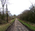
 Farm track and field - geograph.org.uk - 2697637.jpg 1,280 × 959; 343 KB
-
 Farm track off Melton Road - geograph.org.uk - 4040300.jpg 640 × 480; 65 KB
-
 Farmland off Melton Road - geograph.org.uk - 4040299.jpg 640 × 480; 60 KB
-
 Farmland off the A606 - geograph.org.uk - 4040295.jpg 640 × 480; 70 KB
-
 Female Common Darter - geograph.org.uk - 2697658.jpg 1,280 × 959; 497 KB
-
 Field access - geograph.org.uk - 2848106.jpg 1,024 × 768; 204 KB
-
 Field by Folly Hall - geograph.org.uk - 2820060.jpg 640 × 480; 107 KB
-

-

-
 Field footpath, Hickling - geograph.org.uk - 4420442.jpg 1,280 × 960; 308 KB
-
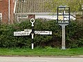 Fingerpost, Main Street-Bridegate Lane, Hickling - geograph.org.uk - 4407303.jpg 1,280 × 960; 491 KB
-
 Finnish Honorary Consulate - geograph.org.uk - 4420438.jpg 1,280 × 960; 335 KB
-
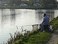 Fisherman at Hickling - geograph.org.uk - 2697684.jpg 1,280 × 959; 414 KB
-
 Folly Hall - geograph.org.uk - 2820061.jpg 640 × 428; 103 KB
-
 Folly Hall entrance - geograph.org.uk - 2820062.jpg 640 × 480; 76 KB
-
 Folly Hall Lane - geograph.org.uk - 2820063.jpg 640 × 464; 117 KB
-
 Folly Hall Lane - geograph.org.uk - 2820079.jpg 640 × 552; 126 KB
-
 Folly Hall Lane - geograph.org.uk - 4040304.jpg 640 × 480; 93 KB
-

-

-

-
 Folly Hall Lane railway bridge - geograph.org.uk - 2820066.jpg 640 × 461; 98 KB
-
 Folly Hall Lane towards Folly Hall - geograph.org.uk - 2820067.jpg 640 × 578; 110 KB
-
 Folly Hall Lane towards Wolds Farm - geograph.org.uk - 2820068.jpg 640 × 524; 94 KB
-
 Folly Hall Lane towards Wolds Farm - geograph.org.uk - 6380439.jpg 640 × 426; 116 KB
-
 Folly Hall Lane-Melton Road junction - geograph.org.uk - 6380456.jpg 640 × 466; 113 KB
-
 Folly Hall Lane-Melton Road junction - geograph.org.uk - 6380457.jpg 640 × 423; 90 KB
-
 Footpath sign - geograph.org.uk - 5935476.jpg 640 × 445; 94 KB
-
 Footpath to Hickling - geograph.org.uk - 5935477.jpg 640 × 466; 133 KB
-
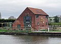 Former Canal Warehouse, Hickling.jpg 1,024 × 731; 173 KB
-
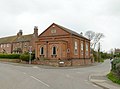 Former Wesleyan Methodist Chapel - geograph.org.uk - 4420463.jpg 1,280 × 945; 211 KB
-
 Gate and field - geograph.org.uk - 2820085.jpg 640 × 520; 107 KB
-
 Glebe farm buildings - geograph.org.uk - 2227680.jpg 1,280 × 854; 232 KB
-
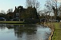
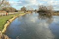 Grantham Canal at Hickling - geograph.org.uk - 2227723.jpg 1,280 × 854; 259 KB
-
 Grantham Canal at Hickling - geograph.org.uk - 2227756.jpg 1,280 × 854; 371 KB
-
 Grantham Canal at Hickling - geograph.org.uk - 2227761.jpg 1,280 × 854; 325 KB
-
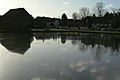
 Grantham Canal basin in Hickling - geograph.org.uk - 5610444.jpg 800 × 569; 138 KB
-
 Grantham Canal near Hickling - geograph.org.uk - 2227766.jpg 1,280 × 838; 291 KB
-
 Grantham Canal near Hickling - geograph.org.uk - 2697627.jpg 1,280 × 959; 502 KB
-
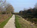
 Grantham Canal towpath at Hickling - geograph.org.uk - 5610415.jpg 800 × 596; 199 KB
-
 Grantham Canal towpath near Hickling - geograph.org.uk - 5610411.jpg 800 × 559; 131 KB
-
 Grazing off Melton Road - geograph.org.uk - 4040306.jpg 640 × 509; 79 KB
-
 Green Lane - geograph.org.uk - 2820098.jpg 640 × 469; 89 KB
-
 Green Lane - geograph.org.uk - 4040312.jpg 640 × 480; 81 KB
-
 Green Lane goes into the Vale of Belvoir - geograph.org.uk - 2820086.jpg 640 × 466; 121 KB
-
 Green Lane passes Sycamore Lodge - geograph.org.uk - 2820087.jpg 640 × 468; 112 KB
-
 Green Lane towards A606 - geograph.org.uk - 2820089.jpg 640 × 447; 92 KB
-
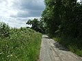
 Green Lane towards Hickling - geograph.org.uk - 2820090.jpg 640 × 461; 97 KB
-
 Green Lane towards Hickling - geograph.org.uk - 6380458.jpg 640 × 476; 79 KB
-

-

-
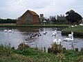
 Hickling Basin - geograph.org.uk - 2227721.jpg 1,280 × 854; 266 KB
-
 Hickling Basin - geograph.org.uk - 2227733.jpg 1,280 × 854; 153 KB
-
 Hickling Basin - geograph.org.uk - 3549613.jpg 640 × 427; 81 KB
-
 Hickling Basin - geograph.org.uk - 3550749.jpg 640 × 427; 122 KB
-
 Hickling Basin - geograph.org.uk - 3550755.jpg 640 × 427; 89 KB
-
 Hickling Bridge - geograph.org.uk - 2227753.jpg 1,280 × 854; 318 KB
-
 Hickling Cemetery - geograph.org.uk - 944545.jpg 640 × 539; 81 KB
-
 Hickling Cemetery - geograph.org.uk - 944561.jpg 640 × 517; 132 KB
-
-
-

-
 Hickling Churchyard - Belvoir Angel headstone - geograph.org.uk - 4417413.jpg 1,280 × 960; 416 KB
-
 Hickling Churchyard - Belvoir Angel headstone - geograph.org.uk - 4417418.jpg 1,280 × 960; 442 KB
-
 Hickling Churchyard - Belvoir Angel headstone - geograph.org.uk - 4417426.jpg 1,280 × 960; 435 KB
-
 Hickling Churchyard - Belvoir Angel headstone - geograph.org.uk - 4417430.jpg 1,280 × 960; 509 KB
-
 Hickling Churchyard - Belvoir Angel headstone - geograph.org.uk - 4417443.jpg 1,280 × 960; 414 KB
-
 Hickling Churchyard - Belvoir Angel headstone - geograph.org.uk - 4417450.jpg 1,280 × 960; 362 KB
-
 Hickling Churchyard - Belvoir Angel headstone - geograph.org.uk - 4417451.jpg 1,280 × 960; 488 KB
-
 Hickling Churchyard - Belvoir Angel headstone - geograph.org.uk - 4417455.jpg 1,280 × 960; 458 KB
-
 Hickling Churchyard - Belvoir Angel headstone - geograph.org.uk - 4417473.jpg 1,280 × 960; 459 KB
-
 Hickling Churchyard - Belvoir Angel headstone - geograph.org.uk - 4417477.jpg 1,280 × 960; 499 KB
-
 Hickling Churchyard - Belvoir Angel headstone - geograph.org.uk - 4417483.jpg 1,280 × 960; 468 KB
-
 Hickling Churchyard - Belvoir Angel headstone - geograph.org.uk - 4417485.jpg 1,280 × 960; 450 KB
-
 Hickling Churchyard - Belvoir Angel headstone - geograph.org.uk - 4417514.jpg 1,280 × 960; 422 KB
-
 Hickling Churchyard - Belvoir Angel headstone - geograph.org.uk - 4417519.jpg 1,280 × 960; 523 KB
-
 Hickling Churchyard - Belvoir Angel headstone - geograph.org.uk - 4417521.jpg 1,280 × 960; 491 KB
-
 Hickling Churchyard - Belvoir Angel headstone - geograph.org.uk - 4417522.jpg 1,280 × 960; 414 KB
-
 Hickling Churchyard - Belvoir Angel headstone - geograph.org.uk - 4418985.jpg 1,280 × 960; 415 KB
-
 Hickling Churchyard - Belvoir Angel headstone - geograph.org.uk - 4418987.jpg 1,280 × 985; 340 KB
-
 Hickling Churchyard - Belvoir Angel headstone - geograph.org.uk - 4418990.jpg 1,280 × 960; 445 KB
-
 Hickling Churchyard - Belvoir Angel headstone - geograph.org.uk - 4418993.jpg 1,280 × 960; 497 KB
-
 Hickling Churchyard - Belvoir Angel headstone - geograph.org.uk - 4418994.jpg 1,280 × 960; 486 KB
-
 Hickling Churchyard - Belvoir Angel headstone - geograph.org.uk - 4418996.jpg 960 × 1,280; 486 KB
-
 Hickling Churchyard - Belvoir Angel headstone - geograph.org.uk - 4418997.jpg 1,280 × 960; 314 KB
-
 Hickling Churchyard - Belvoir Angel headstone - geograph.org.uk - 4419000.jpg 1,280 × 960; 524 KB
-
 Hickling Churchyard - Belvoir Angel headstone - geograph.org.uk - 4419002.jpg 1,280 × 960; 405 KB
-
 Hickling Churchyard - Belvoir Angel headstone - geograph.org.uk - 4419003.jpg 1,280 × 960; 449 KB
-
 Hickling Churchyard - Belvoir Angel headstone - geograph.org.uk - 4419013.jpg 1,280 × 960; 371 KB
-
 Hickling Churchyard - Belvoir Angel headstone - geograph.org.uk - 4419019.jpg 1,280 × 960; 376 KB
-
 Hickling Churchyard - Belvoir Angel headstone - geograph.org.uk - 4419021.jpg 1,280 × 960; 484 KB
-
 Hickling Churchyard - Belvoir Angel headstones - geograph.org.uk - 4417446.jpg 1,280 × 960; 394 KB
-
 Hickling Churchyard - Belvoir Angel headstones - geograph.org.uk - 4417469.jpg 1,280 × 960; 420 KB
-
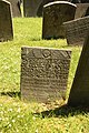
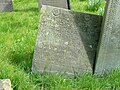
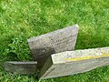
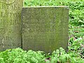
 Hickling Churchyard - C17 headstone - geograph.org.uk - 4417438.jpg 1,280 × 960; 496 KB
-
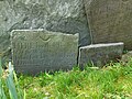
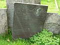
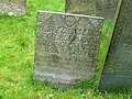
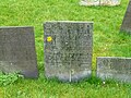
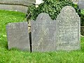
 Hickling Churchyard - C18 slate headstone - geograph.org.uk - 4417422.jpg 1,280 × 960; 518 KB
-
 Hickling Churchyard - C18 slate headstone - geograph.org.uk - 4417424.jpg 1,280 × 960; 558 KB
-
 Hickling Churchyard - C18 slate headstone - geograph.org.uk - 4417467.jpg 1,280 × 960; 437 KB
-
 Hickling Churchyard - C18 slate headstone - geograph.org.uk - 4417497.jpg 1,280 × 960; 419 KB
-
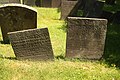
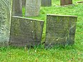
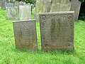
 Hickling Churchyard - C18 slate headstones - geograph.org.uk - 4417462.jpg 1,280 × 960; 429 KB
-
 Hickling Churchyard - C18 slate headstones - geograph.org.uk - 4417518.jpg 1,280 × 960; 452 KB
-
 Hickling Churchyard - C18 slate headstones - geograph.org.uk - 4418982.jpg 1,280 × 960; 458 KB
-
 Hickling Churchyard - C18 slate headstones - geograph.org.uk - 4418984.jpg 1,280 × 960; 499 KB
-
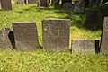
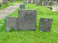
 Hickling Churchyard - group of headstones - geograph.org.uk - 4417440.jpg 1,280 × 960; 475 KB
-
 Hickling Churchyard - group of headstones - geograph.org.uk - 4417492.jpg 1,280 × 960; 418 KB
-
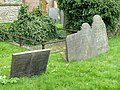
 Hickling Churchyard - slate headstones - geograph.org.uk - 4417433.jpg 1,280 × 960; 544 KB
-
 Hickling Former Methodist Chapel.jpg 3,591 × 2,425; 3.62 MB
-
 Hickling Lane at Castle View - geograph.org.uk - 944448.jpg 640 × 356; 51 KB
-
 Hickling Lane descends Muxlow Hill - geograph.org.uk - 908331.jpg 640 × 466; 80 KB
-
 Hickling Lane north of Upper Broughton - geograph.org.uk - 908332.jpg 640 × 480; 113 KB
-
 Hickling Lane north of Upper Broughton - geograph.org.uk - 908336.jpg 640 × 575; 126 KB
-
-
 Hickling Main Street at The Wharf - geograph.org.uk - 2227707.jpg 1,280 × 854; 287 KB
-
 Hickling Notts Village Sign.jpg 2,144 × 3,184; 2.76 MB
-
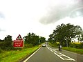
 Hickling Pastures sign - geograph.org.uk - 6380562.jpg 640 × 634; 134 KB
-
 Hickling Standard - geograph.org.uk - 2820100.jpg 640 × 429; 65 KB
-
 Hickling Standard - geograph.org.uk - 4420446.jpg 1,280 × 960; 195 KB
-
 Hickling Village - geograph.org.uk - 2227702.jpg 1,280 × 854; 291 KB


_postbox,_ref_LE14_65_-_geograph.org.uk_-_4420420.jpg)


