Category:High Ham
Jump to navigation
Jump to search
English: High Ham is a village and civil parish in Somerset, England. Within the parish of High Ham are the villages or High and Low Ham and the hamlets of Bowdens, Henley, Paradise and Picts Hill.
village in Somerset, England, UK  | |||||
| Upload media | |||||
| Instance of | |||||
|---|---|---|---|---|---|
| Location | South Somerset, Somerset, South West England, England | ||||
 | |||||
Subcategories
This category has the following 4 subcategories, out of 4 total.
Media in category "High Ham"
The following 200 files are in this category, out of 286 total.
(previous page) (next page)-
 2011 , Wheatfield south of Doulting, recently harvested - geograph.org.uk - 2548866.jpg 4,045 × 1,928; 3.41 MB
-
 Access to Turn Hill - geograph.org.uk - 5127963.jpg 1,024 × 822; 351 KB
-
 Agricultural Buildings Standhill Rd - geograph.org.uk - 5282860.jpg 640 × 428; 57 KB
-
 Approaching Cradle Bridge - geograph.org.uk - 5128136.jpg 1,024 × 821; 239 KB
-
 Approaching Henley - geograph.org.uk - 5244437.jpg 1,024 × 768; 189 KB
-
 Approaching St Andrew's Church, High Ham - geograph.org.uk - 4798234.jpg 2,048 × 1,536; 805 KB
-
 Army machine at The Church in the Field - geograph.org.uk - 4702633.jpg 3,456 × 2,304; 1.76 MB
-
 Baled hay, King's Sedge Moor - geograph.org.uk - 4072739.jpg 1,024 × 768; 156 KB
-
 Beer Drove - geograph.org.uk - 4439992.jpg 800 × 449; 124 KB
-
 Beer Drove - geograph.org.uk - 4440005.jpg 800 × 533; 173 KB
-
 Beer Drove - geograph.org.uk - 5128104.jpg 1,024 × 823; 185 KB
-
 Beer Drove - geograph.org.uk - 5128129.jpg 1,024 × 837; 354 KB
-
 Beer Drove - geograph.org.uk - 6151495.jpg 3,813 × 2,410; 2.17 MB
-
 Beer Drove - geograph.org.uk - 6347703.jpg 4,288 × 2,848; 2.56 MB
-
 Beer Drove - geograph.org.uk - 6347731.jpg 2,581 × 3,591; 1.93 MB
-
 Beer Drove - geograph.org.uk - 6347938.jpg 4,288 × 2,848; 2.74 MB
-
 Beer Drove at Fyddlers End - geograph.org.uk - 4072668.jpg 1,024 × 768; 175 KB
-
 Beer Drove, King's Sedge Moor - geograph.org.uk - 4072727.jpg 1,024 × 768; 259 KB
-
 Beer Road on Turn Hill - geograph.org.uk - 6296318.jpg 4,288 × 2,848; 2.15 MB
-
 Beer Road on Turn Hill - geograph.org.uk - 6296326.jpg 2,815 × 3,872; 1.89 MB
-
 Beer Wood - geograph.org.uk - 6296343.jpg 4,288 × 2,848; 2.04 MB
-
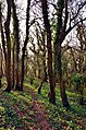 Beer Wood, Turn Hill, Somerset - geograph.org.uk - 2864811.jpg 596 × 900; 348 KB
-
-
 Blackhole Outlet - geograph.org.uk - 5297838.jpg 1,024 × 789; 259 KB
-
 Boundary wall, High Ham (geograph 6124979).jpg 4,288 × 2,848; 2.09 MB
-
 Bridge across River Cary - geograph.org.uk - 6349633.jpg 4,288 × 2,848; 1.07 MB
-
 Bridge over Suttonmoor Rhyne - geograph.org.uk - 6368671.jpg 4,288 × 2,848; 2.13 MB
-
 Broadacre Drove - geograph.org.uk - 6349819.jpg 4,288 × 2,848; 2.52 MB
-
 Broadacre Drove - geograph.org.uk - 6349843.jpg 2,848 × 4,288; 2.54 MB
-
 Broadacre Drove - geograph.org.uk - 6349902.jpg 4,288 × 2,848; 2.48 MB
-
 Broadacre Drove - geograph.org.uk - 6349915.jpg 2,848 × 4,288; 2.3 MB
-
 Bungalow on Standhill Road - geograph.org.uk - 5127957.jpg 1,024 × 796; 242 KB
-
 Cattle and wall on Hext Hill - geograph.org.uk - 4702630.jpg 3,456 × 2,304; 1.22 MB
-
 Cattle on Hext Hill - geograph.org.uk - 4704144.jpg 3,456 × 2,304; 1.34 MB
-
 Cemetery at High Ham - geograph.org.uk - 5282867.jpg 640 × 428; 93 KB
-
 Chapel House, Henley - geograph.org.uk - 6368502.jpg 4,288 × 2,848; 1.08 MB
-
 Charity Farm, at the foot of Turn Hill - geograph.org.uk - 4072692.jpg 932 × 699; 151 KB
-
 Church at Low Ham below Hext Hill - geograph.org.uk - 4702620.jpg 3,008 × 1,980; 1.06 MB
-
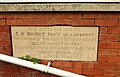 Commemorative stone, Henley - geograph.org.uk - 6368453.jpg 3,796 × 2,423; 1.19 MB
-
 Communications in Henley - geograph.org.uk - 6368506.jpg 4,288 × 2,848; 2.17 MB
-
 Congregational Chapel, Low Ham - geograph.org.uk - 5463991.jpg 640 × 427; 54 KB
-
 Cooke's Lane - geograph.org.uk - 6368484.jpg 4,243 × 2,350; 1.61 MB
-
 Corner of field by Nythe Lane - geograph.org.uk - 6348246.jpg 4,288 × 2,848; 2.29 MB
-
 Cottages at the centre of High Ham - geograph.org.uk - 5244558.jpg 1,024 × 689; 207 KB
-

-
 Cyclists stop for a chat on Nythe Road - geograph.org.uk - 5128126.jpg 1,024 × 864; 225 KB
-
 Del Boys Goodies - geograph.org.uk - 1724228.jpg 640 × 480; 265 KB
-

-
 Drove Junction near Henley - geograph.org.uk - 6349818.jpg 4,288 × 2,848; 2.23 MB
-
 Drove over Sedgemoor - geograph.org.uk - 3160121.jpg 4,592 × 3,056; 3.46 MB
-
 Dunch Hill Cottage - geograph.org.uk - 5127899.jpg 1,024 × 768; 168 KB
-
 Edge of Sedgemoor - geograph.org.uk - 4439996.jpg 800 × 533; 201 KB
-
 Edge of the levels - geograph.org.uk - 6347720.jpg 4,288 × 2,848; 2.02 MB
-
 Eighteen Feet Rhyne - geograph.org.uk - 5375945.jpg 1,024 × 768; 166 KB
-
 Entrance to Langport Range on Mildmay's Road - geograph.org.uk - 5127918.jpg 1,024 × 841; 272 KB
-
 Entrance to Turn Hill - geograph.org.uk - 5282782.jpg 640 × 428; 80 KB
-
 Entrance, Langport Range and Dry Training Area - geograph.org.uk - 5127868.jpg 1,024 × 768; 225 KB
-
 Farmland inside Langport Range - geograph.org.uk - 5127886.jpg 1,024 × 720; 195 KB
-
 Farmland near Henley - geograph.org.uk - 6368445.jpg 4,053 × 2,361; 1.12 MB
-
 Farmland, Henley - geograph.org.uk - 6348289.jpg 4,288 × 2,848; 1.78 MB
-
 Farmyard at Wishel - geograph.org.uk - 5244429.jpg 1,024 × 781; 172 KB
-
 Field at Furpits Lane - geograph.org.uk - 5284387.jpg 640 × 428; 78 KB
-
 Field gate, King's Sedge Moor - geograph.org.uk - 4072730.jpg 1,024 × 768; 180 KB
-
 Field near Rushley - geograph.org.uk - 6296611.jpg 4,288 × 2,848; 2.67 MB
-
 Field near Rushley - geograph.org.uk - 6296619.jpg 4,288 × 2,848; 1.81 MB
-
 Field on Turn Hill - geograph.org.uk - 6296426.jpg 4,288 × 2,848; 1.69 MB
-
 Field Road, High Ham - geograph.org.uk - 6296675.jpg 4,260 × 2,298; 1.83 MB
-
 Field, Hurst Farm - geograph.org.uk - 6368479.jpg 4,277 × 2,042; 1.05 MB
-
 Fields near Henley - geograph.org.uk - 6349841.jpg 3,653 × 2,226; 1.15 MB
-
 Fields on Sedge Moor - geograph.org.uk - 231096.jpg 640 × 480; 97 KB
-
 Former shop on Pict's Hill - geograph.org.uk - 5127775.jpg 1,024 × 808; 175 KB
-
 Furlongs Lane - geograph.org.uk - 5244359.jpg 1,024 × 768; 255 KB
-
 Gate by Nythe Road - geograph.org.uk - 6368606.jpg 4,288 × 2,848; 1.28 MB
-
 Gate into a field at Nythe Bridge - geograph.org.uk - 4622052.jpg 640 × 480; 224 KB
-
 Gometz-la-Ville le 1er mai 2012 - 11.jpg 5,184 × 3,456; 10.54 MB
-
 Goodings End - geograph.org.uk - 5244519.jpg 1,024 × 812; 190 KB
-
 Grass field near Henley - geograph.org.uk - 6368461.jpg 4,288 × 2,848; 1.65 MB
-
 Grass field, Henley ^1 - geograph.org.uk - 6348326.jpg 4,288 × 2,848; 1.72 MB
-
 Grass field, Henley ^2 - geograph.org.uk - 6348865.jpg 3,518 × 2,420; 1.13 MB
-
 Grass field, Henley ^3 - geograph.org.uk - 6348869.jpg 4,288 × 2,848; 1.74 MB
-
 Grass triangle, Henley - geograph.org.uk - 6368499.jpg 4,027 × 2,233; 1.1 MB
-
 Grazing sheep near Cradle Bridge - geograph.org.uk - 5297868.jpg 1,024 × 817; 230 KB
-
 Hay bales on Sedgemoor - geograph.org.uk - 3160110.jpg 4,529 × 2,993; 6.24 MB
-
 Hedge along the Eastfield Nature reserve - geograph.org.uk - 3452514.jpg 1,600 × 1,067; 686 KB
-
 Hedge, Ham Down - geograph.org.uk - 4856627.jpg 640 × 426; 49 KB
-
 Hedgecoes, Pict's Hill - geograph.org.uk - 5284404.jpg 640 × 479; 78 KB
-
 Henley Bridge and Sluice - geograph.org.uk - 5244480.jpg 1,024 × 768; 337 KB
-
 Henley Corner Drove - geograph.org.uk - 5238749.jpg 640 × 428; 79 KB
-
 Henley Corner Farm - geograph.org.uk - 5244474.jpg 1,024 × 833; 176 KB
-
 Henley Road - geograph.org.uk - 6348306.jpg 4,285 × 2,306; 1.32 MB
-
 Hext Hill - geograph.org.uk - 5284265.jpg 640 × 480; 70 KB
-
 High Ham - geograph.org.uk - 2864821.jpg 900 × 596; 267 KB
-
 High Ham - geograph.org.uk - 2864822.jpg 900 × 596; 246 KB
-
 High Ham Rhyne - geograph.org.uk - 4072674.jpg 1,024 × 768; 215 KB
-
 High Ham Rhyne - geograph.org.uk - 4439994.jpg 800 × 533; 179 KB
-
 High Ham Rhyne - geograph.org.uk - 6347698.jpg 2,789 × 3,540; 1.31 MB
-
 High Ham village - geograph.org.uk - 1716780.jpg 640 × 480; 112 KB
-
 High Ham village - geograph.org.uk - 1716783.jpg 640 × 480; 100 KB
-
 High Ham, Paradise Mill - geograph.org.uk - 3048031.jpg 640 × 427; 262 KB
-
 High Ham, St. Andrew's Church - geograph.org.uk - 6273907.jpg 6,602 × 4,400; 7.23 MB
-

-
 High Ham, St. Andrew's Church, c15th roof (detail) - geograph.org.uk - 6273946.jpg 6,785 × 4,523; 7.43 MB
-
 High Ham, St. Andrew's Church, c15th roof (detail) - geograph.org.uk - 6273967.jpg 6,665 × 4,442; 7.71 MB
-
 High Ham, St. Andrew's Church, c15th roof - geograph.org.uk - 6273940.jpg 7,372 × 4,915; 6.85 MB
-
 High Ham, St. Andrew's Church, c15th roof - geograph.org.uk - 6273943.jpg 6,957 × 4,638; 7.46 MB
-
 High Ham, St. Andrew's Church, Door to the rood stair - geograph.org.uk - 6273918.jpg 4,667 × 7,002; 6.21 MB
-

-
 High Ham, St. Andrew's Church, Frances Walton ledger slab - geograph.org.uk - 6273928.jpg 6,680 × 4,453; 7.08 MB
-
 High Ham, St. Andrew's Church, Nave arches - geograph.org.uk - 6273951.jpg 6,615 × 4,411; 4.96 MB
-
 High Ham, St. Andrew's Church, Poppy head - geograph.org.uk - 6273939.jpg 7,501 × 5,000; 6.24 MB
-

-

-

-

-
 High Ham, St. Andrew's Church, Roof corbel - geograph.org.uk - 6273962.jpg 5,881 × 3,921; 5.05 MB
-

-

-
 High Ham, St. Andrew's Church, The altar - geograph.org.uk - 6273932.jpg 6,122 × 4,082; 5.07 MB
-
 High Ham, St. Andrew's Church, The font (detail) - geograph.org.uk - 6273938.jpg 6,566 × 4,377; 7.35 MB
-
 High Ham, St. Andrew's Church, The font - geograph.org.uk - 6273937.jpg 6,117 × 4,078; 4.61 MB
-
 High Ham, St. Andrew's Church, The Mead memorial plaque - geograph.org.uk - 6273952.jpg 4,368 × 6,552; 4.96 MB
-
 High Ham, St. Andrew's Church, The nave - geograph.org.uk - 6273910.jpg 7,398 × 4,931; 6.79 MB
-

-

-
 High walls on Hext Hill - geograph.org.uk - 4702625.jpg 3,456 × 2,304; 1.79 MB
-
 Higher Wishel - geograph.org.uk - 5244379.jpg 1,024 × 841; 210 KB
-
 Hillview Barn - geograph.org.uk - 5127970.jpg 1,024 × 771; 129 KB
-
 House at Bere Farm - geograph.org.uk - 5128014.jpg 1,024 × 821; 216 KB
-
 House at Henley Corner - geograph.org.uk - 5244452.jpg 1,024 × 833; 217 KB
-
 House at Lower Stout - geograph.org.uk - 5244368.jpg 1,024 × 804; 175 KB
-
 House in High Ham - geograph.org.uk - 5244598.jpg 1,024 × 858; 246 KB
-
 House on Windmill Road - geograph.org.uk - 5127910.jpg 1,024 × 735; 224 KB
-
 Houses at Pict's Hill - geograph.org.uk - 5284398.jpg 640 × 428; 60 KB
-
 Houses in Henley - geograph.org.uk - 6348277.jpg 3,264 × 1,832; 1,012 KB
-
 Houses on Windmill Road, High Ham - geograph.org.uk - 5127914.jpg 1,024 × 768; 136 KB
-
 Huge trees on Beer Drove - geograph.org.uk - 5128110.jpg 1,024 × 814; 208 KB
-
 Huish Moor - geograph.org.uk - 6368673.jpg 3,264 × 1,832; 792 KB
-
 Huish Moor Rhyne - geograph.org.uk - 6368675.jpg 2,848 × 4,288; 1.45 MB
-

-
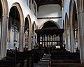 Interior, St Andrew's Church, High Ham - geograph.org.uk - 5244581.jpg 1,024 × 823; 174 KB
-
 Isolated tree on Stout Road - geograph.org.uk - 5244363.jpg 1,024 × 768; 222 KB
-
 Junction near Henley - geograph.org.uk - 6368476.jpg 4,265 × 2,487; 1.3 MB
-
 King's Sedge Moor - geograph.org.uk - 485715.jpg 640 × 480; 122 KB
-
 King's Sedge Moor - geograph.org.uk - 6368608.jpg 4,288 × 2,848; 1.86 MB
-
 King's Sedgemoor Drain - geograph.org.uk - 4440016.jpg 800 × 533; 131 KB
-
 King's Sedgemoor Drain - geograph.org.uk - 5128144.jpg 1,024 × 835; 173 KB
-
 King's Sedgemoor Drain - geograph.org.uk - 5297849.jpg 1,024 × 779; 154 KB
-
 King's Sedgemoor Drain - geograph.org.uk - 5297882.jpg 1,024 × 768; 157 KB
-
 King's Sedgemoor Drain, looking west - geograph.org.uk - 4618685.jpg 4,228 × 1,132; 3.46 MB
-
 Kings Sedgemoor Drain - geograph.org.uk - 5237778.jpg 640 × 428; 93 KB
-
 Kings Sedgemoor Drain - geograph.org.uk - 5237786.jpg 640 × 428; 86 KB
-
 Lane to Chantry Farm - geograph.org.uk - 6347691.jpg 4,284 × 2,323; 1.19 MB
-
 Lane to Low Ham - geograph.org.uk - 3452507.jpg 1,600 × 1,069; 490 KB
-
 Lane to Low Ham - geograph.org.uk - 5127873.jpg 1,024 × 768; 269 KB
-
 Lane to Wishel Farm - geograph.org.uk - 6368495.jpg 4,227 × 2,418; 1.36 MB
-
 Langport Steam Rally, nr Low Ham, Somerset 1990 - geograph.org.uk - 5325174.jpg 2,592 × 1,585; 505 KB
-
 Langport Steam Rally, nr Low Ham, Somerset 1990 - geograph.org.uk - 5325500.jpg 2,541 × 1,602; 651 KB
-
 Langport Steam Rally, nr Low Ham, Somerset 1990 - geograph.org.uk - 5838651.jpg 2,426 × 1,606; 681 KB
-
 Langport Steam Rally, nr Low Ham, Somerset 1990 - geograph.org.uk - 6238659.jpg 2,317 × 1,582; 874 KB
-
 Langport Steam Rally, nr Low Ham, Somerset 1990 - geograph.org.uk - 6238662.jpg 1,024 × 683; 262 KB
-
 Langport Steam Rally, nr Low Ham, Somerset 1991 - geograph.org.uk - 6238656.jpg 2,592 × 1,728; 1.03 MB
-
 Large house in High Ham - geograph.org.uk - 5244551.jpg 1,024 × 768; 322 KB
-
 Levels near Beer - geograph.org.uk - 6347667.jpg 4,288 × 2,848; 1.71 MB
-
 Levels near Henley - geograph.org.uk - 6347940.jpg 4,288 × 2,848; 2.03 MB
-

-
 Lorry blocking the end of Beer Drove - geograph.org.uk - 4089230.jpg 640 × 480; 199 KB
-
 Low Ham Drove - geograph.org.uk - 6349653.jpg 4,288 × 2,848; 1.57 MB
-
 Low Ham Drove - geograph.org.uk - 6349677.jpg 4,288 × 2,848; 1.86 MB
-
 Manor Farm - geograph.org.uk - 5244545.jpg 1,024 × 768; 169 KB
-
 Meadow inside Langport Range - geograph.org.uk - 5127890.jpg 1,024 × 842; 178 KB
-
 Memorial Hall, High Ham - geograph.org.uk - 5244541.jpg 1,024 × 706; 142 KB
-
 Memorial Stone to Bryson Bellot - geograph.org.uk - 5282795.jpg 640 × 428; 117 KB
-
 Mildmay's Road - geograph.org.uk - 5127946.jpg 1,024 × 850; 307 KB
-
 Mildmay's Road - geograph.org.uk - 6296576.jpg 2,528 × 3,598; 2.17 MB
-
 Mildmay's Road - geograph.org.uk - 6296587.jpg 4,219 × 2,535; 2.02 MB
-
 MOD area off Wood Lane - geograph.org.uk - 3641584.jpg 2,592 × 3,888; 4.48 MB
-
 National Trust sheep, Turn Hill - geograph.org.uk - 6296420.jpg 4,288 × 2,848; 2.51 MB
-
 North Hill - geograph.org.uk - 6368457.jpg 3,264 × 1,832; 1.49 MB
-
 North Hill - geograph.org.uk - 6368489.jpg 4,288 × 2,848; 1.4 MB
-
 North Hill Farmhouse - geograph.org.uk - 5244374.jpg 1,024 × 853; 275 KB
-
 Nythe Rhyne - geograph.org.uk - 4440028.jpg 800 × 533; 222 KB
-
 Nythe Road - geograph.org.uk - 4440021.jpg 800 × 533; 121 KB
-
 Nythe Road - geograph.org.uk - 4440125.jpg 800 × 533; 262 KB
-
 Nythe Road - geograph.org.uk - 6368605.jpg 4,288 × 2,848; 1.18 MB
-
 Nythe Road - geograph.org.uk - 6368612.jpg 4,288 × 2,848; 1.98 MB
-
 Nythe Sluice - geograph.org.uk - 5236487.jpg 640 × 428; 90 KB
-
-

-
 Old machinery near Nettlebed Cottage - geograph.org.uk - 3641596.jpg 3,888 × 2,592; 6.49 MB
-
 Old Manor Grounds Low Ham - geograph.org.uk - 5284263.jpg 640 × 428; 62 KB
-
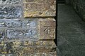
 Ordnance Survey Cut Mark - geograph.org.uk - 4262386.jpg 640 × 480; 125 KB
-
 Othery and North Moor Floods - geograph.org.uk - 3853423.jpg 1,920 × 1,080; 393 KB
-
 Paradise Mill - geograph.org.uk - 5127855.jpg 1,024 × 768; 211 KB
-
 Part of the south side of St Andrew's Church, High Ham - geograph.org.uk - 4798227.jpg 2,048 × 1,536; 845 KB
-
 Pasture with Pitney in the distance - geograph.org.uk - 3452500.jpg 1,600 × 1,066; 474 KB
-
 Peaky Corner Drove - geograph.org.uk - 6368616.jpg 4,288 × 2,848; 2.38 MB
-
 Pitney Steart Bridge - geograph.org.uk - 5357326.jpg 1,024 × 768; 272 KB
-
 Ploughed field near Henley - geograph.org.uk - 6348080.jpg 4,288 × 2,848; 1.76 MB
-
 Poplar Farmyard - geograph.org.uk - 5244445.jpg 1,024 × 734; 162 KB
-
 Postbox, Henley - geograph.org.uk - 6368507.jpg 2,755 × 3,757; 831 KB


.jpg)


_-_geograph.org.uk_-_6273946.jpg)
_-_geograph.org.uk_-_6273967.jpg)


_1_-_geograph.org.uk_-_6273931.jpg)
_2_-_geograph.org.uk_-_6273947.jpg)
_3_-_geograph.org.uk_-_6273956.jpg)
_4_-_geograph.org.uk_-_6273959.jpg)


_-_geograph.org.uk_-_6273938.jpg)


_-_geograph.org.uk_-_6273964.jpg)


