Category:High Roding
Vai alla navigazione
Vai alla ricerca
High Roding is a village and civil parish in the Uttlesford district of Essex, England. The parish contains dispersed farms, woods and buildings. The village is one of eight villages in The Rodings, an area through which flows the River Roding.

village and civil parish in Essex, England, UK | |||||
| Carica un file multimediale | |||||
| Istanza di | |||||
|---|---|---|---|---|---|
| Parte di | |||||
| Luogo | Uttlesford, Essex, Est dell'Inghilterra, Inghilterra | ||||
| Popolazione |
| ||||
 | |||||
Sottocategorie
Questa categoria contiene le 5 sottocategorie indicate di seguito, su un totale di 5.
- All Saints' Church, High Roding (20 F)
B
- Black Lion, High Roding (10 F)
C
O
- Old Lamb, High Roding (1 F)
File nella categoria "High Roding"
Questa categoria contiene 37 file, indicati di seguito, su un totale di 37.
-
 'Leaves from a Hunting Diary in Essex' p.227 - High Roding.jpg 485 × 345; 199 KB
-
 High Roding, Essex, Ordnance Survey map 1805.jpg 582 × 394; 276 KB
-
 A straw stack - geograph.org.uk - 2592171.jpg 640 × 480; 106 KB
-
 A thatched and tile-roofed cottage at High Roding, Essex, England 01.jpg 5 472 × 3 648; 6,79 MB
-
 A thatched and tile-roofed cottage at High Roding, Essex, England 02.jpg 5 472 × 3 648; 7 MB
-
 All Saints, High Roding - geograph.org.uk - 5059352.jpg 1 000 × 650; 418 KB
-
 All Saints, High Roding - geograph.org.uk - 5059356.jpg 1 000 × 677; 360 KB
-
 All Saints, High Roding - geograph.org.uk - 5059359.jpg 1 000 × 560; 244 KB
-
 B184 from south entering High Roding, Essex, England.jpg 3 993 × 2 535; 6,21 MB
-
 Badgers from the air - geograph.org.uk - 5682682.jpg 640 × 480; 125 KB
-
 Barns at Attridge's Farm - geograph.org.uk - 2591865.jpg 640 × 480; 88 KB
-
 Bridleway by Poplars Shaw - geograph.org.uk - 3534750.jpg 640 × 480; 156 KB
-
 Bridleway to Roffey - geograph.org.uk - 5189180.jpg 640 × 428; 211 KB
-
 Buildings on Rands Road, High Roding - geograph.org.uk - 2592551.jpg 640 × 480; 103 KB
-
 Dunmow Road, High Roding - geograph.org.uk - 5607665.jpg 2 048 × 1 536; 1,51 MB
-
 Fields by Dunmow Road, High Roding - geograph.org.uk - 5607281.jpg 1 990 × 1 454; 737 KB
-
 Footpath Near Bury Spring - geograph.org.uk - 515601.jpg 640 × 426; 159 KB
-
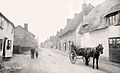 High Roding 1908.jpg 1 772 × 1 079; 923 KB
-
 High Roding from the air - geograph.org.uk - 2412122.jpg 480 × 640; 150 KB
-
 Houses on Dunmow Road, High Roding - geograph.org.uk - 5607668.jpg 1 804 × 1 300; 565 KB
-
 Houses on Dunmow Road, High Roding - geograph.org.uk - 5607671.jpg 2 048 × 1 536; 1,49 MB
-
 Lane from High Roding to Barnston - geograph.org.uk - 5189173.jpg 640 × 428; 235 KB
-
 Lucerne - geograph.org.uk - 3537226.jpg 480 × 640; 115 KB
-
 Pargeted house, High Roding - geograph.org.uk - 2592563.jpg 640 × 428; 75 KB
-
 Poplars and Poplars - geograph.org.uk - 3534726.jpg 640 × 480; 130 KB
-
 Rands Road - geograph.org.uk - 5189130.jpg 640 × 428; 203 KB
-
 Rands Road, High Roding - geograph.org.uk - 5604509.jpg 2 002 × 1 474; 820 KB
-
 Reservoir, High Roding - geograph.org.uk - 2591939.jpg 640 × 480; 92 KB
-
 River Roding at Broad Bridge - geograph.org.uk - 3534684.jpg 640 × 480; 160 KB
-
 Road junction by Garnetts Wood - geograph.org.uk - 3993058.jpg 1 600 × 1 064; 344 KB
-
 Road junction in High Roding - geograph.org.uk - 5607656.jpg 2 048 × 1 536; 993 KB
-

-

-
 The B184 through High Roding, Essex - geograph.org.uk - 1371517.jpg 640 × 480; 82 KB
-
 Village sign, High Roding - geograph.org.uk - 4695605.jpg 4 320 × 3 240; 3,98 MB
-
 Ware Farm, High Roding - geograph.org.uk - 2591903.jpg 640 × 480; 96 KB
-


