Category:Highway 8 (Taiwan)
Jump to navigation
Jump to search
road in Taiwan    | |||||
| Upload media | |||||
| Instance of | |||||
|---|---|---|---|---|---|
| Location | |||||
| Transport network | |||||
| Maintained by | |||||
| Has part(s) |
| ||||
| Length |
| ||||
| |||||
English: Provincial Highway 8 (Taiwan) is also known for the main route of Central Cross-Island Highway.
日本語: 台8省道の意味では中橫公路の主線。
中文(臺灣):臺8省道就是指中橫公路的主線。
中文(中国大陆):台8省道就是指中橫公路的主线。
Subcategories
This category has the following 5 subcategories, out of 5 total.
B
- Bilu Tunnel (2 F)
T
- Tianleng Tunnel (8 F)
Media in category "Highway 8 (Taiwan)"
The following 97 files are in this category, out of 97 total.
-
 20110404台8線、台7甲線交會處景觀.JPG 4,320 × 3,240; 2.74 MB
-
 20110404梨山一景.JPG 4,320 × 3,240; 2.19 MB
-
 20110405中橫臨37便道德基端.JPG 4,320 × 3,240; 3.4 MB
-
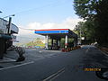 20110405梨山加油站.JPG 4,320 × 3,240; 2.52 MB
-
 20130815梨山街景.JPG 4,000 × 3,000; 2.82 MB
-
 2017-08-05 Central Cross-Island Highway, Taroko National Park.jpg 6,000 × 3,376; 9.13 MB
-
 2017-10-21 Highway 8 in the Taroko Gorge.jpg 3,840 × 2,552; 2.68 MB
-
 2017-10-21 Taroko Gorge 03.jpg 3,840 × 2,552; 3.08 MB
-
 2024年4月4日行政院長陳建仁視察崇德火車站受損情形 3.jpg 1,567 × 1,045; 340 KB
-
 972, Taiwan, 花蓮縣秀林鄉富世村 - panoramio (12).jpg 2,048 × 2,048; 1.27 MB
-
 972, Taiwan, 花蓮縣秀林鄉富世村 - panoramio (13).jpg 2,048 × 2,048; 1.02 MB
-
 972, Taiwan, 花蓮縣秀林鄉富世村 - panoramio (16).jpg 1,536 × 2,048; 930 KB
-
 972, Taiwan, 花蓮縣秀林鄉富世村 - panoramio (18).jpg 1,536 × 2,048; 815 KB
-
 972, Taiwan, 花蓮縣秀林鄉富世村 - panoramio (21).jpg 2,048 × 2,048; 1.04 MB
-
 972, Taiwan, 花蓮縣秀林鄉富世村 - panoramio (5).jpg 1,536 × 2,048; 1.06 MB
-

-
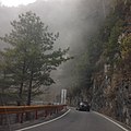
 Along Highway in Hehuanshan (5453407325).jpg 3,008 × 2,000; 2.11 MB
-
 Approach to the Taroko Archway on Highway No.8.jpg 3,460 × 2,287; 4.41 MB
-
 Bike rider taking photo of Dayuling.jpg 4,912 × 2,760; 3.31 MB
-
 Central Cross-Island Highway between Qilai Restaurant and Hehuan Hotel.jpg 1,280 × 960; 1.38 MB
-
 CPCCT Guanyuan Station 20140831.jpg 4,912 × 2,760; 3.36 MB
-
 Cyclist entering Xibao Tunnel.jpg 4,912 × 2,760; 2.85 MB
-
 Dayuling.JPG 1,600 × 1,200; 387 KB
-

-
 Earthslide in Taroko.jpg 900 × 675; 187 KB
-
 East side view from the Lyushui Trail.jpg 3,888 × 2,592; 9.27 MB
-
 End of Taiwan Provincial Highway 8A.jpg 2,592 × 1,936; 1.27 MB
-
 End of Taiwan Provincial Highway No.8 (Opposite Direction).JPG 2,592 × 1,936; 1.79 MB
-
 End of Temporary Path No.37 (Taiwan Provincial Highway No.8).JPG 2,592 × 1,936; 2.76 MB
-
 Fengyuan Bus 6506 about to enter rock shed on Provincial Highway 8.jpg 4,608 × 3,456; 6.9 MB
-
 Fengyuan Bus 6506 stopped at the side of the Provincial Highway 8.jpg 4,608 × 3,456; 8.59 MB
-
 Highway No.8 passing through Taroko.jpg 4,000 × 3,000; 5.25 MB
-
 In the tunnel at Taroko Gorge 01.jpg 1,920 × 1,080; 864 KB
-
 Km 174 on Provincial Highway 8 near Jiuqudong.jpg 2,391 × 3,587; 7.57 MB
-
 Landslides in Taiwan Provincial Highway No.8-1 (Temporary Path No.37).JPG 2,592 × 1,936; 2.12 MB
-

-
 Lishan 梨山 - panoramio (5).jpg 6,000 × 4,000; 7.22 MB
-
 Near Cihmu Bridge at Taroko National Park (5451200346).jpg 2,000 × 3,008; 2.64 MB
-
 Near Cihmu Bridge at Taroko National Park (5451208192).jpg 2,000 × 3,008; 2.79 MB
-
 Pilu Sacred Tree sign at the roadside.jpg 4,912 × 2,760; 2.71 MB
-
 Place name sign of Luoshao on the Central Cross-Island Highway.jpg 4,912 × 2,760; 2.66 MB
-
 Provincial Highway 8 at the junction with Provincial Highway 3.jpg 4,256 × 2,848; 5.56 MB
-
 Pure white marble cliffs of Taroko Gorge.jpg 2,592 × 3,888; 7.2 MB
-
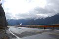
 Rest Stop in Hehuanshan (5456104287).jpg 2,000 × 3,008; 2.54 MB
-
 Small waterfall at the roadside near the 146.6K on Provincial Highway 8.jpg 4,912 × 2,760; 4.01 MB
-
 SV400066.JPG 2,272 × 1,504; 861 KB
-
 Taiwan 2009 HuaLien Taroko Gorge Biking FRD 5416 Pano Extracted.jpg 4,256 × 2,828; 4.24 MB
-
 Taiwan 2009 HuaLien Taroko Gorge Biking PB140018.jpg 3,072 × 2,304; 2.96 MB
-
 Taiwan 2009 HuaLien Taroko Gorge Biking PB160057.jpg 2,304 × 3,072; 2.5 MB
-
 Taiwan 2009 HuaLien Taroko Gorge FRD 5467.jpg 4,256 × 2,828; 3.5 MB
-
 Taiwan 2009 HuaLien Taroko Gorge FRD 5672 Pano Extracted.jpg 4,126 × 2,828; 4.1 MB
-

-
 Taiwan Provincial Highway 8 westbound approaching the 160 kilometer marker.jpg 4,912 × 2,760; 1.97 MB
-
 Taiwan Provincial Highway 8 westbound approaching the Xinbaiyang sign.jpg 4,912 × 2,760; 1.76 MB
-
 Taiwan Route 8 台八線 - panoramio.jpg 2,560 × 1,788; 1.38 MB
-
 Taiwan Taroko-Schlucht 114.jpg 4,564 × 3,410; 5.02 MB
-
 Taiwan Traffic-signs Work-Zone-Signs-01.jpg 3,121 × 4,039; 5.58 MB
-
 Taiwan-central-cross-highway-cloudsea.jpg 500 × 375; 67 KB
-
 Taroko National Park - panoramio (8).jpg 2,736 × 3,648; 3.84 MB
-
 Taroko National Park+HSU、WU-CHIH+005.jpg 6,000 × 4,000; 18.76 MB
-
 Taroko National Park, Hualien County, Taiwan - panoramio (2).jpg 2,048 × 1,360; 883 KB
-
 Taroko National Park, Hualien County, Taiwan - panoramio.jpg 1,360 × 2,048; 1,023 KB
-
 Taroko rockfall barrier and tunnel.jpg 1,536 × 1,024; 256 KB
-
 Taroko-Gorge-Zhuilu-Tunnel-2015-Luka-Peternel.jpg 5,472 × 3,648; 7.83 MB
-
 Taroko070219 08.JPG 653 × 490; 77 KB
-
 Taroko070219 11.JPG 490 × 653; 74 KB
-
 Temporary Path No.37 21K (Taiwan Provincial Highway No.8-1).JPG 2,592 × 1,936; 1.33 MB
-
 The entrance of Guguan.jpg 1,600 × 1,200; 364 KB
-
 The entry control point at Shanguguan.jpg 1,600 × 1,200; 660 KB
-
 Tianleng bus stop sign, as taken on 20 January 2021.jpg 4,000 × 3,000; 2.83 MB
-
 Tianleng bus stop, as taken on 20 January 2021.jpg 4,000 × 3,000; 2.94 MB
-
 Tiansiang approach.jpg 2,848 × 2,136; 1.5 MB
-
 Tunnels on Central Cross-Island Highway in Taiwan.jpg 1,920 × 1,080; 821 KB
-
 TW PHW8 maps.svg 600 × 400; 141 KB
-
 TW PHW8.png 480 × 480; 47 KB
-
 TW PHW8.svg 875 × 875; 14 KB
-
 TW PHW8a.png 480 × 480; 49 KB
-
 TW PHW8a.svg 875 × 875; 15 KB
-
 TW PHW8t maps.svg 550 × 300; 141 KB
-
 TW PHY8 Photo 01.JPG 600 × 402; 209 KB
-
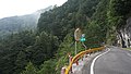
 View From Near Bilyu Sacred Tree in Hehuanshan (5453978532).jpg 2,000 × 3,008; 3.13 MB
-
 View From Sinbaiyang in Hehuanshan (5453289295).jpg 2,000 × 3,008; 2.58 MB
-
 View From Sinbaiyang in Hehuanshan (5453876464).jpg 2,000 × 3,008; 3.01 MB
-
 View From Swallow Grotto in Taroko Gorge (5448586370).jpg 2,000 × 3,008; 2.99 MB
-
 View from the visitor's center at the entrance to Taroko National Park.jpg 3,766 × 2,512; 4.36 MB
-
 View of Taiwan Route No.8 台八線風光 - panoramio.jpg 2,560 × 1,792; 984 KB
-
 West side view from the Lyushui Trail.jpg 3,888 × 2,592; 9.79 MB
-
 Xiulin Township, Hualien County, Taiwan 972 - panoramio (1).jpg 2,048 × 2,048; 1.07 MB
-
 八號省道 Taiwan Highway No. 8 - panoramio.jpg 3,086 × 3,086; 3.42 MB
-
 台8線 位於合歡山隧道西口.jpg 4,032 × 3,024; 4.29 MB
-
 台8線 松泉崗路段.jpg 4,032 × 3,024; 1.46 MB
-
 台8雪景.jpg 4,096 × 3,072; 1.7 MB
-
 大理石.jpg 1,944 × 2,592; 2.95 MB
-
 太魯閣 Taroko - panoramio.jpg 4,260 × 3,080; 5.17 MB
-
 太魯閣1.jpeg 720 × 960; 81 KB
-
 绿水管理站 - Lyushui Service Station - 2012.02 - panoramio.jpg 3,200 × 2,400; 3.21 MB
-
 谷關風景特定區.jpg 1,134 × 960; 1.03 MB


.jpg)
.jpg)
.jpg)
.jpg)
.jpg)
.jpg)

.jpg)


.JPG)
.JPG)


.JPG)
.jpg)
.jpg)
.jpg)


.jpg)


.jpg)

.jpg)


.JPG)


.jpg)
.jpg)
.jpg)
.jpg)


.jpg)


