Category:Historic counties of England
Vai alla navigazione
Vai alla ricerca

Suddivisioni storiche dell'Inghilterra | |||||
| Carica un file multimediale | |||||
| Sottoclasse di | |||||
|---|---|---|---|---|---|
| Luogo |
| ||||
| |||||

Sottocategorie
Questa categoria contiene le 9 sottocategorie indicate di seguito, su un totale di 9.
C
H
M
S
W
Y
File nella categoria "Historic counties of England"
Questa categoria contiene 39 file, indicati di seguito, su un totale di 39.
-
 -ham and -ingham place names.png 1 632 × 2 016; 298 KB
-
 Dorset Map.png 4 967 × 4 967; 4,21 MB
-
 Gloucestershire Map.png 4 967 × 4 967; 4,21 MB
-
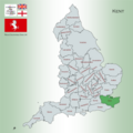
 Hampshire Map.png 4 967 × 4 967; 4,27 MB
-
 Herefordshire Map.png 4 967 × 4 967; 4,27 MB
-
 Hertfordshire Map.png 4 967 × 4 967; 4,29 MB
-
 Huntingdonshire Map.png 4 967 × 4 967; 4,29 MB
-
 Kent Map.png 4 967 × 4 967; 4,26 MB
-
 Lancashire Map.png 4 967 × 4 967; 4,32 MB
-
 Leicestershire County Map.png 4 967 × 4 967; 4,25 MB
-
 Lincolnshire Map.png 4 967 × 4 967; 4,19 MB
-
 Map showing the traditional, geographical counties of England.png 4 967 × 4 967; 4,45 MB
-
 Map showing the traditional, geographical county of Bedfordshire, England.png 4 967 × 4 967; 4,27 MB
-
 Map showing the traditional, geographical county of Berkshire, England.png 4 967 × 4 967; 4,35 MB
-
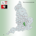 Map showing the traditional, geographical county of Buckinghamshire, England.png 4 967 × 4 967; 4,39 MB
-
 Map showing the traditional, geographical county of Cambridgeshire, England.png 4 967 × 4 967; 4,28 MB
-
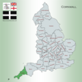 Map showing the traditional, geographical county of Cornwall Kernow, England.png 4 967 × 4 967; 4,19 MB
-
 Map showing the traditional, geographical county of County Durham, England.png 4 967 × 4 967; 4,23 MB
-
 Map showing the traditional, geographical county of Cumberland, England.png 4 967 × 4 967; 4,31 MB
-
 Map showing the traditional, geographical county of Devon, England.png 4 967 × 4 967; 4,2 MB
-
 Map showing the traditional, geographical county of Essex, England.png 4 967 × 4 967; 4,34 MB
-
 Middlesex Map.png 4 967 × 4 967; 4,28 MB
-
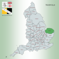 Norfolk Map.png 4 967 × 4 967; 4,22 MB
-
 Northamptonshire Map.png 4 967 × 4 967; 4,23 MB
-
 Northumberland Map.png 4 967 × 4 967; 4,18 MB
-
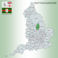 Nottinghamshire Map.png 4 967 × 4 967; 4,22 MB
-
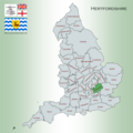
 Oxfordshire Map.png 4 967 × 4 967; 4,34 MB
-
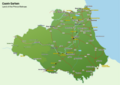 Places of Interest in County Durham.png 4 960 × 3 507; 1,95 MB
-
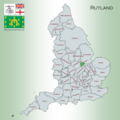 Rutland Map.png 4 967 × 4 967; 4,34 MB
-
 Shropshire Map.png 4 967 × 4 967; 4,38 MB
-
 Somerset Map.png 4 967 × 4 967; 4,37 MB
-
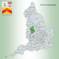 Staffordshire Map.png 4 967 × 4 967; 4,27 MB
-
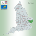 Suffolk Map.png 4 967 × 4 967; 4,31 MB
-
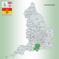
 Surrey Map.png 4 967 × 4 967; 4,21 MB
-
 Sussex Map.png 4 967 × 4 967; 4,3 MB
-
 Warwickshire Map.png 4 967 × 4 967; 4,26 MB
-
 Westmorland Map.png 4 967 × 4 967; 4,52 MB
-
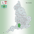 Wiltshire Map.png 4 967 × 4 967; 4,27 MB
-
 Worcestershire Map.png 4 967 × 4 967; 4,25 MB


