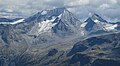
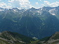
Category:Hochgall
Vai alla navigazione
Vai alla ricerca
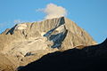
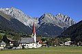
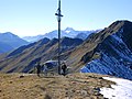
mountain in the Rieserferner Group in South Tyrol  Hochgall a Barmer Spitze od severovýchodu z hory Fenneregg | |||||
| Carica un file multimediale | |||||
| Istanza di | |||||
|---|---|---|---|---|---|
| Luogo | |||||
| Evento significativo |
| ||||
| Catena montuosa | |||||
| Prominenza topografica |
| ||||
| Isolamento topografico |
| ||||
| Altezza sul mare |
| ||||
 | |||||
Pagine nella categoria "Hochgall"
Questa categoria contiene un'unica pagina, indicata di seguito.
File nella categoria "Hochgall"
Questa categoria contiene 54 file, indicati di seguito, su un totale di 54.
-
 Agosto!.jpg 4 821 × 3 238; 1,81 MB
-
 Alplesspitze und Hochgall von der Bonn-Matreier-Hütte a.jpg 3 008 × 2 000; 3,53 MB
-
 Alplesspitze und Keeseck von der Bonn-Matreier-Hütte dahinter Lenkstein.JPG 3 008 × 2 000; 3,47 MB
-
 Barmer Hütte, 2021.jpg 4 032 × 3 024; 3,07 MB
-
 Barmer Spitze und Hochgall vom Fenneregg II.JPG 3 008 × 2 000; 1,32 MB
-
 Barmer Spitze und Hochgall vom Fenneregg IV.JPG 3 008 × 2 000; 1,26 MB
-
 Barmer Spitze und Hochgall vom Fenneregg.jpg 3 008 × 2 000; 1,39 MB
-
 Barmer Spitze und Hochgall von unterhalb der Roßhornscharte.JPG 3 008 × 2 000; 1,59 MB
-
 Barmer Spitze unterhalb der Roßhornscharte II.JPG 3 008 × 2 000; 1,56 MB
-
 Barmer Spitze, Hochgall und Östlicher Rieserferner.JPG 3 008 × 2 000; 1,4 MB
-
 Der Hochgall von Rain aus.jpg 4 174 × 3 163; 2,86 MB
-
 Fenneregg - Grenzstein.jpg 3 008 × 2 000; 2,43 MB
-
 Fenneregg und Lenkstein von der Rotenmannspitze, dahinter der Hochgall.JPG 6 000 × 4 000; 8,66 MB
-
 Furkestraße in Richtung Hochgall und Antholzertal.jpg 3 648 × 2 736; 6,81 MB
-
 Gritzer See.JPG 732 × 1 077; 643 KB
-
 Hochgall - Panorama mit Barmer Spitze vom Fenneregg.JPG 6 945 × 1 831; 6,73 MB
-
 Hochgall - Panorama vom Fenneregg.jpg 5 526 × 1 813; 2,41 MB
-
 Hochgall from Gefrorene Wand Spitze - panoramio.jpg 2 592 × 1 944; 1,47 MB
-
 Hochgall fromW.jpg 800 × 537; 354 KB
-
 Hochgall ohrenspitzen amperspitze.jpg 3 648 × 2 736; 7,88 MB
-
 Hochgall Rieserfernergruppe.jpg 1 024 × 683; 351 KB
-
 Hochgall und wildgall abendsonne im winter.jpg 3 648 × 2 280; 6 MB
-
 Hochgall und Wildgall von Südost 1.JPG 3 264 × 2 448; 3,27 MB
-
 Hochgall und Wildgall von Südost 2.JPG 3 264 × 2 448; 3,41 MB
-
 Hochgall und Wildgall von Südost 3.JPG 3 264 × 2 448; 3,75 MB
-
 Hochgall wildgall.jpg 4 916 × 2 721; 4,15 MB
-
 Hochgall, Seespitze, Pizleshorn, Lasörling.jpg 6 000 × 4 000; 8,94 MB
-
 HochgallFromN.JPG 4 320 × 3 240; 5,39 MB
-
 HochgallNWRidge.jpg 3 240 × 4 320; 2,56 MB
-
 Hörndljoch Hochgall Rieserferner.jpg 3 264 × 2 448; 3,59 MB
-
 I07 807 Antholzer Tal.jpg 4 248 × 2 832; 3,42 MB
-
 I07 808 Antholz Niedertal, St. Walburg.jpg 4 248 × 2 832; 2,85 MB
-
 I07 823 Wildgall, Hochgall.jpg 4 494 × 2 996; 4,03 MB
-
 I07 831 Obersee, Wildgall.jpg 4 328 × 2 885; 3,35 MB
-
 I07 880 Rein, Bachertal.jpg 4 494 × 2 996; 1,56 MB
-
 I07 882 Hochgall.jpg 4 248 × 2 832; 1,52 MB
-
 Knuttental, Valle dei Dossi - panoramio (1).jpg 1 152 × 864; 457 KB
-
 Lenkstein und Winkelspitze von der Rotenmannspitze.JPG 6 000 × 4 000; 9,7 MB
-
 Meyers b17 s0792a.jpg 3 050 × 2 507; 3,38 MB
-
 Panorama auf Hochgall und Fleischbachkess von der Seespitze.jpg 4 783 × 832; 659 KB
-
 Panorama der Rieserfernergruppe vom Rotenmanntörl.jpg 19 470 × 2 707; 47,62 MB
-
 Panorama von der Seespitze.JPG 8 712 × 678; 974 KB
-
 Patschertal 2008 I.JPG 3 008 × 2 000; 1,51 MB
-
 Patschertal 2008 II.JPG 3 008 × 2 000; 1,53 MB
-
 Rein in Taufers 160.jpg 2 112 × 2 816; 1,44 MB
-
 Rein in taufers panorama.jpg 7 646 × 2 584; 9,78 MB
-
 Rein in taufers.jpg 3 743 × 2 321; 4,21 MB
-
 Riva di Tures e Monte Collalto - Hochgall.jpg 3 000 × 1 996; 5,32 MB
-
 Schneebiger noch lage.jpg 4 591 × 2 566; 5,65 MB
-
 Speikboden1.JPG 2 304 × 1 728; 1,79 MB
-
 Staller Sattel - panoramio.jpg 2 048 × 1 536; 910 KB
-
 Staller Sattel Grenzübergang Winter 2018 - 19.jpg 4 320 × 3 240; 6,92 MB
-
 Westliche floitenspitze löffler tribbachsattel schwarzensteinhütte.jpg 5 587 × 2 976; 8,52 MB
-
 Wildgall Hochgall from StallerSattel.jpg 800 × 542; 454 KB


.jpg)


