Category:Hoge der A 37 (Groningen)
Jump to navigation
Jump to search
| Object location | | View all coordinates using: OpenStreetMap |
|---|
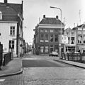
building in Groningen, Netherlands  | |||||
| Upload media | |||||
| Instance of | |||||
|---|---|---|---|---|---|
| Location | Groningen, Netherlands | ||||
| Street address |
| ||||
| Heritage designation |
| ||||
 | |||||
|
This is a category about rijksmonument number 18531
|
| Address |
|
Media in category "Hoge der A 37 (Groningen)"
The following 6 files are in this category, out of 6 total.
-
 20100812 Hoge der A 37 Groningen NL.jpg 2,500 × 2,500; 1.54 MB
-
 Hoek Hoge der A.37 - Groningen - 20094080 - RCE.jpg 813 × 1,200; 246 KB
-
 Overzicht Hoge der A - Visserstraat - Groningen - 20092255 - RCE.jpg 1,196 × 1,200; 303 KB
-
 Overzicht Hoge der A - Visserstraat - Groningen - 20092256 - RCE.jpg 1,200 × 1,200; 351 KB
-
 Vishoek (Graanpakhuis) achtergevel - Groningen - 20094383 - RCE.jpg 1,200 × 951; 247 KB
-
 Voorgevels - Groningen - 20093979 - RCE.jpg 812 × 1,200; 222 KB


_achtergevel_-_Groningen_-_20094383_-_RCE.jpg)
