Category:Hohe Schule Herborn
Jump to navigation
Jump to search
| Object location | | View all coordinates using: OpenStreetMap |
|---|
 | |||||
| Upload media | |||||
| Instance of | |||||
|---|---|---|---|---|---|
| Location | Herborn Academy, Herborn, Lahn-Dill-Kreis, Giessen Government Region, Hesse, Germany | ||||
 | |||||
This is the category of the Hessian Kulturdenkmal (cultural monument) with the ID 133065 (Wikidata)
|
Media in category "Hohe Schule Herborn"
The following 10 files are in this category, out of 10 total.
-
 Herborn - Comenius.jpg 1,000 × 1,000; 270 KB
-
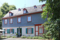
 Herborn - Hohe Schule Schulhofstraße 3-5 (KD.HE 133065 1 07.2015).jpg 2,384 × 3,676; 5.61 MB
-
 Herborn - Hohe Schule Schulhofstraße 3-5 (KD.HE 133065 3 07.2015).jpg 3,982 × 2,655; 9.74 MB
-
 Herborn - Hohe Schule Schulhofstraße 3-5 (KD.HE 133065 7 07.2015).jpg 4,653 × 3,102; 11.71 MB
-
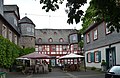
 Herborn - Hohe Schule.jpg 2,000 × 1,500; 574 KB
-
 Herborn, Brunnen im Hof der Hohen Schule Herborn.jpg 4,928 × 3,264; 7.35 MB
-
 Herborn, Hof der Hohen Schule Herborn.jpg 4,884 × 3,180; 7.56 MB
-
 Hohe Schule Herborn (31022380634).jpg 3,768 × 2,466; 4.46 MB
-
 Hohe Schule Herborn.jpg 4,650 × 3,065; 724 KB
-
 Luthmer IV-086-Herborn Hohe Schule.jpg 1,744 × 2,732; 3.39 MB

.jpg)
.jpg)
.jpg)


.jpg)

