Category:Hoher Göll
Vai alla navigazione
Vai alla ricerca
mountain .jpg) | |||||
| Carica un file multimediale | |||||
| Istanza di | |||||
|---|---|---|---|---|---|
| Area protetta | |||||
| Luogo | Baviera, Germania | ||||
| Evento significativo |
| ||||
| Catena montuosa | |||||
| Prominenza topografica |
| ||||
| Isolamento topografico |
| ||||
| Altezza sul mare |
| ||||
 | |||||
Sottocategorie
Questa categoria contiene un'unica sottocategoria, indicata di seguito.
A
- Alpeltalhütte (3 F)
Pagine nella categoria "Hoher Göll"
Questa categoria contiene un'unica pagina, indicata di seguito.
File nella categoria "Hoher Göll"
Questa categoria contiene 76 file, indicati di seguito, su un totale di 76.
-

-
 2020 03 15 Salzburg 780DSC 0235 (50032533821).jpg 1 624 × 1 055; 536 KB
-
 2020 03 15 Salzburg 780DSC 0237 (50032533626).jpg 1 624 × 1 087; 519 KB
-
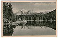 AK - Hintersee - Göllspiegelung - 1912.jpg 859 × 556; 112 KB
-
 Am Mannlgrat MQ.jpg 1 944 × 2 592; 1,1 MB
-
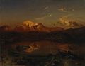
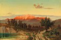 Anton Hlavacek - Sunset over the Hoher Göll.jpg 3 158 × 2 093; 1,06 MB
-
 Berchtesgaden IMG 5337.JPG 3 264 × 2 448; 3,94 MB
-
 Berchtesgaden IMG 5338.jpg 2 448 × 3 264; 3,97 MB
-
 Berchtesgaden IMG 5393.jpg 15 482 × 2 500; 11,65 MB
-
 Berchtesgaden IMG 5395.jpg 8 192 × 2 500; 5,89 MB
-
 Berchtesgaden Sonnenuntergang Hoher Göll.jpg 1 536 × 2 048; 775 KB
-
 Blick auf den Hohen Göll vom Lattengebirge.jpg 4 000 × 2 250; 3,51 MB
-
 Blick vom Hoher Göll in westliche Richtung.jpg 12 986 × 4 902; 21,91 MB
-
 Blick zum Kehlstein.JPG 1 280 × 960; 1 002 KB
-
 Blickvomhirschkaser01.jpg 2 304 × 1 728; 2,45 MB
-
 Carl Bolze Hoher Göll im Alpenglühen c1878.jpg 2 560 × 1 369; 1,04 MB
-
 Carl Goebel Der hohe Göll.jpg 2 065 × 1 360; 386 KB
-
 Carl Triebel Hohe Göll.jpg 4 962 × 3 480; 2,69 MB
-
 Carl-rottmann-der-hohe-goell-bei-alpengluehen.jpg 907 × 724; 68 KB
-
 Cesta na Hoher Göll - panoramio.jpg 4 928 × 3 264; 11,73 MB
-
 Cestou na Hoher Göll - panoramio.jpg 4 928 × 3 264; 12,05 MB
-
 Der Hohe Göll und der Hintersee.jpg 700 × 445; 256 KB
-
 Eduard Schleich d Ä Salzburg.jpg 800 × 568; 57 KB
-
 Eduard Wilhelm Pose - Blick auf den Hohen Göll,1837.jpg 1 700 × 879; 174 KB
-
 Edward Theodore Compton Hoher Göll vom Watzmann-Hocheck 1919.jpg 4 336 × 2 831; 2,29 MB
-
 Fagstein.jpg 3 264 × 2 448; 2,53 MB
-
 Thomas Fearnley - Ramsau (1832).jpg 1 000 × 1 057; 795 KB
-
 Former Villa Bodenschatz - panoramio.jpg 4 608 × 3 456; 6,32 MB
-
 Goell Kellau.JPG 2 560 × 1 920; 1,61 MB
-
 Göll.jpg 1 600 × 1 200; 294 KB
-
 Göllspiegelung.jpg 7 000 × 5 434; 12,3 MB
-
 Hintersee Panorama.JPG 2 048 × 1 536; 808 KB
-
 Hintersee und Hoher Göll.jpg 2 080 × 1 560; 990 KB
-
 Hochstaufen-26-Gipfel im Abendlicht-1987-gje.jpg 2 607 × 1 353; 1,03 MB
-
 Hochtörl am 21. August 2023 (1).jpg 4 000 × 2 250; 2,48 MB
-
 Hohe.JPG 578 × 392; 40 KB
-
 Hoher Goell von Süden.JPG 4 896 × 3 672; 6,66 MB
-
 Hoher Göll - Německo - panoramio.jpg 4 928 × 3 264; 10,62 MB
-
 Hoher Göll 2.jpg 818 × 617; 465 KB
-
 Hoher Göll 8-15-2010.jpg 1 280 × 960; 592 KB
-
 Hoher Göll Berchtesgadener Alpen.jpg 3 456 × 4 987; 9,42 MB
-
 Hoher Göll mit Strahlenbüscheln.JPG 2 592 × 1 944; 2,22 MB
-
 Hoher Göll von der Kneifelspitze.jpg 2 000 × 1 500; 576 KB
-
 Hoher Göll.jpg 3 184 × 2 064; 1,1 MB
-
 Hoher Göll.JPG 1 920 × 2 560; 1,29 MB
-
 HoherGoell.jpg 1 187 × 768; 364 KB
-
 IMG 0762-a DxO.jpg 1 305 × 979; 454 KB
-
 Kalkhochalpen SW161492.jpg 4 608 × 3 072; 1,59 MB
-
 Kalkhochalpen SW161523.jpg 3 072 × 4 608; 1,4 MB
-
 Kalkhochalpen SW161548.jpg 4 608 × 3 072; 1,65 MB
-
 Kalkhochalpen SW161563.jpg 4 608 × 3 072; 1,71 MB
-
 Kehlstein Hoher Göll Hohes Brett 270804.jpg 1 024 × 568; 140 KB
-
 Kehlsteinhaus - panoramio (1).jpg 4 608 × 3 456; 6,23 MB
-
 Kehlsteinrundweg.jpg 4 032 × 3 024; 2,65 MB
-
 Landschaft bei Geretsberg Bezirk Braunau.JPG 3 008 × 2 000; 2,29 MB
-
 Ludwig Correggio Hoher Göll und Hohes Brett von Schönau aus.jpg 3 616 × 2 696; 1,75 MB
-
 Marktplatz Kuchl.jpg 3 024 × 4 032; 4,1 MB
-
 Mayburger Salzachtal gegen Hallein 1854.jpg 800 × 569; 63 KB
-
 Mayburger Salzachtal.jpg 1 000 × 690; 131 KB
-
 Na vrcholu Hoher Göll 2522m.n.m. - Německo - panoramio.jpg 4 928 × 3 264; 8,67 MB
-
 NP BGL Hoher Göll Winter.JPG 1 280 × 960; 440 KB
-
 NP BGL Hohes Brett Hoher Göll.jpg 2 048 × 1 536; 893 KB
-
 Panoramablick Puch bei Salzburg.jpg 4 032 × 2 268; 2,61 MB
-
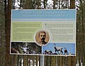 Poster- Legend of the white Chamois.jpg 3 110 × 2 420; 6,6 MB
-
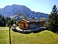 Rossfeldhöhenringstraße - Berghütte mit Blick auf den Hohen Göll.jpg 3 968 × 2 976; 8,14 MB
-

-
 Carl Rottmann - Hoher Göll im Alpenglühen.jpg 2 000 × 1 550; 1,77 MB
-
 Rudolf Reschreiter Hintersee und Hoher Göll.jpg 4 831 × 3 323; 2,8 MB
-
 Schild Jubliläumsweg a.jpg 4 000 × 3 000; 9,32 MB
-
 Schild Jubliläumsweg retusche.jpg 3 411 × 2 940; 6,24 MB
-
 Schild Jubliläumsweg W.jpg 3 412 × 2 670; 5,97 MB
-
 Schild Jubliläumsweg.jpg 4 000 × 3 000; 2,69 MB
-
 Schlenken 05.jpg 3 072 × 2 304; 1,38 MB
-
 Westwand des Hohen Göll.jpg 3 000 × 4 000; 2,31 MB
-
 Westwand Hoher Göll.jpg 3 000 × 4 000; 2,3 MB
-
 Anton Windmaier - Blick auf ein Bauernhaus im Gebirge.jpg 2 854 × 2 085; 3,53 MB

.jpg)
.jpg)


.jpg)


.jpg)


.jpg)


Categorie:
- Mountains of Landkreis Berchtesgadener Land
- 2520s mountains of Upper Bavaria
- Mountains of Salzburg (state)
- 2520s mountains of Austria
- Dachsteinkalk
- Mountains of the Berchtesgaden Alps in Salzburg (state)
- Mountains of the Berchtesgaden Alps in Bavaria
- Mountains of the Göllstock
- Mountains of Austria by name
- Mountains of Germany by name
- International mountains