Category:Holbeck, Nottinghamshire
Jump to navigation
Jump to search
English: Holbeck is a village in Nottinghamshire, England. It is located 6 miles south-west of Worksop. According to the 2001 census it had a population of 449. It is an estate village built for the Dukes of Portland at Welbeck Abbey.
village and former civil parish in Bassetlaw, Nottinghamshire, England, UK  | |||||
| Upload media | |||||
| Instance of |
| ||||
|---|---|---|---|---|---|
| Location |
| ||||
 | |||||
Subcategories
This category has the following 3 subcategories, out of 3 total.
S
- Stable Court, Holbeck (7 F)
W
- St Winifred's Church, Holbeck (16 F)
Media in category "Holbeck, Nottinghamshire"
The following 170 files are in this category, out of 170 total.
-
 'The Winnings' almshouses - geograph.org.uk - 1168722.jpg 640 × 480; 85 KB
-
 A60 heading north - geograph.org.uk - 3893577.jpg 640 × 480; 82 KB
-
 A60 heading north west - geograph.org.uk - 3893571.jpg 640 × 480; 62 KB
-
 A616 approaching crossroads - geograph.org.uk - 3454963.jpg 3,076 × 1,892; 2.4 MB
-
 A616 road - geograph.org.uk - 113089.jpg 640 × 392; 33 KB
-
 A616 Road Scene.jpg 484 × 351; 32 KB
-
 A616 towards Cuckney - geograph.org.uk - 3454969.jpg 3,004 × 1,780; 2.53 MB
-
 A616 towards New Ollerton - geograph.org.uk - 4301038.jpg 640 × 480; 53 KB
-
 A616 towards New Ollerton - geograph.org.uk - 4301039.jpg 640 × 480; 50 KB
-
 A616-Mag Lane-Park Lane junction - geograph.org.uk - 2943759.jpg 3,456 × 2,304; 3.64 MB
-
 Approaching a bend on the A616 - geograph.org.uk - 4301032.jpg 640 × 480; 49 KB
-
 Ash tree at Norwood Farm - geograph.org.uk - 3817715.jpg 3,984 × 2,218; 6.27 MB
-
 Boat House Cave, Creswell Crags - geograph.org.uk - 4313211.jpg 5,119 × 3,694; 5.33 MB
-
 Bridleway near Holbeck and Creswell - geograph.org.uk - 63412.jpg 640 × 427; 167 KB
-
 Bridleway to Holbeck - geograph.org.uk - 2749978.jpg 640 × 427; 86 KB
-

-
-

-
 Corner and lane junction north of Whaley Thorns - geograph.org.uk - 2824527.jpg 1,500 × 929; 548 KB
-
 Cornfield view towards Gorse Covert - geograph.org.uk - 1389837.jpg 640 × 480; 82 KB
-
 Cottage, Holbeck Woodhouse - geograph.org.uk - 3893564.jpg 640 × 480; 73 KB
-
 Country lanes junction - geograph.org.uk - 1168808.jpg 640 × 480; 68 KB
-
 Crag Lake and Creswell Crags - geograph.org.uk - 90872.jpg 640 × 480; 96 KB
-
 Crags Pond, Creswell Crags - geograph.org.uk - 4313205.jpg 4,880 × 3,680; 5.63 MB
-

-
 Creswell Crags - geograph.org.uk - 3551743.jpg 800 × 533; 154 KB
-
 Creswell Crags - geograph.org.uk - 4037931.jpg 640 × 400; 55 KB
-
 Creswell Crags and Crags Pond - geograph.org.uk - 63404.jpg 640 × 427; 192 KB
-
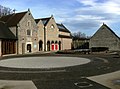
 Creswell Crags Museum, Visitor and Education Centre - geograph.org.uk - 3548820.jpg 4,000 × 2,248; 4.35 MB
-
 Crop field towards woodland - geograph.org.uk - 4301024.jpg 640 × 480; 68 KB
-
 Crop Fields to the North of Whaley Thorns - geograph.org.uk - 4102038.jpg 4,000 × 3,000; 2.78 MB
-
 Deer Park, Welbeck Estate - geograph.org.uk - 476613.jpg 640 × 480; 124 KB
-
 Dukeries Garden Centre - geograph.org.uk - 996329.jpg 640 × 480; 104 KB
-
 Dukeries Garden Centre - geograph.org.uk - 996334.jpg 640 × 480; 95 KB
-
 Dukeries Garden Centre Car Park - geograph.org.uk - 645104.jpg 640 × 480; 70 KB
-

-
 East end of pond, Creswell Crags - geograph.org.uk - 4672980.jpg 1,024 × 768; 216 KB
-
 Elma Lane - geograph.org.uk - 3893557.jpg 640 × 480; 61 KB
-
 Entering Derbyshire - geograph.org.uk - 3893584.jpg 640 × 480; 76 KB
-
 Entering Nottinghamshire - geograph.org.uk - 4301026.jpg 640 × 480; 52 KB
-
 Entrance to The Harley Gallery - geograph.org.uk - 645089.jpg 640 × 480; 74 KB
-

-
 Estate wall, Welbeck Abbey - geograph.org.uk - 3893582.jpg 640 × 480; 53 KB
-

-
 Farm track, Collingthwaite Farm - geograph.org.uk - 3893544.jpg 640 × 480; 75 KB
-
 Farmland and hedgerow - geograph.org.uk - 4301035.jpg 640 × 480; 68 KB
-
 Farmland off the A616 - geograph.org.uk - 3893539.jpg 640 × 480; 60 KB
-
 Farmland, Collingthwaite Farm - geograph.org.uk - 3893542.jpg 640 × 480; 71 KB
-
 Fields north of Whaley Thorns - geograph.org.uk - 2824512.jpg 1,024 × 608; 129 KB
-
 Footpath and Outbuildings at Norwood Farm - geograph.org.uk - 4102043.jpg 4,000 × 3,000; 2.48 MB
-
 Footpath at Creswell Crags - geograph.org.uk - 2659332.jpg 768 × 1,024; 477 KB
-
 Garden wall at Welbeck - geograph.org.uk - 2043569.jpg 640 × 480; 40 KB
-
 Grazing off Elma Lane - geograph.org.uk - 3893552.jpg 640 × 480; 51 KB
-
 Grazing south of Holbeck Woodhouse - geograph.org.uk - 3893550.jpg 640 × 480; 75 KB
-
 Grazing, Holbeck Woodhouse - geograph.org.uk - 3893559.jpg 640 × 480; 65 KB
-
 Guided Tour at Creswell Crags - geograph.org.uk - 4102100.jpg 4,000 × 3,000; 3.56 MB
-
 Harvested field south of Tile Kiln Wood - geograph.org.uk - 1480251.jpg 640 × 480; 224 KB
-
 Headmaster's House (front), Holbeck, Notts (2).jpg 4,032 × 3,024; 3.47 MB
-
 Headmaster's House, Holbeck, Notts.jpg 3,856 × 2,892; 2.8 MB
-
 Hillside Cottage, Holbeck.jpg 4,032 × 3,024; 3.24 MB
-
 Holbeck - geograph.org.uk - 1175993.jpg 640 × 480; 86 KB
-

-
 Holbeck Woodhouse - geograph.org.uk - 1045828.jpg 640 × 480; 56 KB
-
 Holbeck Woodhouse - geograph.org.uk - 4229272.jpg 4,912 × 3,264; 5.44 MB
-
 Holbeck Woodhouse - Lane Junction - geograph.org.uk - 1045836.jpg 640 × 480; 117 KB
-
 Holbeck Woodhouse Post Office - geograph.org.uk - 3893562.jpg 640 × 480; 58 KB
-
 Junior Terracotta Warriors - geograph.org.uk - 693066.jpg 640 × 465; 118 KB
-
 Lake in the valley floor between Creswell Crags - geograph.org.uk - 2659342.jpg 1,024 × 753; 407 KB
-
 Lane approaching Holbeck Woodhouse - geograph.org.uk - 1045820.jpg 640 × 480; 68 KB
-
 Lane at Welbeck - geograph.org.uk - 2043576.jpg 640 × 480; 49 KB
-
 Lane heading north - geograph.org.uk - 3893547.jpg 640 × 480; 63 KB
-
 Lane heading north - geograph.org.uk - 3893561.jpg 640 × 480; 67 KB
-
 Lane junction with the A60 - geograph.org.uk - 3893567.jpg 640 × 480; 80 KB
-
 Lane passing Collingthwaite Farm - geograph.org.uk - 1045796.jpg 640 × 480; 88 KB
-
 Lane to Holbeck Woodhouse - geograph.org.uk - 1045804.jpg 640 × 480; 86 KB
-
 Lane towards Norwood Farm - geograph.org.uk - 2824540.jpg 1,024 × 676; 133 KB
-
 Laundry Cottage, Laundry Lodge And Garden Wall, Holbeck, Notts.jpg 4,032 × 3,024; 4.42 MB
-
 Limehouse Cafe and Harley Gallery, Welbeck Park - geograph.org.uk - 2950486.jpg 2,000 × 1,500; 1.83 MB
-
 Little Remise - geograph.org.uk - 2750155.jpg 640 × 427; 130 KB
-
 Lodge house for Welbeck Abbey - geograph.org.uk - 3893576.jpg 640 × 480; 92 KB
-
 Lodge on Welbeck Estate on track to Creswell Crags - geograph.org.uk - 3549393.jpg 3,980 × 2,212; 5.57 MB
-
 Lodge, Tile Kiln Wood - geograph.org.uk - 556894.jpg 640 × 480; 137 KB
-
 Main Gates Lodge - geograph.org.uk - 3893573.jpg 640 × 480; 81 KB
-
-
 Mind the Bend - geograph.org.uk - 1433829.jpg 640 × 427; 67 KB
-
 Minor road towards Whaley Common - geograph.org.uk - 4301040.jpg 640 × 480; 50 KB
-
 Moles cleared near Welbeck Abbey - geograph.org.uk - 2044007.jpg 640 × 480; 68 KB
-
 Motor Yard, Bursars Court, Japonica Lodge And Attached Buildings, Holbeck, Notts.jpg 4,032 × 3,024; 3.43 MB
-
 Norwood Farm kissing-gated footpath - geograph.org.uk - 2945367.jpg 3,456 × 2,304; 3.59 MB
-
 Norwood Farm yard with narrowboat 'blanks' - geograph.org.uk - 2945378.jpg 3,456 × 2,304; 3.71 MB
-
 Norwood Trig Point - geograph.org.uk - 4123515.jpg 3,920 × 2,204; 2.6 MB
-
 Nursery Lodge - geograph.org.uk - 2749359.jpg 640 × 427; 106 KB
-
 Nursery Lodge - geograph.org.uk - 3551747.jpg 800 × 533; 128 KB
-
 Nursery Lodge, Welbeck - geograph.org.uk - 3817398.jpg 4,912 × 3,264; 5.16 MB
-
 Oaksetts Lodge - geograph.org.uk - 3546372.jpg 800 × 533; 138 KB
-
 Oaksetts Lodge - geograph.org.uk - 3549409.jpg 4,000 × 2,248; 4.42 MB
-
 Old Milestone by the A60, Holbeck (geograph 5448945).jpg 768 × 1,024; 259 KB
-
 Orchard at Norwood Farm - geograph.org.uk - 3819097.jpg 800 × 484; 164 KB
-
 Park Lane meets the A616 - geograph.org.uk - 2800084.jpg 640 × 496; 61 KB
-
 Parkland, Welbeck Abbey - geograph.org.uk - 3893578.jpg 640 × 480; 120 KB
-
 Ploughed field and copse - geograph.org.uk - 4229258.jpg 4,912 × 3,264; 7.78 MB
-
 Red roof, farmhouse, Holbeck - geograph.org.uk - 4229266.jpg 4,912 × 3,264; 5.88 MB
-
 Road near Holbeck - geograph.org.uk - 2044008.jpg 640 × 480; 60 KB
-
 Road on the Welbeck estate - geograph.org.uk - 2044002.jpg 640 × 480; 57 KB
-
 Road to Holbeck Woodhouse - geograph.org.uk - 1602688.jpg 640 × 480; 96 KB
-
 Road towards the A616 from Whaley Thorns - geograph.org.uk - 2824531.jpg 1,500 × 830; 507 KB
-
 Road towards Welbeck Abbey - geograph.org.uk - 3893583.jpg 640 × 480; 72 KB
-

-
 Robin Hood Way leaving Tile Kiln Wood - geograph.org.uk - 1168699.jpg 640 × 480; 119 KB
-
 Robin Hood Way toward Holbeck - geograph.org.uk - 1175983.jpg 640 × 480; 72 KB
-
 Robin Hood Way towards Oaksetts Lodge - geograph.org.uk - 1929226.jpg 640 × 480; 125 KB
-
 Scenery at Creswell Crags - geograph.org.uk - 2659329.jpg 1,024 × 710; 372 KB
-
 Sculpture at Welbeck - geograph.org.uk - 3415793.jpg 2,592 × 1,936; 2.29 MB
-
 Signpost and wall at High Holbeck - geograph.org.uk - 2800073.jpg 640 × 480; 65 KB
-
 Smith's Cottage, Holbeck.jpg 4,032 × 3,024; 2.45 MB
-
 Southern cliffs, Creswell Crags (1) - geograph.org.uk - 4672976.jpg 1,024 × 768; 368 KB
-
 Southern cliffs, Creswell Crags (2) - geograph.org.uk - 4672978.jpg 1,024 × 768; 202 KB
-
 St Winifred’s Church, Holbeck - geograph.org.uk - 3304506.jpg 1,598 × 973; 383 KB
-
 St. Pancras station in Nottinghamshire^ - geograph.org.uk - 4719426.jpg 1,024 × 768; 226 KB
-
 Stables And Attached Lodges, Walls, Piers And Outbuildings, Holbeck, Notts.jpg 4,032 × 3,024; 3.58 MB
-
 Stubble field off the A616 - geograph.org.uk - 4301036.jpg 640 × 480; 66 KB
-
 The grave of the 6th Duke of Portland - geograph.org.uk - 4938156.jpg 3,835 × 5,113; 4.49 MB
-
 The Harley Gallery and courtyard - geograph.org.uk - 2817987.jpg 640 × 476; 71 KB
-
 The Riding School at Welbeck - geograph.org.uk - 2043580.jpg 640 × 480; 57 KB
-
 The Riding School at Welbeck - geograph.org.uk - 2043584.jpg 640 × 480; 39 KB
-
 The road to Holbeck Woodhouse - geograph.org.uk - 2817980.jpg 640 × 480; 59 KB
-
 The Winnings Almshouses, Welbeck Abbey - geograph.org.uk - 2943205.jpg 3,456 × 2,304; 2.06 MB
-
 Towards the stables at Welbeck - geograph.org.uk - 2043564.jpg 640 × 480; 62 KB
-
 Track to Blue Barn Farm - geograph.org.uk - 3817711.jpg 4,000 × 2,248; 6.04 MB
-
 Two counties view - geograph.org.uk - 2749973.jpg 640 × 427; 58 KB
-
 View to Creswell - geograph.org.uk - 2749993.jpg 640 × 427; 93 KB
-
 Welbeck Abbey outbuildings - geograph.org.uk - 2943229.jpg 3,456 × 2,304; 3.31 MB
-
 Welbeck Bridleway - geograph.org.uk - 117650.jpg 640 × 480; 111 KB
-
 Welbeck estate houses - geograph.org.uk - 2943221.jpg 3,456 × 2,304; 2.57 MB
-

-

-
 Welbeck Tennis Club - geograph.org.uk - 4229275.jpg 4,912 × 3,264; 7.03 MB
-
 Welcome to Welbeck - geograph.org.uk - 2817983.jpg 640 × 480; 75 KB
-
 Welcome to Welbeck - geograph.org.uk - 2943210.jpg 3,456 × 2,304; 4.9 MB
-
 Whitwell quarry, aerial 2013 - geograph.org.uk - 3637102.jpg 640 × 427; 66 KB
-
 Wooden mammoth at Creswell Crags - geograph.org.uk - 3062136.jpg 640 × 480; 122 KB
-

-
 Yellow for summer - geograph.org.uk - 2943941.jpg 3,456 × 2,304; 3.81 MB
-
 A60 road - geograph.org.uk - 556896.jpg 480 × 640; 86 KB
-
 Approaching the woods at South Lodge - geograph.org.uk - 1176432.jpg 640 × 480; 91 KB
-
 Arable land near Norton - geograph.org.uk - 1480228.jpg 640 × 480; 229 KB
-
 Crags Pond - geograph.org.uk - 632962.jpg 640 × 480; 75 KB
-
 Deer in the park - geograph.org.uk - 763266.jpg 640 × 480; 98 KB
-
 Dukeries Garden Centre entrance - geograph.org.uk - 693049.jpg 640 × 480; 123 KB
-
 Elma Lane, Holbeck - geograph.org.uk - 144203.jpg 640 × 425; 58 KB
-
 Farm Building - geograph.org.uk - 556881.jpg 640 × 480; 105 KB
-
 Farmland between Cuckney and Creswell - geograph.org.uk - 302919.jpg 640 × 480; 103 KB
-
 Field and woodland - geograph.org.uk - 763273.jpg 640 × 480; 114 KB
-
 Forgotten tunnel - geograph.org.uk - 563743.jpg 640 × 480; 91 KB
-
 Gouldsmeadow Lake - geograph.org.uk - 563767.jpg 640 × 480; 91 KB
-
 Hedgehog eating mouse - geograph.org.uk - 423387.jpg 640 × 480; 146 KB
-
 Holbeck Woodhouse - geograph.org.uk - 126195.jpg 640 × 480; 104 KB
-
 Lane near Holbeck Woodhouse - geograph.org.uk - 144213.jpg 640 × 425; 75 KB
-
 Lodge - geograph.org.uk - 122893.jpg 640 × 480; 72 KB
-
 Lodge near Dukeries Garden Centre - geograph.org.uk - 556883.jpg 640 × 480; 113 KB
-
 Lodge, Creswell - geograph.org.uk - 556903.jpg 640 × 480; 109 KB
-
 Lodge, Hunciecroft - geograph.org.uk - 556889.jpg 640 × 480; 121 KB
-
 Main Gates Lodge - geograph.org.uk - 144211.jpg 640 × 382; 72 KB
-
 Oaksetts Lodge - geograph.org.uk - 556872.jpg 640 × 480; 116 KB
-

-
 Pathway near Burial Ground Plantation - geograph.org.uk - 563758.jpg 640 × 480; 111 KB
-
 Rose Cottage - geograph.org.uk - 556885.jpg 640 × 480; 99 KB
-
 Sugar beet - geograph.org.uk - 302921.jpg 640 × 480; 124 KB
-
 Tunnel Top - geograph.org.uk - 123770.jpg 640 × 480; 121 KB
-
 View from outside of the deer park - geograph.org.uk - 476609.jpg 640 × 480; 169 KB


.jpg)
.jpg)


_towards_Holbeck_-_geograph.org.uk_-_4301030.jpg)


,_Holbeck,_Notts_(2).jpg)


.jpg)


_-_geograph.org.uk_-_4672976.jpg)
_-_geograph.org.uk_-_4672978.jpg)


_-_geograph.org.uk_-_3637226.jpg)
_-_geograph.org.uk_-_3637242.jpg)


