Category:Holbrook, Suffolk
Jump to navigation
Jump to search
English: Holbrook is a village situated close to the northern shore of the Stour estuary in Suffolk, England. It is located on the Shotley peninsula in Babergh district, around 8⅓ km (5 miles) south of Ipswich.
village and civil parish in Suffolk, UK  | |||||
| Upload media | |||||
| Instance of | |||||
|---|---|---|---|---|---|
| Location | Babergh, Suffolk, East of England, England | ||||
 | |||||
Subcategories
This category has the following 6 subcategories, out of 6 total.
Media in category "Holbrook, Suffolk"
The following 200 files are in this category, out of 344 total.
(previous page) (next page)-
 A crop of potatoes - geograph.org.uk - 4143910.jpg 640 × 430; 102 KB
-
 A crop of potatoes - geograph.org.uk - 4144250.jpg 640 × 405; 59 KB
-
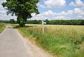
 A narrow Suffolk lane - geograph.org.uk - 4144249.jpg 640 × 430; 69 KB
-
 A wooded lane - geograph.org.uk - 4152966.jpg 640 × 430; 104 KB
-
 A young crop - geograph.org.uk - 5993925.jpg 1,024 × 681; 211 KB
-

-
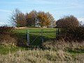
 Alton Green - geograph.org.uk - 5611362.jpg 640 × 480; 142 KB
-
 Alton Green - geograph.org.uk - 5993933.jpg 1,024 × 681; 212 KB
-
 Alton Green Farm - geograph.org.uk - 5993931.jpg 1,024 × 681; 247 KB
-
 Alton Water - geograph.org.uk - 5969809.jpg 1,024 × 681; 134 KB
-
 Alton Water - geograph.org.uk - 5969819.jpg 1,024 × 681; 187 KB
-
 Alton Water - geograph.org.uk - 5969820.jpg 1,024 × 681; 146 KB
-
 Alton Water - geograph.org.uk - 5974337.jpg 1,024 × 681; 118 KB
-
 Alton Water - geograph.org.uk - 5999515.jpg 1,024 × 681; 105 KB
-
 Alton Water - geograph.org.uk - 5999519.jpg 1,024 × 681; 116 KB
-
 Alton Water Dam - geograph.org.uk - 5969834.jpg 1,024 × 681; 163 KB
-
 Alton Water reservoir - geograph.org.uk - 5856282.jpg 1,600 × 1,200; 486 KB
-
 Alton Water Waterworks - geograph.org.uk - 5969838.jpg 1,024 × 681; 123 KB
-
 Alton Water Waterworks - geograph.org.uk - 5969839.jpg 1,024 × 681; 117 KB
-
 Alton Water ^ Draw-off tower near Holbrook - geograph.org.uk - 5239223.jpg 5,184 × 2,920; 4.84 MB
-
 An arable landscape - geograph.org.uk - 4143935.jpg 640 × 430; 64 KB
-
 Arable field - geograph.org.uk - 5993946.jpg 1,024 × 681; 152 KB
-
 Arable land, north of the river - geograph.org.uk - 2553502.jpg 3,648 × 2,736; 2.87 MB
-
 B1080 - geograph.org.uk - 4120987.jpg 640 × 387; 81 KB
-
 B1080 - geograph.org.uk - 5974367.jpg 1,024 × 681; 189 KB
-
 B1080, Holbrook - geograph.org.uk - 4120986.jpg 640 × 430; 60 KB
-
 Barn, Alton Hall Farm - geograph.org.uk - 4143918.jpg 640 × 430; 74 KB
-
 Battle of Jutland Memorial at The Royal Hospital School - geograph.org.uk - 5215025.jpg 2,592 × 1,944; 2.93 MB
-
 Below the Dam, Alton water - geograph.org.uk - 4132987.jpg 640 × 430; 72 KB
-
 Bench and viewpoint at Alton Wharf - geograph.org.uk - 6109181.jpg 6,000 × 4,000; 6.15 MB
-
 Bend in a narrow Suffolk Lane - geograph.org.uk - 4144251.jpg 640 × 430; 102 KB
-
 Bend, New Rd - geograph.org.uk - 5980082.jpg 1,024 × 681; 226 KB
-
 Bin Day - geograph.org.uk - 3679042.jpg 1,024 × 768; 260 KB
-
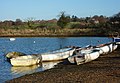 Boats at Holbrook Creek - geograph.org.uk - 1601973.jpg 640 × 445; 101 KB
-
 Boats stored at Alton Wharf - geograph.org.uk - 6109176.jpg 6,000 × 4,000; 5.5 MB
-
 Boats, Holbrook Creek - geograph.org.uk - 5993990.jpg 1,024 × 681; 125 KB
-
 Boatyard at Holbrook Creek - geograph.org.uk - 1602021.jpg 640 × 425; 75 KB
-
 Brick Cottages - geograph.org.uk - 5993941.jpg 1,024 × 681; 253 KB
-
 Brick Kiln Lane - geograph.org.uk - 5980085.jpg 1,024 × 933; 252 KB
-
 Bridlepath on the edge of Woodley Wood - geograph.org.uk - 6109061.jpg 6,000 × 4,000; 6.88 MB
-
 Bridleway off Coxhall Rd - geograph.org.uk - 4143943.jpg 640 × 430; 92 KB
-
 Bridleway through a field of rape - geograph.org.uk - 4144234.jpg 640 × 430; 93 KB
-
 Bridleway through a field of rape - geograph.org.uk - 4144245.jpg 640 × 430; 89 KB
-
 Bridleway, footpath junction - geograph.org.uk - 4144248.jpg 640 × 430; 85 KB
-
 Bridleway, Hale's Grove - geograph.org.uk - 4144267.jpg 640 × 430; 144 KB
-
 Bridleway, Hale's Grove - geograph.org.uk - 4144274.jpg 640 × 430; 141 KB
-
 Bridleway, Hale's Grove - geograph.org.uk - 4144285.jpg 640 × 430; 120 KB
-
 Building Site, The Street, Holbrook - geograph.org.uk - 2197533.jpg 640 × 480; 103 KB
-
 By Coxhall Rd - geograph.org.uk - 4143944.jpg 640 × 430; 84 KB
-
 By Hyams Lane - geograph.org.uk - 1602730.jpg 640 × 481; 109 KB
-
 Bylam Lane - geograph.org.uk - 3679052.jpg 1,024 × 768; 266 KB
-
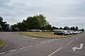 Car park. Alton Water - geograph.org.uk - 4785086.jpg 640 × 426; 48 KB
-
 Cereals by New Rd - geograph.org.uk - 5979963.jpg 1,024 × 681; 165 KB
-
 Cherry Ground - geograph.org.uk - 5611351.jpg 640 × 480; 102 KB
-
 Chest tombs - geograph.org.uk - 5974502.jpg 1,024 × 681; 228 KB
-
 Chestnut Spinney - geograph.org.uk - 5974355.jpg 1,024 × 681; 153 KB
-
 Church Hill, B1080 - geograph.org.uk - 5974358.jpg 1,024 × 681; 189 KB
-
 Church of All Saints' - geograph.org.uk - 5974513.jpg 681 × 1,024; 165 KB
-
 Church of All Saints' - geograph.org.uk - 5974514.jpg 681 × 1,024; 186 KB
-
 Church of All Saints' - geograph.org.uk - 5974516.jpg 1,024 × 681; 181 KB
-
 Church of All Saints' - geograph.org.uk - 5974521.jpg 1,024 × 681; 241 KB
-
 Church of All Saints' - geograph.org.uk - 5974923.jpg 1,024 × 681; 120 KB
-
 Church of All Saints' - geograph.org.uk - 5974942.jpg 681 × 1,024; 221 KB
-
 Clock Tower, Royal Hospital School - geograph.org.uk - 4781195.jpg 640 × 380; 44 KB
-
 Clock Tower, Royal Hospital School - geograph.org.uk - 4781200.jpg 640 × 389; 45 KB
-
 Clock Tower, Royal Hospital School - geograph.org.uk - 4781205.jpg 640 × 426; 46 KB
-
 Clock Tower, Royal Hospital School - geograph.org.uk - 4785113.jpg 640 × 426; 46 KB
-
 Coppicing, Hale's Grove - geograph.org.uk - 4144278.jpg 640 × 430; 140 KB
-
 Coppicing, Hale's Grove - geograph.org.uk - 4152961.jpg 640 × 430; 145 KB
-
 Corner of Hyams Lane - geograph.org.uk - 5974366.jpg 1,024 × 681; 121 KB
-
 Cornfield and Creek - geograph.org.uk - 2553074.jpg 3,648 × 2,736; 2.16 MB
-
 Cottage on the northern edge of Holbrook - geograph.org.uk - 6108981.jpg 6,000 × 4,000; 7.06 MB
-
 Cottages at Lower Holbrook - geograph.org.uk - 6109168.jpg 6,000 × 4,000; 6.52 MB
-
 Coxhall Rd - geograph.org.uk - 4143911.jpg 640 × 430; 77 KB
-
 Coxhall Rd - geograph.org.uk - 4143937.jpg 640 × 430; 68 KB
-
 Coxhall Rd - geograph.org.uk - 4143941.jpg 640 × 430; 62 KB
-
 Coxhall Rd - geograph.org.uk - 4143942.jpg 640 × 430; 64 KB
-
 Crop of potatoes - geograph.org.uk - 4143904.jpg 640 × 430; 104 KB
-
 Crossroads - geograph.org.uk - 1573526.jpg 480 × 640; 92 KB
-
 Dam, Alton Water - geograph.org.uk - 5969815.jpg 1,024 × 681; 154 KB
-
 Dark woodland - geograph.org.uk - 5974347.jpg 1,024 × 681; 280 KB
-
 Dead Tree on Foreshore, River Stour, Lower Holbrook - geograph.org.uk - 6217330.jpg 2,600 × 2,600; 1.35 MB
-
 Draw off tower, Alton Water - geograph.org.uk - 5969824.jpg 1,024 × 681; 119 KB
-
 Draw off tower, Alton Water - geograph.org.uk - 5969841.jpg 1,024 × 681; 135 KB
-
 Entering Harkstead - geograph.org.uk - 5993923.jpg 1,024 × 681; 241 KB
-
 Entering Lower Holbrook - geograph.org.uk - 5993930.jpg 1,024 × 681; 171 KB
-
 Environment Agency Sluice - geograph.org.uk - 5993966.jpg 1,024 × 681; 297 KB
-
 Farmland by New Rd - geograph.org.uk - 5980076.jpg 1,024 × 681; 176 KB
-
 Farmland with small valley - geograph.org.uk - 5611343.jpg 640 × 480; 126 KB
-
 Field and large tree (1) - geograph.org.uk - 1602749.jpg 640 × 480; 102 KB
-
 Field and large tree (2) - geograph.org.uk - 1602752.jpg 480 × 640; 125 KB
-
 Field and trees near Holbrook - geograph.org.uk - 1602745.jpg 640 × 393; 63 KB
-
 Field by Fir Tree Hill - geograph.org.uk - 5979959.jpg 1,024 × 681; 135 KB
-
 Field by Holbrook Creek - geograph.org.uk - 5993994.jpg 1,024 × 681; 171 KB
-
 Field near Red House Farm - geograph.org.uk - 5980088.jpg 1,024 × 681; 164 KB
-
 Field near Red House Farm - geograph.org.uk - 5980091.jpg 1,024 × 681; 138 KB
-
 Field of cereal - geograph.org.uk - 5979968.jpg 1,024 × 681; 162 KB
-
 Field towards houses on Ipswich Road - geograph.org.uk - 1605205.jpg 640 × 349; 84 KB
-
 Field towards Hyams Lane - geograph.org.uk - 1602723.jpg 474 × 640; 144 KB
-
 Fields near Woodlands Farm - geograph.org.uk - 6108997.jpg 6,000 × 4,000; 6.04 MB
-
 Fields on the edge of Hale's Grove - geograph.org.uk - 6109043.jpg 6,000 × 4,000; 5.93 MB
-
 Fields on the edge of Holbrook - geograph.org.uk - 6109084.jpg 6,000 × 4,000; 6.55 MB
-
 Fir Tree Cottages - geograph.org.uk - 5979962.jpg 1,024 × 681; 175 KB
-
 Fir Tree Hill - geograph.org.uk - 5974538.jpg 1,024 × 681; 261 KB
-
 Fir Tree Hill - geograph.org.uk - 5974547.jpg 1,024 × 681; 257 KB
-
 Fir Tree Hill, Back Hill junction - geograph.org.uk - 5974543.jpg 1,024 × 681; 152 KB
-
 Fir Tree Hill, New Rd junction - geograph.org.uk - 5979960.jpg 1,024 × 681; 159 KB
-
 Fire tower - geograph.org.uk - 5974356.jpg 1,024 × 681; 136 KB
-
 Fish Pond at Back Hill, Holbrook - geograph.org.uk - 6109147.jpg 6,000 × 4,000; 6.77 MB
-
 Fish Pond, Holbrook - geograph.org.uk - 5611355.jpg 640 × 480; 76 KB
-
 Fishpond at Holbrook Gardens - geograph.org.uk - 1602756.jpg 640 × 480; 170 KB
-
 Fishpond Lane - geograph.org.uk - 5974527.jpg 1,024 × 681; 210 KB
-
 Fishpond Lane - geograph.org.uk - 5974532.jpg 1,024 × 681; 214 KB
-
 Fishpond Lane - geograph.org.uk - 5974537.jpg 1,024 × 739; 265 KB
-
 Fishponds Lane towards Holbrook - geograph.org.uk - 1602754.jpg 640 × 480; 147 KB
-
 Five Acres Cottages - geograph.org.uk - 2513721.jpg 3,648 × 2,736; 2.54 MB
-
 Flat farmland - geograph.org.uk - 5980072.jpg 1,024 × 681; 151 KB
-
 Flowers at the field's edge - geograph.org.uk - 4495344.jpg 1,024 × 768; 493 KB
-
 Footpath - geograph.org.uk - 3699098.jpg 1,024 × 768; 185 KB
-
 Footpath in Holbrook. - geograph.org.uk - 5858250.jpg 960 × 638; 128 KB
-
 Footpath junction - geograph.org.uk - 1602747.jpg 640 × 480; 139 KB
-
 Footpath junction - geograph.org.uk - 4133015.jpg 640 × 430; 108 KB
-
 Footpath north of Alton Water - geograph.org.uk - 4133054.jpg 640 × 430; 86 KB
-
 Footpath off Fir Tree Hill - geograph.org.uk - 5974544.jpg 1,024 × 681; 280 KB
-
 Footpath off New Rd - geograph.org.uk - 5979972.jpg 681 × 1,024; 286 KB
-
 Footpath off New Rd - geograph.org.uk - 5980074.jpg 1,024 × 681; 294 KB
-
 Footpath to Alton Water - geograph.org.uk - 4133089.jpg 640 × 430; 95 KB
-
 Footpath to Holbrook - geograph.org.uk - 5974344.jpg 1,024 × 681; 204 KB
-
 Footpath to Lower Holbrook - geograph.org.uk - 2553599.jpg 3,648 × 2,736; 3.3 MB
-
 Footpath, Alton Hall Cottages - geograph.org.uk - 4133048.jpg 640 × 430; 103 KB
-
 Foreshore at Lower Holbrook - River Stour - geograph.org.uk - 6217327.jpg 3,648 × 2,255; 2.09 MB
-
 Foxgloves - geograph.org.uk - 5994375.jpg 1,024 × 681; 132 KB
-
 Gone to seed - geograph.org.uk - 4143940.jpg 640 × 430; 56 KB
-
 Grasslands south of Holbrook - geograph.org.uk - 5974517.jpg 1,024 × 681; 144 KB
-
 Grassy hillside - geograph.org.uk - 5993948.jpg 1,024 × 681; 131 KB
-
 Graves, All Saints' Church - geograph.org.uk - 5974369.jpg 1,024 × 681; 208 KB
-
 Hale's Grove - geograph.org.uk - 4144264.jpg 640 × 430; 72 KB
-
 Hale's Grove - geograph.org.uk - 4144270.jpg 640 × 430; 130 KB
-
 Hale's Grove - geograph.org.uk - 4144272.jpg 640 × 430; 138 KB
-
 Hale's Grove - geograph.org.uk - 4144281.jpg 640 × 430; 137 KB
-
 Harkstead Lane, New Rd junction - geograph.org.uk - 5980084.jpg 1,024 × 681; 189 KB
-
 Harkstead Rd - geograph.org.uk - 5993944.jpg 1,024 × 681; 215 KB
-
 Harkstead Rd - geograph.org.uk - 5993952.jpg 1,024 × 681; 249 KB
-
 Harkstead Rd - geograph.org.uk - 5993953.jpg 1,024 × 681; 259 KB
-
 Harkstead Rd - geograph.org.uk - 5993956.jpg 1,024 × 681; 249 KB
-
 Harkstead Road - geograph.org.uk - 1602796.jpg 640 × 480; 129 KB
-
 Hedge and copse - geograph.org.uk - 1602633.jpg 640 × 480; 115 KB
-
 Hide, Hale's Grove - geograph.org.uk - 4144284.jpg 640 × 430; 133 KB
-
 High tide, Stour Estuary - geograph.org.uk - 5996685.jpg 1,024 × 681; 92 KB
-
 Holbrook - geograph.org.uk - 4133019.jpg 640 × 430; 62 KB
-
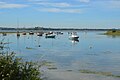
 Holbrook Bay - geograph.org.uk - 2107734.jpg 1,687 × 1,221; 445 KB
-
 Holbrook Bay - geograph.org.uk - 5996641.jpg 1,024 × 681; 135 KB
-
 Holbrook Bay looking east - geograph.org.uk - 2553494.jpg 3,648 × 2,255; 1.67 MB
-
 Holbrook Bay looking west - geograph.org.uk - 2553498.jpg 3,138 × 1,939; 1.6 MB
-
 Holbrook Boat House Sign - geograph.org.uk - 2390910.jpg 1,024 × 576; 133 KB
-
 Holbrook Creek - geograph.org.uk - 4873502.jpg 3,264 × 2,176; 821 KB
-
 Holbrook Creek - geograph.org.uk - 5611361.jpg 640 × 480; 119 KB
-
 Holbrook Creek - geograph.org.uk - 5993964.jpg 1,024 × 681; 189 KB
-
 Holbrook Creek - geograph.org.uk - 5993965.jpg 1,024 × 681; 109 KB
-
 Holbrook Creek - geograph.org.uk - 5993987.jpg 1,024 × 681; 132 KB
-
 Holbrook Creek - geograph.org.uk - 5993991.jpg 1,024 × 681; 147 KB
-
 Holbrook Creek - geograph.org.uk - 5996637.jpg 1,024 × 681; 163 KB
-
 Holbrook Creek - geograph.org.uk - 993762.jpg 640 × 480; 89 KB
-
 Holbrook creek. - geograph.org.uk - 4753731.jpg 640 × 346; 42 KB
-
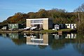
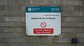
 Holbrook fire station - geograph.org.uk - 1602732.jpg 640 × 475; 116 KB
-
 Holbrook fire station - geograph.org.uk - 1910454.jpg 640 × 427; 188 KB
-
 Holbrook Fire Station - geograph.org.uk - 5974360.jpg 1,024 × 681; 162 KB
-
 Holbrook Fish Pond (Private) - geograph.org.uk - 2553097.jpg 3,648 × 2,736; 1.93 MB
-
 Holbrook Mill - geograph.org.uk - 4495331.jpg 1,024 × 768; 507 KB
-
 Holbrook Rd - geograph.org.uk - 5993927.jpg 1,024 × 681; 176 KB
-
 Holbrook Rd - geograph.org.uk - 5993928.jpg 1,024 × 681; 170 KB
-
 Holbrook Rd - geograph.org.uk - 5999473.jpg 1,024 × 681; 178 KB
-
 Holbrook Rd, B1080 - geograph.org.uk - 5999475.jpg 1,024 × 681; 197 KB
-

-
 Holbrook Village sign - geograph.org.uk - 5974362.jpg 681 × 1,024; 177 KB
-
 Holbrook War Memorial - geograph.org.uk - 5974363.jpg 681 × 1,024; 238 KB
-
 Holbrook's former estuary - geograph.org.uk - 2108024.jpg 1,930 × 1,395; 876 KB
-
 Honesty Stall at Sandpit Cottages - geograph.org.uk - 4495361.jpg 1,024 × 768; 439 KB
-
 House by Harkstead Rd - geograph.org.uk - 5993951.jpg 1,024 × 681; 170 KB
-
 House on Church Road, Holbrook - geograph.org.uk - 1602742.jpg 640 × 480; 105 KB
-
 Houses in Lower Holbrook - geograph.org.uk - 5993939.jpg 1,024 × 681; 182 KB
-
 Houses on Five Acres - geograph.org.uk - 5974352.jpg 1,024 × 681; 119 KB
-
 Housing at Royal Hospital School - geograph.org.uk - 5611499.jpg 640 × 428; 87 KB
-
 Hyams Lane - geograph.org.uk - 4133081.jpg 640 × 430; 82 KB
-
 Hyams Lane - geograph.org.uk - 4133086.jpg 640 × 430; 91 KB
-
 Hyams Lane - geograph.org.uk - 5974350.jpg 1,024 × 681; 228 KB
-
 Hyams Lane - geograph.org.uk - 5974351.jpg 1,024 × 681; 198 KB
-
 Hyams Lane, Holbrook - geograph.org.uk - 1605202.jpg 640 × 446; 125 KB
-
 Ipswich Rd - geograph.org.uk - 5980092.jpg 1,024 × 681; 196 KB
-
 Irrigation equipment by track - geograph.org.uk - 5980078.jpg 1,024 × 681; 163 KB
-
 Lake at Holbrook Gardens - geograph.org.uk - 1602759.jpg 640 × 461; 87 KB
-
 Lake at Holbrook Gardens - geograph.org.uk - 4855256.jpg 3,264 × 2,176; 1.07 MB
-
 Lane between lakes - geograph.org.uk - 1602755.jpg 462 × 640; 138 KB
-
 Looking across Holbrook Creek - geograph.org.uk - 1601977.jpg 640 × 478; 104 KB
-

-
 Looking towards Holbrook Bay - geograph.org.uk - 2553513.jpg 3,027 × 1,871; 1.92 MB
-
 Looking up Harkstead Road - geograph.org.uk - 1602798.jpg 640 × 473; 151 KB
-
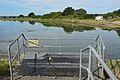
 Low tide at Alton Wharf - geograph.org.uk - 6109186.jpg 5,326 × 3,550; 3.28 MB
-
 Low tide in Holbrook Creek - geograph.org.uk - 710930.jpg 640 × 426; 66 KB
-
 Man made structure in Holbrook Bay - geograph.org.uk - 4855250.jpg 3,264 × 2,176; 631 KB


_-_geograph.org.uk_-_1602749.jpg)
_-_geograph.org.uk_-_1602752.jpg)


_-_geograph.org.uk_-_2553097.jpg)


