Category:Holmbury St Mary
Jump to navigation
Jump to search
English: A small village near Abinger in the Mole Valley district of Surrey, England located within the Hurtwood, the largest area of common land in Surrey. Nearby to the south is Holmbury Hill, which at is the fourth highest point in Surrey. The village itself is named after the hill and the large Victorian church at its heart. St Mary's church, which overlooks the village green, was built in 1879 by George Edmund Street who had built himself a large house in the village between 1873-76 known as Holmdale. Holmdale later became home to Thomas Catto, the Governor of the Bank of England from 1944 to 1949.
village in United Kingdom  | |||||
| Upload media | |||||
| Instance of | |||||
|---|---|---|---|---|---|
| Location | |||||
| Area |
| ||||
| official website | |||||
 | |||||
Subcategories
This category has the following 4 subcategories, out of 4 total.
F
- Felday Chapel (7 F)
H
- Hurt Wood (39 F)
Media in category "Holmbury St Mary"
The following 79 files are in this category, out of 79 total.
-
 Belmont School, Holmbury St Mary - geograph.org.uk - 2978922.jpg 800 × 600; 101 KB
-
 Bluebells, Holmbury St Mary - geograph.org.uk - 1285960.jpg 640 × 480; 540 KB
-
 Chapel in Holmbury St Mary - geograph.org.uk - 2645204.jpg 640 × 430; 121 KB
-
 Chapel, Holmbury St Mary - geograph.org.uk - 2645200.jpg 640 × 430; 135 KB
-
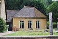 Church Hall, Holmbury St Mary - geograph.org.uk - 2645358.jpg 640 × 430; 97 KB
-
 Clearing in the Hurt Wood - geograph.org.uk - 1094338.jpg 640 × 480; 142 KB
-
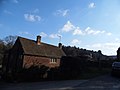
 Cottage in Holmbury St Mary - geograph.org.uk - 2645211.jpg 640 × 430; 95 KB
-
 Cottage on Horsham Road, Holmbury St Mary - geograph.org.uk - 3391273.jpg 2,048 × 1,536; 1.48 MB
-
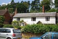 Cottage, Holmbury St Mary - geograph.org.uk - 2645209.jpg 640 × 430; 113 KB
-
 Cottage, Holmbury St Mary - geograph.org.uk - 2645264.jpg 640 × 430; 117 KB
-
 Cottage, Holmbury St Mary - geograph.org.uk - 2645311.jpg 640 × 430; 123 KB
-
 Cottage, Holmbury St Mary - geograph.org.uk - 2645356.jpg 640 × 430; 66 KB
-
 Descending Holmbury Hill - geograph.org.uk - 1094245.jpg 640 × 480; 141 KB
-
 Dry Valley in the Hurt Wood - geograph.org.uk - 1094294.jpg 640 × 480; 133 KB
-
 Entering Holmbury St Mary - geograph.org.uk - 2642373.jpg 640 × 430; 102 KB
-
 Floral approach to Holmbury St Mary - geograph.org.uk - 1320467.jpg 640 × 480; 415 KB
-
 Give Us Your Money^ - geograph.org.uk - 1094238.jpg 640 × 480; 90 KB
-
 Golden Winter on Holmbury Hill - geograph.org.uk - 1094264.jpg 480 × 640; 163 KB
-
 Greensand Ridge by Holmbury - geograph.org.uk - 1094283.jpg 640 × 480; 141 KB
-
 Hillside in the Hurt Wood - geograph.org.uk - 1094310.jpg 640 × 480; 126 KB
-
 Hillside track in the Hurtwood - geograph.org.uk - 1302070.jpg 640 × 480; 337 KB
-
 Holmbury Cricket Field - geograph.org.uk - 1093457.jpg 480 × 640; 121 KB
-
 Holmbury Hill Fort - geograph.org.uk - 1504038.jpg 640 × 480; 144 KB
-
 Holmbury Hillside - geograph.org.uk - 1093441.jpg 480 × 640; 120 KB
-
 Holmbury Pavilion - geograph.org.uk - 1093448.jpg 640 × 480; 123 KB
-
 Holmbury St Mary - geograph.org.uk - 1093410.jpg 640 × 480; 105 KB
-
 Holmbury St Mary - geograph.org.uk - 2645350.jpg 640 × 430; 80 KB
-
 Holmbury St Mary - geograph.org.uk - 271090.jpg 640 × 437; 84 KB
-
 Holmbury St Mary Cricket Club - geograph.org.uk - 1320437.jpg 640 × 480; 376 KB
-
 Holmbury St Mary Cricket Pitch - geograph.org.uk - 2645398.jpg 640 × 430; 64 KB
-
 Holmbury St Mary Recreation Ground - geograph.org.uk - 2645384.jpg 640 × 430; 57 KB
-
 Holmbury St Mary Village Hall - geograph.org.uk - 1320456.jpg 640 × 480; 343 KB
-
 Holmbury St Mary village hall - geograph.org.uk - 2273866.jpg 640 × 480; 128 KB
-
 Holmbury St Mary Village Sign - geograph.org.uk - 1094399.jpg 480 × 640; 70 KB
-
 Holmbury St Mary village sign.jpg 1,259 × 2,000; 581 KB
-
 Holmbury St Mary, Hurt Wood, Sparassis crispa.jpg 4,000 × 2,666; 2.69 MB
-
 Holmbury St Mary, old village well - geograph.org.uk - 101731.jpg 640 × 435; 204 KB
-
 Holmbury St Mary, Surrey.jpg 3,880 × 2,072; 1.8 MB
-
 Holmbury St Mary, the old village well.jpg 3,000 × 1,995; 2.31 MB
-
 Holmbury St Mary.jpg 3,888 × 2,592; 3.54 MB
-
 Holmbury St. Mary - geograph.org.uk - 2941408.jpg 6,902 × 1,540; 2.72 MB
-
 Holmbury St. Mary cricket pitch - geograph.org.uk - 2177188.jpg 3,553 × 2,736; 2.77 MB
-
-
 Holmbury Village Club - geograph.org.uk - 2645271.jpg 640 × 430; 114 KB
-
 Horsham Road - geograph.org.uk - 1094361.jpg 640 × 480; 103 KB
-
 Jubilee weekend at Holmbury St Mary - geograph.org.uk - 2978934.jpg 800 × 600; 120 KB
-
 Kings Head pub, Holmbury Hill Road, Holmbury St Mary (March 2014).jpg 2,400 × 1,600; 736 KB
-
 Looking down on Felday - geograph.org.uk - 46551.jpg 640 × 427; 133 KB
-
 Parkhurst, near Holmbury St Mary, archway on footpath.jpg 1,995 × 3,000; 2.68 MB
-

-
 Pavilion, Holmbury cricket pitch - geograph.org.uk - 2645401.jpg 640 × 430; 76 KB
-
 Pine Stand in Spring in the Hurtwood - geograph.org.uk - 1279476.jpg 640 × 480; 494 KB
-
 Pond on the edge of the Hurtwood - geograph.org.uk - 1302059.jpg 640 × 480; 332 KB
-

-
 Pond, Holmbury St Mary - geograph.org.uk - 1285930.jpg 640 × 480; 330 KB
-
 Rambling on Holmbury Hill - geograph.org.uk - 1094252.jpg 480 × 640; 88 KB
-
 Seat on Somerset Hill - geograph.org.uk - 1504035.jpg 640 × 480; 114 KB
-
 Somerset Hill, Holmbury - geograph.org.uk - 1093461.jpg 640 × 480; 162 KB
-
 Telephone Kiosk, Holmbury St Mary - geograph.org.uk - 2645203.jpg 640 × 430; 124 KB
-

-
 The entrance to Upfolds Farm, Holmbury St Mary - geograph.org.uk - 3391232.jpg 2,048 × 1,536; 1.58 MB
-
 The King's Head, Holmbury St Mary - geograph.org.uk - 1320473.jpg 640 × 480; 320 KB
-
 The Royal Oak - geograph.org.uk - 2645351.jpg 640 × 430; 76 KB
-
 The Royal Oak, Holmbury St Mary - geograph.org.uk - 1320501.jpg 640 × 480; 285 KB
-
 The Royal Oak, Holmbury St Mary - geograph.org.uk - 2978944.jpg 800 × 600; 122 KB
-
 The Royal Oak, Holmbury St. Mary - geograph.org.uk - 2941414.jpg 2,476 × 1,512; 976 KB
-
 Tilehung cottage, Holmbury St Mary - geograph.org.uk - 2645353.jpg 640 × 430; 118 KB
-
 Timber Store on Pasture Wood Road - geograph.org.uk - 1285536.jpg 640 × 480; 434 KB
-
 Valley view at Hurtwood - geograph.org.uk - 1504029.jpg 640 × 480; 79 KB
-
 Village Green Holmbury St Mary - geograph.org.uk - 3585811.jpg 4,000 × 3,000; 2.71 MB
-
 Village green in Holmbury St Mary - geograph.org.uk - 1591763.jpg 640 × 428; 96 KB
-
 Village Green, Holmbury St Mary - geograph.org.uk - 1320492.jpg 640 × 480; 240 KB
-
 Village of Holmbury (1) - geograph.org.uk - 2408838.jpg 640 × 416; 58 KB
-
 Village of Holmbury (2) - geograph.org.uk - 2409761.jpg 640 × 415; 77 KB
-
 Village pump, Holmbury St Mary - geograph.org.uk - 2645268.jpg 640 × 430; 121 KB
-
 Village Sign, Holmbury St Mary - geograph.org.uk - 2645205.jpg 640 × 430; 107 KB
-
 Youth Hostel, Holmbury St Mary - geograph.org.uk - 984952.jpg 640 × 480; 115 KB
-
 Youth Hostel, Holmbury St Mary.JPG 1,728 × 1,296; 698 KB
-


.jpg)


_-_geograph.org.uk_-_2408838.jpg)
_-_geograph.org.uk_-_2409761.jpg)


