Category:Holme Pierrepont
Jump to navigation
Jump to search
hamlet and civil parish in Nottinghamshire, England, UK  | |||||
| Upload media | |||||
| Instance of | |||||
|---|---|---|---|---|---|
| Location | Rushcliffe, Nottinghamshire, East Midlands, England | ||||
 | |||||
Subcategories
This category has the following 7 subcategories, out of 7 total.
A
- Adbolton (8 F)
B
- Bassingfield (43 F)
E
H
- Holme Pierrepont Hall (12 F)
R
S
- Skylarks Nature Reserve (6 F)
Media in category "Holme Pierrepont"
The following 200 files are in this category, out of 338 total.
(previous page) (next page)-
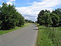
 A cyclist on Holme Lane - geograph.org.uk - 2420542.jpg 1,024 × 768; 354 KB
-
 A July evening by the river - geograph.org.uk - 3060470.jpg 1,024 × 768; 1.08 MB
-
 A July evening by the Trent - geograph.org.uk - 3060460.jpg 1,024 × 754; 1.11 MB
-
 A June evening on Bassingfield Lane - geograph.org.uk - 4552940.jpg 1,024 × 731; 834 KB
-
 A trip on the Trent - geograph.org.uk - 4975096.jpg 1,024 × 731; 1,015 KB
-
 A52 Radcliffe Road - geograph.org.uk - 3321344.jpg 2,256 × 1,504; 975 KB
-
 A52 sign for Cropwell Bishop junction - geograph.org.uk - 3465244.jpg 2,256 × 1,504; 1.05 MB
-

-
 Across the river - geograph.org.uk - 1163812.jpg 640 × 479; 169 KB
-
 Across the Trent - geograph.org.uk - 2910679.jpg 1,024 × 768; 1.13 MB
-
 Adbolton Lane - geograph.org.uk - 1386372.jpg 423 × 640; 77 KB
-
 Adbolton Lane - geograph.org.uk - 1760560.jpg 640 × 480; 80 KB
-
 Adbolton Lane - geograph.org.uk - 5065067.jpg 1,280 × 1,280; 295 KB
-
 Adbolton Lane - geograph.org.uk - 866589.jpg 640 × 480; 98 KB
-
 Adbolton Lane at Holme Pierrepont - geograph.org.uk - 4862630.jpg 800 × 599; 82 KB
-
 Adbolton Lane bus turning circle, Lady Bay - geograph.org.uk - 3631400.jpg 1,024 × 768; 149 KB
-
 Adbolton Lane on a May morning - geograph.org.uk - 2421031.jpg 800 × 600; 546 KB
-
 Adbolton, 'The Trent Lady' at sundown - geograph.org.uk - 4975130.jpg 1,024 × 731; 986 KB
-
 Adbolton, evening reflections - geograph.org.uk - 4163147.jpg 1,024 × 1,024; 971 KB
-
 Adbolton, Nottingham Sailing Club - geograph.org.uk - 4976557.jpg 1,024 × 732; 908 KB
-
 Adbolton, the entrance to Greenacres Park - geograph.org.uk - 5407906.jpg 1,024 × 682; 666 KB
-
 Adbolton, the sun going down - geograph.org.uk - 4976562.jpg 1,024 × 768; 917 KB
-
 All the way from Adbolton - geograph.org.uk - 5408051.jpg 1,024 × 768; 816 KB
-
 An evening walk by the river - geograph.org.uk - 4163164.jpg 1,024 × 768; 711 KB
-
 Approaching the site of Bridge No. 9 - geograph.org.uk - 6005748.jpg 1,024 × 768; 174 KB
-
 Aquatic acrobatics - geograph.org.uk - 2020706.jpg 640 × 480; 85 KB
-
 Aqueduct on the Grantham Canal - geograph.org.uk - 5157957.jpg 800 × 600; 150 KB
-
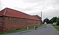
 Armitage Pet Care - geograph.org.uk - 1389428.jpg 640 × 479; 64 KB
-
 At Holme Lock - geograph.org.uk - 5408062.jpg 1,024 × 768; 808 KB
-

-

-

-

-

-

-

-
-

-

-
 Barley field at Holme Pierrepont - geograph.org.uk - 1385970.jpg 640 × 479; 102 KB
-
 Bassingfield Lane End post box, NG12 116 - geograph.org.uk - 1385815.jpg 640 × 479; 141 KB
-
 Bassingfield Lane, Bassingfield (2) - geograph.org.uk - 5172487.jpg 1,024 × 768; 155 KB
-
 Bassingfield next to the Grantham Canal - geograph.org.uk - 5602440.jpg 800 × 600; 127 KB
-
 Bassingfield, a bend in the Grantham Canal - geograph.org.uk - 4553035.jpg 819 × 1,024; 795 KB
-
 Bassingfield, a summer evening ride - geograph.org.uk - 4552950.jpg 819 × 1,024; 971 KB
-
 Bassingfield, Holly Farm - geograph.org.uk - 4552964.jpg 1,024 × 1,024; 1.14 MB
-
 Bassingfield, Notts. - geograph.org.uk - 3793943.jpg 3,395 × 2,010; 1.64 MB
-
 Bassingfield, pantiles, dog and rider - geograph.org.uk - 4552944.jpg 1,024 × 606; 617 KB
-
 Bean field at Holme Pierrepont - geograph.org.uk - 1385921.jpg 479 × 640; 159 KB
-
 Below Holme Lock - geograph.org.uk - 4976340.jpg 819 × 1,024; 943 KB
-
 Bend in the middle of Adbolton Lane - geograph.org.uk - 3631434.jpg 640 × 480; 49 KB
-

-
 Bike lights, sunset and a crescent moon - geograph.org.uk - 5065062.jpg 1,280 × 1,280; 199 KB
-
 Birch and blue - geograph.org.uk - 1385879.jpg 479 × 640; 108 KB
-
 Blott's pit - geograph.org.uk - 1385907.jpg 640 × 479; 84 KB
-
 Boat moored along the River Trent - geograph.org.uk - 4864146.jpg 800 × 536; 74 KB
-
 Boat moored along the River Trent - geograph.org.uk - 4867696.jpg 800 × 540; 69 KB
-
 Boats moored up on the Trent - geograph.org.uk - 6186373.jpg 1,600 × 900; 342 KB
-
 Bottoms up^ - geograph.org.uk - 6005667.jpg 1,024 × 768; 343 KB
-
 Bridge No 9 on the Grantham Canal - geograph.org.uk - 6025315.jpg 800 × 590; 171 KB
-
 Bridge over Grantham Canal, Bassingfield - geograph.org.uk - 5175677.jpg 1,024 × 768; 129 KB
-
 Bridleway to the canal at Bassingfield - geograph.org.uk - 6005669.jpg 1,024 × 768; 140 KB
-
 Bus Stop on the A52 at Holme Lane - geograph.org.uk - 4228098.jpg 640 × 480; 240 KB
-
 By the river on a July evening - geograph.org.uk - 3083598.jpg 1,024 × 768; 1.07 MB
-
 Byway sign - geograph.org.uk - 1385968.jpg 479 × 640; 128 KB
-
 Canada Geese at Nottingham Sailing Club - geograph.org.uk - 5838804.jpg 1,024 × 768; 191 KB
-
 Canada geese on Pond in Holme Pierrpont - geograph.org.uk - 2263465.jpg 640 × 427; 272 KB
-

-
 Canal repair - geograph.org.uk - 6005668.jpg 1,024 × 768; 134 KB
-

-
 Catkins in Colwick Country Park - geograph.org.uk - 1163767.jpg 640 × 479; 62 KB
-

-

-

-
 Coach path - geograph.org.uk - 1386257.jpg 640 × 479; 55 KB
-
 Cold comfort^ - geograph.org.uk - 1163780.jpg 640 × 479; 50 KB
-
 Cold seat - geograph.org.uk - 1163749.jpg 640 × 400; 59 KB
-
 Colwick Country Park - geograph.org.uk - 1760411.jpg 640 × 480; 92 KB
-
 Colwick Country Park - geograph.org.uk - 5638603.jpg 1,280 × 960; 294 KB
-
 Colwick Country Park in the snow - geograph.org.uk - 1166285.jpg 476 × 640; 120 KB
-
 Colwick Marina along the River Trent - geograph.org.uk - 4866733.jpg 800 × 546; 135 KB
-
 Colwick Park Lake - geograph.org.uk - 1144289.jpg 640 × 479; 118 KB
-
 Colwick Park Lake - geograph.org.uk - 2424527.jpg 1,280 × 959; 260 KB
-
 Colwick Park Marina - geograph.org.uk - 5048567.jpg 800 × 600; 140 KB
-
 Colwick sluice gates on the River Trent - geograph.org.uk - 4867662.jpg 800 × 561; 104 KB
-
 Colwick Sluices on River Trent - geograph.org.uk - 5042408.jpg 3,072 × 1,728; 3.64 MB
-
 Colwick sunset - geograph.org.uk - 3060448.jpg 1,024 × 768; 1.06 MB
-
 Colwick, pleasure boats passing - geograph.org.uk - 5408077.jpg 1,024 × 768; 1.06 MB
-
 Control Tower and Main Facility Building - geograph.org.uk - 2263312.jpg 640 × 427; 255 KB
-
 Derelict Industrial Building - geograph.org.uk - 2263460.jpg 427 × 640; 225 KB
-
 Derelict Industrial Building - geograph.org.uk - 2263470.jpg 640 × 427; 257 KB
-
 Derelict Industrial Building - geograph.org.uk - 2263474.jpg 640 × 427; 245 KB
-
 Disused Grantham Canal at Bassingfield - geograph.org.uk - 6025313.jpg 800 × 579; 128 KB
-
-
 Double-stile footbridge - geograph.org.uk - 1385954.jpg 640 × 479; 184 KB
-
 Dragon boats on the Trent near Colwick - geograph.org.uk - 2389531.jpg 1,024 × 703; 718 KB
-
 Drain entering the River Trent - geograph.org.uk - 5838801.jpg 1,024 × 768; 245 KB
-
 End of the public road - geograph.org.uk - 1385944.jpg 640 × 479; 140 KB
-

-
 Entrance to Bassingfield Wood Yard - geograph.org.uk - 5172475.jpg 1,024 × 768; 123 KB
-
 Entrance to Blotts - geograph.org.uk - 1385965.jpg 640 × 479; 130 KB
-

-
 Euston 73 cruising up the Trent - geograph.org.uk - 5837994.jpg 1,024 × 768; 238 KB
-

-
 Farm track off Bassingfield Lane, Bassingfield - geograph.org.uk - 5172470.jpg 1,024 × 768; 186 KB
-
 Finger ponds - geograph.org.uk - 1386224.jpg 640 × 479; 94 KB
-
 Finger ponds - geograph.org.uk - 1386238.jpg 640 × 479; 84 KB
-

-
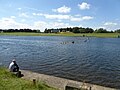
 Fishing at Colwick Lake - geograph.org.uk - 4866737.jpg 800 × 568; 73 KB
-
 Fishing Lake - geograph.org.uk - 867810.jpg 640 × 480; 56 KB
-
 Fishing on a July evening - geograph.org.uk - 2506452.jpg 1,024 × 708; 641 KB
-
 Floating boom across the Trent - geograph.org.uk - 5838831.jpg 1,024 × 768; 127 KB
-
 Flood bank - geograph.org.uk - 1386331.jpg 640 × 479; 135 KB
-

-
 Footpath by the River Trent - geograph.org.uk - 5837725.jpg 1,024 × 768; 151 KB
-
 Footpath through the industrial estate - geograph.org.uk - 1389422.jpg 479 × 640; 115 KB
-
 Footpath under the viaduct - geograph.org.uk - 1389467.jpg 640 × 479; 156 KB
-
 Former Little Chef - geograph.org.uk - 1385865.jpg 640 × 479; 85 KB
-
 Gate along the Trent Valley Way - geograph.org.uk - 4864177.jpg 800 × 527; 118 KB
-
 Geese next to Colwick Lake - geograph.org.uk - 4866736.jpg 800 × 612; 114 KB
-
 Glimpse of the Trent - geograph.org.uk - 5838808.jpg 1,024 × 768; 246 KB
-
 Grantham Canal - geograph.org.uk - 3133457.jpg 640 × 427; 106 KB
-
 Grantham Canal - geograph.org.uk - 3134076.jpg 640 × 427; 88 KB
-
 Grantham Canal - geograph.org.uk - 3134143.jpg 640 × 427; 134 KB
-
 Grantham Canal near Bassingfield (1) - geograph.org.uk - 5175667.jpg 1,024 × 768; 110 KB
-
 Grantham Canal near Bassingfield (2) - geograph.org.uk - 5175684.jpg 1,024 × 768; 113 KB
-
 Grantham Canal near Bassingfield - geograph.org.uk - 5276666.jpg 5,376 × 3,024; 1.67 MB
-
 Grantham Canal towpath - geograph.org.uk - 3134086.jpg 640 × 427; 98 KB
-
 Grantham Canal towpath near Bassingfield (1) - geograph.org.uk - 5175688.jpg 1,024 × 768; 156 KB
-
 Grantham Canal ^ Cotgrave Place Golf Club, Notts. - geograph.org.uk - 3793725.jpg 3,868 × 2,770; 2.07 MB
-
 Grantham Canal, Bassingfield Vicinity, Nottingham 12 - geograph.org.uk - 3793355.jpg 3,816 × 2,578; 1.97 MB
-
 Grantham Canal, Bassingfield Vicinity, Nottingham 12 - geograph.org.uk - 3793417.jpg 3,480 × 2,033; 1.79 MB
-
 Grazing horses at Adbolton - geograph.org.uk - 4174450.jpg 1,000 × 750; 928 KB
-
 Hackett Lakes fishery - geograph.org.uk - 1385908.jpg 640 × 479; 116 KB
-
 Hallam's Bridge, Grantham Canal, Bassingfield, Notts. - geograph.org.uk - 3793494.jpg 3,732 × 2,021; 1.63 MB
-
 Hallam's Bridge, Grantham Canal, Bassingfield, Notts. - geograph.org.uk - 3793553.jpg 3,954 × 1,925; 1.78 MB
-
 Headland footpath - geograph.org.uk - 1385833.jpg 640 × 479; 133 KB
-
 Holme Cut - geograph.org.uk - 2516822.jpg 640 × 480; 77 KB
-
 Holme House - geograph.org.uk - 893799.jpg 640 × 480; 56 KB
-
 Holme Lane - geograph.org.uk - 1385857.jpg 640 × 479; 89 KB
-
 Holme Lane - geograph.org.uk - 1760596.jpg 640 × 480; 99 KB
-
 Holme Lane - geograph.org.uk - 2420539.jpg 800 × 600; 687 KB
-
 Holme Lane - geograph.org.uk - 2516851.jpg 640 × 480; 96 KB
-
 Holme Lane - geograph.org.uk - 746322.jpg 640 × 427; 138 KB
-
 Holme Lane in Holme Pierrepont - geograph.org.uk - 4862617.jpg 800 × 571; 185 KB
-
 Holme lock - geograph.org.uk - 2516818.jpg 640 × 480; 130 KB
-
 Holme Lock along the River Trent - geograph.org.uk - 4863852.jpg 800 × 524; 93 KB
-
 Holme Lock gates opening - geograph.org.uk - 5408067.jpg 1,024 × 768; 777 KB
-

-

-
 Holme Pierrepont - St Edmund's Church - geograph.org.uk - 6014931.jpg 5,184 × 2,920; 7.45 MB
-
 Holme Pierrepont Hall - geograph.org.uk - 5488177.jpg 1,024 × 683; 280 KB
-
 Holme Pierrepont Hall near Nottingham - geograph.org.uk - 6014929.jpg 5,184 × 2,920; 5.43 MB
-
 Holme Pierrepont Lock - geograph.org.uk - 2263452.jpg 427 × 640; 239 KB
-

-

-

-
 Holme Pierrepont, St Edmund - Great War plaque - geograph.org.uk - 3868025.jpg 1,024 × 1,024; 1.57 MB
-
 Holme Pierrepont, white-water rafting - geograph.org.uk - 5408071.jpg 1,024 × 768; 1.02 MB
-
 Holme Sluices - geograph.org.uk - 4976547.jpg 1,024 × 731; 981 KB
-
 Holme Sluices and the entrance to Holme Lock - geograph.org.uk - 5838850.jpg 1,024 × 768; 166 KB
-
 Home Farm, Holme Pierrepont - geograph.org.uk - 1385934.jpg 640 × 419; 63 KB
-
 Hooked up - geograph.org.uk - 1166262.jpg 640 × 479; 226 KB
-
 Horse in a field at Adbolton - geograph.org.uk - 4174371.jpg 1,000 × 750; 957 KB
-
 Horse in a field at Adbolton - geograph.org.uk - 4174447.jpg 1,000 × 750; 783 KB
-
 House on Nathans Lane, Bassingfield - geograph.org.uk - 5172492.jpg 1,024 × 768; 142 KB
-
 Houses at Holme Lane - geograph.org.uk - 1385826.jpg 640 × 479; 108 KB
-
 Jacob ewes and lambs at Holme Pierrepont - geograph.org.uk - 4862624.jpg 800 × 543; 161 KB
-
 Jubilee Cottage - geograph.org.uk - 1385950.jpg 476 × 640; 72 KB
-
 Junction of Adbolton Lane and Adbolton Lane - geograph.org.uk - 3631421.jpg 1,024 × 768; 115 KB
-

-

-
 Keeper's House, Holme Locks - geograph.org.uk - 1163854.jpg 477 × 640; 122 KB
-
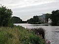
 Lake near Holme Pierrepont - geograph.org.uk - 1760583.jpg 640 × 480; 70 KB
-
 Lake off Adbolton Lane - geograph.org.uk - 1760572.jpg 640 × 480; 108 KB
-

-
 Lane at Holme Pierrepont - geograph.org.uk - 1385939.jpg 640 × 479; 126 KB
-
 Lane off Holme Lane - geograph.org.uk - 867673.jpg 640 × 480; 128 KB
-
 Lane to Bassingfield - geograph.org.uk - 3134203.jpg 640 × 427; 126 KB
-
 Lay-by on the A52 Radcliffe Road - geograph.org.uk - 4100032.jpg 1,280 × 853; 1,022 KB
-
 Learning the hard way - geograph.org.uk - 1386327.jpg 640 × 479; 105 KB
-
 Llama at the Firs, Holme Pierrepont - geograph.org.uk - 4862612.jpg 800 × 678; 172 KB
-
 Llamas at Holme - geograph.org.uk - 2516848.jpg 640 × 480; 93 KB
-

-
 Looking across the Grantham Canal to Bassingfield - geograph.org.uk - 5276674.jpg 3,072 × 1,728; 922 KB
-
 Looking towards Holme Farm - geograph.org.uk - 746336.jpg 640 × 427; 97 KB
-
 Lower mark - geograph.org.uk - 1386243.jpg 479 × 640; 58 KB
-
 Maintenance at Holme Lock - geograph.org.uk - 4975719.jpg 1,024 × 683; 863 KB
-
 Marina in Colwick Country Park - geograph.org.uk - 5042388.jpg 1,600 × 900; 418 KB
-
 Meadows by the River Trent - geograph.org.uk - 5837792.jpg 1,024 × 768; 154 KB
-
 Messing about on the river - geograph.org.uk - 2389550.jpg 1,024 × 768; 860 KB
-
 Moorings from the bank of the River Trent - geograph.org.uk - 4606674.jpg 2,000 × 1,500; 401 KB
-
 Nathan's Lane Vicinity, Bassingfield, Notts. - geograph.org.uk - 3793634.jpg 3,490 × 2,717; 1.98 MB
-
 Nathan's Lane, Bassingfield, Notts. - geograph.org.uk - 3793600.jpg 3,461 × 2,439; 1.88 MB
-
 National Water Sports Centre - geograph.org.uk - 4174380.jpg 1,000 × 702; 643 KB
-
 National Water Sports Centre - geograph.org.uk - 4174386.jpg 1,000 × 725; 568 KB
-
 National Water Sports Centre, Holme Pierrepont - geograph.org.uk - 6014932.jpg 5,184 × 2,920; 5.33 MB
-
 New plantation - geograph.org.uk - 1385924.jpg 640 × 479; 140 KB
-
 New pleasure boat moorings - geograph.org.uk - 6272032.jpg 1,024 × 732; 904 KB
-
 No entry - geograph.org.uk - 1385893.jpg 640 × 479; 144 KB


_-_geograph.org.uk_-_5172487.jpg)


_-_geograph.org.uk_-_5175667.jpg)
_-_geograph.org.uk_-_5175684.jpg)


_-_geograph.org.uk_-_5175688.jpg)


