Category:Hook, East Riding of Yorkshire
Jump to navigation
Jump to search
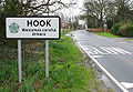
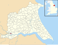
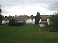
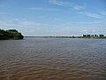
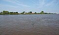
English: Hook is a village and civil parish in the East Riding of Yorkshire, England. It is situated approximately 1.5 miles (2.4 km) north east of Goole town centre and lies on the west bank of the River Ouse.
village and civil parish in the East Riding of Yorkshire, England  | |||||
| Upload media | |||||
| Instance of | |||||
|---|---|---|---|---|---|
| Location | East Riding of Yorkshire, Yorkshire and the Humber, England | ||||
 | |||||
Subcategories
This category has the following 3 subcategories, out of 3 total.
C
- St Mary Church, Hook (4 F)
R
- River Ouse at Hook (9 F)
- River Ouse railway bridge, Goole (22 F)
Media in category "Hook, East Riding of Yorkshire"
The following 102 files are in this category, out of 102 total.
-
 "The Port in Green Fields" - geograph.org.uk - 878238.jpg 640 × 433; 59 KB
-
 A boat slipway at Hook, East Riding of Yorkshire.jpg 480 × 640; 92 KB
-
 A farmer and his cattle at Hook circa. 1900 (archive ref DDX1712-1) (29964025173).jpg 3,079 × 1,900; 198 KB
-
 A footpath leading to Goole - geograph.org.uk - 2392741.jpg 800 × 600; 339 KB
-
 A Footpath west of Hook - geograph.org.uk - 1391364.jpg 480 × 640; 120 KB
-
 Balk Lane - geograph.org.uk - 2930472.jpg 1,024 × 768; 239 KB
-
 Blacksmiths Arms, Hook - geograph.org.uk - 6225155.jpg 1,600 × 1,065; 475 KB
-
 Church Lane Hook.jpg 640 × 441; 139 KB
-
 Church Lane, Hook - geograph.org.uk - 5458187.jpg 640 × 480; 447 KB
-
 CRT work boats rounding the 'hook' at Hook - geograph.org.uk - 5128826.jpg 1,024 × 768; 116 KB
-
 Disused mooring bollards - geograph.org.uk - 878234.jpg 640 × 512; 113 KB
-
 Farmland, Hook - geograph.org.uk - 2023584.jpg 640 × 480; 55 KB
-
 Field north of Westfield Lane-Church Lane - geograph.org.uk - 2741926.jpg 1,500 × 1,125; 1.22 MB
-
 Fields beyond end of High Street, Hook - geograph.org.uk - 2741683.jpg 1,500 × 806; 753 KB
-
 Flood bank near Hook - geograph.org.uk - 2930396.jpg 1,024 × 768; 193 KB
-
 Footpath and Flood Bank at Hook - geograph.org.uk - 4903991.jpg 4,608 × 3,456; 3.93 MB
-
 Footpath into town - geograph.org.uk - 2930446.jpg 1,024 × 768; 240 KB
-
 Footpath west of Hook - geograph.org.uk - 1391221.jpg 491 × 640; 127 KB
-
 Former ferry landing, Howdendyke - geograph.org.uk - 878225.jpg 640 × 490; 135 KB
-
 Goole Road Railway Bridge - geograph.org.uk - 1247412.jpg 640 × 480; 58 KB
-
 Hay workers at Hook circa.1900 (archive ref DDX1712-1) (30597973235).jpg 2,477 × 1,708; 284 KB
-
 Hay working at Hook circa.1900 (archive ref DDX1712-1) (30597973355).jpg 7,814 × 5,054; 1.98 MB
-
 High Street in Hook - geograph.org.uk - 4903986.jpg 4,422 × 3,307; 3.51 MB
-
 High Street, Hook - geograph.org.uk - 2023581.jpg 640 × 480; 73 KB
-
 High Street, Hook - geograph.org.uk - 2392757.jpg 800 × 600; 315 KB
-
 Highland cattle grazing - geograph.org.uk - 4280462.jpg 800 × 600; 215 KB
-
 Hook - Goole Bridge - geograph.org.uk - 1824403.jpg 1,600 × 1,200; 364 KB
-

-
 Hook Churchyard - geograph.org.uk - 5458191.jpg 640 × 481; 603 KB
-
 Hook Hall.jpg 640 × 480; 106 KB
-
 Hook Lane and M62 Ouse Bridge in distance - geograph.org.uk - 3136737.jpg 4,000 × 3,000; 2.33 MB
-
 Hook Memorial Hall.jpg 640 × 480; 60 KB
-
 Hook Nr Goole, Blacksmiths Arms.jpg 640 × 480; 146 KB
-
 Hook Post Office.jpg 640 × 480; 49 KB
-
 Hook, East Riding of Yorkshire UK parish locator map.svg 1,425 × 1,107; 1.68 MB
-
 Houses on Main Street, Hook - geograph.org.uk - 6225136.jpg 1,600 × 1,065; 763 KB
-
 Howden Dyke Island and the Ouse Bridge - geograph.org.uk - 2930410.jpg 1,024 × 768; 152 KB
-
 Hudscroft Drive - geograph.org.uk - 4280456.jpg 800 × 600; 106 KB
-
 Landing stage and houses at Hook - geograph.org.uk - 5128356.jpg 1,024 × 768; 109 KB
-
 Lee Mouth, River Ouse, from the south - geograph.org.uk - 5128871.jpg 1,024 × 768; 106 KB
-

-
 Looking to Hook - geograph.org.uk - 1521420.jpg 640 × 426; 172 KB
-
 M62 Ouse Bridge - geograph.org.uk - 4280602.jpg 800 × 600; 147 KB
-
 Memorial Hall, High Street, Hook - geograph.org.uk - 6225140.jpg 1,600 × 1,065; 598 KB
-
 Minor road towards Airmyn - geograph.org.uk - 2023587.jpg 640 × 480; 77 KB
-
 Navigable channel, River Ouse, at Ouse Bridge - geograph.org.uk - 5131885.jpg 1,024 × 768; 128 KB
-
 Navigation beacon - geograph.org.uk - 2930416.jpg 1,024 × 768; 172 KB
-
 New houses at Ferry Lane Hook.jpg 640 × 464; 72 KB
-
 Ouse bank near Hook - geograph.org.uk - 6082532.jpg 1,024 × 768; 134 KB
-
 Ouse Bridge near Goole - geograph.org.uk - 2930441.jpg 1,024 × 768; 183 KB
-
 Ouse floodbank - geograph.org.uk - 775425.jpg 640 × 480; 50 KB
-
 Partly demolished buildings, Hook - geograph.org.uk - 2930369.jpg 1,024 × 768; 168 KB
-
 Pathway Junction - geograph.org.uk - 1391390.jpg 594 × 640; 180 KB
-
 Post Office and stores, Hook - geograph.org.uk - 2023579.jpg 640 × 480; 56 KB
-
 Prestige dwellings by the river, Hook - geograph.org.uk - 2930386.jpg 1,024 × 768; 140 KB
-
 Resting at Hook - geograph.org.uk - 2930378.jpg 1,024 × 768; 129 KB
-
 River Ouse at Lee Mouth - geograph.org.uk - 2741693.jpg 1,500 × 845; 1.24 MB
-
 River Ouse from Ouse Bridge - geograph.org.uk - 5435896.jpg 640 × 426; 37 KB
-
 River Ouse, south of Howden Dyke Island - geograph.org.uk - 5128865.jpg 1,024 × 768; 87 KB
-

-
 Ships berthed at Howdendyke Wharf - geograph.org.uk - 6082537.jpg 1,024 × 768; 121 KB
-
 St Mary's Church, Hook - geograph.org.uk - 6225158.jpg 1,600 × 1,065; 970 KB
-
 St Mary's Church, Hook - geograph.org.uk - 6225165.jpg 632 × 1,600; 473 KB
-
 St Mary's Church, Hook - geograph.org.uk - 6225166.jpg 604 × 1,600; 410 KB
-
 St Mary's Church, Hook - geograph.org.uk - 6225215.jpg 1,600 × 1,065; 385 KB
-
 St Mary's Church, Hook - geograph.org.uk - 6225219.jpg 1,427 × 1,600; 820 KB
-
 St Mary's Church, Hook - geograph.org.uk - 6225221.jpg 1,324 × 1,600; 812 KB
-
 St Mary's Church, Hook - geograph.org.uk - 6225242.jpg 696 × 1,600; 427 KB
-
 St Mary's Church, Hook - geograph.org.uk - 6225245.jpg 1,065 × 1,600; 468 KB
-
 St Mary's Church, Hook - geograph.org.uk - 6225248.jpg 1,206 × 1,600; 834 KB
-
 St Mary's Church, Hook - geograph.org.uk - 6225250.jpg 1,167 × 1,600; 863 KB
-
 St Mary's Church, Hook - geograph.org.uk - 6225372.jpg 665 × 1,600; 489 KB
-
 St Mary's Church, Hook - geograph.org.uk - 6225375.jpg 1,600 × 1,065; 380 KB
-
 St Mary's Church, Hook - geograph.org.uk - 6225389.jpg 1,065 × 1,600; 425 KB
-
 St Mary's Church, Hook - geograph.org.uk - 6225508.jpg 1,199 × 1,600; 836 KB
-
 St Mary's Church, Hook - geograph.org.uk - 6225510.jpg 552 × 1,600; 401 KB
-
 St Mary's Church, Hook - geograph.org.uk - 6225512.jpg 660 × 1,600; 553 KB
-
 St Mary's Church, Hook - geograph.org.uk - 6225513.jpg 692 × 1,600; 428 KB
-
 St Mary's Church, Hook - geograph.org.uk - 6225515.jpg 1,221 × 1,600; 1,004 KB
-
 The Blacksmiths Arms - geograph.org.uk - 4280447.jpg 800 × 600; 73 KB
-
 The river bank near Hook - geograph.org.uk - 2930438.jpg 1,024 × 768; 129 KB
-
 The River Ouse and the M62 - geograph.org.uk - 5131881.jpg 1,024 × 768; 133 KB
-
 The River Ouse at Howdendyke - geograph.org.uk - 5128816.jpg 1,024 × 768; 112 KB
-
 The River Ouse at Water Lane, Hook - geograph.org.uk - 5128345.jpg 1,024 × 615; 92 KB
-
 The River Ouse near Hook - geograph.org.uk - 2930421.jpg 1,024 × 768; 144 KB
-
 The River Ouse Passing Howden Dike Island - geograph.org.uk - 4904122.jpg 4,530 × 3,356; 3.38 MB
-
 The River Ouse upstream of Howdendyke - geograph.org.uk - 5128835.jpg 1,024 × 615; 87 KB
-
 The River Ouse, north of Hook and Skelton - geograph.org.uk - 5128360.jpg 1,024 × 768; 122 KB
-
 The River Ouse, south-east of Howden Dyke Island - geograph.org.uk - 5128862.jpg 1,024 × 768; 118 KB
-
 The Sotheron Arms, Hook - geograph.org.uk - 2392846.jpg 800 × 600; 263 KB
-
 The Sotheron Arms, Hook - geograph.org.uk - 2392853.jpg 800 × 600; 214 KB
-
 Threshing at Hook circa. 1900 (archive ref DDX1712-1) (29965823324).jpg 16,782 × 10,879; 5.85 MB
-
 Track west of Hook - geograph.org.uk - 1391375.jpg 561 × 640; 126 KB
-
 Village Store and Post Office in Hook - geograph.org.uk - 4903979.jpg 4,278 × 3,215; 3.4 MB
-
 Westfield Banks Recreation Ground - geograph.org.uk - 1247378.jpg 640 × 480; 36 KB
-
 Westfield Lakes - geograph.org.uk - 6082512.jpg 1,024 × 768; 166 KB
-
 Westfield Park Nursing Home - geograph.org.uk - 4904135.jpg 4,414 × 3,171; 3.96 MB
-
 Westfield Park Nursing Home Hook.jpg 640 × 480; 75 KB
-
 Westfield Ponds - geograph.org.uk - 1248384.jpg 640 × 480; 67 KB
-
 Wharf at Howdendyke - geograph.org.uk - 2930390.jpg 1,024 × 768; 99 KB
-
 Willow Croft - geograph.org.uk - 4280448.jpg 800 × 600; 123 KB
-
 Z-bend on Westfield Lane - geograph.org.uk - 4280459.jpg 800 × 600; 78 KB


_(29964025173).jpg)


_(30597973235).jpg)
_(30597973355).jpg)


_(29965823324).jpg)


