Category:Hopeman
Vai alla navigazione
Vai alla ricerca
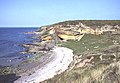
English: Hopeman is a seaside village in Moray, Scotland, on the coast of the Moray Firth, founded in 1805 to house and re-employ people displaced during the Highland clearances. The population is around 1 000 people in approximately 670 households.
village in Moray, Scotland, UK  | |||||
| Carica un file multimediale | |||||
| Istanza di | |||||
|---|---|---|---|---|---|
| Luogo |
| ||||
| Popolazione |
| ||||
 | |||||
Sottocategorie
Questa categoria contiene un'unica sottocategoria, indicata di seguito.
I
- Inverugie House (2 F)
File nella categoria "Hopeman"
Questa categoria contiene 161 file, indicati di seguito, su un totale di 161.
-
 "Aaaaaaaaaaaaaaaaaaagh^^^^^^^^^^^" - geograph.org.uk - 4291080.jpg 800 × 598; 108 KB
-

-
 "These boys are such whimps............" - geograph.org.uk - 4291088.jpg 800 × 600; 141 KB
-
 30 miles per hour from the Nor'east^ - geograph.org.uk - 2306059.jpg 800 × 534; 116 KB
-
 A cauldron on Hopeman's east beach - geograph.org.uk - 3818246.jpg 800 × 534; 239 KB
-

-
-

-

-

-
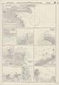 Admiralty Chart No 1462 Harbours on the (North and) East Coasts of Scotland, Published 1962.jpg 6 818 × 9 842; 21,33 MB
-
 Admiralty Chart No 3547 Logie Head to Tarbet Ness, Published 1906.jpg 10 560 × 6 354; 23,97 MB
-

-

-
 Beach huts at Hopeman. - panoramio (1).jpg 2 000 × 1 502; 1,37 MB
-
 Beach huts at Hopeman. - panoramio.jpg 2 000 × 1 502; 1,6 MB
-
 Between the swells at Hopeman harbour - geograph.org.uk - 6090285.jpg 1 600 × 1 069; 932 KB
-
 Boat Entering Hopeman Harbour - geograph.org.uk - 196111.jpg 640 × 481; 82 KB
-
 Breakwater, Hopeman Harbour - geograph.org.uk - 6011468.jpg 1 024 × 683; 287 KB
-
 Car park at Hopeman where we went for a coastal walk. - panoramio.jpg 2 000 × 1 502; 1,37 MB
-

-
 Character building for Gordonstoun - geograph.org.uk - 5965287.jpg 1 600 × 1 204; 260 KB
-
 Clashach Cove - geograph.org.uk - 217162.jpg 640 × 444; 243 KB
-
 Clashach Cove by Hopeman - geograph.org.uk - 111948.jpg 640 × 480; 104 KB
-
 Cliff at Clashach Cove by Hopeman - geograph.org.uk - 111953.jpg 640 × 480; 118 KB
-
 Cliffs at Clashach Cove - geograph.org.uk - 9625.jpg 470 × 640; 290 KB
-
 Close-up of a "tubenose" - geograph.org.uk - 4052441.jpg 800 × 534; 156 KB
-
 Cross-bedded Sandstone - geograph.org.uk - 3506710.jpg 640 × 418; 409 KB
-
 Daisy Rock and Intertidal Zone - geograph.org.uk - 3506720.jpg 640 × 427; 416 KB
-
 Deformed Sandstones - geograph.org.uk - 5148501.jpg 640 × 427; 389 KB
-
 Dunes at Hopeman East Beach - geograph.org.uk - 196108.jpg 640 × 481; 62 KB
-
 East Beach - geograph.org.uk - 2545227.jpg 3 456 × 2 304; 1,76 MB
-
 East Beach, Hopeman - geograph.org.uk - 3574312.jpg 4 608 × 3 456; 5,31 MB
-
 Eastward Ho^ Northern Light is underway - geograph.org.uk - 2170756.jpg 800 × 534; 216 KB
-
 Entrance to Hopeman Harbour - geograph.org.uk - 3840591.jpg 640 × 427; 50 KB
-
 Entrance, Hopeman Harbour - geograph.org.uk - 6011469.jpg 1 024 × 683; 271 KB
-
 Fishing from the end of the harbour - geograph.org.uk - 3655184.jpg 448 × 640; 155 KB
-
 Footprints in the Sand - geograph.org.uk - 3506733.jpg 640 × 427; 521 KB
-
 Full tilt on Hopeman's east beach - geograph.org.uk - 1520064.jpg 640 × 427; 44 KB
-
 Gulls on the Sand - geograph.org.uk - 3506726.jpg 640 × 368; 254 KB
-
 Harbour Pier - geograph.org.uk - 2543786.jpg 3 456 × 2 304; 1,6 MB
-
 Harbour Rocks - geograph.org.uk - 2545183.jpg 3 456 × 2 304; 1,53 MB
-
 Harbour Wall - geograph.org.uk - 2543754.jpg 3 456 × 2 304; 1,41 MB
-
 Hive Rock and Daisy Rock - geograph.org.uk - 3506714.jpg 640 × 427; 423 KB
-
 Hopeman Bay - geograph.org.uk - 6002249.jpg 640 × 480; 79 KB
-
 Hopeman Beach - geograph.org.uk - 5866116.jpg 640 × 385; 81 KB
-
 Hopeman East (50707452846).jpg 5 769 × 3 245; 12,23 MB
-
 Hopeman East Beach - geograph.org.uk - 6011499.jpg 1 024 × 683; 284 KB
-
 Hopeman East Beach - geograph.org.uk - 936871.jpg 640 × 480; 72 KB
-
 Hopeman Harbour - geograph.org.uk - 1273605.jpg 640 × 359; 42 KB
-
 Hopeman Harbour - geograph.org.uk - 3655220.jpg 640 × 476; 192 KB
-
 Hopeman Harbour - geograph.org.uk - 6002814.jpg 640 × 360; 59 KB
-
 Hopeman Harbour - geograph.org.uk - 6011473.jpg 1 024 × 683; 281 KB
-
 Hopeman Harbour - geograph.org.uk - 80562.jpg 640 × 427; 129 KB
-
 Hopeman Harbour - geograph.org.uk - 997253.jpg 640 × 480; 68 KB
-
 Hopeman harbour entrance - geograph.org.uk - 4105652.jpg 4 608 × 3 456; 3,5 MB
-
 Hopeman Harbour Entrance - geograph.org.uk - 5864857.jpg 640 × 401; 58 KB
-
 Hot And Cold - panoramio.jpg 4 320 × 3 240; 5,3 MB
-
 I'm sure we met before........ - geograph.org.uk - 4052395.jpg 800 × 533; 214 KB
-
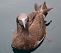
 Immature Gannet - geograph.org.uk - 4705715.jpg 800 × 600; 119 KB
-
 Inner Harbour Wall - geograph.org.uk - 2545211.jpg 3 456 × 2 304; 1,62 MB
-
 Jellyfish - geograph.org.uk - 185478.jpg 640 × 480; 83 KB
-
 Jellyfish - geograph.org.uk - 185481.jpg 594 × 517; 89 KB
-
 Kayaks in Hopeman harbour - geograph.org.uk - 602721.jpg 640 × 406; 102 KB
-
 Line Fishing - geograph.org.uk - 2545223.jpg 3 456 × 2 304; 3,2 MB
-
 Looking around the point at the lighthouse - panoramio.jpg 2 000 × 1 502; 1,27 MB
-
 Looking back at Hopeman. - panoramio (1).jpg 2 000 × 1 502; 1,37 MB
-
 Looking back at Hopeman. - panoramio.jpg 2 000 × 1 502; 1,58 MB
-

-
 Male And His Harem - panoramio.jpg 4 320 × 3 240; 4,76 MB
-
 Moray Firth - geograph.org.uk - 2543762.jpg 3 456 × 2 304; 1,34 MB
-
 Moray Firth - geograph.org.uk - 3351588.jpg 640 × 480; 176 KB
-
 Near Sculptors Cave - geograph.org.uk - 2592859.jpg 640 × 480; 88 KB
-
 New Red Sandstone - geograph.org.uk - 5148537.jpg 640 × 427; 388 KB
-

-
 Now you see it, now you ...... - geograph.org.uk - 2499855.jpg 800 × 534; 125 KB
-

-
 Pleasure boats of Hopeman - geograph.org.uk - 998621.jpg 640 × 490; 93 KB
-
 Pole Star and Northern Light - geograph.org.uk - 2545217.jpg 3 456 × 2 304; 1,63 MB
-
 Pole Star en route to exit the harbour - geograph.org.uk - 2170717.jpg 534 × 800; 268 KB
-
 Pontoons at last for Hopeman - geograph.org.uk - 998601.jpg 640 × 413; 54 KB
-

-

-
 Rocks off Hopeman - geograph.org.uk - 6011464.jpg 1 024 × 683; 318 KB
-

-
 Rocky Shoreline at Hopeman - geograph.org.uk - 6007066.jpg 1 024 × 731; 162 KB
-
 Roll on the good weather^ - geograph.org.uk - 1712964.jpg 640 × 428; 91 KB
-
 Sandstone Formation - geograph.org.uk - 3506587.jpg 640 × 427; 396 KB
-

-
 Seagull Female - panoramio.jpg 4 320 × 3 240; 4,3 MB
-
 Seating Area at Hopeman - geograph.org.uk - 1458401.jpg 640 × 391; 113 KB
-
 Seine Net Trawler Hopeman 1958 - geograph.org.uk - 84412.jpg 465 × 294; 52 KB
-
 Ships that pass........ - geograph.org.uk - 5483841.jpg 1 200 × 799; 429 KB
-

-

-

-
 Soft Sediment Deformation - geograph.org.uk - 5148529.jpg 640 × 479; 483 KB
-
 Soft Sediment Deformation - geograph.org.uk - 5148532.jpg 640 × 476; 488 KB
-

-
 Surfboarder off Hopeman East Beach - geograph.org.uk - 6007064.jpg 1 024 × 640; 209 KB
-
 The "new" pontoons of Hopeman harbour - geograph.org.uk - 998606.jpg 640 × 418; 60 KB
-
 The Ballan Wrasse (Labrus bergylta) - geograph.org.uk - 4055596.jpg 800 × 535; 226 KB
-
 The beach at Hopeman - geograph.org.uk - 3893683.jpg 640 × 422; 74 KB
-

-
 The East Beach at Hopeman - geograph.org.uk - 1438432.jpg 640 × 480; 78 KB
-
 The Fulmar (Fulmaris glacialis) - geograph.org.uk - 1995663.jpg 800 × 534; 199 KB
-
 The Fulmar (Fulmaris glacialis) - geograph.org.uk - 4052431.jpg 800 × 533; 61 KB
-

-

-
 The Harbour at Hopeman - geograph.org.uk - 1438364.jpg 640 × 385; 47 KB
-
 The Harbour Basin at Hopeman - geograph.org.uk - 1438502.jpg 640 × 480; 89 KB
-
 The Harbour Entrance at Hopeman - geograph.org.uk - 1438621.jpg 640 × 480; 69 KB
-

-

-
 The price of oil - geograph.org.uk - 5785792.jpg 1 201 × 1 600; 260 KB
-

-

-

-
 The West Beach at Hopeman - geograph.org.uk - 1438349.jpg 640 × 480; 59 KB
-
 Third years before the mast^ - geograph.org.uk - 2170726.jpg 800 × 531; 245 KB
-
 Too rough for fishin' today - geograph.org.uk - 6090282.jpg 1 600 × 1 110; 761 KB
-

-

-
 Views along the coastal path - panoramio (2).jpg 2 000 × 1 502; 1,7 MB
-
 West Beach - geograph.org.uk - 2543852.jpg 3 456 × 2 304; 1,49 MB
-
 West Beach at Hopeman - geograph.org.uk - 2208687.jpg 800 × 534; 184 KB
-
 West of Hopeman - geograph.org.uk - 5148520.jpg 640 × 427; 397 KB
-

-

-
 Who's a pretty boy then^ - geograph.org.uk - 4611141.jpg 598 × 800; 72 KB
-

-

-
 A southerly view of Hopeman harbour. - geograph.org.uk - 998631.jpg 640 × 426; 85 KB
-

-

-
 Bay to the east of Daisy Rock - geograph.org.uk - 1519985.jpg 640 × 427; 74 KB
-
 Beach Huts at Hopeman - geograph.org.uk - 1438591.jpg 640 × 480; 64 KB
-
 Braemou trough and drinking cup - geograph.org.uk - 1519658.jpg 427 × 640; 93 KB
-
 Braemou Well - geograph.org.uk - 217163.jpg 640 × 447; 264 KB
-
 Chalk and Cheese^^ - geograph.org.uk - 270514.jpg 640 × 426; 79 KB
-
 East Beach - geograph.org.uk - 9626.jpg 640 × 391; 205 KB
-
 Hopeman - geograph.org.uk - 10172.jpg 640 × 480; 64 KB
-
 Hopeman East Beach - geograph.org.uk - 9627.jpg 640 × 403; 222 KB
-

-
 Hopeman Harbour - geograph.org.uk - 1438414.jpg 640 × 358; 55 KB
-
 Hopeman Harbour - geograph.org.uk - 217164.jpg 640 × 210; 89 KB
-
 Hopeman Harbour - geograph.org.uk - 684589.jpg 640 × 451; 194 KB
-
 Hopeman Harbour - geograph.org.uk - 9628.jpg 640 × 308; 147 KB
-
 Lighting up time at Hopeman harbour - geograph.org.uk - 634545.jpg 640 × 426; 57 KB
-

-
 Looking seaward to Hopeman. - geograph.org.uk - 185864.jpg 640 × 427; 85 KB
-
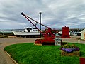
 Portable Derrick at Hopeman. - geograph.org.uk - 580512.jpg 640 × 480; 141 KB
-
 Quarry debris east of Hopeman - geograph.org.uk - 572588.jpg 640 × 426; 107 KB
-

-

-

-

-

-
 Time and tide awaits ............... - geograph.org.uk - 274760.jpg 640 × 538; 126 KB
-

-
 Track to dinosaur footprints - geograph.org.uk - 330290.jpg 640 × 480; 82 KB


_-_geograph.org.uk_-_4705703.jpg)


_East_Coasts_of_Scotland,_Published_1962.jpg)


.jpg)


.jpg)


.jpg)


_-_geograph.org.uk_-_4055596.jpg)


_-_geograph.org.uk_-_1995663.jpg)
_-_geograph.org.uk_-_4052431.jpg)

_-_geograph.org.uk_-_4611135.jpg)


_warts_and_all_-_geograph.org.uk_-_1712999.jpg)


_on_the_harbour_wall_-_geograph.org.uk_-_1712994.jpg)
.jpg)


