Category:Houghton, Norfolk
Jump to navigation
Jump to search
village and civil parish in Norfolk, UK  | |||||
| Upload media | |||||
| Instance of | |||||
|---|---|---|---|---|---|
| Location | King's Lynn and West Norfolk, Norfolk, East of England, England | ||||
| Area |
| ||||
 | |||||
Subcategories
This category has the following 5 subcategories, out of 5 total.
Media in category "Houghton, Norfolk"
The following 40 files are in this category, out of 40 total.
-
 A benchmark on Houghton main street - geograph.org.uk - 5489990.jpg 1,600 × 1,200; 527 KB
-
 A very long black stack - geograph.org.uk - 3077277.jpg 4,320 × 3,240; 5.65 MB
-
 An unclear benchmark - geograph.org.uk - 5489994.jpg 1,600 × 1,200; 446 KB
-
 Footpath at the side of 40 acre plantation - geograph.org.uk - 3077196.jpg 4,320 × 3,240; 5.83 MB
-
 Free range Hen Houses - geograph.org.uk - 361887.jpg 640 × 480; 81 KB
-
 Hall or Home Farmhouse, Houghton - geograph.org.uk - 6211868.jpg 3,648 × 2,432; 2.2 MB
-
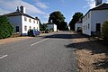
 Houghton, An Estate Village - geograph.org.uk - 3461097.jpg 1,024 × 768; 157 KB
-
 Little Massingham ahead, Anmer to the right - geograph.org.uk - 4526765.jpg 1,024 × 768; 308 KB
-
 Minor Road - geograph.org.uk - 454317.jpg 640 × 480; 116 KB
-
 Permissive footpath sign - geograph.org.uk - 5588123.jpg 3,456 × 2,592; 4.02 MB
-
 Pig Huts near Houghton - geograph.org.uk - 3459676.jpg 2,560 × 1,920; 1.27 MB
-
 Regimented rows of baled silage at Houghton - geograph.org.uk - 5616101.jpg 3,456 × 2,592; 1.59 MB
-
 Rhododendron flowers in Old Bottom - geograph.org.uk - 4526768.jpg 1,024 × 768; 565 KB
-
 Rhododendron flowers in Old Bottom - geograph.org.uk - 4526770.jpg 1,024 × 768; 533 KB
-
 Road approaching Houghton - geograph.org.uk - 4619047.jpg 800 × 531; 134 KB
-
 Rural road beside Forty Acre Plantation - geograph.org.uk - 5588135.jpg 3,456 × 2,592; 3.98 MB
-
 The village of Houghton - geograph.org.uk - 4619039.jpg 1,024 × 680; 300 KB
-

-
 Track from Lime Kiln Lane, Houghton, Norfolk - geograph.org.uk - 2600820.jpg 4,320 × 3,240; 5.49 MB
-
 Traditional buildings at North Pole Farm - geograph.org.uk - 2600835.jpg 4,320 × 3,240; 5.47 MB
-

-
 Village of Houghton - geograph.org.uk - 4619041.jpg 800 × 531; 99 KB
-
 Village of Houghton - geograph.org.uk - 4619042.jpg 800 × 531; 146 KB
-
 Walking the cross country course - geograph.org.uk - 2435260.jpg 2,848 × 2,136; 2.97 MB
-
 West towards New Houghton - geograph.org.uk - 544952.jpg 640 × 480; 69 KB
-
 Wildflower planting - geograph.org.uk - 485926.jpg 640 × 480; 151 KB
-
 A148 - geograph.org.uk - 417137.jpg 640 × 480; 70 KB
-
 British Long Horn cattle - geograph.org.uk - 485921.jpg 640 × 480; 107 KB
-
 Crossroads - geograph.org.uk - 361877.jpg 640 × 480; 100 KB
-
 Green And Pleasant Lane - geograph.org.uk - 417161.jpg 640 × 480; 147 KB
-
 Harplay Dams - geograph.org.uk - 306038.jpg 640 × 480; 87 KB
-
 Houghton - geograph.org.uk - 417182.jpg 640 × 480; 112 KB
-
 Limekiln Lane - geograph.org.uk - 545764.jpg 640 × 480; 112 KB
-
 New Houghton village street - geograph.org.uk - 545750.jpg 640 × 480; 55 KB
-
 North from Harpley Dams Farm - geograph.org.uk - 593293.jpg 640 × 458; 42 KB
-
 Peddars Way track - geograph.org.uk - 104551.jpg 640 × 480; 123 KB
-

-

-

-
 Tumulus on Harpley Common - geograph.org.uk - 29861.jpg 640 × 480; 64 KB


