Category:Huis Nederhoff, Wijk bij Duurstede
Jump to navigation
Jump to search
| Object location | | View all coordinates using: OpenStreetMap |
|---|
house in Wijk bij Duurstede, Netherlands  | |||||
| Upload media | |||||
| Instance of | |||||
|---|---|---|---|---|---|
| Location | Wijk bij Duurstede, Utrecht, Netherlands | ||||
| Street address |
| ||||
| Located on street | |||||
| Heritage designation |
| ||||
 | |||||
|
This is a category about rijksmonument number 39693
|
| Address |
|
Media in category "Huis Nederhoff, Wijk bij Duurstede"
The following 83 files are in this category, out of 83 total.
-
 1209 Wijk bij Duurstede 193.JPG 3,512 × 2,636; 1.15 MB
-
 Detail van een van de binnenluiken - Wijk bij Duurstede - 20379517 - RCE.jpg 784 × 1,200; 107 KB
-
 Dorpsbeeld - Wijk bij Duurstede - 20213316 - RCE.jpg 1,200 × 958; 267 KB
-
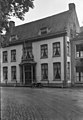
 Gevel woonhuis eind 18e eeuw - Wijk bij Duurstede - 20213385 - RCE.jpg 887 × 1,200; 197 KB
-
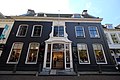
 Historic house, now a confection shop, at Wijk bij Duurstede - panoramio.jpg 3,648 × 2,736; 2.68 MB
-
 Ingangspartij - Wijk bij Duurstede - 20213396 - RCE.jpg 833 × 1,200; 207 KB
-

-

-

-

-

-

-

-

-

-

-

-
-
-

-

-

-

-
-
-
-

-

-

-
-

-

-

-

-

-

-

-

-

-

-
-
-
-

-

-

-

-

-

-
-

-

-

-

-

-

-
 Interieur, kelder - Wijk bij Duurstede - 20379563 - RCE.jpg 1,200 × 794; 156 KB
-
 Interieur, kelder - Wijk bij Duurstede - 20379564 - RCE.jpg 1,200 × 794; 112 KB
-
 Interieur, keuken - Wijk bij Duurstede - 20379565 - RCE.jpg 794 × 1,200; 92 KB
-
 Interieur, keuken - Wijk bij Duurstede - 20379566 - RCE.jpg 794 × 1,200; 93 KB
-
-
 Interieur, keuken, overzicht schouw - Wijk bij Duurstede - 20379569 - RCE.jpg 1,200 × 794; 124 KB
-

-
 Interieur, overzicht keuken met schouw - Wijk bij Duurstede - 20379567 - RCE.jpg 1,200 × 794; 120 KB
-

-

-
 Interieur, tussendeurtje op zolder - Wijk bij Duurstede - 20379558 - RCE.jpg 794 × 1,200; 144 KB
-
 Nederhoff" poortje achterzijde - Wijk bij Duurstede - 20213398 - RCE.jpg 804 × 1,200; 191 KB
-
 Overzicht achter zolder - Wijk bij Duurstede - 20379511 - RCE.jpg 794 × 1,200; 165 KB
-
 Overzicht achter zolder - Wijk bij Duurstede - 20379512 - RCE.jpg 1,200 × 794; 162 KB
-
 Overzicht achter zolder - Wijk bij Duurstede - 20379513 - RCE.jpg 794 × 1,200; 127 KB
-
 Overzicht achtergevel - Wijk bij Duurstede - 20379578 - RCE.jpg 1,200 × 794; 226 KB
-

-

-
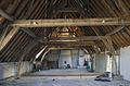
 Overzicht zolder - Wijk bij Duurstede - 20379514 - RCE.jpg 1,200 × 794; 145 KB
-
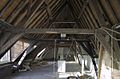
 Overzicht zolder met kapconstructie - Wijk bij Duurstede - 20379510 - RCE.jpg 1,200 × 794; 169 KB
-
 Voorgevel - Wijk bij Duurstede - 20213397 - RCE.jpg 831 × 1,200; 199 KB
-

-
 WbD EF Markt 14+15 RM 39693.JPG 2,288 × 1,712; 985 KB
-
 WbD Monumenten Markt 14 RM 39693.JPG 2,288 × 1,712; 847 KB
-
 Wijk bij Duurstede, Netherlands - panoramio (15).jpg 1,148 × 2,048; 272 KB
-
 Wijk bij Duurstede, Netherlands - panoramio - Ben Bender (30).jpg 4,896 × 3,264; 4.2 MB
-
 Zolder - Wijk bij Duurstede - 20379515 - RCE.jpg 794 × 1,200; 143 KB


_en_de_trap_(links)_-_Wijk_bij_Duurstede_-_20379577_-_RCE.jpg)


.jpg)
.jpg)
