Category:Huize Duinbeek, Oostkapelle
Jump to navigation
Jump to search
| Object location | | View all coordinates using: OpenStreetMap |
|---|
 | |||||
| Upload media | |||||
| Instance of | |||||
|---|---|---|---|---|---|
| Location | Oostkapelle, Zeeland, Netherlands | ||||
| Has part(s) | |||||
| Heritage designation |
| ||||
 | |||||
|
This is a category about rijksmonumentcomplex number 513261
|
Landhuis:
|
This is a category about rijksmonument number 513260
|
Historische tuin- en parkaanleg behorende tot de buitenplaats duinbeek:
|
This is a category about rijksmonument number 513262
|
Koetsierswoning:
|
This is a category about rijksmonument number 513263
|
Tuinmanswoning met bakkeet:
|
This is a category about rijksmonument number 513264
|
Varkenshok:
|
This is a category about rijksmonument number 513265
|
| Address |
|
Media in category "Huize Duinbeek, Oostkapelle"
The following 42 files are in this category, out of 42 total.
-
 Achtergevel met uitkijktorentje - Oostkapelle - 20175412 - RCE.jpg 894 × 1,200; 321 KB
-
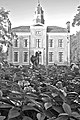
 Achtergevel verzameling, Zeeuws Genootschap - Oostkapelle - 20175426 - RCE.jpg 1,200 × 963; 197 KB
-
 Achtergevel verzameling, Zeeuws Genootschap - Oostkapelle - 20175427 - RCE.jpg 1,200 × 964; 233 KB
-
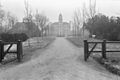 De oprijlaan van Duinbeek, vanaf de weg - Oostkapelle - 20175622 - RCE.jpg 1,200 × 803; 195 KB
-

-
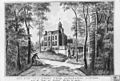
 Duinbeek (zwart-wit).jpg 2,300 × 3,450; 2.28 MB
-
 Duinbeek gracht.JPG 3,008 × 2,000; 5.84 MB
-
 Duinbeek in de steigers - Oostkapelle - 20175413 - RCE.jpg 1,190 × 1,200; 351 KB
-
 Duinbeek in de steigers - Oostkapelle - 20175415 - RCE.jpg 1,185 × 1,200; 434 KB
-
 Duinbeek in de steigers - Oostkapelle - 20175416 - RCE.jpg 1,200 × 1,197; 373 KB
-
 Duinbeek in de steigers- achtergevel - Oostkapelle - 20175414 - RCE.jpg 1,185 × 1,200; 472 KB
-
 Duinbeek in de steigers- rechter zijgevel - Oostkapelle - 20175417 - RCE.jpg 1,190 × 1,200; 432 KB
-
 Duinbeek in de steigers- voorzijde - Oostkapelle - 20175418 - RCE.jpg 1,197 × 1,200; 365 KB
-
 Duinbeek ver.JPG 3,008 × 2,000; 6.06 MB
-
 Duinbeek.jpg 3,008 × 2,000; 882 KB
-
 Interieur linker voorkamer - Oostkapelle - 20175422 - RCE.jpg 1,190 × 1,200; 442 KB
-
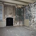
 Interieur linker voorkamer, met schouw - Oostkapelle - 20175423 - RCE.jpg 1,190 × 1,200; 358 KB
-

-

-
-

-
 Interieur- achterwand linker voorkamer - Oostkapelle - 20175442 - RCE.jpg 1,200 × 788; 256 KB
-
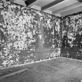
 Interieur- detail achterwand linker voorkamer - Oostkapelle - 20175440 - RCE.jpg 788 × 1,200; 230 KB
-
 Interieur- detail achterwand linker voorkamer - Oostkapelle - 20175443 - RCE.jpg 788 × 1,200; 244 KB
-
-
 Interieur- linker wand in linker voorkamer - Oostkapelle - 20175438 - RCE.jpg 788 × 1,200; 184 KB
-
 Interieur- linker wand in linker voorkamer - Oostkapelle - 20175439 - RCE.jpg 1,200 × 788; 171 KB
-
 Interieur- schouw in linker voorkamer - Oostkapelle - 20175421 - RCE.jpg 1,190 × 1,200; 282 KB
-

-
 Koetshuis - Oostkapelle - 20175420 - RCE.jpg 1,192 × 1,200; 394 KB
-
-
 Overzicht voorgevel met belvedéretoren - Oostkapelle - 20352670 - RCE.jpg 1,185 × 1,200; 408 KB
-

-

-

-
 Verankering in de voorgevel - Oostkapelle - 20175432 - RCE.jpg 1,200 × 788; 303 KB
-
 Verankering in de voorgevel - Oostkapelle - 20175433 - RCE.jpg 1,200 × 788; 268 KB
-
 Verankering in de voorgevel - Oostkapelle - 20175434 - RCE.jpg 1,200 × 779; 190 KB
-
 Verankering in de voorgevel - Oostkapelle - 20175435 - RCE.jpg 1,200 × 781; 249 KB
-
 Verankering in de voorgevel - Oostkapelle - 20175436 - RCE.jpg 1,200 × 788; 231 KB
-
 Verankering in de voorgevel - Oostkapelle - 20175437 - RCE.jpg 1,200 × 788; 286 KB
-
 Voorgevel - Oostkapelle - 20175431 - RCE.jpg 1,200 × 894; 327 KB


.jpg)


