Category:Huize Gerra
Jump to navigation
Jump to search
| Object location | | View all coordinates using: OpenStreetMap |
|---|
 | |||||
| Upload media | |||||
| Instance of | |||||
|---|---|---|---|---|---|
| Part of |
| ||||
| Location | Haaren, Oisterwijk, North Brabant, Netherlands | ||||
| Street address |
| ||||
| Located on street |
| ||||
| Architect | |||||
| Heritage designation |
| ||||
 | |||||
|
This is a category about rijksmonumentcomplex number 517014
|
Pastorie:
|
This is a category about rijksmonument number 517015
|
Kerk:
|
This is a category about rijksmonument number 517016
|
Poortgebouw:
|
This is a category about rijksmonument number 526012
|
Poort:
|
This is a category about rijksmonument number 526013
|
| Address |
|
Media in category "Huize Gerra"
The following 61 files are in this category, out of 61 total.
-
 Begraafplaats in tuin - Haaren - 20370162 - RCE.jpg 1,200 × 956; 426 KB
-
 Binnenplaats hospitium, voor de verbouwing - Haaren - 20370158 - RCE.jpg 1,200 × 1,200; 314 KB
-
 Binnenplaats kapel, voor de verbouwing - Haaren - 20370170 - RCE.jpg 1,200 × 1,200; 304 KB
-
 Geira", voorgevel - Haaren - 20095697 - RCE.jpg 967 × 1,200; 269 KB
-
 Gerra-Haaren.JPG 3,008 × 2,000; 1.88 MB
-
 Hospitium, vanuit het zuid-westen, voor de verbouwing - Haaren - 20370189 - RCE.jpg 1,200 × 1,200; 368 KB
-
 Interieur gang in de kelder - Haaren - 20370443 - RCE.jpg 1,200 × 1,200; 250 KB
-
 Interieur hospitium, deur in hek van ontvangstkamer - Haaren - 20370431 - RCE.jpg 1,200 × 1,200; 246 KB
-
 Interieur hospitium, deur in hek van ontvangstkamer - Haaren - 20370432 - RCE.jpg 1,200 × 1,200; 285 KB
-
 Interieur hospitium, kleine ontvangstkamer - Haaren - 20370434 - RCE.jpg 1,200 × 1,200; 224 KB
-
 Interieur hospitium, luikje in hek van ontvangstkamer - Haaren - 20370430 - RCE.jpg 1,200 × 1,200; 267 KB
-
 Interieur kapel - Haaren - 20370199 - RCE.jpg 1,200 × 1,200; 269 KB
-
 Interieur kapel - Haaren - 20370205 - RCE.jpg 1,200 × 1,200; 353 KB
-
 Interieur kapel, altaar - Haaren - 20370198 - RCE.jpg 1,200 × 1,200; 297 KB
-
 Interieur kapel, glas-in-lood raam - Haaren - 20370451 - RCE.jpg 700 × 1,200; 186 KB
-
 Interieur kapel, overzicht - Haaren - 20370453 - RCE.jpg 794 × 1,200; 215 KB
-
 Interieur kapel, overzicht wand - Haaren - 20370445 - RCE.jpg 798 × 1,200; 250 KB
-
 Interieur kapel, reliekkastje - Haaren - 20370206 - RCE.jpg 1,200 × 1,200; 372 KB
-
 Interieur kapel, zustergedeelte - Haaren - 20370452 - RCE.jpg 869 × 1,200; 225 KB
-
 Interieur kelder - Haaren - 20370441 - RCE.jpg 1,200 × 1,200; 249 KB
-
 Interieur keuken - Haaren - 20370437 - RCE.jpg 1,200 × 1,200; 198 KB
-
 Interieur overzicht keuken - Haaren - 20370444 - RCE.jpg 1,200 × 1,200; 183 KB
-
 Interieur villa, keuken in kelder - Haaren - 20370204 - RCE.jpg 1,200 × 1,200; 148 KB
-
 Interieur wasruimte - Haaren - 20370438 - RCE.jpg 1,200 × 1,200; 218 KB
-
 Interieur wasruimte - Haaren - 20370440 - RCE.jpg 1,200 × 1,200; 200 KB
-
 Interieur, gang in hospitium - Haaren - 20370203 - RCE.jpg 1,200 × 1,200; 130 KB
-
 Interieur, gang op de bel-etage - Haaren - 20370191 - RCE.jpg 1,200 × 1,200; 161 KB
-
 Interieur, grote bezoekkamer met hek - Haaren - 20370202 - RCE.jpg 1,200 × 1,200; 244 KB
-
 Interieur, grote bezoekkamer zusters - Haaren - 20370200 - RCE.jpg 1,200 × 1,200; 214 KB
-
 Interieur, kamer op de bel-etage met stucplafond - Haaren - 20370192 - RCE.jpg 1,200 × 1,200; 209 KB
-
 Interieur, kamer op de bel-etage met stucplafond en schouw - Haaren - 20370193 - RCE.jpg 1,200 × 1,200; 211 KB
-
 Interieur, kamer op de bel-etage, naast kapel - Haaren - 20370195 - RCE.jpg 1,200 × 1,200; 142 KB
-
 Interieur, overzicht gang naar kapel - Haaren - 20370424 - RCE.jpg 1,200 × 1,200; 139 KB
-
 Interieur, overzicht gang naar kapel - Haaren - 20370425 - RCE.jpg 1,200 × 1,200; 153 KB
-
 Interieur, overzicht kapel - Haaren - 20370423 - RCE.jpg 1,200 × 1,200; 274 KB
-
 Interieur, overzicht voorraadkelder - Haaren - 20370429 - RCE.jpg 1,200 × 1,200; 153 KB
-
 Interieur, sacristie pastoor - Haaren - 20370426 - RCE.jpg 1,200 × 1,200; 158 KB
-
 Interieur, sacristie zustergedeelte - Haaren - 20370428 - RCE.jpg 1,200 × 1,200; 121 KB
-
 Kapelletje in tuin - Haaren - 20370181 - RCE.jpg 1,200 × 1,200; 433 KB
-
 Moestuin - Haaren - 20370165 - RCE.jpg 1,200 × 1,200; 424 KB
-
 Moestuin - Haaren - 20370166 - RCE.jpg 1,200 × 956; 304 KB
-
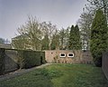
 Ommuring zuidgevel hospitium - Haaren - 20370179 - RCE.jpg 1,200 × 1,200; 363 KB
-
 Ommuring zuidgevel hospitium - Haaren - 20370180 - RCE.jpg 1,200 × 1,200; 493 KB
-
 Overzicht binnenplaats hospitium, voor de verbouwing - Haaren - 20370157 - RCE.jpg 1,200 × 1,200; 455 KB
-

-
 Overzicht noordgevel hospitium, voor de verbouwing - Haaren - 20370184 - RCE.jpg 1,200 × 1,200; 483 KB
-
 Overzicht noordgevel kapel voor de verbouwing - Haaren - 20370168 - RCE.jpg 1,200 × 956; 349 KB
-

-
 Overzicht oostgevel hospitium, voor de verbouwing - Haaren - 20370186 - RCE.jpg 1,200 × 1,199; 396 KB
-
 Overzicht tuin - Haaren - 20370176 - RCE.jpg 1,200 × 1,200; 454 KB
-
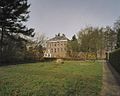 Overzicht villa vanuit de tuin - Haaren - 20370164 - RCE.jpg 1,200 × 956; 292 KB
-

-
 Overzicht westgevel kapel voor de verbouwing - Haaren - 20370167 - RCE.jpg 1,200 × 956; 360 KB
-

-

-
 Overzicht zuidgevel kapel, voor de verbouwing - Haaren - 20370172 - RCE.jpg 1,200 × 956; 259 KB
-
 Stal achter hospitium, voor de verbouwing - Haaren - 20370160 - RCE.jpg 1,200 × 956; 357 KB
-
 Tuin richting oosten - Haaren - 20370161 - RCE.jpg 1,200 × 1,200; 456 KB
-
 Vijver in de tuin - Haaren - 20370190 - RCE.jpg 1,200 × 1,200; 500 KB
-
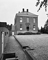
 Voorgevel villa, voor de verbouwing - Haaren - 20370159 - RCE.jpg 1,200 × 956; 252 KB
-
 Wandelpad in de tuin - Haaren - 20370175 - RCE.jpg 1,200 × 1,200; 531 KB


