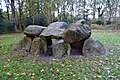
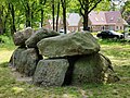
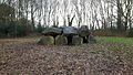
Category:Hunebed D06 in Tynaarlo
Jump to navigation
Jump to search
| Object location | | View all coordinates using: OpenStreetMap |
|---|
dolmen in the Netherlands  | |||||
| Upload media | |||||
| Instance of | |||||
|---|---|---|---|---|---|
| Part of | |||||
| Location | Tynaarlo, Drenthe, Netherlands | ||||
| Street address |
| ||||
| Located on street |
| ||||
| Heritage designation |
| ||||
| Different from | |||||
 | |||||
|
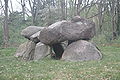
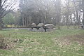
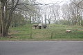
This is a category about rijksmonument number 467470
|
| Address |
|
Media in category "Hunebed D06 in Tynaarlo"
The following 26 files are in this category, out of 26 total.
-
 20171031 Hunebed D6 Tynaarlo1.jpg 2,592 × 1,728; 1.2 MB
-
 20171031 Hunebed D6 Tynaarlo2.jpg 2,592 × 1,728; 1.18 MB
-
 Bueninck - The Heath and Hunebed at Tinaarloo.png 2,092 × 1,557; 3.9 MB
-
 D 6 - Hunebed bij Tynaarlo (Drenthe).jpg 1,374 × 1,031; 1.07 MB
-
 D6 2016.jpg 4,608 × 2,592; 7.96 MB
-

-
 Het hunebed van Tynaarlo1 1861 door Willem Roelofs (1822-1897).jpg 3,024 × 2,246; 3.28 MB
-
 Het hunebed van Tynaarlo2 1861 door Willem Roelofs (1822-1897).jpg 2,625 × 1,796; 2.08 MB
-
 Hunebed bij Tynaarlo, RP-T-1988-92.jpg 5,020 × 3,478; 3.05 MB
-
 Hunebed D6 - 1.JPG 4,272 × 2,848; 5.14 MB
-
 Hunebed D6 - 2.JPG 4,272 × 2,848; 5.34 MB
-
 Hunebed D6 - 3.JPG 4,272 × 2,848; 5.81 MB
-
 Hunebed D6 - 4.JPG 4,272 × 2,848; 4.44 MB
-
 Hunebed D6 - 5.JPG 4,272 × 2,848; 5.17 MB
-
 Hunebed D6 - 6.JPG 4,272 × 2,848; 4.89 MB
-
 Hunebed D6 - 7.JPG 4,272 × 2,848; 5.98 MB
-
 Hunebed D6 - 8.JPG 4,272 × 2,848; 4.85 MB
-
 Hunebed D6 - 9.JPG 4,272 × 2,848; 5.21 MB
-

-
 Hunebed D6 bij Tynaarlo.jpg 1,296 × 786; 248 KB
-
 Hunebed D6 Ver Huell 2.png 745 × 527; 630 KB
-
 Hunebed D6 Ver Huell.png 468 × 363; 188 KB
-
 Hunebed te Tynaarlo Hunnebed te Tinaarloo (titel op object), RP-P-OB-23.456.jpg 2,778 × 4,276; 2.26 MB
-

-
 Hunnebed D 6-Tynaarlo.jpg 4,160 × 3,120; 5.61 MB
-
 Willem Roelofs Hunebed Tynaarlo.jpg 525 × 319; 25 KB


.jpg)

,_RP-P-OB-52.415.jpg)
.jpg)
.jpg)


_Aardrijkskundige_beeldengalerij,_verzameld_door_M.J._Broekhuijsen,_hoofd_eener_school_te_Amsterdam_(serietitel_op_object)_Collectie_A_(serietitel_op_object),_RP-F-F11914.jpg)


,_RP-P-OB-23.456.jpg)
_Album_van_den_Nederlandschen_spectator_No_3_(serietitel),_RP-P-OB-29.527.jpg)

