Category:Hunebed D43 in Emmen Schimmeres
Jump to navigation
Jump to search
| Object location | | View all coordinates using: OpenStreetMap |
|---|
dolmen in the Netherlands  | |||||
| Upload media | |||||
| Instance of | |||||
|---|---|---|---|---|---|
| Part of | |||||
| Location | Emmen, Drenthe, Netherlands | ||||
| Located on street |
| ||||
| Heritage designation |
| ||||
 | |||||
|
This is a category about rijksmonument number 45371
|
| Address |
|
Media in category "Hunebed D43 in Emmen Schimmeres"
The following 34 files are in this category, out of 34 total.
-
 Emmen Municipality.JPG 1,920 × 1,080; 1.36 MB
-
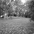
 Exterieur overzicht hunebed - Emmen - 20321497 - RCE.jpg 1,193 × 1,200; 513 KB
-
-
 Holwerda Hunebed D43 Entrance North.png 627 × 428; 48 KB
-
 Holwerda Hunebed D43 Entrance South.png 342 × 460; 49 KB
-
 Holwerda Hunebed D43 Plan.png 1,035 × 526; 398 KB
-
 Holwerda Hunebed D43 Section A.png 433 × 170; 32 KB
-
 Holwerda Hunebed D43 Section C.png 483 × 132; 25 KB
-
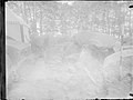
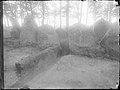
 Hunebed D43 Excavation 01.jpg 2,000 × 1,494; 486 KB
-
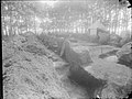
 Hunebed D43 Excavation 04.jpg 2,000 × 1,496; 712 KB
-
 Hunebed D43 Excavation 05.jpg 2,000 × 1,505; 469 KB
-
 Hunebed D43 Excavation 06.jpg 2,000 × 1,497; 629 KB
-
 Hunebed D43 Excavation 07.jpg 2,000 × 1,500; 370 KB
-
 Hunebed D43 Excavation 08.jpg 2,000 × 1,500; 568 KB
-
 Hunebed D43 Excavation 09.jpg 2,000 × 1,494; 345 KB
-
 Hunebed D43 Excavation 10.jpg 2,000 × 1,500; 650 KB
-
 Hunebed D43 Excavation 11.jpg 2,000 × 1,500; 615 KB
-
 Hunebed D43 Excavation 12.jpg 2,000 × 1,500; 685 KB
-
 Hunebed D43 Excavation 13.jpg 2,000 × 1,495; 607 KB
-
 Hunebed D43 Excavation 14.jpg 2,000 × 1,511; 338 KB
-
 Hunebed D43 Excavation 15.jpg 2,000 × 1,499; 561 KB
-
 Hunebed D43 Excavation 16.jpg 2,000 × 1,509; 697 KB
-
 Hunebed D43 Excavation 17.jpg 2,000 × 1,500; 489 KB
-
 Hunebed D43 Excavation 18.jpg 2,000 × 1,500; 777 KB
-
 Hunebed D43 Excavation 19.jpg 2,000 × 1,500; 312 KB
-
 Hunebed D43 Goedeljee.jpg 2,000 × 1,544; 577 KB
-
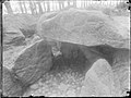
 Hunebed D43 in Emmen Schimmeres.jpg 4,032 × 3,024; 5.59 MB
-
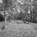
 Hunebed D43 langgraf op de Emmer-esch.jpg 1,296 × 972; 296 KB
-
 Hunebed D43 v2.jpg 4,032 × 3,024; 5.03 MB
-
 Hunedbed D43 Emmen-1.JPG 3,648 × 2,736; 2.35 MB
-
 Hunedbed D43 Emmen-2.JPG 3,648 × 2,736; 2.38 MB
-
 Hunedbed D43 Emmen-3.JPG 3,648 × 2,736; 1.99 MB
-
 Noordelijke grafkamer D43.jpg 5,312 × 2,988; 8.44 MB
-
 Zuidelijke grafkamer D43.jpg 5,312 × 2,988; 8.81 MB


