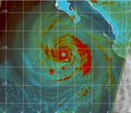
Category:Hurricane Dolores (2015)
Jump to navigation
Jump to search
Category 4 Pacific hurricane in 2015 | |||||
| Upload media | |||||
| Instance of |
| ||||
|---|---|---|---|---|---|
| Part of | |||||
| Location | North-East Pacific Ocean | ||||
| Start time |
| ||||
| End time |
| ||||
| Part of the series |
| ||||
| |||||
Media in category "Hurricane Dolores (2015)"
The following 27 files are in this category, out of 27 total.
-
05E 2015 5day.GIF 895 × 716; 20 KB
-
Dolores 2015 track.png 3,000 × 2,020; 3.79 MB
-
Dolores 2015-07-11 1640Z.jpg 3,760 × 5,537; 1.74 MB
-
Dolores 2015-07-11 1945Z.jpg 4,577 × 7,025; 3.26 MB
-
Dolores 2015-07-12 1725Z.jpg 6,400 × 8,400; 8.39 MB
-
Dolores 2015-07-12 2030Z.jpg 5,473 × 7,025; 3.83 MB
-
Dolores 2015-07-13 1805Z.jpg 4,785 × 6,289; 2.49 MB
-
Dolores 2015-07-14 2015Z.jpg 6,400 × 8,400; 7.76 MB
-
Dolores 2015-07-15 1445Z.png 2,048 × 1,152; 3.17 MB
-
Dolores 2015-07-15 1755Z (gallery).jpg 7,200 × 9,400; 10.66 MB
-
Dolores 2015-07-15 1755Z.jpg 6,400 × 8,000; 7.58 MB
-
Dolores 2015-07-15 2100Z.jpg 5,025 × 7,617; 3.52 MB
-
Dolores 2015-07-16 1835Z.jpg 4,209 × 5,281; 2.25 MB
-
Dolores 2015-07-17 2050Z.jpg 4,209 × 5,729; 2.34 MB
-
Dolores 2015-07-18 1825Z.jpg 5,073 × 7,665; 3.97 MB
-
Dolores 2015-07-18 2130Z.jpg 5,073 × 7,361; 3.74 MB
-
Dolores lightning strike map in Southern California.jpg 780 × 556; 190 KB
-
Dolores rainfall loop in the Southwestern US.gif 1,000 × 800; 3.33 MB
-
Dolores.a2015196.1755.1km.webp 1,800 × 2,350; 1.1 MB
-
Hurricane Dolores (2015) IR.png 1,074 × 718; 1.13 MB
-
Hurricane Dolores (2015) rainfall map.png 1,075 × 669; 757 KB
-
Hurricane Dolores car wreck rear view.jpg 1,024 × 768; 96 KB
-
Hurricane Dolores car wreck.jpg 1,024 × 576; 101 KB
-
Hurricane Dolores microwave image.png 956 × 829; 806 KB
-
Hurricane Dolores peak VIIRS image, at 0902 UTC on July 15, 2015.png 837 × 513; 446 KB
-
Hurricane Dolores underpass flash flooding.jpg 1,024 × 768; 91 KB
-
Moon and Dolores comparison.png 2,826 × 1,674; 4.52 MB


