Category:Hutton, Lancashire
Jump to navigation
Jump to search
English: Hutton is a village and civil parish in Lancashire, England. It is located to the south west of Preston in South Ribble borough and parliamentary constituency. The village is bypassed by the A59 Preston to Liverpool road. The village is to the west of the road, and to the east towards New Longton, is the location of the Lancashire Constabulary headquarters.
village and civil parish in Lancashire, England  | |||||
| Upload media | |||||
| Instance of | |||||
|---|---|---|---|---|---|
| Location | South Ribble, Lancashire, North West England, England | ||||
| Located in or next to body of water | |||||
 | |||||
Media in category "Hutton, Lancashire"
The following 121 files are in this category, out of 121 total.
-
 A bend in Ratten Lane - geograph.org.uk - 4257253.jpg 640 × 480; 87 KB
-
 A farm track leaves the Ribble Way - geograph.org.uk - 3940956.jpg 4,320 × 2,875; 6.32 MB
-
 A footbridge out of the wood and into the park - geograph.org.uk - 3652817.jpg 4,456 × 3,056; 7.72 MB
-
 A footpath off Lindle Lane Bamford's Wood - geograph.org.uk - 3652687.jpg 4,592 × 3,056; 6.99 MB
-
 A pair of shelduck (Tadorna tadorna) - geograph.org.uk - 3940870.jpg 2,360 × 2,150; 3.67 MB
-
 A pond or lagoon - geograph.org.uk - 3793846.jpg 4,557 × 3,033; 6.42 MB
-
 A59 approaching Hutton - geograph.org.uk - 2974191.jpg 640 × 482; 59 KB
-
 A59 by junction with Ratten Lane - geograph.org.uk - 2974196.jpg 800 × 537; 101 KB
-
 An eyesore on the Ribble Way - geograph.org.uk - 5187323.jpg 4,608 × 3,456; 3.48 MB
-
 Anchor Drive, Hutton - geograph.org.uk - 3275101.jpg 1,600 × 1,067; 293 KB
-
 Approaching the A59 - geograph.org.uk - 4257255.jpg 640 × 480; 103 KB
-
 Beware of the bull - geograph.org.uk - 3941269.jpg 4,278 × 2,846; 7.31 MB
-
 Boats on the River Ribble - geograph.org.uk - 3940912.jpg 4,199 × 2,795; 7.26 MB
-
 Bring your own wellingtons - geograph.org.uk - 3275097.jpg 2,000 × 1,333; 2.78 MB
-
 Bus stop on Pope Lane - geograph.org.uk - 5955031.jpg 640 × 480; 51 KB
-
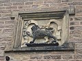 Carving on Penwortham Priory Lodge - geograph.org.uk - 158039.jpg 640 × 480; 102 KB
-
 Cockerton Farm - geograph.org.uk - 3981422.jpg 4,608 × 2,827; 6.05 MB
-
 Course of Old Railway - geograph.org.uk - 6153628.jpg 800 × 600; 1.18 MB
-
 Cow and JCB at Dungeon Farm - geograph.org.uk - 3981404.jpg 3,983 × 2,854; 5.8 MB
-
 Cycle path beside Liverpool Road (A59) - geograph.org.uk - 4257256.jpg 640 × 480; 107 KB
-
 Electric grid Station - geograph.org.uk - 141127.jpg 640 × 480; 86 KB
-
 End of Grange Lane - geograph.org.uk - 4968738.jpg 640 × 481; 100 KB
-
 End of the rainbow - geograph.org.uk - 4257252.jpg 640 × 480; 71 KB
-
 Entering Hutton - geograph.org.uk - 4257233.jpg 640 × 480; 76 KB
-
 Farmland north of Ratten Lane - geograph.org.uk - 4257251.jpg 640 × 480; 39 KB
-
 Farrers Farm, Longton - geograph.org.uk - 2175157.jpg 640 × 480; 137 KB
-
 Field entrance off Pope Lane - geograph.org.uk - 5955022.jpg 640 × 480; 82 KB
-
 Flotsam and jetsam - geograph.org.uk - 3940802.jpg 4,592 × 3,056; 6.17 MB
-
 Footpath from The Bottom of Hutton to Hutton and Longton - geograph.org.uk - 3949677.jpg 4,502 × 2,861; 7.95 MB
-
 Footpath Near Hutton - geograph.org.uk - 6068031.jpg 640 × 423; 125 KB
-
 Gate into Field south of Lindle Lane - geograph.org.uk - 6153638.jpg 800 × 533; 769 KB
-
 Grange Lane at Farrers Farm - geograph.org.uk - 4968730.jpg 640 × 480; 93 KB
-
 Grange Lane, Longton - geograph.org.uk - 2175154.jpg 584 × 438; 89 KB
-
 Grazing off Liverpool Road, Hutton - geograph.org.uk - 4257235.jpg 640 × 480; 57 KB
-
 Green Lane - geograph.org.uk - 3642938.jpg 4,592 × 3,056; 6.17 MB
-
 Houses in Hutton - geograph.org.uk - 4257246.jpg 640 × 480; 49 KB
-
 Houses on Liverpool Road, Hutton - geograph.org.uk - 4257242.jpg 640 × 411; 62 KB
-
 Houses on Pope Lane - geograph.org.uk - 5955030.jpg 640 × 480; 42 KB
-
 Hutton Grammar School cricket field - geograph.org.uk - 158041.jpg 640 × 480; 129 KB
-
 Hutton Marsh - geograph.org.uk - 3941355.jpg 4,073 × 2,710; 6.54 MB
-
 Hutton, Liverpool Road - geograph.org.uk - 6153945.jpg 800 × 533; 708 KB
-
 Hutton, Liverpool Road - geograph.org.uk - 6153954.jpg 800 × 533; 714 KB
-

-

-
 Lindle Lane - geograph.org.uk - 6153620.jpg 800 × 533; 845 KB
-
 Liverpool Road at Hutton boundary - geograph.org.uk - 4968711.jpg 640 × 480; 62 KB
-
 Liverpool Road, Hutton - geograph.org.uk - 4257236.jpg 640 × 480; 62 KB
-
 Liverpool Road, Hutton - geograph.org.uk - 4257244.jpg 640 × 480; 60 KB
-
 Liverpool Road, Hutton - geograph.org.uk - 4968714.jpg 640 × 480; 61 KB
-
 Longton Brook - geograph.org.uk - 3652943.jpg 4,592 × 3,056; 7.1 MB
-
 Longton Brook - geograph.org.uk - 3788386.jpg 1,600 × 1,065; 636 KB
-
 Longton Marsh - geograph.org.uk - 3282871.jpg 2,560 × 1,920; 3.21 MB
-
 Longton stocks - geograph.org.uk - 158064.jpg 640 × 480; 122 KB
-
 Mill Brook - geograph.org.uk - 6067970.jpg 640 × 445; 81 KB
-
 Mill Brook Enters The Ribble - geograph.org.uk - 6067948.jpg 640 × 422; 68 KB
-
 Mill Brow Farm - geograph.org.uk - 6068039.jpg 640 × 426; 77 KB
-
 Millennium Ribble Link At Low Tide - geograph.org.uk - 3282939.jpg 2,560 × 1,920; 3.43 MB
-
 New Longton Village Hall - geograph.org.uk - 4574931.jpg 640 × 481; 420 KB
-
 Path into Woodland off Lindle Lane - geograph.org.uk - 6153631.jpg 800 × 600; 1.11 MB
-
 Path, ditch and hedge - geograph.org.uk - 3792860.jpg 4,263 × 2,837; 7.25 MB
-
 Pope Lane towards White Stake - geograph.org.uk - 5955028.jpg 640 × 480; 96 KB
-
 Power lines and a bare tree - geograph.org.uk - 3949637.jpg 4,592 × 3,056; 7.65 MB
-
 Ratten Lane - geograph.org.uk - 3949605.jpg 640 × 433; 92 KB
-
 Ratten Lane - geograph.org.uk - 3981428.jpg 4,251 × 2,461; 3.7 MB
-
 Ratten Lane - geograph.org.uk - 4968765.jpg 640 × 480; 96 KB
-
 Ratten Lane at A59 junction - geograph.org.uk - 4968769.jpg 640 × 480; 108 KB
-
 Ratten Lane Junction - geograph.org.uk - 6068036.jpg 640 × 424; 99 KB
-
 Ratten Lane near Sherdley Farm - geograph.org.uk - 4968756.jpg 640 × 480; 89 KB
-
 Ratten Lane with the footpath to Hutton showing - geograph.org.uk - 3949468.jpg 4,494 × 2,991; 7.56 MB
-
 Ratten Lane, Hutton - geograph.org.uk - 2175148.jpg 640 × 480; 104 KB
-
 Ratten Lane, Hutton - geograph.org.uk - 4257249.jpg 640 × 480; 56 KB
-
 Ribble Way looking toward the sea - geograph.org.uk - 5187343.jpg 4,608 × 3,456; 3.22 MB
-
 River Ribble - geograph.org.uk - 6067975.jpg 640 × 437; 70 KB
-
 Road to Westlands Farm - geograph.org.uk - 2175159.jpg 608 × 456; 146 KB
-

-
 Skip Lane - geograph.org.uk - 3981406.jpg 4,370 × 2,914; 4.55 MB
-
 Skip Lane, Hutton - geograph.org.uk - 2175142.jpg 640 × 480; 140 KB
-
 Skip Lane, Hutton - geograph.org.uk - 2175145.jpg 640 × 480; 113 KB
-
 Skip Lane, Hutton - geograph.org.uk - 4257247.jpg 640 × 480; 76 KB
-
 Skip Lane-Ratten Lane junction - geograph.org.uk - 4968719.jpg 640 × 480; 61 KB
-
 Sunset over Longton Marsh - geograph.org.uk - 3793992.jpg 4,381 × 2,916; 7.61 MB
-
 Sunset over Longton Marsh - geograph.org.uk - 3794956.jpg 4,350 × 2,895; 7.07 MB
-
 The A59 approach to a roundabout at Hutton - geograph.org.uk - 3077055.jpg 1,600 × 1,198; 411 KB
-
 The A59 Liverpool Road - geograph.org.uk - 3981433.jpg 4,491 × 2,804; 5.13 MB
-
 The Anchor - a pub with no food - geograph.org.uk - 3652991.jpg 4,248 × 2,515; 5.41 MB
-
 The Anchor at Hutton - geograph.org.uk - 3981438.jpg 4,463 × 2,660; 4.34 MB
-
 The Anchor Inn, Hutton - geograph.org.uk - 6153950.jpg 800 × 533; 558 KB
-
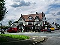 The Anchor, 88 Liverpool Road, Hutton - geograph.org.uk - 872649.jpg 640 × 480; 86 KB
-
 The junction of Ratten Lane and Skip Lane - geograph.org.uk - 3949501.jpg 4,592 × 3,056; 7.63 MB
-
 The lagoon looks empty or just full of a muddy slurry - geograph.org.uk - 3943161.jpg 4,450 × 2,962; 5.76 MB
-

-
 The Ribble Way crosses the track from Westlands Farm - geograph.org.uk - 3793587.jpg 4,439 × 2,898; 7.86 MB
-
 The River Ribble at low tide - geograph.org.uk - 407867.jpg 640 × 480; 85 KB
-
 The start of Bamford's Wood - geograph.org.uk - 3652734.jpg 3,756 × 2,845; 5.69 MB
-

-
 Three trees - geograph.org.uk - 613050.jpg 640 × 412; 193 KB
-
 Track across Hutton Marsh - geograph.org.uk - 3941334.jpg 4,255 × 2,832; 7.77 MB
-
 Track off Grange Lane - geograph.org.uk - 2175153.jpg 640 × 480; 128 KB
-
 Unusual Building - geograph.org.uk - 3282908.jpg 2,554 × 1,821; 3.18 MB
-
 View Across The River Ribble - geograph.org.uk - 3282928.jpg 2,560 × 1,920; 2.29 MB
-
 Walking The Ribble Way Near Longton - geograph.org.uk - 3282894.jpg 2,560 × 1,920; 3.24 MB
-

-
 Wild geese - geograph.org.uk - 3792900.jpg 4,592 × 3,056; 7.01 MB
-
 You can't escape the bank holiday crowds^ - geograph.org.uk - 3940931.jpg 4,592 × 3,056; 7.79 MB
-
 Dungeon Farm - geograph.org.uk - 158048.jpg 640 × 480; 74 KB
-
 Edge of Hutton Marsh - geograph.org.uk - 226793.jpg 640 × 480; 100 KB
-
 End of track off Howick Cross Lane - geograph.org.uk - 669710.jpg 640 × 480; 152 KB
-
 Lancashire Constabulary headquarters - geograph.org.uk - 158034.jpg 640 × 480; 79 KB
-
 Longton Brook - geograph.org.uk - 158051.jpg 640 × 480; 156 KB
-

-

-
 Mill Brow Farm - geograph.org.uk - 158043.jpg 640 × 480; 78 KB
-
 New House equestrian centre - geograph.org.uk - 158067.jpg 640 × 480; 66 KB
-
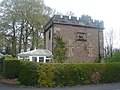 Penwortham Priory Lodge - geograph.org.uk - 158036.jpg 640 × 480; 123 KB
-
 Private road but public footpath - geograph.org.uk - 669703.jpg 640 × 480; 229 KB
-

-
 Sherdley Farm - geograph.org.uk - 158045.jpg 640 × 480; 96 KB
-
 Short track off Howick Cross Lane - geograph.org.uk - 669714.jpg 640 × 480; 127 KB
-
 Townley Lane, Howick Cross - geograph.org.uk - 669719.jpg 640 × 480; 216 KB
-

-
 Wholesome Farm - geograph.org.uk - 158029.jpg 640 × 480; 72 KB


_-_geograph.org.uk_-_3940870.jpg)


_-_geograph.org.uk_-_4257256.jpg)


