Category:Hythe and Dibden
Vai alla navigazione
Vai alla ricerca
civil parish in New Forest, Hampshire, England | |||||
| Carica un file multimediale | |||||
| Istanza di | |||||
|---|---|---|---|---|---|
| Luogo | New Forest, Hampshire, Sud Est dell'Inghilterra, Inghilterra | ||||
| Popolazione |
| ||||
 | |||||
Sottocategorie
Questa categoria contiene le 3 sottocategorie indicate di seguito, su un totale di 3.
D
H
File nella categoria "Hythe and Dibden"
Questa categoria contiene 200 file, indicati di seguito, su un totale di 351.
(pagina precedente) (pagina successiva)-
 A326 north of Applemore roundabout - geograph.org.uk - 4235956.jpg 640 × 480; 53 KB
-
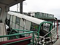
 Aboard the Hythe Pier Train - geograph.org.uk - 5659705.jpg 1 280 × 851; 314 KB
-
 AIDA prima - geograph.org.uk - 6156713.jpg 3 264 × 2 448; 1,55 MB
-
 All aboard - Hythe, Hampshire - geograph.org.uk - 4049116.jpg 3 072 × 2 304; 1,52 MB
-
 All change please - Hythe, Hampshire - geograph.org.uk - 4049112.jpg 3 072 × 2 304; 1,96 MB
-
 All Saints Church, Dibden - geograph.org.uk - 5939261.jpg 1 024 × 683; 196 KB
-
 Allotments at Claypits Lane - geograph.org.uk - 2819541.jpg 640 × 480; 117 KB
-
 Allotments beside School Lane - geograph.org.uk - 2819532.jpg 640 × 480; 114 KB
-
 Along the footpath by the Railway Line - geograph.org.uk - 2839946.jpg 768 × 1 024; 441 KB
-
 Approach to Lord Nelson - geograph.org.uk - 4152781.jpg 1 600 × 1 063; 421 KB
-
 Approaching Hythe Pier - geograph.org.uk - 5660340.jpg 1 280 × 851; 280 KB
-
 Arnwood Avenue - geograph.org.uk - 2357956.jpg 640 × 480; 50 KB
-
 Back into the National Park - geograph.org.uk - 5907552.jpg 1 600 × 1 067; 727 KB
-
 Beach in front of Netley Castle - geograph.org.uk - 4501850.jpg 1 600 × 1 066; 207 KB
-
 Beacons at the Crossing - geograph.org.uk - 5910221.jpg 3 456 × 5 184; 3,4 MB
-
 Beaulieu Road, Hythe - geograph.org.uk - 4989401.jpg 1 600 × 1 200; 665 KB
-
 Beaulieu Road, Hythe - geograph.org.uk - 4989418.jpg 1 600 × 1 200; 572 KB
-
 Black-headed gulls on Hythe Promenade - geograph.org.uk - 4078392.jpg 640 × 480; 240 KB
-

-
 Boardwalk along The Promenade - geograph.org.uk - 5910207.jpg 5 184 × 3 456; 3,41 MB
-
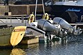
 Boat Lift - geograph.org.uk - 3741922.jpg 1 600 × 1 200; 416 KB
-
 Boat sterns and outboard motors - geograph.org.uk - 5939264.jpg 1 024 × 683; 184 KB
-
 Boats alongside pier at Hythe - geograph.org.uk - 4835463.jpg 640 × 427; 48 KB
-

-
 Butts Ash electricity substation - geograph.org.uk - 515944.jpg 640 × 435; 190 KB
-
 Butts Ash electricity substation - geograph.org.uk - 515950.jpg 640 × 433; 184 KB
-
 Butts Ash Gardens - geograph.org.uk - 2357845.jpg 640 × 480; 64 KB
-
 Butts Ash Lane - geograph.org.uk - 2357966.jpg 640 × 480; 82 KB
-
 Butts Ash, Forest Front - geograph.org.uk - 4574305.jpg 1 024 × 768; 305 KB
-
 Butts Ash, Forest Front - geograph.org.uk - 4574362.jpg 1 024 × 768; 293 KB
-
 Butts Ash, gateway - geograph.org.uk - 4574389.jpg 1 024 × 768; 198 KB
-
 Butts Ash, heathland - geograph.org.uk - 4574282.jpg 1 024 × 768; 233 KB
-
 Butts Ash, heathland - geograph.org.uk - 4574370.jpg 4 608 × 3 456; 2 MB
-
 Butts Ash, path - geograph.org.uk - 4574258.jpg 1 024 × 768; 289 KB
-
 Butts Ash, play area - geograph.org.uk - 4574375.jpg 1 024 × 768; 160 KB
-
 Butts Ash, pond - geograph.org.uk - 4574271.jpg 1 024 × 768; 221 KB
-
 Butts Ash, skatepark - geograph.org.uk - 4574383.jpg 1 024 × 768; 160 KB
-
 Butts Ash, The Glen - geograph.org.uk - 4574249.jpg 1 024 × 768; 253 KB
-
 Butts Ash, woodland - geograph.org.uk - 4574295.jpg 768 × 1 024; 362 KB
-

-
 Car wash, Hythe - geograph.org.uk - 5139861.jpg 640 × 428; 145 KB
-
 Cavalier Close, Dibden - geograph.org.uk - 5907531.jpg 5 184 × 3 456; 3,06 MB
-
 Chaloner Crescent - geograph.org.uk - 2357840.jpg 640 × 480; 53 KB
-

-
 Coastal Marsh, Hythe - geograph.org.uk - 2357781.jpg 640 × 480; 59 KB
-
 Coastal marsh, Hythe - geograph.org.uk - 2357788.jpg 640 × 480; 68 KB
-
 Coming to get you - geograph.org.uk - 4052330.jpg 1 280 × 864; 220 KB
-
 Conmar Gulf - geograph.org.uk - 5046756.jpg 640 × 481; 429 KB
-
 Container ship in Southampton Water - geograph.org.uk - 4078396.jpg 640 × 480; 311 KB
-
 Container Ship Leaving Southampton Docks - geograph.org.uk - 5046562.jpg 640 × 481; 416 KB
-
 Cruise liner in Southampton Water - geograph.org.uk - 4078399.jpg 640 × 480; 296 KB
-
 Deans Elbow marker buoy by Solent Refit's pier - geograph.org.uk - 5482388.jpg 1 500 × 1 125; 139 KB
-
 Deans Elbow marker buoy near Hythe - geograph.org.uk - 5481218.jpg 1 500 × 1 068; 115 KB
-

-
 Dibden Purlieu, The Heath - geograph.org.uk - 4579995.jpg 1 024 × 764; 173 KB
-
 Disembarking from the Hythe Ferry - geograph.org.uk - 4045001.jpg 1 280 × 960; 186 KB
-
 Drainage Ditch from Tates Copse - geograph.org.uk - 2839932.jpg 1 200 × 1 600; 958 KB
-
 Eastern docks at Southampton - geograph.org.uk - 3169141.jpg 4 752 × 3 168; 2,65 MB
-
 Eastern Docks, Southampton - geograph.org.uk - 3323235.jpg 640 × 480; 59 KB
-
 End of Malwood Road, Hythe - geograph.org.uk - 4989445.jpg 1 600 × 1 200; 583 KB
-
 End of the line - geograph.org.uk - 4052396.jpg 1 280 × 960; 256 KB
-
 Entrance to Hythe Marina Village - geograph.org.uk - 3131563.jpg 3 473 × 2 620; 1,92 MB
-
 Eve of AGM 2014 Geographers 1 - Hythe, Hampshire - geograph.org.uk - 4126102.jpg 3 072 × 2 304; 1,89 MB
-
 Eve of AGM 2014 Geographers 10 - Hythe, Hampshire - geograph.org.uk - 4126228.jpg 3 072 × 2 304; 1,96 MB
-
 Eve of AGM 2014 Geographers 11 - Hythe, Hampshire - geograph.org.uk - 4126236.jpg 3 072 × 2 304; 2,03 MB
-
 Eve of AGM 2014 Geographers 2 - Hythe, Hampshire - geograph.org.uk - 4126116.jpg 3 072 × 2 304; 1,98 MB
-
 Eve of AGM 2014 Geographers 3 - Hythe, Hampshire - geograph.org.uk - 4126134.jpg 3 072 × 2 304; 2,11 MB
-
 Eve of AGM 2014 Geographers 4 - Hythe, Hampshire - geograph.org.uk - 4126147.jpg 3 072 × 2 304; 2,02 MB
-
 Eve of AGM 2014 Geographers 5 - Hythe, Hampshire - geograph.org.uk - 4126158.jpg 3 072 × 2 304; 1,94 MB
-
 Eve of AGM 2014 Geographers 6 - Hythe, Hampshire - geograph.org.uk - 4126167.jpg 3 072 × 2 304; 2,12 MB
-
 Eve of AGM 2014 Geographers 7 - Hythe, Hampshire - geograph.org.uk - 4126185.jpg 3 072 × 2 304; 1,83 MB
-
 Eve of AGM 2014 Geographers 8 - Hythe, Hampshire - geograph.org.uk - 4126202.jpg 3 072 × 2 304; 2,11 MB
-
 Eve of AGM 2014 Geographers 9 - Hythe, Hampshire - geograph.org.uk - 4126216.jpg 3 072 × 2 304; 1,91 MB
-
 Evening in Hythe for Geographers - Hythe, Hampshire - geograph.org.uk - 4051668.jpg 3 072 × 2 304; 1,93 MB
-
 Eye eye Capt'n - geograph.org.uk - 4052382.jpg 1 280 × 855; 178 KB
-
 Fascinating Aida - Hythe, Hampshire - geograph.org.uk - 4049129.jpg 3 072 × 2 304; 1,59 MB
-
 Fawley branch line at Veal's Lane - geograph.org.uk - 3130426.jpg 3 648 × 2 736; 3,23 MB
-
 Fawley Branch Line bridge over New Road - geograph.org.uk - 3131571.jpg 3 648 × 2 736; 1,98 MB
-
 Fawley Branch Line Frost Lane crosses - geograph.org.uk - 3132348.jpg 3 342 × 2 628; 1,6 MB
-
 Fawley Road junction with Hamilton Road - geograph.org.uk - 3132368.jpg 3 648 × 2 736; 1,49 MB
-
 Fenced off former shop - geograph.org.uk - 4989426.jpg 1 600 × 1 200; 525 KB
-
 Ferry Terminal with Isle of Wight Ferry - geograph.org.uk - 4499516.jpg 1 600 × 1 066; 265 KB
-
 Festive Street - geograph.org.uk - 4071303.jpg 640 × 427; 412 KB
-
 Field gate near Dibden - geograph.org.uk - 2819517.jpg 640 × 480; 114 KB
-
 Fields under power lines - geograph.org.uk - 2819511.jpg 640 × 480; 64 KB
-
 Fine building - Prospect Place - geograph.org.uk - 4152778.jpg 1 600 × 1 063; 337 KB
-
 Flowers in The Marsh - geograph.org.uk - 5910102.jpg 4 676 × 3 456; 2,74 MB
-
 Football fever in The Lord Nelson - geograph.org.uk - 4046662.jpg 640 × 480; 34 KB
-

-

-
 Footpath Notice - March 2007 - geograph.org.uk - 381185.jpg 640 × 480; 96 KB
-
 Footpath to Industry, Buttsash. - geograph.org.uk - 381126.jpg 640 × 480; 181 KB
-
 Frost Lane junction with Furzedale Park - geograph.org.uk - 3132357.jpg 3 537 × 2 679; 1,6 MB
-
 Fulmar Drive - geograph.org.uk - 2357813.jpg 640 × 480; 64 KB
-
 Fulmar Drive, Hythe - geograph.org.uk - 5139860.jpg 640 × 428; 180 KB
-
 Furzedale Park - geograph.org.uk - 2357819.jpg 640 × 480; 47 KB
-
 Garage in Hythe - geograph.org.uk - 4975017.jpg 1 600 × 1 200; 635 KB
-
 Getting on the Ferry - geograph.org.uk - 5910212.jpg 4 581 × 2 908; 2,68 MB
-
 Glovis Chorus preparing for departure - geograph.org.uk - 5939308.jpg 1 024 × 683; 128 KB
-
 Grain silos, Southampton Eastern Docks - geograph.org.uk - 5139839.jpg 640 × 428; 142 KB
-
 Gull on the Railing - geograph.org.uk - 5910237.jpg 5 184 × 3 456; 2,13 MB
-
 Gymp buoy - geograph.org.uk - 5140631.jpg 640 × 480; 127 KB
-
 Gymp Elbow Buoy, Southampton Water - geograph.org.uk - 5421621.jpg 640 × 480; 414 KB
-
 Gymp Marker Buoy, Southampton Docks - geograph.org.uk - 5050744.jpg 640 × 427; 363 KB
-
 Harmony of the Seas - geograph.org.uk - 6297404.jpg 1 600 × 1 200; 458 KB
-
 Harmony of the Seas passing Hythe Pier - geograph.org.uk - 6297407.jpg 1 600 × 1 200; 448 KB
-
 Hart Hill, The Road Continues as a Restricted Byway - geograph.org.uk - 4909754.jpg 4 608 × 3 456; 4,63 MB
-
 Hayley Close - geograph.org.uk - 2357947.jpg 640 × 480; 107 KB
-
 Here it comes again - Hythe, Hampshire - geograph.org.uk - 4049124.jpg 3 072 × 2 304; 2,65 MB
-
 High Street Hythe - geograph.org.uk - 6633504.jpg 1 024 × 683; 424 KB
-
 High Street, Hythe - geograph.org.uk - 5901419.jpg 4 000 × 3 000; 1,96 MB
-
 Houses and berths at Hythe Marina Village - geograph.org.uk - 3097698.jpg 2 816 × 2 112; 1,19 MB
-
 Houses and boats, Hythe Marina - geograph.org.uk - 5939263.jpg 1 024 × 683; 199 KB
-
 Houses on the shore at Hythe - geograph.org.uk - 4835464.jpg 640 × 427; 99 KB
-
 Hythe , Hythe Pier - geograph.org.uk - 6655608.jpg 6 000 × 4 000; 6,53 MB
-
 Hythe , Southampton Water - geograph.org.uk - 6655607.jpg 6 000 × 4 000; 5,62 MB
-
 Hythe - geograph.org.uk - 2588580.jpg 1 600 × 1 024; 334 KB
-
 Hythe - geograph.org.uk - 5049769.jpg 640 × 480; 600 KB
-
 Hythe awaits after your journey - Hythe, Hampshire - geograph.org.uk - 4049121.jpg 3 072 × 2 304; 2,47 MB
-
 Hythe Ferry - geograph.org.uk - 2686407.jpg 1 600 × 1 200; 377 KB
-
 Hythe Ferry - geograph.org.uk - 5660173.jpg 1 280 × 851; 321 KB
-
 Hythe Ferry - geograph.org.uk - 6654254.jpg 1 024 × 768; 107 KB
-
 Hythe Ferry and Pier - geograph.org.uk - 3323240.jpg 640 × 480; 69 KB
-
 Hythe Ferry and Pier Railway red plaque - geograph.org.uk - 3217566.jpg 2 939 × 2 480; 861 KB
-
 Hythe Ferry at the End of the Pier - geograph.org.uk - 5046427.jpg 640 × 481; 425 KB
-
 Hythe Ferry departs for Southampton - geograph.org.uk - 3168954.jpg 4 752 × 3 168; 2,85 MB
-
 Hythe ferry pier - geograph.org.uk - 4117106.jpg 640 × 360; 98 KB
-
 Hythe from Isle of Wight Ferry - geograph.org.uk - 3323255.jpg 640 × 480; 57 KB
-
 Hythe Garage - geograph.org.uk - 4045944.jpg 1 024 × 768; 89 KB
-
 Hythe Garage and Pier - geograph.org.uk - 4046014.jpg 2 000 × 1 333; 765 KB
-

-
 Hythe Hard near low tide - geograph.org.uk - 4045887.jpg 1 024 × 768; 124 KB
-
 Hythe High Street - geograph.org.uk - 4045891.jpg 1 024 × 768; 153 KB
-
 Hythe Jetties - geograph.org.uk - 5666972.jpg 640 × 360; 40 KB
-
 Hythe Jetty - geograph.org.uk - 5908320.jpg 5 184 × 3 456; 7,54 MB
-
 Hythe Kebab Centre - geograph.org.uk - 4045935.jpg 1 024 × 768; 141 KB
-
 Hythe Knock buoy - geograph.org.uk - 2655076.jpg 800 × 600; 238 KB
-
 Hythe Knock buoy - geograph.org.uk - 4973204.jpg 1 600 × 1 341; 507 KB
-
 Hythe Knock buoy - geograph.org.uk - 5140651.jpg 640 × 480; 146 KB
-
 Hythe Knock buoy - geograph.org.uk - 6631994.jpg 1 024 × 769; 379 KB
-

-
 Hythe Knock Port Marker Buoy - geograph.org.uk - 5421633.jpg 640 × 480; 412 KB
-
 Hythe Marina - geograph.org.uk - 5049773.jpg 640 × 480; 534 KB
-
 Hythe Marina and Village - geograph.org.uk - 5480870.jpg 1 500 × 1 125; 119 KB
-
 Hythe Marina Village - geograph.org.uk - 2686399.jpg 1 600 × 1 200; 585 KB
-
 Hythe Marina Village - geograph.org.uk - 3312663.jpg 1 600 × 1 200; 427 KB
-
 Hythe Marine Park Pier - geograph.org.uk - 5046312.jpg 640 × 427; 346 KB
-
 Hythe Pier - geograph.org.uk - 5050759.jpg 640 × 427; 335 KB
-
 Hythe Pier - geograph.org.uk - 5386786.jpg 1 600 × 1 066; 203 KB
-
 Hythe Pier - geograph.org.uk - 5480878.jpg 1 500 × 1 125; 132 KB
-
 Hythe Pier - geograph.org.uk - 5659649.jpg 1 280 × 851; 322 KB
-
 Hythe Pier - geograph.org.uk - 5659684.jpg 1 280 × 851; 344 KB
-
 Hythe Pier - geograph.org.uk - 5659692.jpg 1 280 × 851; 360 KB
-
 Hythe Pier - geograph.org.uk - 5660446.jpg 851 × 1 280; 333 KB
-
 Hythe Pier - geograph.org.uk - 5721935.jpg 640 × 480; 33 KB
-
 Hythe Pier - geograph.org.uk - 5942479.jpg 5 184 × 3 456; 3,95 MB
-
 Hythe Pier - pier head railway station - geograph.org.uk - 5139846.jpg 640 × 480; 146 KB
-
 Hythe pier and ferry - geograph.org.uk - 5480873.jpg 1 500 × 1 125; 187 KB
-
 Hythe pier and navigation buoy - geograph.org.uk - 5185637.jpg 640 × 427; 89 KB
-
 Hythe Pier is not entirely straight (1) - geograph.org.uk - 5939287.jpg 1 024 × 683; 149 KB
-
 Hythe Pier is not entirely straight (2) - geograph.org.uk - 5939292.jpg 1 024 × 683; 181 KB
-
 Hythe Pier Railway - geograph.org.uk - 5910133.jpg 5 184 × 3 456; 3,1 MB
-
 Hythe Pier Railway Ticket Office - geograph.org.uk - 5910293.jpg 1 600 × 1 122; 407 KB
-
 Hythe Pier train - geograph.org.uk - 5141724.jpg 640 × 480; 159 KB
-
 Hythe Pierhead and electric train - geograph.org.uk - 6634248.jpg 1 024 × 769; 415 KB
-
 Hythe Police Station - geograph.org.uk - 5308270.jpg 1 600 × 1 200; 615 KB
-
 Hythe Promenade - geograph.org.uk - 3013829.jpg 1 024 × 768; 163 KB
-
 Hythe Promenade - geograph.org.uk - 4078391.jpg 640 × 480; 349 KB
-
 Hythe Village Marina - geograph.org.uk - 2409944.jpg 640 × 480; 87 KB
-
 Hythe Village Marina - geograph.org.uk - 2655070.jpg 800 × 600; 209 KB
-
 Hythe Village Marina - geograph.org.uk - 3323231.jpg 640 × 480; 59 KB
-
 Hythe Village Marina - geograph.org.uk - 5386776.jpg 1 600 × 1 066; 244 KB
-
 Hythe, pier railway - geograph.org.uk - 3013787.jpg 1 024 × 768; 118 KB
-
 Hyther Pier (landward end) railway station, Hampshire - geograph.org.uk - 5262946.jpg 1 600 × 1 200; 412 KB
-
 Hyther Pier-end railway station, Hampshire - geograph.org.uk - 5262944.jpg 1 600 × 1 200; 382 KB
-
 Inside cab, Hythe Pier locomotive - geograph.org.uk - 5142508.jpg 480 × 640; 152 KB
-
 Interior of Hythe Pier train - geograph.org.uk - 5141683.jpg 640 × 480; 161 KB
-
 Is that our chairman^ - geograph.org.uk - 4152788.jpg 1 600 × 1 063; 323 KB
-
 Isle of Wight ferry 'Red Eagle' from Hythe pier - geograph.org.uk - 3169279.jpg 4 752 × 3 168; 2,56 MB
-
 It need of some TLC - geograph.org.uk - 4152785.jpg 1 600 × 1 063; 352 KB
-
 Jetty at Hythe - geograph.org.uk - 5901381.jpg 5 184 × 3 456; 2,89 MB
-
 Jones Lane, Hythe - geograph.org.uk - 5308272.jpg 1 600 × 1 200; 505 KB
-
 Keeping Fit in Tates Copse Field - geograph.org.uk - 2839923.jpg 1 600 × 1 200; 958 KB
-
 Langdown Lawn, Hythe - geograph.org.uk - 4989439.jpg 1 600 × 1 200; 787 KB
-

-
 Latchmore Drive, Dibden - geograph.org.uk - 5907560.jpg 4 633 × 2 992; 2,55 MB
-
 Let the feet take the strain - geograph.org.uk - 4152787.jpg 1 600 × 1 023; 292 KB
-
 Level crossing on Frost Lane - geograph.org.uk - 4835456.jpg 640 × 427; 79 KB
-
 Level crossing on Veal's Lane - geograph.org.uk - 2802673.jpg 640 × 480; 130 KB
-
 Level crossing, Frost Lane - geograph.org.uk - 539051.jpg 640 × 480; 97 KB
-
 Local shops off Beaulieu Road - geograph.org.uk - 3483658.jpg 640 × 427; 82 KB
-
 Lock Control at Hythe Marina - geograph.org.uk - 3312662.jpg 1 600 × 1 200; 492 KB
-

-
 Low tide at Hythe - geograph.org.uk - 4152780.jpg 1 600 × 1 063; 415 KB
-
 Magazine buoy - geograph.org.uk - 5141632.jpg 640 × 480; 212 KB
-
 Main Road junction with Claypits Lane - geograph.org.uk - 3131539.jpg 3 648 × 2 736; 1,37 MB
-
 Main Road south of Lock's Farm - geograph.org.uk - 3130520.jpg 3 648 × 2 736; 2,12 MB
-
 Maple Road, Buttsash - geograph.org.uk - 516588.jpg 640 × 427; 100 KB
-
 Marker Buoy "Test" in Southampton Water - geograph.org.uk - 5046453.jpg 640 × 481; 307 KB
-
 Marker buoy and Hythe pier - geograph.org.uk - 5185818.jpg 640 × 427; 99 KB


_-_geograph.org.uk_-_5939287.jpg)
_-_geograph.org.uk_-_5939292.jpg)


_railway_station,_Hampshire_-_geograph.org.uk_-_5262946.jpg)


