Category:Hythe, Hampshire
Jump to navigation
Jump to search
village in Hampshire, England  Rue principale | |||||
| Upload media | |||||
| Instance of | |||||
|---|---|---|---|---|---|
| Location | Hythe and Dibden, New Forest, Hampshire, South East England, England | ||||
| official website | |||||
 | |||||
Subcategories
This category has the following 8 subcategories, out of 8 total.
Media in category "Hythe, Hampshire"
The following 200 files are in this category, out of 254 total.
(previous page) (next page)-
 "Chippy" in the High Street - geograph.org.uk - 1954663.jpg 480 × 640; 65 KB
-
 60 heads from Fawley back toward Eastleigh (48564898767).jpg 1,065 × 1,605; 1.2 MB
-
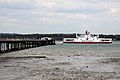 A car ferry passes Hythe Pier - geograph.org.uk - 1907741.jpg 1,500 × 998; 218 KB
-
 A326 Marchwood by-pass - geograph.org.uk - 1977792.jpg 640 × 480; 81 KB
-
 Admirals Way, Hythe - geograph.org.uk - 2357749.jpg 640 × 480; 67 KB
-
 An apartment building on the Solent - geograph.org.uk - 1907746.jpg 1,500 × 1,000; 134 KB
-
 Anchor at Hythe Marina, Hampshire - geograph.org.uk - 1821945.jpg 3,872 × 2,592; 4.07 MB
-
 Bank in St John's Street - geograph.org.uk - 1954685.jpg 640 × 480; 75 KB
-
-
 Blue Plaque for T E Lawrence, Hythe - geograph.org.uk - 3165612.jpg 2,736 × 3,648; 2.1 MB
-
 Boats in Southampton Docks, Hampshire - geograph.org.uk - 1823321.jpg 3,872 × 2,592; 3.08 MB
-
 Bollards at Hythe Marina, Hampshire - geograph.org.uk - 1822045.jpg 3,872 × 2,592; 5.36 MB
-
 BP Hythe CHP Plant, Buttsash. - geograph.org.uk - 381137.jpg 640 × 480; 94 KB
-
 Buttercup field - geograph.org.uk - 1894945.jpg 640 × 480; 116 KB
-
 Car park just off Prospect Place - geograph.org.uk - 1953571.jpg 640 × 480; 68 KB
-
 Charity shop in the High Street - geograph.org.uk - 1954640.jpg 480 × 640; 86 KB
-
 Christopher Cockerell's Memorial, Hythe - geograph.org.uk - 2155873.jpg 1,600 × 1,058; 541 KB
-
 Commander Edward UNWIN, VC RN - Memorial in Hythe, Hampshire.jpg 3,984 × 2,988; 4.42 MB
-
 Container ship in Southampton Water - geograph.org.uk - 1984081.jpg 1,280 × 960; 445 KB
-
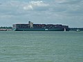 Container ship in Southampton Water - geograph.org.uk - 1984091.jpg 1,280 × 960; 444 KB
-
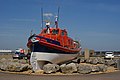 Cromer Lifeboat Ruby and Arthur Reed ON 990.jpg 3,872 × 2,592; 3.51 MB
-
 Cromer Lifeboat Ruby and Arthur Reed.jpg 1,600 × 1,000; 300 KB
-
 Deer in Hythe - geograph.org.uk - 373076.jpg 640 × 470; 109 KB
-
 Drainage Channel at Hythe Marina, Hampshire - geograph.org.uk - 1822174.jpg 3,872 × 2,592; 6.1 MB
-
 Ellie B on Southampton Water, Hampshire - geograph.org.uk - 1821658.jpg 3,872 × 2,592; 3.06 MB
-
 Ellie B on Southampton Water, Hampshire - geograph.org.uk - 1821669.jpg 3,872 × 2,592; 3.09 MB
-
 Entrance to Hythe Pier - geograph.org.uk - 2217648.jpg 427 × 640; 178 KB
-
 Entrance to the Hythe Ferry - geograph.org.uk - 1953477.jpg 640 × 480; 72 KB
-
 Eroded survey point - geograph.org.uk - 1887515.jpg 640 × 480; 127 KB
-
 Esso, Hythe Terminal. - geograph.org.uk - 381194.jpg 640 × 480; 95 KB
-

-
 Fairline Marine Park .jpg 1,500 × 999; 1.48 MB
-
 Fairview Parade, Hythe - geograph.org.uk - 515933.jpg 640 × 427; 149 KB
-
 Ferries in Southampton Docks, Hampshire - geograph.org.uk - 1823296.jpg 3,872 × 2,592; 3.11 MB
-
 Finger post at junction of tracks - geograph.org.uk - 1894922.jpg 640 × 480; 103 KB
-
 Footbridge on the Solent Way, Hythe - geograph.org.uk - 381101.jpg 640 × 480; 155 KB
-
 Footbridge to Hythe Marina, Hampshire - geograph.org.uk - 1822108.jpg 2,592 × 3,872; 3.8 MB
-
 Footpath to the Hythe Marina, Hampshire - geograph.org.uk - 1822151.jpg 2,592 × 3,872; 4.23 MB
-
 Foresters Respite Centre - geograph.org.uk - 641864.jpg 640 × 480; 107 KB
-
 Freight line to Fawley - geograph.org.uk - 2184707.jpg 640 × 480; 128 KB
-
 Garden at Prospect Place, Hythe, Hampshire - geograph.org.uk - 1823231.jpg 2,592 × 3,872; 2.89 MB
-
 Global Spirit Leaves Southampton - geograph.org.uk - 1821025.jpg 3,872 × 2,592; 3.28 MB
-

-
 Grass meadow - geograph.org.uk - 1894955.jpg 640 × 480; 80 KB
-
 High Street, Hythe - geograph.org.uk - 1716828.jpg 553 × 415; 177 KB
-
 High Street, Hythe, Hampshire - geograph.org.uk - 1823172.jpg 2,592 × 3,872; 3.33 MB
-
 High Street, Hythe, Hampshire.jpg 2,080 × 1,544; 1.01 MB
-
 High Street, Hythe, Hants.JPG 2,048 × 1,536; 797 KB
-

-
 Hollydene, Hythe - geograph.org.uk - 2357703.jpg 640 × 480; 57 KB
-
 Hotspur House Prospect Place Hythe - geograph.org.uk - 1953483.jpg 640 × 480; 71 KB
-
 Hotspur IV at Hythe Pier - geograph.org.uk - 2217655.jpg 640 × 427; 164 KB
-

-
 HY17THE.jpg 1,615 × 1,077; 1.33 MB
-
 Hythe - Coastal view - geograph.org.uk - 2085212.jpg 3,504 × 2,336; 1.25 MB
-
 Hythe Ferry and Pier Head - geograph.org.uk - 330218.jpg 640 × 470; 82 KB
-
 Hythe Ferry, Approaching Hythe Pier, Hampshire (1) - geograph.org.uk - 1819721.jpg 2,032 × 1,360; 1.32 MB
-
 Hythe Ferry, Approaching Hythe Pier, Hampshire (2) - geograph.org.uk - 1819736.jpg 3,872 × 2,592; 3.28 MB
-
 Hythe Ferry, Hampshire - geograph.org.uk - 1821540.jpg 3,872 × 2,592; 3.77 MB
-
 Hythe fire station - geograph.org.uk - 279859.jpg 640 × 427; 220 KB
-
 Hythe Foreshore - geograph.org.uk - 328701.jpg 640 × 480; 99 KB
-
 Hythe Hard - geograph.org.uk - 1716803.jpg 553 × 415; 179 KB
-
 Hythe High Street - geograph.org.uk - 1954681.jpg 640 × 480; 76 KB
-
 Hythe High Street - geograph.org.uk - 3013793.jpg 1,024 × 768; 155 KB
-
 Hythe Marina, Hampshire - geograph.org.uk - 1822279.jpg 3,872 × 2,592; 4.29 MB
-
 Hythe Marina, Hampshire - geograph.org.uk - 1822297.jpg 3,872 × 2,592; 3.85 MB
-
 Hythe Marina, Hampshire - geograph.org.uk - 1822308.jpg 3,872 × 2,592; 3.63 MB
-
 Hythe Marina, Hampshire - geograph.org.uk - 1822319.jpg 3,872 × 2,592; 3.87 MB
-
 Hythe Pier - geograph.org.uk - 1907740.jpg 1,500 × 992; 201 KB
-
 Hythe Pier - geograph.org.uk - 2184759.jpg 640 × 480; 74 KB
-
 Hythe Pier - geograph.org.uk - 2197364.jpg 640 × 308; 126 KB
-
 Hythe Pier - geograph.org.uk - 2217659.jpg 640 × 427; 170 KB
-
 Hythe Pier - geograph.org.uk - 2217667.jpg 640 × 427; 203 KB
-
 Hythe Pier - geograph.org.uk - 2218959.jpg 640 × 427; 193 KB
-
 Hythe Pier - geograph.org.uk - 646283.jpg 640 × 480; 53 KB
-
 Hythe pier and ferry - geograph.org.uk - 1966554.jpg 640 × 480; 48 KB
-
 Hythe Pier and ferry terminal - geograph.org.uk - 2281488.jpg 2,992 × 1,893; 897 KB
-
 Hythe Pier from the Marina - geograph.org.uk - 450221.jpg 640 × 480; 158 KB
-
 Hythe Pier from the Pierhead, Hampshire - geograph.org.uk - 2294222.jpg 1,600 × 1,200; 400 KB
-
 Hythe Pier railway - geograph.org.uk - 2218974.jpg 640 × 427; 206 KB
-
 Hythe Pier Railway - geograph.org.uk - 2282955.jpg 640 × 480; 79 KB
-
 Hythe Pier, Hampshire - geograph.org.uk - 1819928.jpg 2,592 × 3,872; 2.68 MB
-
 Hythe Pier, Hampshire - geograph.org.uk - 1823135.jpg 3,872 × 2,592; 4.24 MB
-
 Hythe Post Office - geograph.org.uk - 2357760.jpg 640 × 480; 76 KB
-
 Hythe Post Office - geograph.org.uk - 3013801.jpg 1,024 × 757; 188 KB
-
 Hythe Post Office, High Street - geograph.org.uk - 1954668.jpg 480 × 640; 65 KB
-
 Hythe spartina Marsh - geograph.org.uk - 3131610.jpg 3,648 × 2,736; 1.55 MB
-
 Hythe to Veals Farm Footpath - geograph.org.uk - 386958.jpg 640 × 480; 142 KB
-
 Hythe to Veals Farm Footpath - geograph.org.uk - 386970.jpg 640 × 473; 142 KB
-
 Hythe Village Marina - geograph.org.uk - 2197361.jpg 640 × 291; 108 KB
-
 Hythe, church hall - geograph.org.uk - 3013854.jpg 1,024 × 766; 178 KB
-
 Hythe, ferries - geograph.org.uk - 3013840.jpg 1,024 × 768; 152 KB
-
 Hythe, foreshore - geograph.org.uk - 3013776.jpg 1,024 × 768; 166 KB
-
 Hythe, Hants - geograph.org.uk - 2109097.jpg 3,504 × 2,336; 340 KB
-
 Hythe, Hants - geograph.org.uk - 2109101.jpg 1,800 × 1,200; 349 KB
-
 Hythe, Hants - geograph.org.uk - 2220013.jpg 3,504 × 2,336; 497 KB
-
 Hythe, Prospect Green - geograph.org.uk - 3013779.jpg 1,024 × 768; 255 KB
-

-
 Isle of Wight ferries - geograph.org.uk - 1997215.jpg 1,280 × 960; 471 KB
-
 Itchen Bridge - geograph.org.uk - 2282956.jpg 640 × 480; 50 KB
-
 Junction of tracks - geograph.org.uk - 1887442.jpg 640 × 480; 75 KB
-
 Junction of tracks - geograph.org.uk - 1887446.jpg 640 × 480; 77 KB
-
 Junction of tracks - geograph.org.uk - 1887480.jpg 640 × 480; 56 KB
-

-
 Just warning you - geograph.org.uk - 2217669.jpg 640 × 428; 166 KB
-
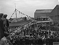 Launching ceremony of MGB 116.jpg 800 × 612; 65 KB
-

-
 Lichen covering the ground - geograph.org.uk - 1887502.jpg 640 × 480; 135 KB
-

-
 Looking down Hythe Pier - geograph.org.uk - 1907742.jpg 1,500 × 995; 166 KB
-

-

-
 Magic Time and Queen Mary 2, Hythe, Hampshire - geograph.org.uk - 1826272.jpg 3,872 × 2,592; 3.5 MB
-
 Main Road - geograph.org.uk - 2184728.jpg 640 × 480; 109 KB
-
 Memorial at Hythe Marina, Hampshire - geograph.org.uk - 1821965.jpg 3,872 × 2,592; 4.83 MB
-

-
 Missed the ferry - geograph.org.uk - 2217662.jpg 640 × 428; 149 KB
-
 Mooring Buoy at Hythe Marina, Hampshire - geograph.org.uk - 1822030.jpg 3,872 × 2,592; 4.42 MB
-

-
 Morris Dibben in the High Street - geograph.org.uk - 1954648.jpg 640 × 480; 85 KB
-
 Nautical seat, The Promenade, Hythe - geograph.org.uk - 2357745.jpg 640 × 480; 43 KB
-

-
 Nearly there - geograph.org.uk - 2217671.jpg 640 × 427; 227 KB
-
 New Flats at Hythe with Rainbow - geograph.org.uk - 330241.jpg 640 × 464; 45 KB
-
 New Houses near the Fountain Inn, Hythe - geograph.org.uk - 381109.jpg 640 × 480; 100 KB
-
 New promenade feature at Hythe - geograph.org.uk - 397171.jpg 640 × 640; 84 KB
-
 New Road - geograph.org.uk - 2184768.jpg 640 × 480; 109 KB
-
 New Road in July - geograph.org.uk - 1977534.jpg 640 × 480; 85 KB
-
 New Road leading into Hythe Village - geograph.org.uk - 328723.jpg 640 × 461; 78 KB
-
 Newish housing on Hythe waterfront - geograph.org.uk - 514731.jpg 640 × 427; 105 KB
-
 On and off Hythe Pier - geograph.org.uk - 2218964.jpg 640 × 427; 178 KB
-
 Path beneath railway line at Hythe - geograph.org.uk - 515911.jpg 427 × 640; 202 KB
-
 Path through Grove Gardens, Hythe - geograph.org.uk - 514703.jpg 427 × 640; 103 KB
-
 Path to Veal's Farm - geograph.org.uk - 2184804.jpg 640 × 480; 109 KB
-
 Pedestrianised Street - geograph.org.uk - 294409.jpg 640 × 480; 52 KB
-
 Pedestrians in the High Street - geograph.org.uk - 1954697.jpg 640 × 480; 88 KB
-
 Pier at Hythe Marina, Hampshire - geograph.org.uk - 1823280.jpg 3,872 × 2,592; 3.51 MB
-
 Pier at Hythe Marina, Hampshire - geograph.org.uk - 1823337.jpg 3,872 × 2,592; 3.78 MB
-
 Plaque on Sir Christopher Cockerell's Memorial, Hythe - geograph.org.uk - 3217556.jpg 2,501 × 2,186; 1.77 MB
-
 Pontoons at Hythe - geograph.org.uk - 2197368.jpg 640 × 350; 151 KB
-
 Port Signal ^ Radar Station, Southampton, Hampshire - geograph.org.uk - 1821637.jpg 3,872 × 2,592; 3.11 MB
-
 Promenade , Hythe - geograph.org.uk - 664826.jpg 640 × 480; 74 KB
-

-
 Prospect Place, Hythe - geograph.org.uk - 1558568.jpg 640 × 415; 93 KB
-
 Pylewell Cottages, Hythe - geograph.org.uk - 328840.jpg 640 × 480; 79 KB
-
 Queen Mary 2, Hythe, Hampshire - geograph.org.uk - 1821394.jpg 3,872 × 2,592; 3.44 MB
-
 Queen Mary 2, Leaving Southampton (1) - geograph.org.uk - 1819645.jpg 2,032 × 1,360; 1.25 MB
-
 Queen Mary 2, Leaving Southampton (2) - geograph.org.uk - 1819659.jpg 3,872 × 2,592; 3.5 MB
-
 Queen Mary 2, Leaving Southampton (3) - geograph.org.uk - 1821372.jpg 3,872 × 2,592; 3.5 MB
-
 Queen Mary 2, Leaving Southampton (4) - geograph.org.uk - 1821377.jpg 3,872 × 2,592; 3.34 MB
-
 Queen Victoria, Leaving Southampton (1) - geograph.org.uk - 1819851.jpg 3,872 × 2,176; 2.88 MB
-
 Queen Victoria, Leaving Southampton (2) - geograph.org.uk - 1819858.jpg 3,872 × 2,592; 3.64 MB
-
 Red Funnel Ferry on Southampton Water, Hythe, Hampshire - geograph.org.uk - 1821600.jpg 3,872 × 2,176; 2.85 MB
-
 Red Jet on Southampton Water, Hythe, Hampshire (1) - geograph.org.uk - 1821559.jpg 3,872 × 2,176; 2.93 MB
-
 Red Jet on Southampton Water, Hythe, Hampshire (2) - geograph.org.uk - 1821564.jpg 3,872 × 2,176; 3.18 MB
-
 Ripples on the shore at Hythe - geograph.org.uk - 2282954.jpg 640 × 480; 54 KB
-
 River test at Dibden - geograph.org.uk - 2197359.jpg 640 × 296; 120 KB
-
 Roundabout at Hythe Marina, Hampshire.jpg 3,872 × 2,592; 3.39 MB
-
 Royal Navy Commandos Memorial, Hythe, Hampshire - geograph.org.uk - 1821066.jpg 3,872 × 2,592; 5.81 MB
-
 Scott-Paine Drive, Hythe - geograph.org.uk - 514752.jpg 640 × 418; 115 KB
-
 Seat with a view - geograph.org.uk - 1007833.jpg 640 × 480; 39 KB
-
 Shore Road gateway to Hythe Sailing Club - geograph.org.uk - 538975.jpg 640 × 480; 123 KB
-
 Shore Road, Hythe - geograph.org.uk - 2357802.jpg 640 × 480; 47 KB
-
 South Street, Hythe - geograph.org.uk - 515908.jpg 640 × 427; 129 KB
-
 Southampton Docks - geograph.org.uk - 1966548.jpg 640 × 480; 47 KB
-
 Southampton Road, Hythe - geograph.org.uk - 2357712.jpg 640 × 480; 63 KB
-
 Southampton Water - geograph.org.uk - 1947190.jpg 2,048 × 1,536; 1.22 MB
-
 Southampton Water - geograph.org.uk - 1990231.jpg 1,280 × 960; 459 KB
-
 Southampton Water, Hampshire - geograph.org.uk - 1819955.jpg 3,872 × 2,592; 2.84 MB
-
 Southampton Water, Hampshire - geograph.org.uk - 1821399.jpg 3,872 × 2,592; 2.44 MB
-
 Southampton, harbour entrance - geograph.org.uk - 1811413.jpg 1,600 × 1,200; 196 KB
-
 Spartina Marshes. - geograph.org.uk - 372988.jpg 640 × 466; 119 KB
-
 St Johns Street, Hythe - geograph.org.uk - 2357722.jpg 640 × 480; 67 KB
-
 Steps along The Promenade, Hythe - geograph.org.uk - 514769.jpg 640 × 427; 93 KB
-

-

-
 Sunset by the Lock on Hythe Marina - geograph.org.uk - 330237.jpg 640 × 480; 51 KB
-

-
 TE Lawrence's House, Hythe - geograph.org.uk - 3165602.jpg 3,001 × 2,676; 1.63 MB
-
 Tesco supermarket, Applemore - geograph.org.uk - 1977808.jpg 640 × 480; 89 KB
-
 The electric train on Hythe Pier - geograph.org.uk - 1907743.jpg 1,500 × 995; 213 KB
-
 The electric train on Hythe Pier - geograph.org.uk - 1907744.jpg 1,500 × 979; 207 KB
-
 The end of the pier in Hythe - geograph.org.uk - 1906562.jpg 1,500 × 983; 137 KB
-

-
 The High Street in Hythe - geograph.org.uk - 1906558.jpg 1,500 × 1,000; 142 KB
-
 The Lord Nelson on High Street - geograph.org.uk - 1906559.jpg 1,500 × 996; 158 KB
-
 The Lord Nelson, Hythe, Hampshire - geograph.org.uk - 1823156.jpg 2,592 × 3,872; 2.63 MB
-
 The Marsh in Hythe - geograph.org.uk - 1906554.jpg 1,500 × 983; 220 KB
-
 The Marsh, Hythe - geograph.org.uk - 515962.jpg 640 × 427; 147 KB
-
 The Marsh, Hythe, Hampshire - geograph.org.uk - 1823189.jpg 3,872 × 2,592; 4.25 MB
-
 The Marsh, Hythe, Hampshire.jpg 2,080 × 1,544; 1.02 MB
-
 The seafront at Hythe - geograph.org.uk - 2713481.jpg 1,500 × 1,000; 142 KB
-
 The seafront at Hythe - geograph.org.uk - 2713483.jpg 1,500 × 1,000; 193 KB
-
 The shore at Hythe - geograph.org.uk - 2282953.jpg 640 × 480; 97 KB
-
 Thursday morning, High Street, Hythe - geograph.org.uk - 1716822.jpg 553 × 415; 162 KB
-
 Town centre, Hythe, Hampshire, England.jpg 3,709 × 2,700; 3 MB
-
 Track adjacent foreshore - geograph.org.uk - 1887471.jpg 640 × 480; 75 KB
-
 Track adjacent foreshore - geograph.org.uk - 1887490.jpg 640 × 480; 55 KB
-
 Track away from foreshore - geograph.org.uk - 1894912.jpg 640 × 480; 67 KB
-
 Track from Veal's Farm - geograph.org.uk - 1887410.jpg 640 × 480; 113 KB

.jpg)


_-_geograph.org.uk_-_1819721.jpg)
_-_geograph.org.uk_-_1819736.jpg)


_-_geograph.org.uk_-_1819645.jpg)
_-_geograph.org.uk_-_1819659.jpg)
_-_geograph.org.uk_-_1821372.jpg)
_-_geograph.org.uk_-_1821377.jpg)
_-_geograph.org.uk_-_1819851.jpg)
_-_geograph.org.uk_-_1819858.jpg)

_-_geograph.org.uk_-_1821559.jpg)
_-_geograph.org.uk_-_1821564.jpg)


