Category:Höchstadt an der Aisch
Jump to navigation
Jump to search
municipality of Germany | |||||
| Upload media | |||||
| Pronunciation audio | |||||
|---|---|---|---|---|---|
| Instance of |
| ||||
| Part of |
| ||||
| Location | Erlangen-Höchstadt, Middle Franconia, Bavaria, Germany | ||||
| Population |
| ||||
| Area |
| ||||
| Elevation above sea level |
| ||||
| official website | |||||
 | |||||
Subcategories
This category has the following 12 subcategories, out of 12 total.
B
C
P
S
Pages in category "Höchstadt an der Aisch"
This category contains only the following page.
Media in category "Höchstadt an der Aisch"
The following 43 files are in this category, out of 43 total.
-
De-Höchstadt.ogg 1.7 s; 17 KB
-
Wappen Höchstadt an der Aisch.svg 512 × 559; 113 KB
-
Wappen von Höchstadt an der Aisch.png 193 × 207; 11 KB
-
20130225 GymHoesBaustelle.jpg 2,448 × 3,264; 2.47 MB
-
Aischbrücke.jpg 640 × 480; 92 KB
-
Alte Aisch Brücke Höchstadt.JPG 2,592 × 1,728; 2.5 MB
-
Alte Aischbrücke und Höchstadter Schloss.JPG 4,000 × 3,000; 4.04 MB
-
Alte und neue Aisch Brücke Höchstadt.JPG 2,592 × 1,728; 2.91 MB
-
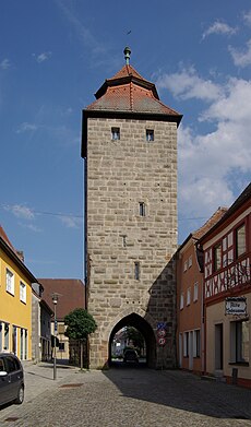
Am Stadttor Höchstadt.JPG 3,000 × 4,000; 4.14 MB
-
An der Stadtmühle Höchstadt.JPG 4,000 × 3,000; 3.86 MB
-
Antoniuskapelle (Hoechstadt).jpg 3,264 × 2,448; 3.59 MB
-
Einrichtung des Armeninstituts zu Höchstadt.pdf 900 × 1,281, 7 pages; 226 KB
-
Gossenpoeten Schlosshof.jpg 4,608 × 3,456; 6.25 MB
-
Helden Friedhof Höchstadt an der Aisch.jpg 2,592 × 1,728; 2.3 MB
-
Höchstadt Alte Brücke.JPG 2,304 × 3,072; 399 KB
-
Höchstadt an der Aisch BW 2011-07-27 19-44-17.JPG 3,872 × 2,592; 3.4 MB
-
Höchstadt an der Aisch BW 2011-07-27 19-44-31.JPG 3,872 × 2,592; 3.57 MB
-
Höchstadt an der Aisch BW 2011-07-27 19-44-42.JPG 3,872 × 2,592; 3.5 MB
-
Höchstadt an der Aisch in ERH.svg 691 × 537; 481 KB
-
Höchstadt Ausblick vom Schloss.JPG 2,592 × 1,728; 1.26 MB
-
Höchstadt Badgasse mit Schloß.JPG 2,592 × 1,728; 2.9 MB
-
Höchstadt Fischteich-20220514-RM-172408.jpg 5,184 × 3,888; 9.49 MB
-
Höchstadt Fischteich-20220514-RM-172416.jpg 5,184 × 3,888; 8.38 MB
-
Höchstadt Fischteich-20220514-RM-172442.jpg 5,184 × 3,888; 13.26 MB
-
Höchstadt Fischteich-20220514-RM-172500.jpg 5,184 × 3,888; 13.55 MB
-
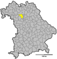
Höchstadt im Landkreis Erlangen-Höchstadt.png 680 × 464; 26 KB
-
Höchstadt Schloss Dachgeschoß.JPG 2,592 × 1,728; 2.57 MB
-
Höchstadt Schloss Veranstaltungssaal.JPG 2,592 × 1,728; 2.4 MB
-
Höchstadt Schloß und Stadtmühle.JPG 2,592 × 1,728; 2.16 MB
-
Landkreis Hoechstadt an der Aisch.png 581 × 599; 25 KB
-
Mühlstüberl in Höchstadt.JPG 2,560 × 1,920; 3.02 MB
-
Pfarrheim St. Georg Höchstadt.JPG 4,000 × 3,000; 4.14 MB
-
Schloßberg Höchstadt 01.JPG 4,000 × 3,000; 3.94 MB
-
Schuppen zwischen Weihern - geo.hlipp.de - 42148.jpg 640 × 480; 85 KB
-
Spital Kirche St. Anna von 1513 Höchstadt.JPG 2,592 × 1,728; 2.21 MB
-
Stadtmühle Höchstadt.JPG 4,000 × 3,000; 4 MB
-
Stadttor Höchstadt 01.JPG 4,000 × 3,000; 3.8 MB
-
Steinbank am Türmersturm - panoramio.jpg 1,700 × 1,241; 523 KB
-
Vitanas Senioren Centrum St. Anna Höchstadt.JPG 4,000 × 3,000; 3.72 MB
-
Wegekreuz-Hoechstadt an der Aisch-Rothenburger-Str.JPG 2,160 × 3,840; 4.33 MB
-
Wegkreuz-Höchstadt an der Aisch.JPG 2,160 × 3,840; 3.69 MB


